From time to time I like to hop into my personal helicopter, aka Google Earth, to roam new (for me) neighborhoods.
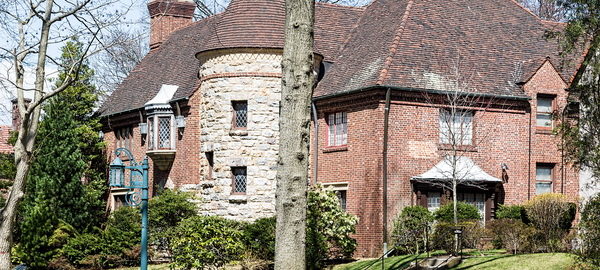
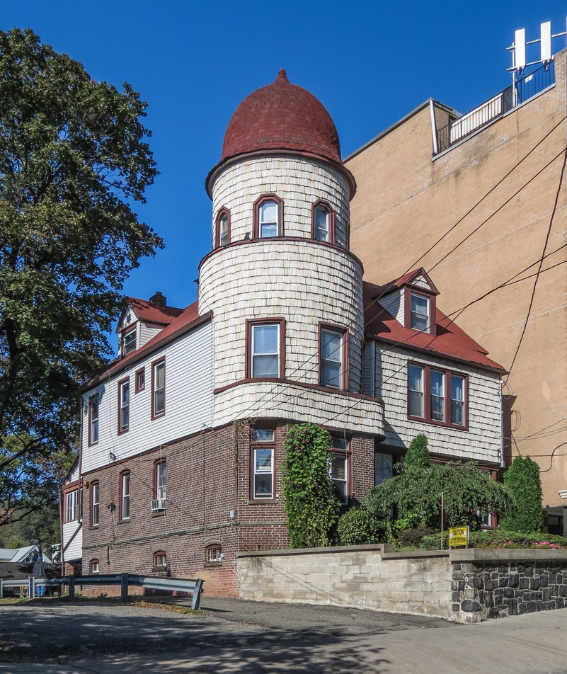
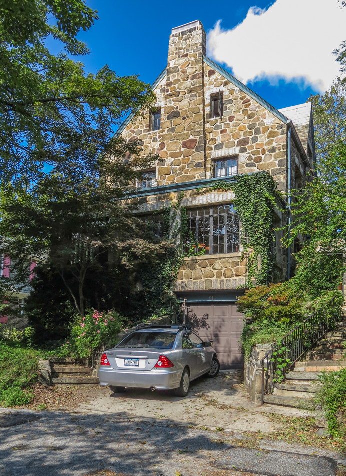
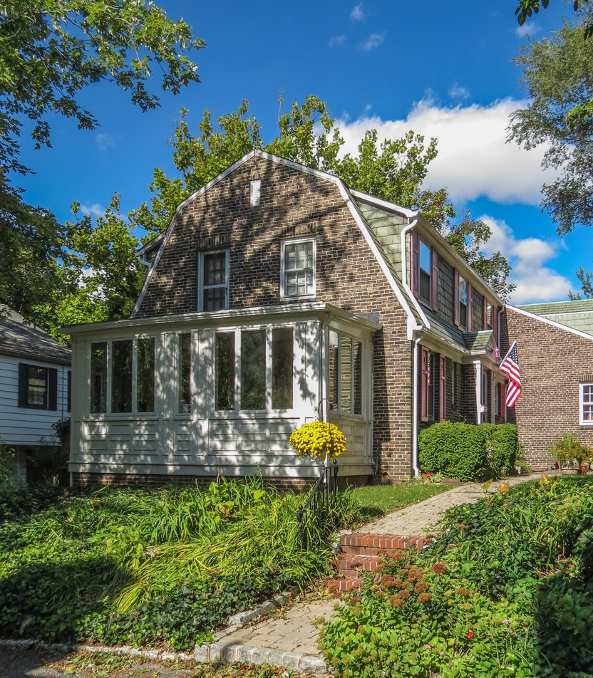
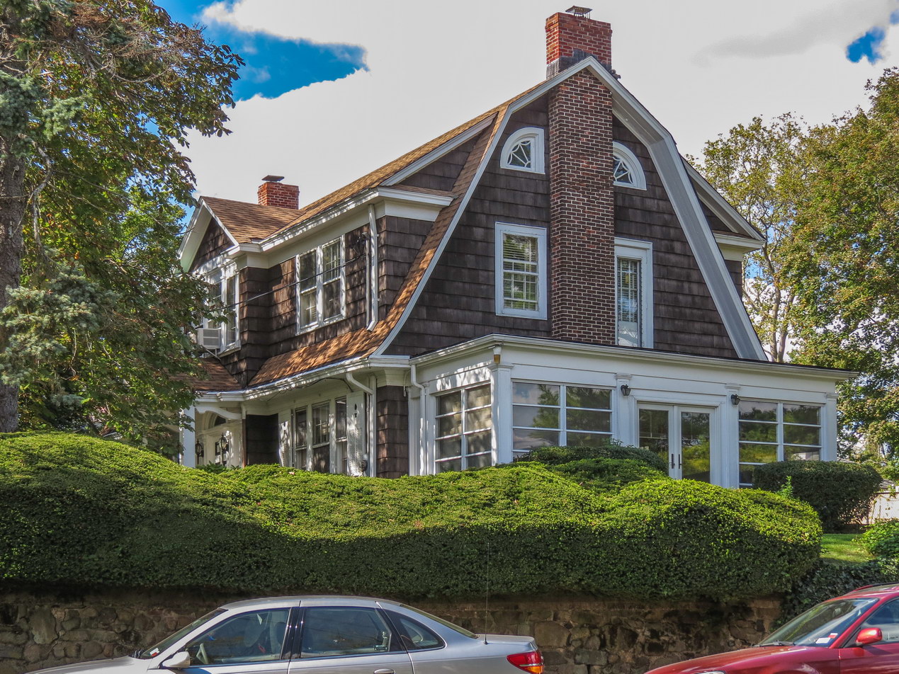
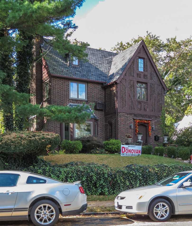
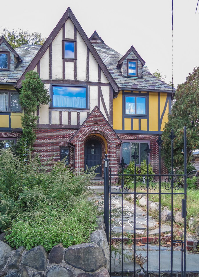
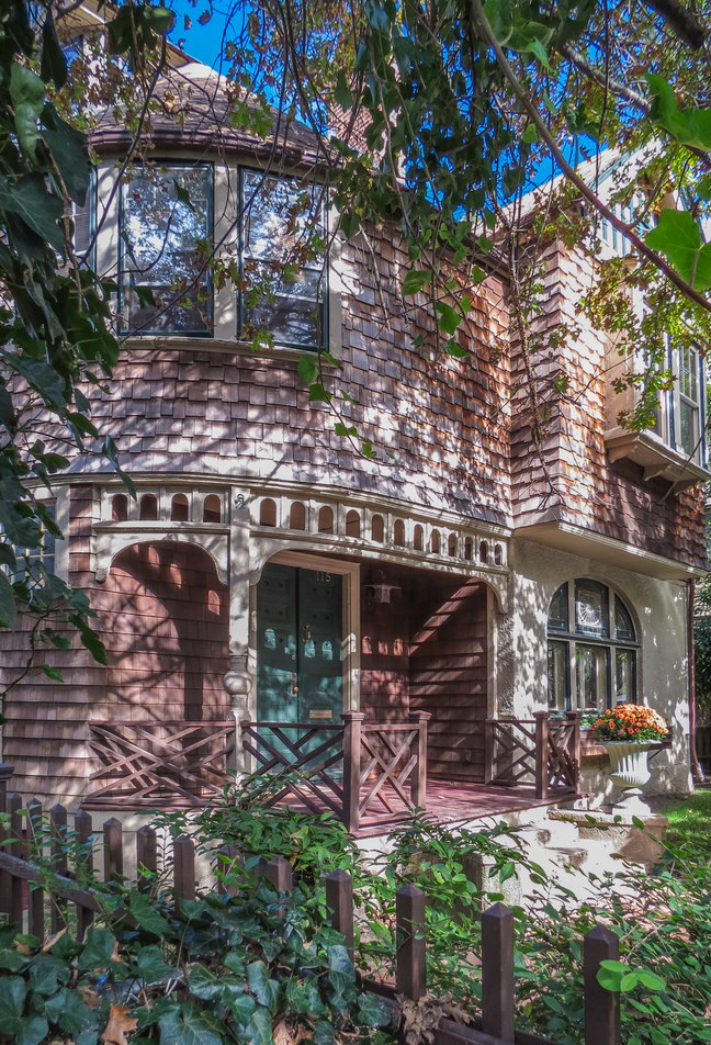
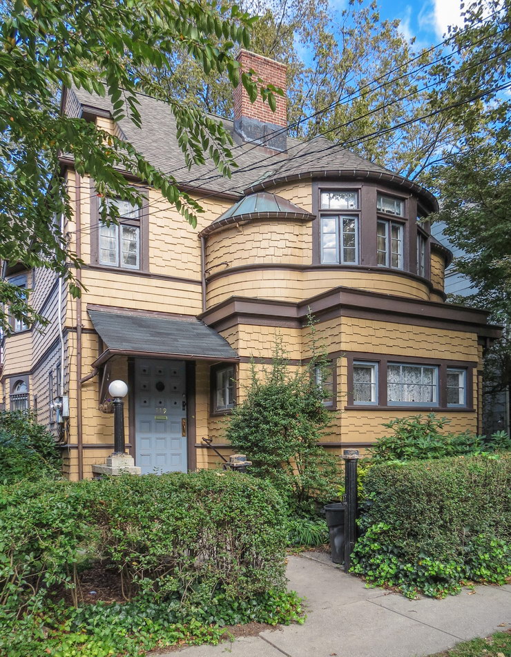
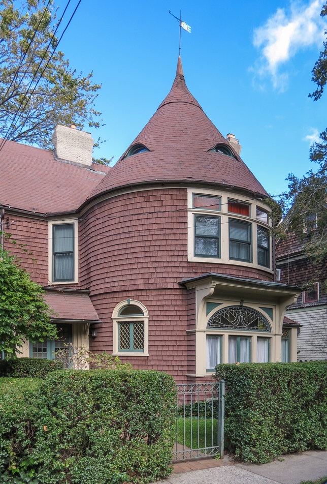
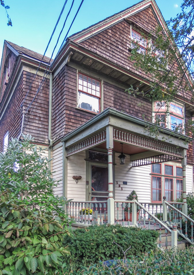
A recent “discovery” was the Tudor fantasyland of Forest Hills Gardens, Queens. Architecturally, it’s a residential enclave that makes Manhattan’s Tudor City look like public housing. Take a quick look for yourself in Google Earth view. I’ll wait.
Caution: It’s easy to get to Forest Hills Gardens by public transport,* and it’s just as easy to get hopelessly lost in the neighborhood’s maze of winding narrow lanes.
If you need a guide, let me recommend Adrienne Onofri – my former co-worker, a licensed guide, and more importantly the author of “Walking Queens: 30 Tours for Discovering the Diverse Communities, Historic Places, and Natural Treasures of New York City’s Largest Borough.” By happy coincidence I had just purchased the book. When I spotted Forest Hills in Google Earth, I checked “Walking Queens” and sure enough, Walk 9 was titled, “Forest Hills: Better Homes and Gardens.” I learned that the neighborhood’s history was as fascinating as its architecture, and my wife and I hopped on the subway to scout the area, book in hand.
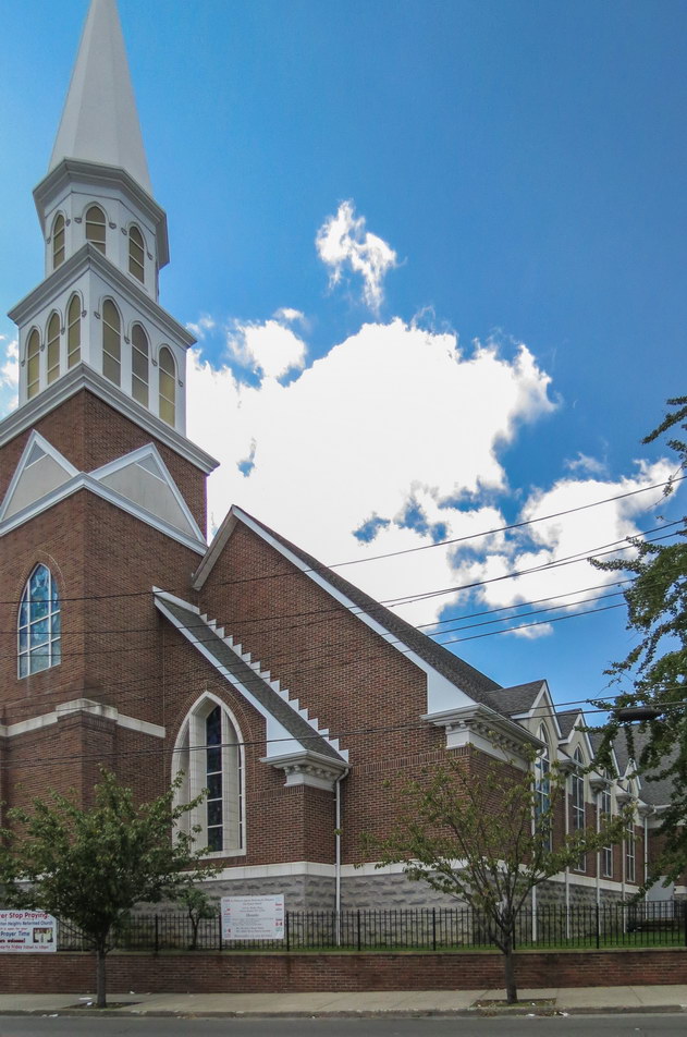
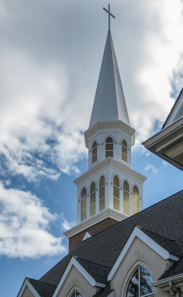
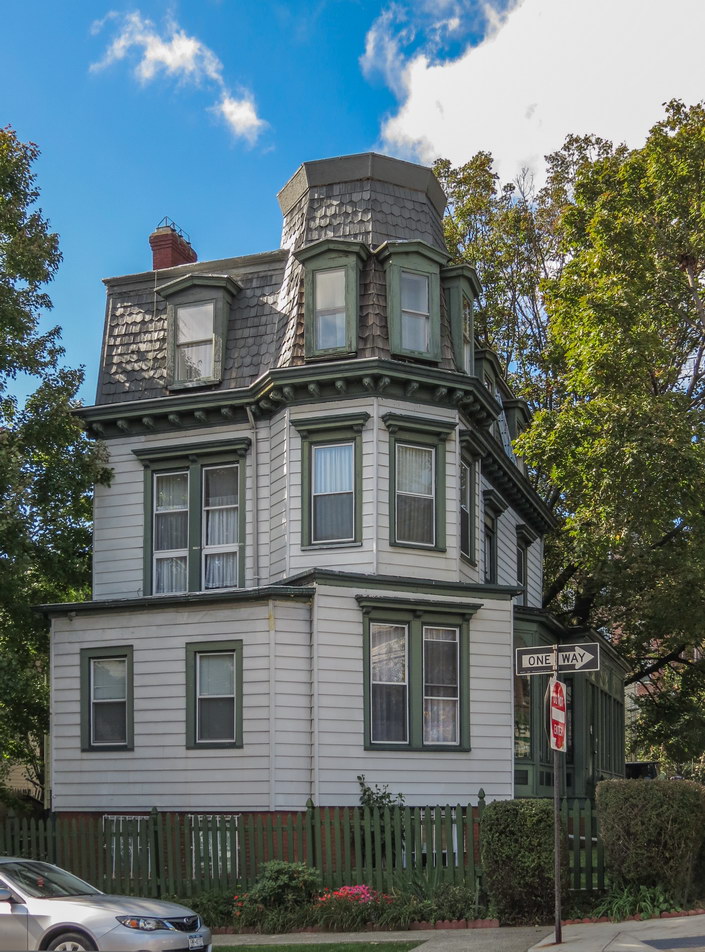
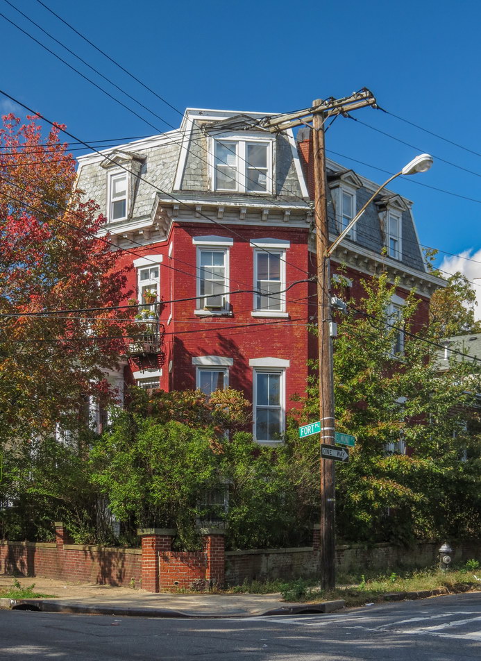
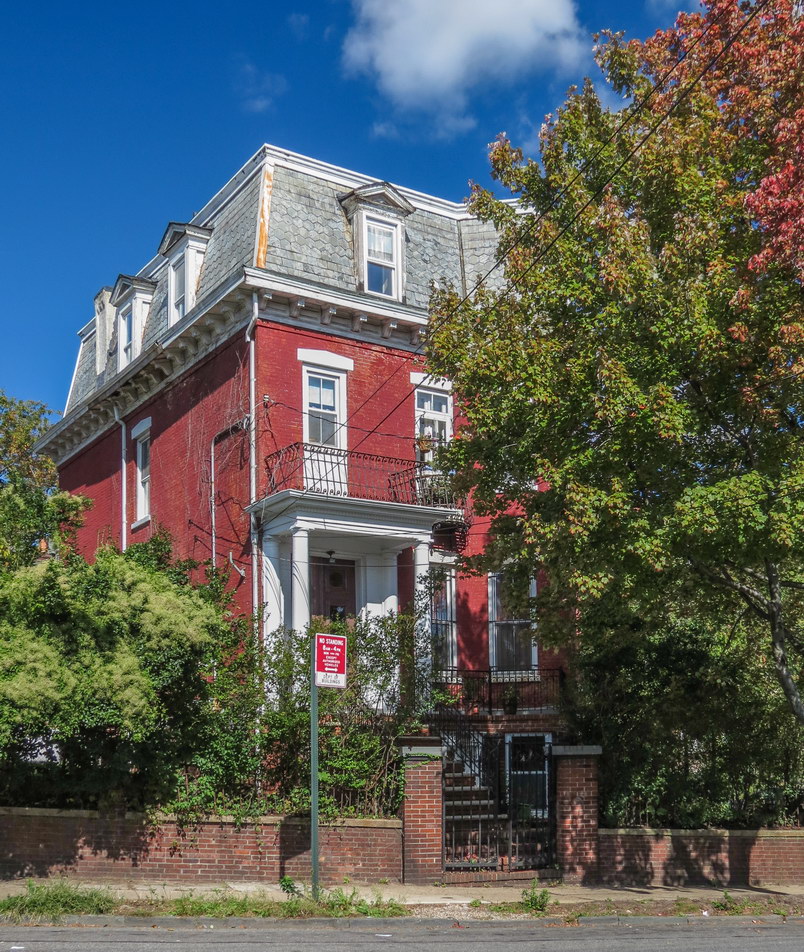
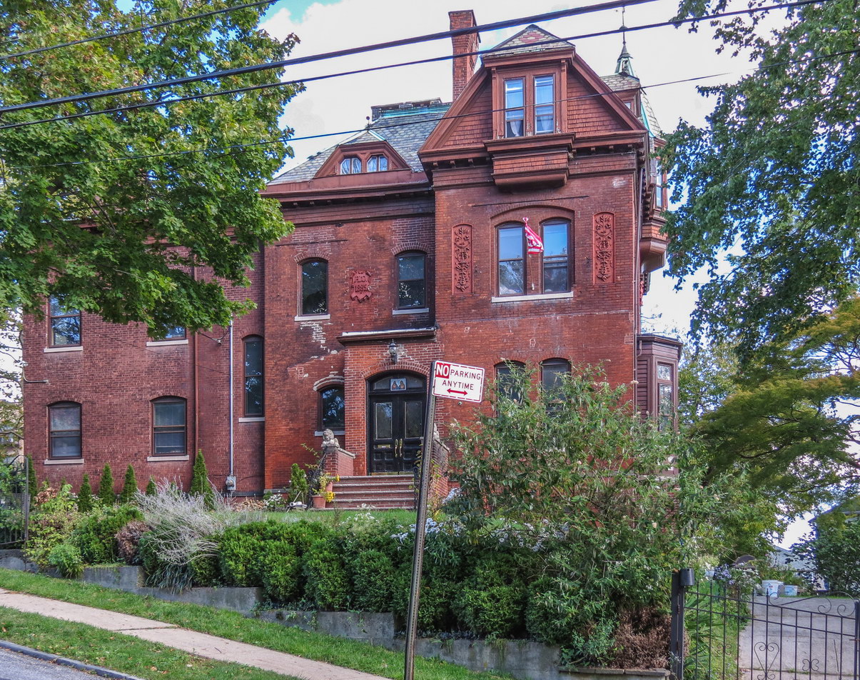
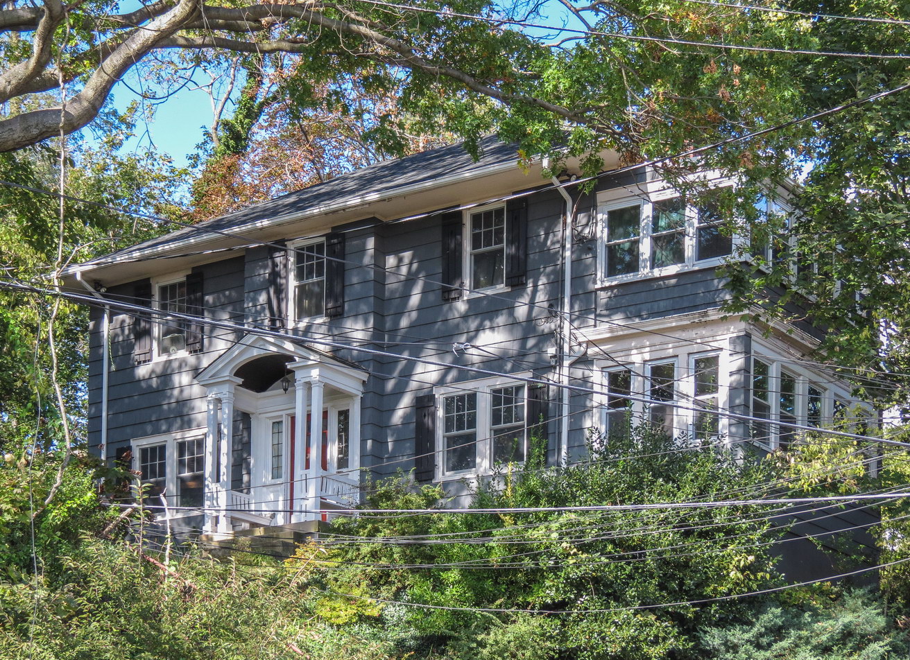
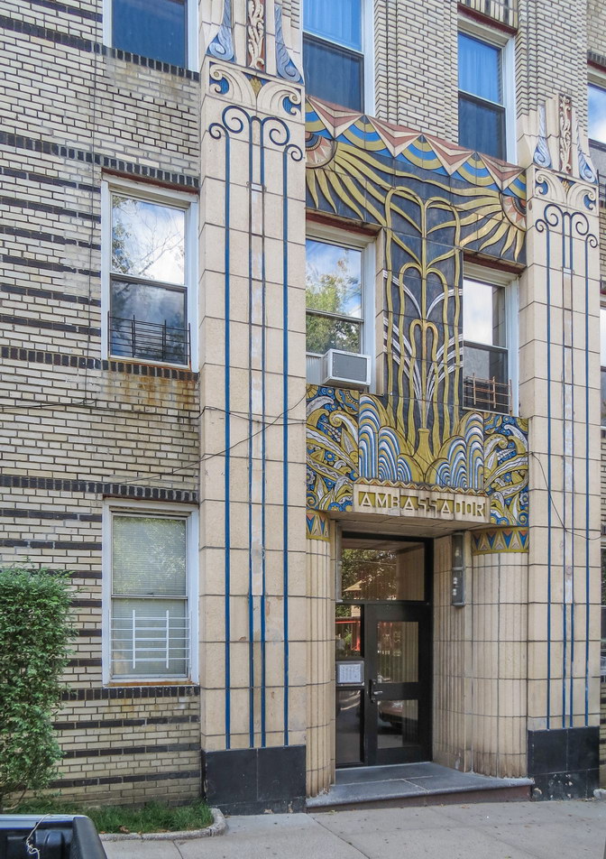
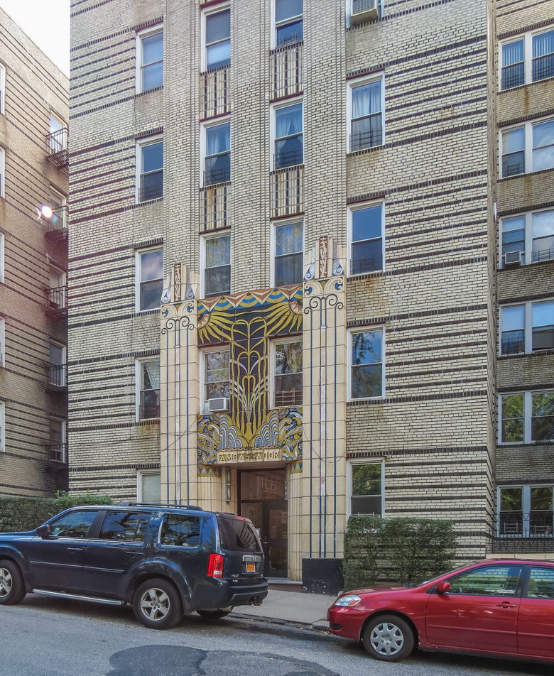
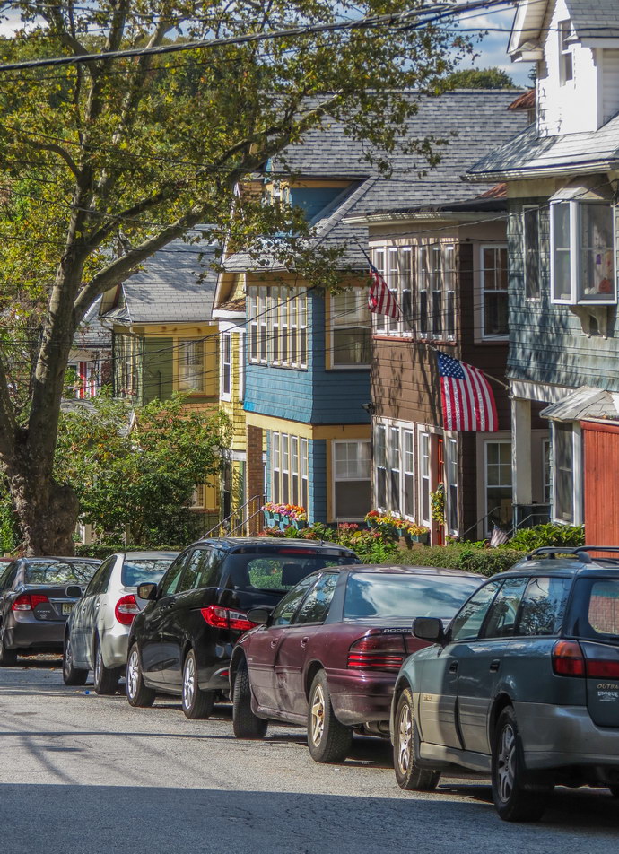
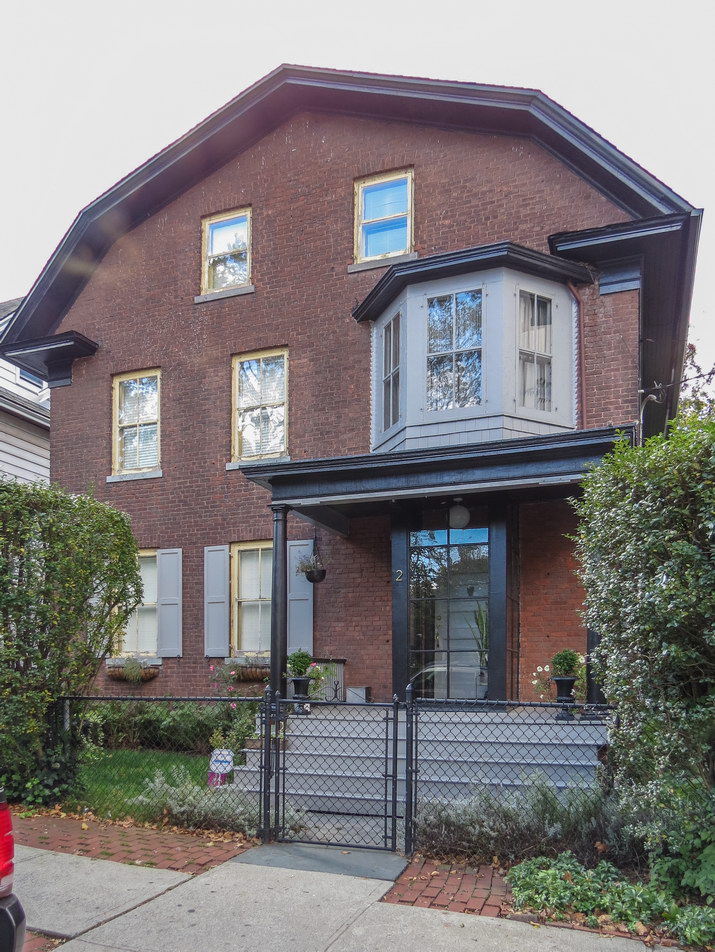
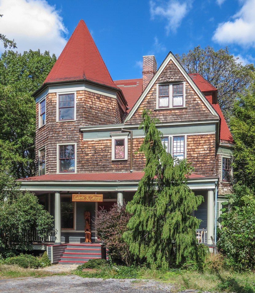
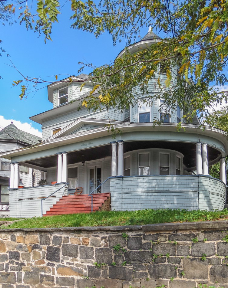
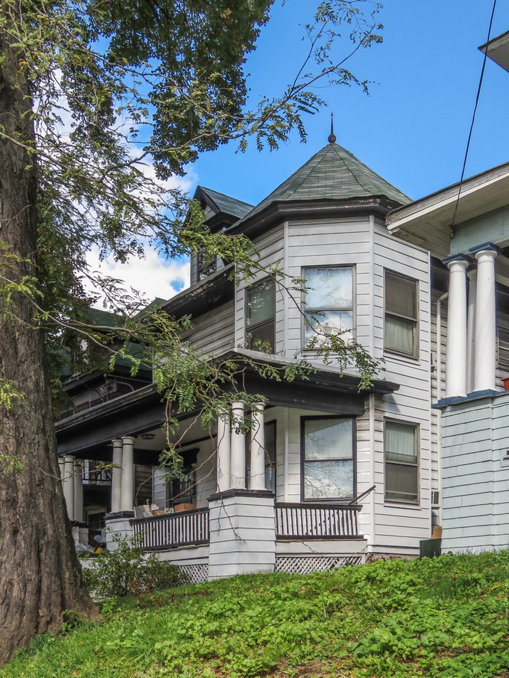
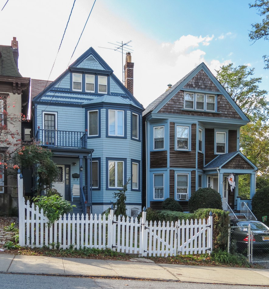
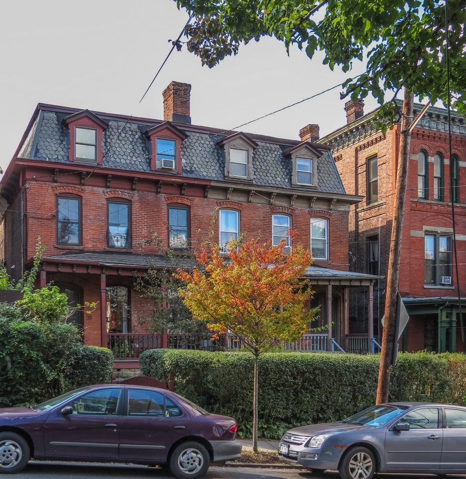
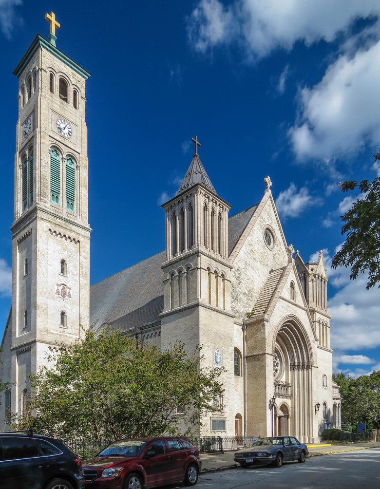
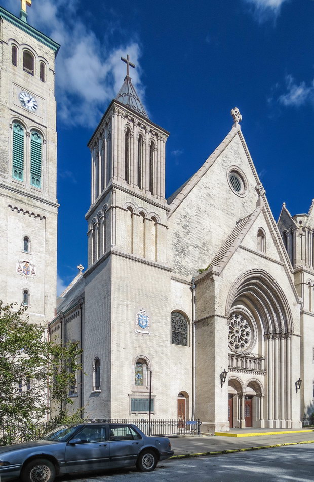
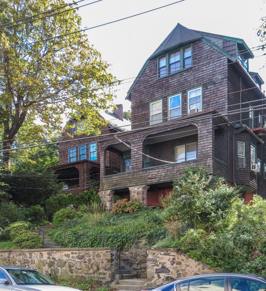
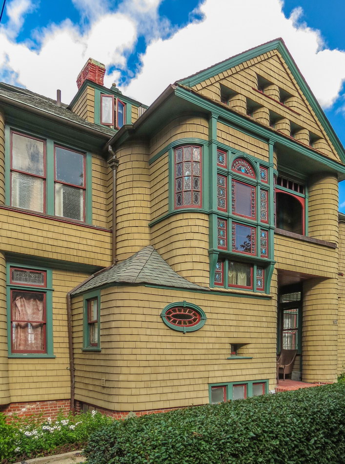
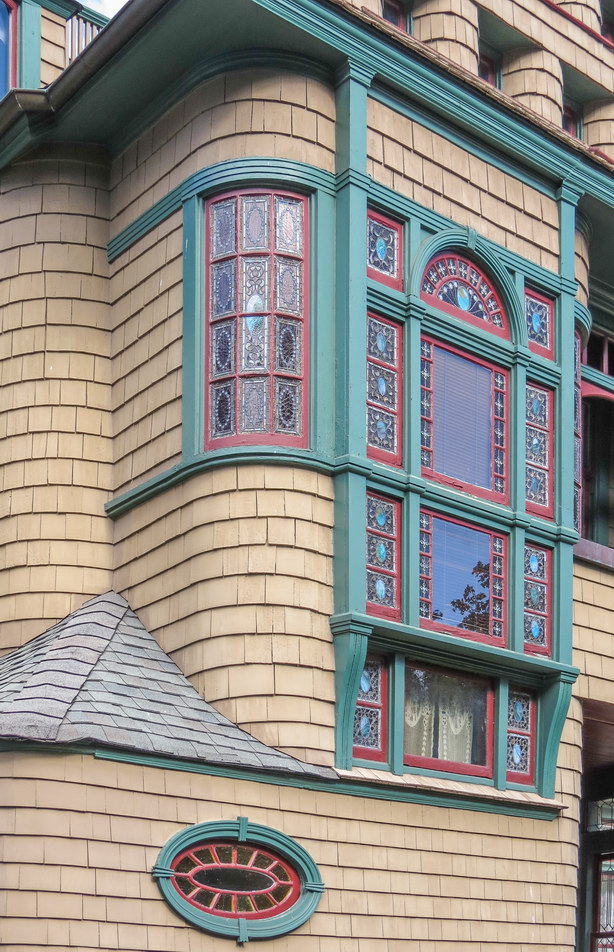
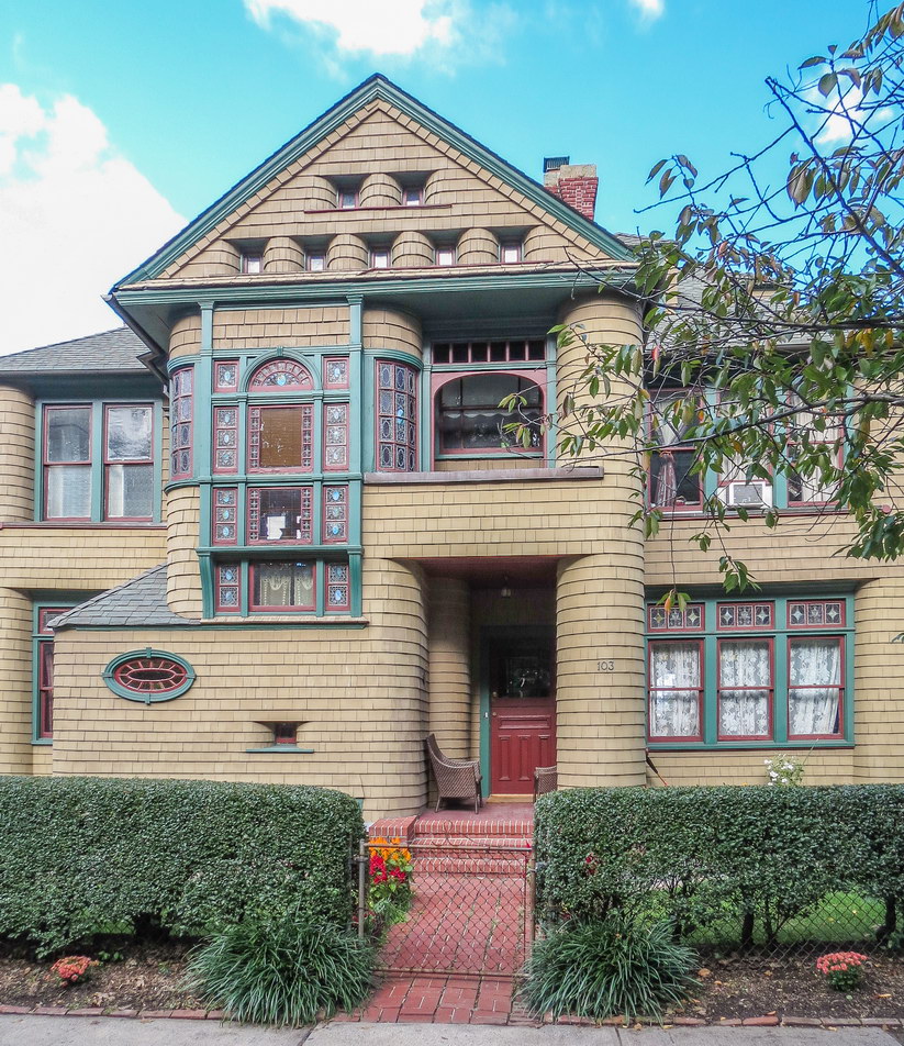
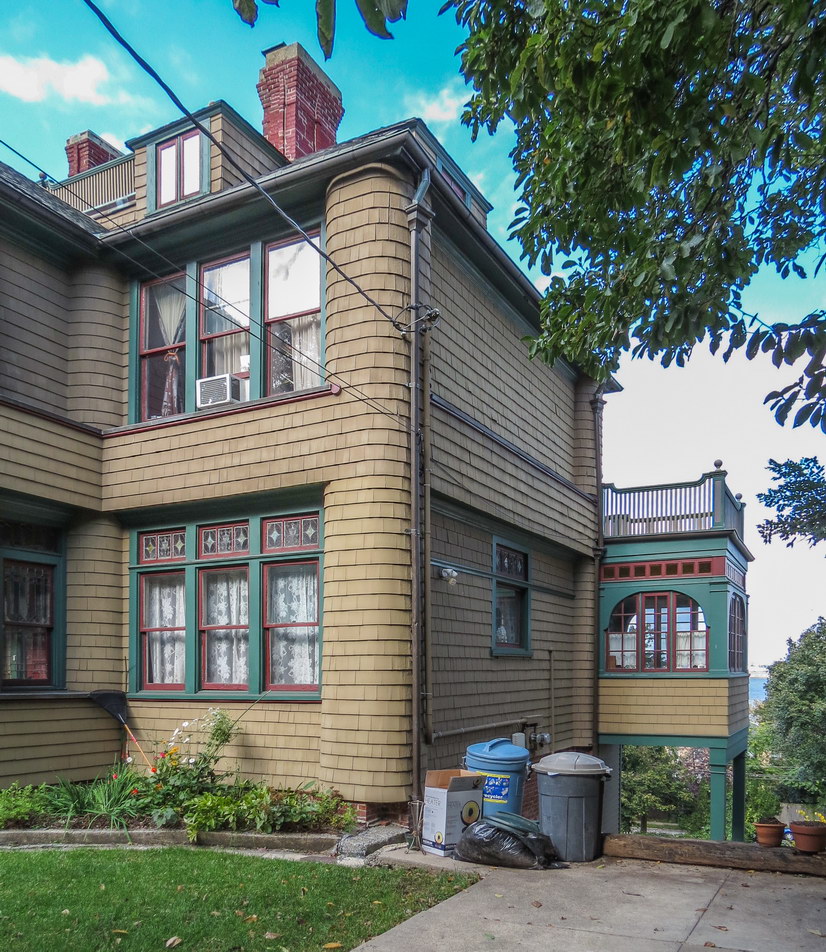
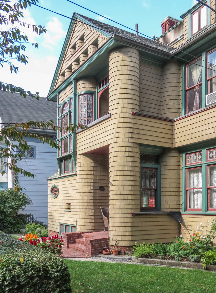
Alas, Adrienne is a better guide than I am a follower. I didn’t pay attention, and more than once I turned left when I should have turned right or vice versa. But I wasn’t disappointed, and I went back with camera in hand to capture and share photos of Forest Hills’ architecture. See Forest Hills Gardens and Forest Hills Inn.
And to think: There are 29 more tours in the book to enjoy! The routes are about two to five miles each, clearly mapped and accompanied by a turn-by-turn summary. Each route begins and ends at or near a subway, so you can leave your GPS and car at home.
Adrienne also wrote the earlier guide, “Walking Brooklyn: 30 tours exploring historical legacies, neighborhood culture, side streets and waterways .” The book store shelves are filled with Manhattan tour books; it’s nice to see the outer boroughs get some play. (Yes, I’ll admit that even my own work is Manhattan-centric, though I’ve lived in Brooklyn or Queens for about 55 years.)
Like “Walking Queens,” “Walking Brooklyn” is rich in architectural and historical context. Each of the 30 two- to five-mile tours is accompanied by clear two-color maps and turn-by-turn instructions.
I really have to be kept on a short leash in a book store. My mother took me to the library a year before she took me to school, and I’ve been a bookworm ever since.
The same day that I picked up “Walking Queens” and “Walking Brooklyn,” I got Janko Puls’ “Point of View New York City: A Visual Game of the City You Think You Know .” This is a wonderful little book for lovers of New York, architecture and photography. It’s a puzzle book: 144 closely-cropped photos of well-known New York City places. Your challenge: identify the places. Some are easy, some are difficult; all demonstrate the power of seeing something familiar from a different point of view. Beautifully done, Janko!
Last, but not least, I got Tom Miller’s “Seeking New York: The Stories Behind the Historic Architecture of Manhattan–One Building at a Time .” Tom is one of my favorite writers – he’s the author of the Daytonian in Manhattan blog that I often refer to in my galleries. In “Seeking New York,” Tom has uncovered the stories of the people who lived, worked, and sometimes died in 54 landmarks across the length and breadth of Manhattan. Wonderful illustrations by Jenny Seddon, and color photography throughout.
See NYC Architecture: Books for more good reading about New York City and architecture.
* Forest Hills Gardens is just two blocks south of the Forest Hills/71st Avenue station on the E/F/M/R lines, or right at the exit of the LIRR Forest Hills station.
![[Lincoln Center] IMG_1764 [5/31/2012 10:36:51 AM] [Lincoln Center] IMG_1764 [5/31/2012 10:36:51 AM]](https://www.newyorkitecture.com/wp-content/gallery/lincoln-square/img_1764_resize.jpg)
![[Lincoln Center] IMG_1770 [5/31/2012 10:39:11 AM] [Lincoln Center] IMG_1770 [5/31/2012 10:39:11 AM]](https://www.newyorkitecture.com/wp-content/gallery/lincoln-square/img_1770_resize.jpg)
![[Lincoln Center] IMG_2550 [6/8/2012 12:17:28 PM] [Lincoln Center] IMG_2550 [6/8/2012 12:17:28 PM]](https://www.newyorkitecture.com/wp-content/gallery/lincoln-square/img_2550_resize.jpg)
![[Lincoln Center] IMG_2552 [6/8/2012 12:19:23 PM] [Lincoln Center] IMG_2552 [6/8/2012 12:19:23 PM]](https://www.newyorkitecture.com/wp-content/gallery/lincoln-square/img_2552_resize.jpg)
![[Lincoln Center] IMG_2565 [6/8/2012 12:25:15 PM] [Lincoln Center] IMG_2565 [6/8/2012 12:25:15 PM]](https://www.newyorkitecture.com/wp-content/gallery/lincoln-square/img_2565_resize.jpg)
![[Lincoln Center] IMG_2575 [6/8/2012 12:35:39 PM] [Lincoln Center] IMG_2575 [6/8/2012 12:35:39 PM]](https://www.newyorkitecture.com/wp-content/gallery/lincoln-square/img_2575_resize.jpg)
![[Lincoln Center] IMG_2581 [6/8/2012 12:37:36 PM] [Lincoln Center] IMG_2581 [6/8/2012 12:37:36 PM]](https://www.newyorkitecture.com/wp-content/gallery/lincoln-square/img_2581_resize.jpg)
![[Lincoln Center] IMG_2584 [6/8/2012 12:39:03 PM] [Lincoln Center] IMG_2584 [6/8/2012 12:39:03 PM]](https://www.newyorkitecture.com/wp-content/gallery/lincoln-square/img_2584_resize.jpg)
![[Lincoln Center] IMG_2590 [6/8/2012 12:41:08 PM] [Lincoln Center] IMG_2590 [6/8/2012 12:41:08 PM]](https://www.newyorkitecture.com/wp-content/gallery/lincoln-square/img_2590_resize.jpg)
![[Lincoln Center] IMG_2591 [6/8/2012 12:41:39 PM] [Lincoln Center] IMG_2591 [6/8/2012 12:41:39 PM]](https://www.newyorkitecture.com/wp-content/gallery/lincoln-square/img_2591_resize.jpg)
![[Lincoln Center] IMG_2593 [6/8/2012 12:42:09 PM] [Lincoln Center] IMG_2593 [6/8/2012 12:42:09 PM]](https://www.newyorkitecture.com/wp-content/gallery/lincoln-square/img_2593_resize.jpg)
![[Lincoln Center] IMG_2595 [6/8/2012 12:44:17 PM] [Lincoln Center] IMG_2595 [6/8/2012 12:44:17 PM]](https://www.newyorkitecture.com/wp-content/gallery/lincoln-square/img_2595_resize.jpg)
![[Lincoln Center] IMG_2604 [6/8/2012 12:47:52 PM] [Lincoln Center] IMG_2604 [6/8/2012 12:47:52 PM]](https://www.newyorkitecture.com/wp-content/gallery/lincoln-square/img_2604_resize.jpg)
![[Lincoln Center] IMG_2623 [6/8/2012 12:49:34 PM] [Lincoln Center] IMG_2623 [6/8/2012 12:49:34 PM]](https://www.newyorkitecture.com/wp-content/gallery/lincoln-square/img_2623_resize.jpg)
![[Lincoln Center] IMG_2627 [6/8/2012 12:50:39 PM] [Lincoln Center] IMG_2627 [6/8/2012 12:50:39 PM]](https://www.newyorkitecture.com/wp-content/gallery/lincoln-square/img_2627_resize.jpg)
![[Lincoln Center] IMG_2629 [6/8/2012 12:51:07 PM] [Lincoln Center] IMG_2629 [6/8/2012 12:51:07 PM]](https://www.newyorkitecture.com/wp-content/gallery/lincoln-square/img_2629_resize.jpg)
![[Lincoln Center] IMG_2632 [6/8/2012 12:52:32 PM] [Lincoln Center] IMG_2632 [6/8/2012 12:52:32 PM]](https://www.newyorkitecture.com/wp-content/gallery/lincoln-square/img_2632_resize.jpg)
![[Lincoln Center] IMG_2695 [6/8/2012 1:21:16 PM] [Lincoln Center] IMG_2695 [6/8/2012 1:21:16 PM]](https://www.newyorkitecture.com/wp-content/gallery/lincoln-square/img_2695_resize.jpg)
![[Lincoln Center] IMG_2700 [6/8/2012 1:25:40 PM] [Lincoln Center] IMG_2700 [6/8/2012 1:25:40 PM]](https://www.newyorkitecture.com/wp-content/gallery/lincoln-square/img_2700_resize.jpg)
![[Lincoln Center] IMG_2702 [6/8/2012 1:26:18 PM] [Lincoln Center] IMG_2702 [6/8/2012 1:26:18 PM]](https://www.newyorkitecture.com/wp-content/gallery/lincoln-square/img_2702_resize.jpg)
![[Lincoln Center] IMG_2705 [6/8/2012 1:27:41 PM] [Lincoln Center] IMG_2705 [6/8/2012 1:27:41 PM]](https://www.newyorkitecture.com/wp-content/gallery/lincoln-square/img_2705_resize.jpg)
![[Lincoln Center] IMG_2714 [6/8/2012 1:35:01 PM] [Lincoln Center] IMG_2714 [6/8/2012 1:35:01 PM]](https://www.newyorkitecture.com/wp-content/gallery/lincoln-square/img_2714_resize.jpg)
![[Lincoln Center] IMG_2718 [6/8/2012 1:35:54 PM] [Lincoln Center] IMG_2718 [6/8/2012 1:35:54 PM]](https://www.newyorkitecture.com/wp-content/gallery/lincoln-square/img_2718_resize.jpg)
![[Lincoln Center] IMG_2725 [6/8/2012 1:38:47 PM] [Lincoln Center] IMG_2725 [6/8/2012 1:38:47 PM]](https://www.newyorkitecture.com/wp-content/gallery/lincoln-square/img_2725_resize.jpg)
![[Lincoln Center] IMG_2727 [6/8/2012 1:39:10 PM] [Lincoln Center] IMG_2727 [6/8/2012 1:39:10 PM]](https://www.newyorkitecture.com/wp-content/gallery/lincoln-square/img_2727_resize.jpg)
![[Lincoln Center] IMG_2730 [6/8/2012 1:41:22 PM] [Lincoln Center] IMG_2730 [6/8/2012 1:41:22 PM]](https://www.newyorkitecture.com/wp-content/gallery/lincoln-square/img_2730_resize.jpg)
![[Lincoln Center] IMG_2732 [6/8/2012 1:41:43 PM] [Lincoln Center] IMG_2732 [6/8/2012 1:41:43 PM]](https://www.newyorkitecture.com/wp-content/gallery/lincoln-square/img_2732_resize.jpg)
![[Lincoln Center] IMG_2738 [6/8/2012 1:42:27 PM] [Lincoln Center] IMG_2738 [6/8/2012 1:42:27 PM]](https://www.newyorkitecture.com/wp-content/gallery/lincoln-square/img_2738_resize.jpg)
![[Lincoln Center] IMG_2744 [6/8/2012 1:48:28 PM] [Lincoln Center] IMG_2744 [6/8/2012 1:48:28 PM]](https://www.newyorkitecture.com/wp-content/gallery/lincoln-square/img_2744_resize.jpg)
![[Lincoln Center] IMG_2750 [6/8/2012 1:49:49 PM] [Lincoln Center] IMG_2750 [6/8/2012 1:49:49 PM]](https://www.newyorkitecture.com/wp-content/gallery/lincoln-square/img_2750_resize.jpg)
![[Lincoln Center] IMG_2757 [6/8/2012 1:51:08 PM] [Lincoln Center] IMG_2757 [6/8/2012 1:51:08 PM]](https://www.newyorkitecture.com/wp-content/gallery/lincoln-square/img_2757_resize.jpg)
![[Lincoln Center] IMG_2765 [6/8/2012 1:54:48 PM] [Lincoln Center] IMG_2765 [6/8/2012 1:54:48 PM]](https://www.newyorkitecture.com/wp-content/gallery/lincoln-square/img_2765_resize.jpg)
![[Lincoln Center] IMG_2768 [6/8/2012 1:55:43 PM] [Lincoln Center] IMG_2768 [6/8/2012 1:55:43 PM]](https://www.newyorkitecture.com/wp-content/gallery/lincoln-square/img_2768_resize.jpg)
![[Lincoln Center] IMG_2770 [6/8/2012 1:59:33 PM] [Lincoln Center] IMG_2770 [6/8/2012 1:59:33 PM]](https://www.newyorkitecture.com/wp-content/gallery/lincoln-square/img_2770_resize.jpg)
![[Lincoln Center] IMG_2777 [6/8/2012 2:01:37 PM] [Lincoln Center] IMG_2777 [6/8/2012 2:01:37 PM]](https://www.newyorkitecture.com/wp-content/gallery/lincoln-square/img_2777_resize.jpg)
![[Lincoln Center] IMG_2779 [6/8/2012 2:02:09 PM] [Lincoln Center] IMG_2779 [6/8/2012 2:02:09 PM]](https://www.newyorkitecture.com/wp-content/gallery/lincoln-square/img_2779_resize.jpg)
![[Lincoln Center] IMG_2790 [6/8/2012 2:04:16 PM] [Lincoln Center] IMG_2790 [6/8/2012 2:04:16 PM]](https://www.newyorkitecture.com/wp-content/gallery/lincoln-square/img_2790_resize.jpg)
![[Lincoln Center] IMG_2792 [6/8/2012 2:04:46 PM] [Lincoln Center] IMG_2792 [6/8/2012 2:04:46 PM]](https://www.newyorkitecture.com/wp-content/gallery/lincoln-square/img_2792_resize.jpg)
![[Lincoln Center] IMG_2804 [6/8/2012 2:09:54 PM] [Lincoln Center] IMG_2804 [6/8/2012 2:09:54 PM]](https://www.newyorkitecture.com/wp-content/gallery/lincoln-square/img_2804_resize.jpg)
![[Lincoln Center] IMG_2813 [6/8/2012 2:13:00 PM] [Lincoln Center] IMG_2813 [6/8/2012 2:13:00 PM]](https://www.newyorkitecture.com/wp-content/gallery/lincoln-square/img_2813_resize.jpg)
![[Lincoln Center] IMG_2823 [6/8/2012 2:15:48 PM] [Lincoln Center] IMG_2823 [6/8/2012 2:15:48 PM]](https://www.newyorkitecture.com/wp-content/gallery/lincoln-square/img_2823_resize.jpg)
![[Lincoln Center] IMG_2837 [6/8/2012 2:19:50 PM] [Lincoln Center] IMG_2837 [6/8/2012 2:19:50 PM]](https://www.newyorkitecture.com/wp-content/gallery/lincoln-square/img_2837_resize.jpg)
![[Lincoln Center] IMG_2842 [6/8/2012 2:23:33 PM] [Lincoln Center] IMG_2842 [6/8/2012 2:23:33 PM]](https://www.newyorkitecture.com/wp-content/gallery/lincoln-square/img_2842_resize.jpg)
![[Lincoln Center] IMG_2847 [6/8/2012 2:24:14 PM] [Lincoln Center] IMG_2847 [6/8/2012 2:24:14 PM]](https://www.newyorkitecture.com/wp-content/gallery/lincoln-square/img_2847_resize.jpg)
![[Lincoln Center] IMG_2851 [6/8/2012 2:25:24 PM] [Lincoln Center] IMG_2851 [6/8/2012 2:25:24 PM]](https://www.newyorkitecture.com/wp-content/gallery/lincoln-square/img_2851_resize.jpg)
![[Lincoln Center] IMG_2866 [6/8/2012 2:34:28 PM] [Lincoln Center] IMG_2866 [6/8/2012 2:34:28 PM]](https://www.newyorkitecture.com/wp-content/gallery/lincoln-square/img_2866_resize.jpg)
![[Lincoln Center] IMG_2880 [6/8/2012 2:43:52 PM] [Lincoln Center] IMG_2880 [6/8/2012 2:43:52 PM]](https://www.newyorkitecture.com/wp-content/gallery/lincoln-square/img_2880_resize.jpg)
![[Lincoln Center] IMG_2900 [6/8/2012 2:50:15 PM] [Lincoln Center] IMG_2900 [6/8/2012 2:50:15 PM]](https://www.newyorkitecture.com/wp-content/gallery/lincoln-square/img_2900_resize.jpg)
![[Lincoln Center] IMG_2914 [6/8/2012 2:59:19 PM] [Lincoln Center] IMG_2914 [6/8/2012 2:59:19 PM]](https://www.newyorkitecture.com/wp-content/gallery/lincoln-square/img_2914_resize.jpg)
![[Lincoln Center] IMG_2918 [6/8/2012 3:01:34 PM] [Lincoln Center] IMG_2918 [6/8/2012 3:01:34 PM]](https://www.newyorkitecture.com/wp-content/gallery/lincoln-square/img_2918_resize.jpg)
![[Lincoln Center] IMG_2919 [6/8/2012 3:02:03 PM] [Lincoln Center] IMG_2919 [6/8/2012 3:02:03 PM]](https://www.newyorkitecture.com/wp-content/gallery/lincoln-square/img_2919_resize.jpg)
![[Lincoln Center] IMG_2922 [6/8/2012 3:06:31 PM] [Lincoln Center] IMG_2922 [6/8/2012 3:06:31 PM]](https://www.newyorkitecture.com/wp-content/gallery/lincoln-square/img_2922_resize.jpg)
![[Lincoln Center] IMG_2943 [6/8/2012 3:19:56 PM] [Lincoln Center] IMG_2943 [6/8/2012 3:19:56 PM]](https://www.newyorkitecture.com/wp-content/gallery/lincoln-square/img_2943_resize.jpg)
![[Lincoln Center] IMG_2949 [6/8/2012 3:20:53 PM] [Lincoln Center] IMG_2949 [6/8/2012 3:20:53 PM]](https://www.newyorkitecture.com/wp-content/gallery/lincoln-square/img_2949_resize.jpg)
![[Lincoln Center] IMG_2952 [6/8/2012 3:21:25 PM] [Lincoln Center] IMG_2952 [6/8/2012 3:21:25 PM]](https://www.newyorkitecture.com/wp-content/gallery/lincoln-square/img_2952_resize.jpg)
![[Lincoln Center] IMG_2961 [6/8/2012 3:22:40 PM] [Lincoln Center] IMG_2961 [6/8/2012 3:22:40 PM]](https://www.newyorkitecture.com/wp-content/gallery/lincoln-square/img_2961_resize.jpg)
![[Lincoln Center] IMG_2966 [6/8/2012 3:24:33 PM] [Lincoln Center] IMG_2966 [6/8/2012 3:24:33 PM]](https://www.newyorkitecture.com/wp-content/gallery/lincoln-square/img_2966_resize.jpg)
![New York by Gehry: NYG_0009 [] New York by Gehry: NYG_0009 []](https://www.newyorkitecture.com/wp-content/gallery/new-york-by-gehry/NYG_0009.jpg)
![New York by Gehry: NYG_0014 [] New York by Gehry: NYG_0014 []](https://www.newyorkitecture.com/wp-content/gallery/new-york-by-gehry/NYG_0014.jpg)
![New York by Gehry: NYG_0010 [] New York by Gehry: NYG_0010 []](https://www.newyorkitecture.com/wp-content/gallery/new-york-by-gehry/NYG_0010.jpg)
![New York by Gehry: NYG_0008 [] New York by Gehry: NYG_0008 []](https://www.newyorkitecture.com/wp-content/gallery/new-york-by-gehry/NYG_0008.jpg)
![Faces of Brooklyn: Face19 [] Faces of Brooklyn: Face19 []](https://www.newyorkitecture.com/wp-content/gallery/faces-of-brooklyn/Face19.jpg)
![Faces of Brooklyn: Face20 [] Faces of Brooklyn: Face20 []](https://www.newyorkitecture.com/wp-content/gallery/faces-of-brooklyn/Face20.jpg)
![Faces of Brooklyn: Face21 [] Faces of Brooklyn: Face21 []](https://www.newyorkitecture.com/wp-content/gallery/faces-of-brooklyn/Face21.jpg)
![Faces of Brooklyn: Face22 [] Faces of Brooklyn: Face22 []](https://www.newyorkitecture.com/wp-content/gallery/faces-of-brooklyn/Face22.jpg)
![Faces of Brooklyn: Face23 [] Faces of Brooklyn: Face23 []](https://www.newyorkitecture.com/wp-content/gallery/faces-of-brooklyn/Face23.jpg)
![Faces of Brooklyn: Face24 [] Faces of Brooklyn: Face24 []](https://www.newyorkitecture.com/wp-content/gallery/faces-of-brooklyn/Face24.jpg)
![Faces of Brooklyn: Face25 [] Faces of Brooklyn: Face25 []](https://www.newyorkitecture.com/wp-content/gallery/faces-of-brooklyn/Face25.jpg)
![Faces of Brooklyn: Face26 [] Faces of Brooklyn: Face26 []](https://www.newyorkitecture.com/wp-content/gallery/faces-of-brooklyn/Face26.jpg)
You must be logged in to post a comment.