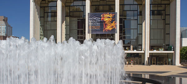
The Lincoln Square neighborhood got its name in May 1906, but it took the Lincoln Center Redevelopment project to really put the area on the map. The 1955 public/private urban renewal project turned a slum into a cultural complex. Some fifty years later, the center was renovated and extended with the addition of less formal features, such as the Illumination Lawn and the plaza, grandstand and cafe on Broadway between West 65th and West 66th Streets.
The project’s enduring flaw is the lack of mass transit: A single subway stop – and a local stop at that – serves Lincoln Center.
Fordham University’s Lincoln Center campus occupies two square blocks south of Lincoln Center; Fiorello H. LaGuardia High School and Martin Luther King, Jr. High School occupy two blocks west of Lincoln Center. Capital Cities/ABC has a cluster of four buildings at Columbus Avenue and West 66th Street. Retail culture – in the form of Tower Records and Barnes and Noble – used to be Lincoln Center’s neighbors on opposite sides of Broadway at West 66th; they’ve been succeeded by Raymour & Flanigan furniture and Century 21 discount department store.
The slide show begins with Lincoln Center for the Performing Arts, then continues with the Lincoln Square neighborhood outside Lincoln Center.
Lincoln Square and Lincoln Center Suggested Reading
- Google Map
- Wikipedia: Lincoln Square
- Wikipedia: Lincoln Center for the Performing Arts
- Landmarks Preservation Commission: First Battery Armory designation report
- Landmarks Preservation Commission: Sofia Brothers Warehouse designation report

![[Lincoln Center] IMG_2633 [6/8/2012 12:54:00 PM] [Lincoln Center] IMG_2633 [6/8/2012 12:54:00 PM]](https://www.newyorkitecture.com/wp-content/gallery/lincoln-center/img_2633_resize.jpg)
![[Lincoln Center] IMG_2904_resize [6/8/2012 2:54:39 PM] [Lincoln Center] IMG_2904_resize [6/8/2012 2:54:39 PM]](https://www.newyorkitecture.com/wp-content/gallery/lincoln-center/img_2904_resize.jpg)
![[Lincoln Center] IMG_2895_resize [6/8/2012 2:49:05 PM] [Lincoln Center] IMG_2895_resize [6/8/2012 2:49:05 PM]](https://www.newyorkitecture.com/wp-content/gallery/lincoln-center/img_2895_resize.jpg)
![[Lincoln Center] IMG_2889_resize [6/8/2012 2:48:35 PM] [Lincoln Center] IMG_2889_resize [6/8/2012 2:48:35 PM]](https://www.newyorkitecture.com/wp-content/gallery/lincoln-center/img_2889_resize.jpg)
![[Lincoln Center] IMG_2861_resize [6/8/2012 2:32:40 PM] [Lincoln Center] IMG_2861_resize [6/8/2012 2:32:40 PM]](https://www.newyorkitecture.com/wp-content/gallery/lincoln-center/img_2861_resize.jpg)
![[Lincoln Center] IMG_2692_resize [6/8/2012 1:13:30 PM] [Lincoln Center] IMG_2692_resize [6/8/2012 1:13:30 PM]](https://www.newyorkitecture.com/wp-content/gallery/lincoln-center/img_2692_resize.jpg)
![[Lincoln Center] IMG_2687_resize [6/8/2012 1:11:37 PM] [Lincoln Center] IMG_2687_resize [6/8/2012 1:11:37 PM]](https://www.newyorkitecture.com/wp-content/gallery/lincoln-center/img_2687_resize.jpg)
![[Lincoln Center] IMG_2682_resize [6/8/2012 1:10:38 PM] [Lincoln Center] IMG_2682_resize [6/8/2012 1:10:38 PM]](https://www.newyorkitecture.com/wp-content/gallery/lincoln-center/img_2682_resize.jpg)
![[Lincoln Center] IMG_2675_resize [6/8/2012 1:06:32 PM] [Lincoln Center] IMG_2675_resize [6/8/2012 1:06:32 PM]](https://www.newyorkitecture.com/wp-content/gallery/lincoln-center/img_2675_resize.jpg)
![[Lincoln Center] IMG_2669_resize [6/8/2012 1:04:13 PM] [Lincoln Center] IMG_2669_resize [6/8/2012 1:04:13 PM]](https://www.newyorkitecture.com/wp-content/gallery/lincoln-center/img_2669_resize.jpg)
![[Lincoln Center] IMG_2660_resize [6/8/2012 1:01:28 PM] [Lincoln Center] IMG_2660_resize [6/8/2012 1:01:28 PM]](https://www.newyorkitecture.com/wp-content/gallery/lincoln-center/img_2660_resize.jpg)
![[Lincoln Center] IMG_2657_resize [6/8/2012 1:00:24 PM] [Lincoln Center] IMG_2657_resize [6/8/2012 1:00:24 PM]](https://www.newyorkitecture.com/wp-content/gallery/lincoln-center/img_2657_resize.jpg)
![[Lincoln Center] IMG_2656_resize [6/8/2012 1:00:13 PM] [Lincoln Center] IMG_2656_resize [6/8/2012 1:00:13 PM]](https://www.newyorkitecture.com/wp-content/gallery/lincoln-center/img_2656_resize.jpg)
![[Lincoln Center] IMG_2649_resize [6/8/2012 12:59:04 PM] [Lincoln Center] IMG_2649_resize [6/8/2012 12:59:04 PM]](https://www.newyorkitecture.com/wp-content/gallery/lincoln-center/img_2649_resize.jpg)
![[Lincoln Center] IMG_2639_resize [6/8/2012 12:56:59 PM] [Lincoln Center] IMG_2639_resize [6/8/2012 12:56:59 PM]](https://www.newyorkitecture.com/wp-content/gallery/lincoln-center/img_2639_resize.jpg)
![[Lincoln Center] IMG_1644_resize [5/31/2012 9:51:49 AM] [Lincoln Center] IMG_1644_resize [5/31/2012 9:51:49 AM]](https://www.newyorkitecture.com/wp-content/gallery/lincoln-center/img_1644_resize.jpg)
![[Lincoln Center] IMG_2570_resize [6/8/2012 12:30:48 PM] [Lincoln Center] IMG_2570_resize [6/8/2012 12:30:48 PM]](https://www.newyorkitecture.com/wp-content/gallery/lincoln-center/img_2570_resize.jpg)
![[Lincoln Center] IMG_1759_resize [5/31/2012 10:31:51 AM] [Lincoln Center] IMG_1759_resize [5/31/2012 10:31:51 AM]](https://www.newyorkitecture.com/wp-content/gallery/lincoln-center/img_1759_resize.jpg)
![[Lincoln Center] IMG_1748_resize [5/31/2012 10:28:56 AM] [Lincoln Center] IMG_1748_resize [5/31/2012 10:28:56 AM]](https://www.newyorkitecture.com/wp-content/gallery/lincoln-center/img_1748_resize.jpg)
![[Lincoln Center] IMG_1742_resize [5/31/2012 10:26:19 AM] [Lincoln Center] IMG_1742_resize [5/31/2012 10:26:19 AM]](https://www.newyorkitecture.com/wp-content/gallery/lincoln-center/img_1742_resize.jpg)
![[Lincoln Center] IMG_1736_resize [5/31/2012 10:22:00 AM] [Lincoln Center] IMG_1736_resize [5/31/2012 10:22:00 AM]](https://www.newyorkitecture.com/wp-content/gallery/lincoln-center/img_1736_resize.jpg)
![[Lincoln Center] IMG_1731_resize [5/31/2012 10:19:53 AM] [Lincoln Center] IMG_1731_resize [5/31/2012 10:19:53 AM]](https://www.newyorkitecture.com/wp-content/gallery/lincoln-center/img_1731_resize.jpg)
![[Lincoln Center] IMG_1699_resize [5/31/2012 10:15:02 AM] [Lincoln Center] IMG_1699_resize [5/31/2012 10:15:02 AM]](https://www.newyorkitecture.com/wp-content/gallery/lincoln-center/img_1699_resize.jpg)
![[Lincoln Center] IMG_1696_resize [5/31/2012 10:14:50 AM] [Lincoln Center] IMG_1696_resize [5/31/2012 10:14:50 AM]](https://www.newyorkitecture.com/wp-content/gallery/lincoln-center/img_1696_resize.jpg)
![[Lincoln Center] IMG_1667_resize [5/31/2012 10:06:49 AM] [Lincoln Center] IMG_1667_resize [5/31/2012 10:06:49 AM]](https://www.newyorkitecture.com/wp-content/gallery/lincoln-center/img_1667_resize.jpg)
![[Lincoln Center] IMG_1660_resize [5/31/2012 10:00:57 AM] [Lincoln Center] IMG_1660_resize [5/31/2012 10:00:57 AM]](https://www.newyorkitecture.com/wp-content/gallery/lincoln-center/img_1660_resize.jpg)
![[Lincoln Center] IMG_1659_resize [5/31/2012 9:59:39 AM] [Lincoln Center] IMG_1659_resize [5/31/2012 9:59:39 AM]](https://www.newyorkitecture.com/wp-content/gallery/lincoln-center/img_1659_resize.jpg)
![[Lincoln Center] IMG_1655_resize [5/31/2012 9:58:28 AM] [Lincoln Center] IMG_1655_resize [5/31/2012 9:58:28 AM]](https://www.newyorkitecture.com/wp-content/gallery/lincoln-center/img_1655_resize.jpg)
![[Lincoln Center] IMG_1652_resize [5/31/2012 9:57:25 AM] [Lincoln Center] IMG_1652_resize [5/31/2012 9:57:25 AM]](https://www.newyorkitecture.com/wp-content/gallery/lincoln-center/img_1652_resize.jpg)
![[Lincoln Center] IMG_1645_resize [5/31/2012 9:51:57 AM] [Lincoln Center] IMG_1645_resize [5/31/2012 9:51:57 AM]](https://www.newyorkitecture.com/wp-content/gallery/lincoln-center/img_1645_resize.jpg)