These three neighboring Brooklyn apartment towers along Flatbush Avenue Extension aren’t actually called the Three Sisters, but maybe they should be. From north to south they are: Oro (Gold), Avalon Fort Greene, and Toren (Tower). Besides proximity, they are similar in height (40, 42 and 38 floors, respectively), have similar luxury amenities, and have glass corner designs (wraparound corner windows) for spectacular views.
For each of these towers, check out the developer’s website, of course, but also the City Realty articles. This real estate broker has its own architectural critic, Carter B. Horsley, who was a real estate/architecture reporter and critic for The New York Times and the New York Post.
![C_IMG_6880_1_2Adjust [4/4/2012 9:04:57 AM]](https://www.newyorkitecture.com/wp-content/flagallery/three-sisters/thumbs/thumbs_c_img_6880_1_2adjust.jpg) Oro, designed by Ismael Leyva, Architects, is the eldest sister, completed in 2008. The 40-story building contains 303 condominium apartments, with asking prices reported in the range of $365,000 to $1.2 million for studio through 3BR units. Apartments have nine-foot ceilings (eight feet is the norm), floor-to-ceiling windows, granite countertops and other luxury features. The building’s amenities include a health club with indoor pool and basketball/racquetball court. Oro’s irregular shape allows five of the seven or eight apartments on each floor to have wraparound corner windows. The condo’s name has a double meaning: Oro (Gold) of course implies luxury; but it so happens that the address is 306 Gold Street.
Oro, designed by Ismael Leyva, Architects, is the eldest sister, completed in 2008. The 40-story building contains 303 condominium apartments, with asking prices reported in the range of $365,000 to $1.2 million for studio through 3BR units. Apartments have nine-foot ceilings (eight feet is the norm), floor-to-ceiling windows, granite countertops and other luxury features. The building’s amenities include a health club with indoor pool and basketball/racquetball court. Oro’s irregular shape allows five of the seven or eight apartments on each floor to have wraparound corner windows. The condo’s name has a double meaning: Oro (Gold) of course implies luxury; but it so happens that the address is 306 Gold Street.
Oro website: www.orocondos.com
City Realty architectural commentary: www.cityrealty.com/nyc/downtown-brooklyn/oro-306-gold-street/42134
![D_IMG_6937_8_9Adjust [4/4/2012 9:12:45 AM]](https://www.newyorkitecture.com/wp-content/flagallery/three-sisters/thumbs/thumbs_d_img_6937_8_9adjust.jpg) Avalon Fort Greene – the middle sister – is a rental building offering 631 studio, one-, two- and three-bedroom apartments at monthly rents of $2,180-$5,000. Perkins Eastman Architects designed Avalon Fort Greene, which was completed in 2010. Like Oro, this 42-story residential tower has floor-to-ceiling windows and other luxury features.
Avalon Fort Greene – the middle sister – is a rental building offering 631 studio, one-, two- and three-bedroom apartments at monthly rents of $2,180-$5,000. Perkins Eastman Architects designed Avalon Fort Greene, which was completed in 2010. Like Oro, this 42-story residential tower has floor-to-ceiling windows and other luxury features.
Avalon Fort Greene website: www.avaloncommunities.com/
City Realty architectural commentary: www.cityrealty.com/nyc/fort-greene/avalon-fort-greene-343-gold-street/45851
![B_IMG_6868_69_70Adjust [4/4/2012 9:02:21 AM]](https://www.newyorkitecture.com/wp-content/flagallery/three-sisters/thumbs/thumbs_b_img_6868_69_70adjust.jpg) Toren is the smallest sister – just 240 apartments and 38 floors. Designed by Carl Galioto of Skidmore, Owings & Merrill, it was completed in 2010. This is a condo development, also offering studio, one-, two- and three-bedroom units at prices of up to $1.2 million. Toren’s unusual non-rectangular shape creates some odd-shaped living and bedrooms. Kitchens are open to the living/dining rooms – not even an “island” stands between sink, stove and sofa.
Toren is the smallest sister – just 240 apartments and 38 floors. Designed by Carl Galioto of Skidmore, Owings & Merrill, it was completed in 2010. This is a condo development, also offering studio, one-, two- and three-bedroom units at prices of up to $1.2 million. Toren’s unusual non-rectangular shape creates some odd-shaped living and bedrooms. Kitchens are open to the living/dining rooms – not even an “island” stands between sink, stove and sofa.
Toren website: www.torencondo.com/
City Realty architectural commentary: www.cityrealty.com/nyc/downtown-brooklyn/toren-150-myrtle-avenue/40806
Google Map
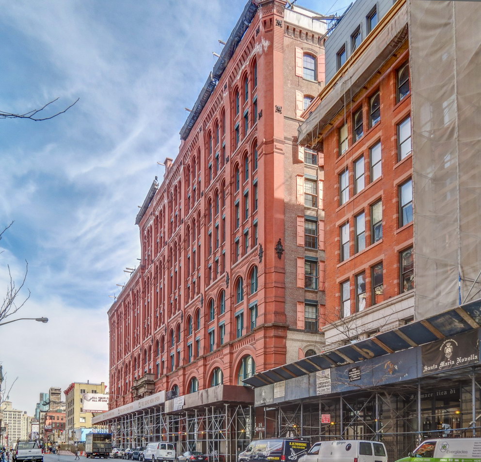
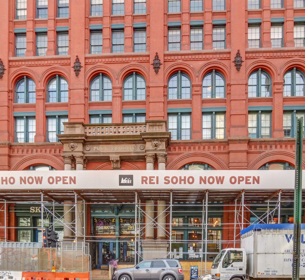
![IMG_0586_7_8Adjust [2/19/2012 2:46:50 PM] IMG_0586_7_8Adjust [2/19/2012 2:46:50 PM]](https://www.newyorkitecture.com/wp-content/gallery/soho/img_a_0586_7_8adjust.jpg)
![IMG_0592_3_4Adjust [2/19/2012 2:50:12 PM] IMG_0592_3_4Adjust [2/19/2012 2:50:12 PM]](https://www.newyorkitecture.com/wp-content/gallery/soho/img_a_0592_3_4adjust.jpg)
![IMG_0997_8_9Adjust [2/22/2012 12:43:28 PM] IMG_0997_8_9Adjust [2/22/2012 12:43:28 PM]](https://www.newyorkitecture.com/wp-content/gallery/soho/img_a_0997_8_9adjust.jpg)
![IMG_1027_8_9Adjust [2/22/2012 12:53:48 PM] IMG_1027_8_9Adjust [2/22/2012 12:53:48 PM]](https://www.newyorkitecture.com/wp-content/gallery/soho/img_a_1027_8_9adjust.jpg)
![IMG_1030_1_2Adjust [2/22/2012 12:59:53 PM] IMG_1030_1_2Adjust [2/22/2012 12:59:53 PM]](https://www.newyorkitecture.com/wp-content/gallery/soho/img_a_1030_1_2adjust.jpg)
![IMG_1051_2_3Adjust [2/22/2012 1:03:25 PM] IMG_1051_2_3Adjust [2/22/2012 1:03:25 PM]](https://www.newyorkitecture.com/wp-content/gallery/soho/img_a_1051_2_3adjust.jpg)
![IMG_1060_1_2Adjust [2/22/2012 1:05:30 PM] IMG_1060_1_2Adjust [2/22/2012 1:05:30 PM]](https://www.newyorkitecture.com/wp-content/gallery/soho/img_a_1060_1_2adjust.jpg)
![IMG_1063_4_5Adjust [2/22/2012 1:06:36 PM] IMG_1063_4_5Adjust [2/22/2012 1:06:36 PM]](https://www.newyorkitecture.com/wp-content/gallery/soho/img_a_1063_4_5adjust.jpg)
![IMG_1072_3_4Adjust [2/22/2012 1:09:09 PM] IMG_1072_3_4Adjust [2/22/2012 1:09:09 PM]](https://www.newyorkitecture.com/wp-content/gallery/soho/img_a_1072_3_4adjust.jpg)
![IMG_1078_79_80Adjust [2/22/2012 1:14:15 PM] IMG_1078_79_80Adjust [2/22/2012 1:14:15 PM]](https://www.newyorkitecture.com/wp-content/gallery/soho/img_a_1078_79_80adjust.jpg)
![IMG_1081_2_3Adjust [2/22/2012 1:16:09 PM] IMG_1081_2_3Adjust [2/22/2012 1:16:09 PM]](https://www.newyorkitecture.com/wp-content/gallery/soho/img_a_1081_2_3adjust.jpg)
![IMG_1084_5_6Adjust [2/22/2012 1:17:19 PM] IMG_1084_5_6Adjust [2/22/2012 1:17:19 PM]](https://www.newyorkitecture.com/wp-content/gallery/soho/img_a_1084_5_6adjust.jpg)
![IMG_1102_3_4Adjust [2/22/2012 1:22:40 PM] IMG_1102_3_4Adjust [2/22/2012 1:22:40 PM]](https://www.newyorkitecture.com/wp-content/gallery/soho/img_a_1102_3_4adjust.jpg)
![IMG_1114_5_6Adjust [2/22/2012 1:25:45 PM] IMG_1114_5_6Adjust [2/22/2012 1:25:45 PM]](https://www.newyorkitecture.com/wp-content/gallery/soho/img_a_1114_5_6adjust.jpg)
![IMG_1120_1_2Adjust [2/22/2012 1:27:14 PM] IMG_1120_1_2Adjust [2/22/2012 1:27:14 PM]](https://www.newyorkitecture.com/wp-content/gallery/soho/img_a_1120_1_2adjust.jpg)
![IMG_1126_7_8Adjust [2/22/2012 1:28:59 PM] IMG_1126_7_8Adjust [2/22/2012 1:28:59 PM]](https://www.newyorkitecture.com/wp-content/gallery/soho/img_a_1126_7_8adjust.jpg)
![IMG_1147_8_9Adjust [2/22/2012 1:33:28 PM] IMG_1147_8_9Adjust [2/22/2012 1:33:28 PM]](https://www.newyorkitecture.com/wp-content/gallery/soho/img_a_1147_8_9adjust.jpg)
![IMG_1162_3_4Adjust [2/22/2012 1:40:58 PM] IMG_1162_3_4Adjust [2/22/2012 1:40:58 PM]](https://www.newyorkitecture.com/wp-content/gallery/soho/img_a_1162_3_4adjust.jpg)
![IMG_1168_69_70Adjust [2/22/2012 1:43:23 PM] IMG_1168_69_70Adjust [2/22/2012 1:43:23 PM]](https://www.newyorkitecture.com/wp-content/gallery/soho/img_a_1168_69_70adjust.jpg)
![IMG_1177_8_9Adjust [2/22/2012 1:45:42 PM] IMG_1177_8_9Adjust [2/22/2012 1:45:42 PM]](https://www.newyorkitecture.com/wp-content/gallery/soho/img_a_1177_8_9adjust.jpg)
![IMG_1186_7_8Adjust [2/22/2012 1:48:09 PM] IMG_1186_7_8Adjust [2/22/2012 1:48:09 PM]](https://www.newyorkitecture.com/wp-content/gallery/soho/img_a_1186_7_8adjust.jpg)
![IMG_1192_3_4Adjust [2/22/2012 1:50:42 PM] IMG_1192_3_4Adjust [2/22/2012 1:50:42 PM]](https://www.newyorkitecture.com/wp-content/gallery/soho/img_a_1192_3_4adjust.jpg)
![IMG_1198_199_200Adjust [2/22/2012 1:52:16 PM] IMG_1198_199_200Adjust [2/22/2012 1:52:16 PM]](https://www.newyorkitecture.com/wp-content/gallery/soho/img_a_1198_199_200adjust.jpg)
![IMG_1207_8_9Adjust [2/22/2012 1:54:57 PM] IMG_1207_8_9Adjust [2/22/2012 1:54:57 PM]](https://www.newyorkitecture.com/wp-content/gallery/soho/img_a_1207_8_9adjust.jpg)
![IMG_1225_6_7Adjust [2/22/2012 1:57:53 PM] IMG_1225_6_7Adjust [2/22/2012 1:57:53 PM]](https://www.newyorkitecture.com/wp-content/gallery/soho/img_a_1225_6_7adjust.jpg)
![IMG_1228_29_30Adjust [2/22/2012 2:01:29 PM] IMG_1228_29_30Adjust [2/22/2012 2:01:29 PM]](https://www.newyorkitecture.com/wp-content/gallery/soho/img_a_1228_29_30adjust.jpg)
![IMG_1255_6_7Adjust [2/22/2012 2:08:08 PM] IMG_1255_6_7Adjust [2/22/2012 2:08:08 PM]](https://www.newyorkitecture.com/wp-content/gallery/soho/img_a_1255_6_7adjust.jpg)
![IMG_1267_8_9Adjust [2/22/2012 2:13:49 PM] IMG_1267_8_9Adjust [2/22/2012 2:13:49 PM]](https://www.newyorkitecture.com/wp-content/gallery/soho/img_a_1267_8_9adjust.jpg)
![IMG_1273_4_5Adjust [2/22/2012 2:15:00 PM] IMG_1273_4_5Adjust [2/22/2012 2:15:00 PM]](https://www.newyorkitecture.com/wp-content/gallery/soho/img_a_1273_4_5adjust.jpg)
![IMG_1282_3_4Adjust [2/22/2012 2:19:07 PM] IMG_1282_3_4Adjust [2/22/2012 2:19:07 PM]](https://www.newyorkitecture.com/wp-content/gallery/soho/img_a_1282_3_4adjust.jpg)
![IMG_1288_89_90Adjust [2/22/2012 2:21:45 PM] IMG_1288_89_90Adjust [2/22/2012 2:21:45 PM]](https://www.newyorkitecture.com/wp-content/gallery/soho/img_a_1288_89_90adjust.jpg)
![IMG_1291_2_3Adjust [2/22/2012 2:23:54 PM] IMG_1291_2_3Adjust [2/22/2012 2:23:54 PM]](https://www.newyorkitecture.com/wp-content/gallery/soho/img_a_1291_2_3adjust.jpg)
![IMG_1303_4_5Adjust [2/22/2012 2:30:35 PM] IMG_1303_4_5Adjust [2/22/2012 2:30:35 PM]](https://www.newyorkitecture.com/wp-content/gallery/soho/img_a_1303_4_5adjust.jpg)
![IMG_1306_7_8Adjust [2/22/2012 2:31:31 PM] IMG_1306_7_8Adjust [2/22/2012 2:31:31 PM]](https://www.newyorkitecture.com/wp-content/gallery/soho/img_a_1306_7_8adjust.jpg)
![IMG_1321_2_3Adjust [2/22/2012 2:40:00 PM] IMG_1321_2_3Adjust [2/22/2012 2:40:00 PM]](https://www.newyorkitecture.com/wp-content/gallery/soho/img_a_1321_2_3adjust.jpg)
![IMG_1324_5_6Adjust [2/22/2012 2:43:43 PM] IMG_1324_5_6Adjust [2/22/2012 2:43:43 PM]](https://www.newyorkitecture.com/wp-content/gallery/soho/img_a_1324_5_6adjust.jpg)
![IMG_1333_4_5Adjust [2/22/2012 2:46:33 PM] IMG_1333_4_5Adjust [2/22/2012 2:46:33 PM]](https://www.newyorkitecture.com/wp-content/gallery/soho/img_a_1333_4_5adjust.jpg)
![IMG_1339_40_41Adjust [2/22/2012 2:47:53 PM] IMG_1339_40_41Adjust [2/22/2012 2:47:53 PM]](https://www.newyorkitecture.com/wp-content/gallery/soho/img_a_1339_40_41adjust.jpg)
![IMG_1354_5_6Adjust [2/22/2012 2:50:54 PM] IMG_1354_5_6Adjust [2/22/2012 2:50:54 PM]](https://www.newyorkitecture.com/wp-content/gallery/soho/img_a_1354_5_6adjust.jpg)
![IMG_1390_1_2Adjust [2/22/2012 3:04:50 PM] IMG_1390_1_2Adjust [2/22/2012 3:04:50 PM]](https://www.newyorkitecture.com/wp-content/gallery/soho/img_a_1390_1_2adjust.jpg)
![IMG_1396_7_8Adjust [2/22/2012 3:07:52 PM] IMG_1396_7_8Adjust [2/22/2012 3:07:52 PM]](https://www.newyorkitecture.com/wp-content/gallery/soho/img_a_1396_7_8adjust.jpg)
![IMG_1402_3_4Adjust [2/22/2012 3:09:28 PM] IMG_1402_3_4Adjust [2/22/2012 3:09:28 PM]](https://www.newyorkitecture.com/wp-content/gallery/soho/img_a_1402_3_4adjust.jpg)
![IMG_1405_6_7Adjust [2/22/2012 3:10:04 PM] IMG_1405_6_7Adjust [2/22/2012 3:10:04 PM]](https://www.newyorkitecture.com/wp-content/gallery/soho/img_a_1405_6_7adjust.jpg)
![IMG_1414_5_6Adjust [2/22/2012 3:13:41 PM] IMG_1414_5_6Adjust [2/22/2012 3:13:41 PM]](https://www.newyorkitecture.com/wp-content/gallery/soho/img_a_1414_5_6adjust.jpg)
![IMG_1429_30_31Adjust [2/22/2012 3:19:30 PM] IMG_1429_30_31Adjust [2/22/2012 3:19:30 PM]](https://www.newyorkitecture.com/wp-content/gallery/soho/img_a_1429_30_31adjust.jpg)
![IMG_1438_39_40Adjust [2/22/2012 3:22:18 PM] IMG_1438_39_40Adjust [2/22/2012 3:22:18 PM]](https://www.newyorkitecture.com/wp-content/gallery/soho/img_a_1438_39_40adjust.jpg)
![IMG_1447_8_9Adjust [2/22/2012 3:26:49 PM] IMG_1447_8_9Adjust [2/22/2012 3:26:49 PM]](https://www.newyorkitecture.com/wp-content/gallery/soho/img_a_1447_8_9adjust.jpg)
![IMG_1459_60_61Adjust [2/22/2012 3:31:06 PM] IMG_1459_60_61Adjust [2/22/2012 3:31:06 PM]](https://www.newyorkitecture.com/wp-content/gallery/soho/img_a_1459_60_61adjust.jpg)
![IMG_1471_2_3Adjust [2/22/2012 3:36:28 PM] IMG_1471_2_3Adjust [2/22/2012 3:36:28 PM]](https://www.newyorkitecture.com/wp-content/gallery/soho/img_a_1471_2_3adjust.jpg)
![IMG_1477_8_9Adjust [2/22/2012 3:37:36 PM] IMG_1477_8_9Adjust [2/22/2012 3:37:36 PM]](https://www.newyorkitecture.com/wp-content/gallery/soho/img_a_1477_8_9adjust.jpg)
![IMG_1480_1_2Adjust [2/22/2012 3:41:01 PM] IMG_1480_1_2Adjust [2/22/2012 3:41:01 PM]](https://www.newyorkitecture.com/wp-content/gallery/soho/img_a_1480_1_2adjust.jpg)
![IMG_1492_3_4Adjust [2/22/2012 3:46:13 PM] IMG_1492_3_4Adjust [2/22/2012 3:46:13 PM]](https://www.newyorkitecture.com/wp-content/gallery/soho/img_a_1492_3_4adjust.jpg)
![IMG_1501_2_3Adjust [2/22/2012 3:49:13 PM] IMG_1501_2_3Adjust [2/22/2012 3:49:13 PM]](https://www.newyorkitecture.com/wp-content/gallery/soho/img_a_1501_2_3adjust.jpg)
![IMG_1507_8_9Adjust [2/22/2012 3:51:02 PM] IMG_1507_8_9Adjust [2/22/2012 3:51:02 PM]](https://www.newyorkitecture.com/wp-content/gallery/soho/img_a_1507_8_9adjust.jpg)
![IMG_1513_4_5Adjust [2/22/2012 3:52:56 PM] IMG_1513_4_5Adjust [2/22/2012 3:52:56 PM]](https://www.newyorkitecture.com/wp-content/gallery/soho/img_a_1513_4_5adjust.jpg)
![IMG_1528_29_30Adjust [2/22/2012 3:57:26 PM] IMG_1528_29_30Adjust [2/22/2012 3:57:26 PM]](https://www.newyorkitecture.com/wp-content/gallery/soho/img_a_1528_29_30adjust.jpg)
![IMG_1537_8_9Adjust [2/22/2012 3:58:39 PM] IMG_1537_8_9Adjust [2/22/2012 3:58:39 PM]](https://www.newyorkitecture.com/wp-content/gallery/soho/img_a_1537_8_9adjust.jpg)
![IMG_1546_7_8Adjust [2/22/2012 4:03:12 PM] IMG_1546_7_8Adjust [2/22/2012 4:03:12 PM]](https://www.newyorkitecture.com/wp-content/gallery/soho/img_a_1546_7_8adjust.jpg)
![IMG_1549_50_51Adjust [2/22/2012 4:04:48 PM] IMG_1549_50_51Adjust [2/22/2012 4:04:48 PM]](https://www.newyorkitecture.com/wp-content/gallery/soho/img_a_1549_50_51adjust.jpg)
![IMG_1555_6_7Adjust [2/22/2012 4:07:32 PM] IMG_1555_6_7Adjust [2/22/2012 4:07:32 PM]](https://www.newyorkitecture.com/wp-content/gallery/soho/img_a_1555_6_7adjust.jpg)
![IMG_1564_5_6Adjust [2/22/2012 4:09:59 PM] IMG_1564_5_6Adjust [2/22/2012 4:09:59 PM]](https://www.newyorkitecture.com/wp-content/gallery/soho/img_a_1564_5_6adjust.jpg)
![IMG_1567_8_9Adjust [2/27/2012 11:55:31 AM] IMG_1567_8_9Adjust [2/27/2012 11:55:31 AM]](https://www.newyorkitecture.com/wp-content/gallery/soho/img_a_1567_8_9adjust.jpg)
![IMG_1582_3_4Adjust [2/27/2012 11:57:24 AM] IMG_1582_3_4Adjust [2/27/2012 11:57:24 AM]](https://www.newyorkitecture.com/wp-content/gallery/soho/img_a_1582_3_4adjust.jpg)
![IMG_1372_3_4Adjust [2/22/2012 2:57:21 PM] IMG_1372_3_4Adjust [2/22/2012 2:57:21 PM]](https://www.newyorkitecture.com/wp-content/gallery/soho/img_b_1372_3_4adjust.jpg)
![IMG_1375_6_7Adjust [2/22/2012 2:58:02 PM] IMG_1375_6_7Adjust [2/22/2012 2:58:02 PM]](https://www.newyorkitecture.com/wp-content/gallery/soho/img_b_1375_6_7adjust.jpg)
![IMG_1378_79_80Adjust [2/22/2012 3:00:13 PM] IMG_1378_79_80Adjust [2/22/2012 3:00:13 PM]](https://www.newyorkitecture.com/wp-content/gallery/soho/img_b_1378_79_80adjust.jpg)
![IMG_1381_2_3Adjust [2/22/2012 3:02:01 PM] IMG_1381_2_3Adjust [2/22/2012 3:02:01 PM]](https://www.newyorkitecture.com/wp-content/gallery/soho/img_b_1381_2_3adjust.jpg)
![IMG_1585_6_7Adjust [2/27/2012 12:02:14 PM] IMG_1585_6_7Adjust [2/27/2012 12:02:14 PM]](https://www.newyorkitecture.com/wp-content/gallery/soho/img_b_1585_6_7adjust.jpg)
![IMG_1612_3_4Adjust [2/27/2012 12:07:47 PM] IMG_1612_3_4Adjust [2/27/2012 12:07:47 PM]](https://www.newyorkitecture.com/wp-content/gallery/soho/img_b_1612_3_4adjust.jpg)
![IMG_1615_6_7Adjust [2/27/2012 12:08:54 PM] IMG_1615_6_7Adjust [2/27/2012 12:08:54 PM]](https://www.newyorkitecture.com/wp-content/gallery/soho/img_b_1615_6_7adjust.jpg)
![IMG_1618_19_20Adjust [2/27/2012 12:09:29 PM] IMG_1618_19_20Adjust [2/27/2012 12:09:29 PM]](https://www.newyorkitecture.com/wp-content/gallery/soho/img_b_1618_19_20adjust.jpg)
![IMG_1624_5_6Adjust [2/27/2012 12:10:36 PM] IMG_1624_5_6Adjust [2/27/2012 12:10:36 PM]](https://www.newyorkitecture.com/wp-content/gallery/soho/img_b_1624_5_6adjust.jpg)
![IMG_1627_8_9Adjust [2/27/2012 12:11:16 PM] IMG_1627_8_9Adjust [2/27/2012 12:11:16 PM]](https://www.newyorkitecture.com/wp-content/gallery/soho/img_b_1627_8_9adjust.jpg)
![IMG_1630_1_2Adjust [2/27/2012 12:13:08 PM] IMG_1630_1_2Adjust [2/27/2012 12:13:08 PM]](https://www.newyorkitecture.com/wp-content/gallery/soho/img_b_1630_1_2adjust.jpg)
![IMG_1636_7_8Adjust [2/27/2012 12:14:14 PM] IMG_1636_7_8Adjust [2/27/2012 12:14:14 PM]](https://www.newyorkitecture.com/wp-content/gallery/soho/img_c_1636_7_8adjust.jpg)
![IMG_1642_3_4Adjust [2/27/2012 12:15:56 PM] IMG_1642_3_4Adjust [2/27/2012 12:15:56 PM]](https://www.newyorkitecture.com/wp-content/gallery/soho/img_c_1642_3_4adjust.jpg)
![IMG_1651_2_3Adjust [2/27/2012 12:18:16 PM] IMG_1651_2_3Adjust [2/27/2012 12:18:16 PM]](https://www.newyorkitecture.com/wp-content/gallery/soho/img_c_1651_2_3adjust.jpg)
![IMG_1669_70_71Adjust [2/27/2012 12:26:53 PM] IMG_1669_70_71Adjust [2/27/2012 12:26:53 PM]](https://www.newyorkitecture.com/wp-content/gallery/soho/img_c_1669_70_71adjust.jpg)
![IMG_1684_5_6Adjust [2/27/2012 12:31:42 PM] IMG_1684_5_6Adjust [2/27/2012 12:31:42 PM]](https://www.newyorkitecture.com/wp-content/gallery/soho/img_c_1684_5_6adjust.jpg)
![IMG_1693_4_5Adjust [2/27/2012 12:33:42 PM] IMG_1693_4_5Adjust [2/27/2012 12:33:42 PM]](https://www.newyorkitecture.com/wp-content/gallery/soho/img_c_1693_4_5adjust.jpg)
![IMG_1699_700_701Adjust [2/27/2012 12:35:32 PM] IMG_1699_700_701Adjust [2/27/2012 12:35:32 PM]](https://www.newyorkitecture.com/wp-content/gallery/soho/img_c_1699_700_701adjust.jpg)
![IMG_1720_1_2Adjust [2/27/2012 12:41:43 PM] IMG_1720_1_2Adjust [2/27/2012 12:41:43 PM]](https://www.newyorkitecture.com/wp-content/gallery/soho/img_c_1720_1_2adjust.jpg)
![IMG_1738_39_40Adjust [2/27/2012 12:46:12 PM] IMG_1738_39_40Adjust [2/27/2012 12:46:12 PM]](https://www.newyorkitecture.com/wp-content/gallery/soho/img_c_1738_39_40adjust.jpg)
![IMG_1762_3_4Adjust [2/27/2012 12:53:20 PM] IMG_1762_3_4Adjust [2/27/2012 12:53:20 PM]](https://www.newyorkitecture.com/wp-content/gallery/soho/img_c_1762_3_4adjust.jpg)
![IMG_1783_4_5Adjust [2/27/2012 12:57:42 PM] IMG_1783_4_5Adjust [2/27/2012 12:57:42 PM]](https://www.newyorkitecture.com/wp-content/gallery/soho/img_c_1783_4_5adjust.jpg)
![IMG_1801_2_3Adjust [2/27/2012 1:01:52 PM] IMG_1801_2_3Adjust [2/27/2012 1:01:52 PM]](https://www.newyorkitecture.com/wp-content/gallery/soho/img_c_1801_2_3adjust.jpg)
![IMG_1810_1_2Adjust [2/27/2012 1:05:42 PM] IMG_1810_1_2Adjust [2/27/2012 1:05:42 PM]](https://www.newyorkitecture.com/wp-content/gallery/soho/img_c_1810_1_2adjust.jpg)
![IMG_1819_20_21Adjust [2/27/2012 1:08:21 PM] IMG_1819_20_21Adjust [2/27/2012 1:08:21 PM]](https://www.newyorkitecture.com/wp-content/gallery/soho/img_c_1819_20_21adjust.jpg)
![IMG_1822_3_4Adjust [2/27/2012 1:09:52 PM] IMG_1822_3_4Adjust [2/27/2012 1:09:52 PM]](https://www.newyorkitecture.com/wp-content/gallery/soho/img_c_1822_3_4adjust.jpg)
![IMG_1834_5_6Adjust [2/27/2012 1:17:13 PM] IMG_1834_5_6Adjust [2/27/2012 1:17:13 PM]](https://www.newyorkitecture.com/wp-content/gallery/soho/img_c_1834_5_6adjust.jpg)
![IMG_1840_1_2Adjust [2/27/2012 1:18:55 PM] IMG_1840_1_2Adjust [2/27/2012 1:18:55 PM]](https://www.newyorkitecture.com/wp-content/gallery/soho/img_c_1840_1_2adjust.jpg)
![IMG_1852_3_4Adjust [2/27/2012 1:20:31 PM] IMG_1852_3_4Adjust [2/27/2012 1:20:31 PM]](https://www.newyorkitecture.com/wp-content/gallery/soho/img_c_1852_3_4adjust.jpg)
![IMG_1855_6_7Adjust [2/27/2012 1:21:34 PM] IMG_1855_6_7Adjust [2/27/2012 1:21:34 PM]](https://www.newyorkitecture.com/wp-content/gallery/soho/img_c_1855_6_7adjust.jpg)
![IMG_1864_5_6Adjust [2/27/2012 1:23:36 PM] IMG_1864_5_6Adjust [2/27/2012 1:23:36 PM]](https://www.newyorkitecture.com/wp-content/gallery/soho/img_c_1864_5_6adjust.jpg)
![IMG_1876_7_8Adjust [2/27/2012 1:26:46 PM] IMG_1876_7_8Adjust [2/27/2012 1:26:46 PM]](https://www.newyorkitecture.com/wp-content/gallery/soho/img_c_1876_7_8adjust.jpg)
![IMG_1918_19_20Adjust [2/27/2012 1:32:55 PM] IMG_1918_19_20Adjust [2/27/2012 1:32:55 PM]](https://www.newyorkitecture.com/wp-content/gallery/soho/img_c_1918_19_20adjust.jpg)
![IMG_1924_5_6Adjust [2/27/2012 1:34:03 PM] IMG_1924_5_6Adjust [2/27/2012 1:34:03 PM]](https://www.newyorkitecture.com/wp-content/gallery/soho/img_c_1924_5_6adjust.jpg)
![IMG_1954_5_6Adjust [2/27/2012 1:37:33 PM] IMG_1954_5_6Adjust [2/27/2012 1:37:33 PM]](https://www.newyorkitecture.com/wp-content/gallery/soho/img_c_1954_5_6adjust.jpg)
![IMG_d_1966_7_8Adjust [2/28/2012 11:46:02 AM] IMG_d_1966_7_8Adjust [2/28/2012 11:46:02 AM]](https://www.newyorkitecture.com/wp-content/gallery/soho/img_d_1966_7_8adjust.jpg)
![IMG_d_1978_79_80Adjust [2/28/2012 11:50:17 AM] IMG_d_1978_79_80Adjust [2/28/2012 11:50:17 AM]](https://www.newyorkitecture.com/wp-content/gallery/soho/img_d_1978_79_80adjust.jpg)
![IMG_d_2008_09_10Adjust [2/28/2012 11:54:02 AM] IMG_d_2008_09_10Adjust [2/28/2012 11:54:02 AM]](https://www.newyorkitecture.com/wp-content/gallery/soho/img_d_2008_09_10adjust.jpg)
![IMG_d_2026_7_8Adjust [2/28/2012 11:57:07 AM] IMG_d_2026_7_8Adjust [2/28/2012 11:57:07 AM]](https://www.newyorkitecture.com/wp-content/gallery/soho/img_d_2026_7_8adjust.jpg)
![IMG_d_2050_1_2Adjust [2/28/2012 12:02:09 PM] IMG_d_2050_1_2Adjust [2/28/2012 12:02:09 PM]](https://www.newyorkitecture.com/wp-content/gallery/soho/img_d_2050_1_2adjust.jpg)
![IMG_d_2074_5_6Adjust [2/28/2012 12:09:12 PM] IMG_d_2074_5_6Adjust [2/28/2012 12:09:12 PM]](https://www.newyorkitecture.com/wp-content/gallery/soho/img_d_2074_5_6adjust.jpg)
![IMG_d_2086_7_8Adjust [2/28/2012 12:11:23 PM] IMG_d_2086_7_8Adjust [2/28/2012 12:11:23 PM]](https://www.newyorkitecture.com/wp-content/gallery/soho/img_d_2086_7_8adjust.jpg)
![IMG_d_2095_6_7Adjust [2/28/2012 12:12:25 PM] IMG_d_2095_6_7Adjust [2/28/2012 12:12:25 PM]](https://www.newyorkitecture.com/wp-content/gallery/soho/img_d_2095_6_7adjust.jpg)
![IMG_d_2101_2_3Adjust [2/28/2012 12:15:17 PM] IMG_d_2101_2_3Adjust [2/28/2012 12:15:17 PM]](https://www.newyorkitecture.com/wp-content/gallery/soho/img_d_2101_2_3adjust.jpg)
![IMG_d_2104_5_6Adjust [2/28/2012 12:20:24 PM] IMG_d_2104_5_6Adjust [2/28/2012 12:20:24 PM]](https://www.newyorkitecture.com/wp-content/gallery/soho/img_d_2104_5_6adjust.jpg)
![IMG_d_2122_3_4Adjust [2/28/2012 12:31:59 PM] IMG_d_2122_3_4Adjust [2/28/2012 12:31:59 PM]](https://www.newyorkitecture.com/wp-content/gallery/soho/img_d_2122_3_4adjust.jpg)
![IMG_d_2140_1_2Adjust [2/28/2012 12:37:25 PM] IMG_d_2140_1_2Adjust [2/28/2012 12:37:25 PM]](https://www.newyorkitecture.com/wp-content/gallery/soho/img_d_2140_1_2adjust.jpg)
![IMG_d_2152_3_4Adjust [2/28/2012 12:41:45 PM] IMG_d_2152_3_4Adjust [2/28/2012 12:41:45 PM]](https://www.newyorkitecture.com/wp-content/gallery/soho/img_d_2152_3_4adjust.jpg)
![IMG_d_2173_4_5Adjust [2/28/2012 12:50:09 PM] IMG_d_2173_4_5Adjust [2/28/2012 12:50:09 PM]](https://www.newyorkitecture.com/wp-content/gallery/soho/img_d_2173_4_5adjust.jpg)
![IMG_d_2188_89_90Adjust [2/28/2012 12:53:30 PM] IMG_d_2188_89_90Adjust [2/28/2012 12:53:30 PM]](https://www.newyorkitecture.com/wp-content/gallery/soho/img_d_2188_89_90adjust.jpg)
![IMG_d_2203_4_5Adjust [2/28/2012 1:00:23 PM] IMG_d_2203_4_5Adjust [2/28/2012 1:00:23 PM]](https://www.newyorkitecture.com/wp-content/gallery/soho/img_d_2203_4_5adjust.jpg)
![IMG_d_2212_3_4Adjust [2/28/2012 1:01:47 PM] IMG_d_2212_3_4Adjust [2/28/2012 1:01:47 PM]](https://www.newyorkitecture.com/wp-content/gallery/soho/img_d_2212_3_4adjust.jpg)
![IMG_d_2215_6_7Adjust [2/28/2012 1:04:43 PM] IMG_d_2215_6_7Adjust [2/28/2012 1:04:43 PM]](https://www.newyorkitecture.com/wp-content/gallery/soho/img_d_2215_6_7adjust.jpg)
![IMG_d_2230_1_2Adjust [2/28/2012 1:10:40 PM] IMG_d_2230_1_2Adjust [2/28/2012 1:10:40 PM]](https://www.newyorkitecture.com/wp-content/gallery/soho/img_d_2230_1_2adjust.jpg)
![IMG_d_2245_6_7Adjust [2/28/2012 1:16:27 PM] IMG_d_2245_6_7Adjust [2/28/2012 1:16:27 PM]](https://www.newyorkitecture.com/wp-content/gallery/soho/img_d_2245_6_7adjust.jpg)
![IMG_d_2251_2_3Adjust [2/28/2012 1:18:15 PM] IMG_d_2251_2_3Adjust [2/28/2012 1:18:15 PM]](https://www.newyorkitecture.com/wp-content/gallery/soho/img_d_2251_2_3adjust.jpg)
![IMG_d_2260_1_2Adjust [2/28/2012 1:22:30 PM] IMG_d_2260_1_2Adjust [2/28/2012 1:22:30 PM]](https://www.newyorkitecture.com/wp-content/gallery/soho/img_d_2260_1_2adjust.jpg)
![IMG_d_2266_7_8Adjust [2/28/2012 1:25:44 PM] IMG_d_2266_7_8Adjust [2/28/2012 1:25:44 PM]](https://www.newyorkitecture.com/wp-content/gallery/soho/img_d_2266_7_8adjust.jpg)
![IMG_d_2275_6_7Adjust [2/28/2012 1:29:52 PM] IMG_d_2275_6_7Adjust [2/28/2012 1:29:52 PM]](https://www.newyorkitecture.com/wp-content/gallery/soho/img_d_2275_6_7adjust.jpg)
![IMG_d_2296_7_8Adjust [2/28/2012 1:36:53 PM] IMG_d_2296_7_8Adjust [2/28/2012 1:36:53 PM]](https://www.newyorkitecture.com/wp-content/gallery/soho/img_d_2296_7_8adjust.jpg)
![IMG_d_2305_6_7Adjust [2/28/2012 1:43:07 PM] IMG_d_2305_6_7Adjust [2/28/2012 1:43:07 PM]](https://www.newyorkitecture.com/wp-content/gallery/soho/img_d_2305_6_7adjust.jpg)
![IMG_d_2311_2_3Adjust [2/28/2012 1:43:52 PM] IMG_d_2311_2_3Adjust [2/28/2012 1:43:52 PM]](https://www.newyorkitecture.com/wp-content/gallery/soho/img_d_2311_2_3adjust.jpg)
![IMG_d_2317_8_9Adjust [2/28/2012 1:47:07 PM] IMG_d_2317_8_9Adjust [2/28/2012 1:47:07 PM]](https://www.newyorkitecture.com/wp-content/gallery/soho/img_d_2317_8_9adjust.jpg)
![IMG_d_2326_7_8Adjust [2/28/2012 1:51:25 PM] IMG_d_2326_7_8Adjust [2/28/2012 1:51:25 PM]](https://www.newyorkitecture.com/wp-content/gallery/soho/img_d_2326_7_8adjust.jpg)
![IMG_d_2332_3_4Adjust [2/28/2012 1:52:15 PM] IMG_d_2332_3_4Adjust [2/28/2012 1:52:15 PM]](https://www.newyorkitecture.com/wp-content/gallery/soho/img_d_2332_3_4adjust.jpg)
![IMG_d_2338_39_40Adjust [2/28/2012 1:54:25 PM] IMG_d_2338_39_40Adjust [2/28/2012 1:54:25 PM]](https://www.newyorkitecture.com/wp-content/gallery/soho/img_d_2338_39_40adjust.jpg)
![IMG_d_2341_2_3Adjust [2/28/2012 1:55:50 PM] IMG_d_2341_2_3Adjust [2/28/2012 1:55:50 PM]](https://www.newyorkitecture.com/wp-content/gallery/soho/img_d_2341_2_3adjust.jpg)
![IMG_d_2377_8_9Adjust [2/28/2012 2:04:50 PM] IMG_d_2377_8_9Adjust [2/28/2012 2:04:50 PM]](https://www.newyorkitecture.com/wp-content/gallery/soho/img_d_2377_8_9adjust.jpg)
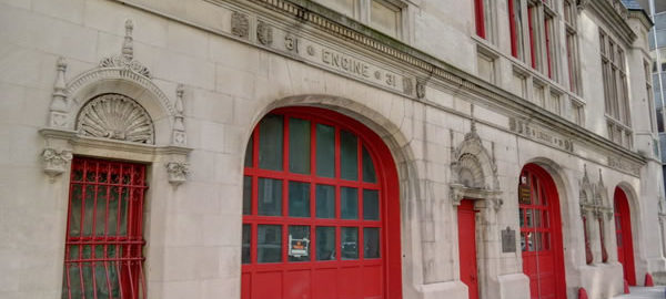
![IMG_7063_4_5Adjust [2/4/2012 1:29:19 PM] IMG_7063_4_5Adjust [2/4/2012 1:29:19 PM]](https://www.newyorkitecture.com/wp-content/gallery/nyc-firehouses/img_7063_4_5adjust.jpg)
![WAT_10_10121 [11/30/2011 11:46:52 AM] WAT_10_10121 [11/30/2011 11:46:52 AM]](https://www.newyorkitecture.com/wp-content/gallery/nyc-firehouses/wat_10_10121.jpg)
![P9150247 [9/15/2011 11:47:26 AM] P9150247 [9/15/2011 11:47:26 AM]](https://www.newyorkitecture.com/wp-content/gallery/nyc-firehouses/p9150247.jpg)
![P9150246 [9/15/2011 11:46:26 AM] P9150246 [9/15/2011 11:46:26 AM]](https://www.newyorkitecture.com/wp-content/gallery/nyc-firehouses/p9150246.jpg)
![P9150004 [9/15/2011 7:37:56 AM] P9150004 [9/15/2011 7:37:56 AM]](https://www.newyorkitecture.com/wp-content/gallery/nyc-firehouses/p9150004.jpg)
![IMG_9725_6_7_tonemapped [11/27/2011 3:25:04 PM] IMG_9725_6_7_tonemapped [11/27/2011 3:25:04 PM]](https://www.newyorkitecture.com/wp-content/gallery/nyc-firehouses/img_9725_6_7_tonemapped.jpg)
![IMG_09724_5_6Adjust [2/18/2012 1:01:56 PM] IMG_09724_5_6Adjust [2/18/2012 1:01:56 PM]](https://www.newyorkitecture.com/wp-content/gallery/nyc-firehouses/img_09724_5_6adjust.jpg)
![IMG_09718_19_20Adjust [2/18/2012 1:00:51 PM] IMG_09718_19_20Adjust [2/18/2012 1:00:51 PM]](https://www.newyorkitecture.com/wp-content/gallery/nyc-firehouses/img_09718_19_20adjust.jpg)
![IMG_09712_3_4Adjust [2/18/2012 12:58:43 PM] IMG_09712_3_4Adjust [2/18/2012 12:58:43 PM]](https://www.newyorkitecture.com/wp-content/gallery/nyc-firehouses/img_09712_3_4adjust.jpg)
![CC_13375_6_7_fused [12/17/2011 11:13:39 AM] CC_13375_6_7_fused [12/17/2011 11:13:39 AM]](https://www.newyorkitecture.com/wp-content/gallery/nyc-firehouses/cc_13375_6_7_fused.jpg)
![IMG_7027_8_9Adjust [2/4/2012 1:21:59 PM] IMG_7027_8_9Adjust [2/4/2012 1:21:59 PM]](https://www.newyorkitecture.com/wp-content/gallery/nyc-firehouses/img_7027_8_9adjust.jpg)
![IMG_5926_7_8Adjust [3/14/2012 2:04:41 PM] IMG_5926_7_8Adjust [3/14/2012 2:04:41 PM]](https://www.newyorkitecture.com/wp-content/gallery/nyc-firehouses/img_5926_7_8adjust.jpg)
![IMG_5494_5_6 [10/31/2011 1:30:09 PM] IMG_5494_5_6 [10/31/2011 1:30:09 PM]](https://www.newyorkitecture.com/wp-content/gallery/nyc-firehouses/img_5494_5_6.jpg)
![IMG_5233_4_5Adjust [3/12/2012 11:58:13 AM] IMG_5233_4_5Adjust [3/12/2012 11:58:13 AM]](https://www.newyorkitecture.com/wp-content/gallery/nyc-firehouses/img_5233_4_5adjust.jpg)
![IMG_5227_8_9Adjust [3/12/2012 11:56:25 AM] IMG_5227_8_9Adjust [3/12/2012 11:56:25 AM]](https://www.newyorkitecture.com/wp-content/gallery/nyc-firehouses/img_5227_8_9adjust.jpg)
![IMG_5215_6_7Adjust [3/12/2012 11:54:10 AM] IMG_5215_6_7Adjust [3/12/2012 11:54:10 AM]](https://www.newyorkitecture.com/wp-content/gallery/nyc-firehouses/img_5215_6_7adjust.jpg)
![IMG_5191_2_3Adjust [3/12/2012 11:50:34 AM] IMG_5191_2_3Adjust [3/12/2012 11:50:34 AM]](https://www.newyorkitecture.com/wp-content/gallery/nyc-firehouses/img_5191_2_3adjust.jpg)
![IMG_0788_89_90_tonemapped [9/30/2011 12:20:52 PM] IMG_0788_89_90_tonemapped [9/30/2011 12:20:52 PM]](https://www.newyorkitecture.com/wp-content/gallery/nyc-firehouses/img_0788_89_90_tonemapped.jpg)
![IMG_3358_59_60Adjust [3/9/2012 11:08:54 AM] IMG_3358_59_60Adjust [3/9/2012 11:08:54 AM]](https://www.newyorkitecture.com/wp-content/gallery/gansevoort-meatpacking-district/img_3358_59_60adjust.jpg)
![IMG_6463_4_5Adjust [2/1/2012 3:35:19 PM] IMG_6463_4_5Adjust [2/1/2012 3:35:19 PM]](https://www.newyorkitecture.com/wp-content/gallery/gansevoort-meatpacking-district/img_6463_4_5adjust.jpg)
![IMG_6451_2_3Adjust [2/1/2012 3:29:15 PM] IMG_6451_2_3Adjust [2/1/2012 3:29:15 PM]](https://www.newyorkitecture.com/wp-content/gallery/gansevoort-meatpacking-district/img_6451_2_3adjust.jpg)
![IMG_6430_1_2Adjust [2/1/2012 3:21:49 PM] IMG_6430_1_2Adjust [2/1/2012 3:21:49 PM]](https://www.newyorkitecture.com/wp-content/gallery/gansevoort-meatpacking-district/img_6430_1_2adjust.jpg)
![IMG_6424_5_6Adjust [2/1/2012 3:17:49 PM] IMG_6424_5_6Adjust [2/1/2012 3:17:49 PM]](https://www.newyorkitecture.com/wp-content/gallery/gansevoort-meatpacking-district/img_6424_5_6adjust.jpg)
![IMG_3436_7_8Adjust [3/9/2012 11:36:57 AM] IMG_3436_7_8Adjust [3/9/2012 11:36:57 AM]](https://www.newyorkitecture.com/wp-content/gallery/gansevoort-meatpacking-district/img_3436_7_8adjust.jpg)
![IMG_3424_5_6Adjust [3/9/2012 11:29:55 AM] IMG_3424_5_6Adjust [3/9/2012 11:29:55 AM]](https://www.newyorkitecture.com/wp-content/gallery/gansevoort-meatpacking-district/img_3424_5_6adjust.jpg)
![IMG_3418_19_20Adjust [3/9/2012 11:26:33 AM] IMG_3418_19_20Adjust [3/9/2012 11:26:33 AM]](https://www.newyorkitecture.com/wp-content/gallery/gansevoort-meatpacking-district/img_3418_19_20adjust.jpg)
![IMG_3412_3_4Adjust [3/9/2012 11:25:22 AM] IMG_3412_3_4Adjust [3/9/2012 11:25:22 AM]](https://www.newyorkitecture.com/wp-content/gallery/gansevoort-meatpacking-district/img_3412_3_4adjust.jpg)
![IMG_3403_4_5Adjust [3/9/2012 11:24:07 AM] IMG_3403_4_5Adjust [3/9/2012 11:24:07 AM]](https://www.newyorkitecture.com/wp-content/gallery/gansevoort-meatpacking-district/img_3403_4_5adjust.jpg)
![IMG_3394_5_6Adjust [3/9/2012 11:22:42 AM] IMG_3394_5_6Adjust [3/9/2012 11:22:42 AM]](https://www.newyorkitecture.com/wp-content/gallery/gansevoort-meatpacking-district/img_3394_5_6adjust.jpg)
![IMG_3376_7_8Adjust [3/9/2012 11:19:21 AM] IMG_3376_7_8Adjust [3/9/2012 11:19:21 AM]](https://www.newyorkitecture.com/wp-content/gallery/gansevoort-meatpacking-district/img_3376_7_8adjust.jpg)
![IMG_3370_1_2Adjust [3/9/2012 11:18:04 AM] IMG_3370_1_2Adjust [3/9/2012 11:18:04 AM]](https://www.newyorkitecture.com/wp-content/gallery/gansevoort-meatpacking-district/img_3370_1_2adjust.jpg)
![IMG_3361_2_3Adjust [3/9/2012 11:14:52 AM] IMG_3361_2_3Adjust [3/9/2012 11:14:52 AM]](https://www.newyorkitecture.com/wp-content/gallery/gansevoort-meatpacking-district/img_3361_2_3adjust.jpg)
![IMG_3235_6_7Adjust [3/9/2012 10:26:17 AM] IMG_3235_6_7Adjust [3/9/2012 10:26:17 AM]](https://www.newyorkitecture.com/wp-content/gallery/gansevoort-meatpacking-district/img_3235_6_7adjust.jpg)
![IMG_3349_50_51Adjust [3/9/2012 11:05:57 AM] IMG_3349_50_51Adjust [3/9/2012 11:05:57 AM]](https://www.newyorkitecture.com/wp-content/gallery/gansevoort-meatpacking-district/img_3349_50_51adjust.jpg)
![IMG_3346_7_8Adjust [3/9/2012 11:03:44 AM] IMG_3346_7_8Adjust [3/9/2012 11:03:44 AM]](https://www.newyorkitecture.com/wp-content/gallery/gansevoort-meatpacking-district/img_3346_7_8adjust.jpg)
![IMG_3322_3_4Adjust [3/9/2012 10:58:41 AM] IMG_3322_3_4Adjust [3/9/2012 10:58:41 AM]](https://www.newyorkitecture.com/wp-content/gallery/gansevoort-meatpacking-district/img_3322_3_4adjust.jpg)
![IMG_3310_1_2Adjust [3/9/2012 10:53:13 AM] IMG_3310_1_2Adjust [3/9/2012 10:53:13 AM]](https://www.newyorkitecture.com/wp-content/gallery/gansevoort-meatpacking-district/img_3310_1_2adjust.jpg)
![IMG_3298_299_300Adjust [3/9/2012 10:48:05 AM] IMG_3298_299_300Adjust [3/9/2012 10:48:05 AM]](https://www.newyorkitecture.com/wp-content/gallery/gansevoort-meatpacking-district/img_3298_299_300adjust.jpg)
![IMG_3286_7_8Adjust [3/9/2012 10:44:45 AM] IMG_3286_7_8Adjust [3/9/2012 10:44:45 AM]](https://www.newyorkitecture.com/wp-content/gallery/gansevoort-meatpacking-district/img_3286_7_8adjust.jpg)
![IMG_3280_1_2Adjust [3/9/2012 10:43:14 AM] IMG_3280_1_2Adjust [3/9/2012 10:43:14 AM]](https://www.newyorkitecture.com/wp-content/gallery/gansevoort-meatpacking-district/img_3280_1_2adjust.jpg)
![IMG_3268_69_70Adjust [3/9/2012 10:41:16 AM] IMG_3268_69_70Adjust [3/9/2012 10:41:16 AM]](https://www.newyorkitecture.com/wp-content/gallery/gansevoort-meatpacking-district/img_3268_69_70adjust.jpg)
![IMG_3262_3_4Adjust [3/9/2012 10:38:08 AM] IMG_3262_3_4Adjust [3/9/2012 10:38:08 AM]](https://www.newyorkitecture.com/wp-content/gallery/gansevoort-meatpacking-district/img_3262_3_4adjust.jpg)
![IMG_3250_1_2Adjust [3/9/2012 10:33:31 AM] IMG_3250_1_2Adjust [3/9/2012 10:33:31 AM]](https://www.newyorkitecture.com/wp-content/gallery/gansevoort-meatpacking-district/img_3250_1_2adjust.jpg)
![IMG_3244_5_6Adjust [3/9/2012 10:31:11 AM] IMG_3244_5_6Adjust [3/9/2012 10:31:11 AM]](https://www.newyorkitecture.com/wp-content/gallery/gansevoort-meatpacking-district/img_3244_5_6adjust.jpg)
![IMG_3241_2_3Adjust [3/9/2012 10:28:18 AM] IMG_3241_2_3Adjust [3/9/2012 10:28:18 AM]](https://www.newyorkitecture.com/wp-content/gallery/gansevoort-meatpacking-district/img_3241_2_3adjust.jpg)
![IMG_3238_39_40Adjust [3/9/2012 10:26:53 AM] IMG_3238_39_40Adjust [3/9/2012 10:26:53 AM]](https://www.newyorkitecture.com/wp-content/gallery/gansevoort-meatpacking-district/img_3238_39_40adjust.jpg)
![IMG_5599_600_601 [1/1/2012 2:47:59 PM] IMG_5599_600_601 [1/1/2012 2:47:59 PM]](https://www.newyorkitecture.com/wp-content/gallery/posterized-photos/img_5599_600_601.jpg)
![IMG_4765_6_7 [3/12/2012 9:09:07 AM] IMG_4765_6_7 [3/12/2012 9:09:07 AM]](https://www.newyorkitecture.com/wp-content/gallery/posterized-photos/img_4765_6_7.jpg)
![IMG_4792_3_4 [3/12/2012 9:18:50 AM] IMG_4792_3_4 [3/12/2012 9:18:50 AM]](https://www.newyorkitecture.com/wp-content/gallery/posterized-photos/img_4792_3_4.jpg)
![IMG_4795_6_7 [3/12/2012 9:20:07 AM] IMG_4795_6_7 [3/12/2012 9:20:07 AM]](https://www.newyorkitecture.com/wp-content/gallery/posterized-photos/img_4795_6_7.jpg)
![IMG_4948_49_50 [3/12/2012 10:18:21 AM] IMG_4948_49_50 [3/12/2012 10:18:21 AM]](https://www.newyorkitecture.com/wp-content/gallery/posterized-photos/img_4948_49_50.jpg)
![IMG_4993_4_5 [3/12/2012 10:47:48 AM] IMG_4993_4_5 [3/12/2012 10:47:48 AM]](https://www.newyorkitecture.com/wp-content/gallery/posterized-photos/img_4993_4_5.jpg)
![IMG_5050_1_2 [3/12/2012 11:01:18 AM] IMG_5050_1_2 [3/12/2012 11:01:18 AM]](https://www.newyorkitecture.com/wp-content/gallery/posterized-photos/img_5050_1_2.jpg)
![IMG_5080_1_2 [3/12/2012 11:09:44 AM] IMG_5080_1_2 [3/12/2012 11:09:44 AM]](https://www.newyorkitecture.com/wp-content/gallery/posterized-photos/img_5080_1_2.jpg)
![IMG_5086_7_8 [3/12/2012 11:11:37 AM] IMG_5086_7_8 [3/12/2012 11:11:37 AM]](https://www.newyorkitecture.com/wp-content/gallery/posterized-photos/img_5086_7_8.jpg)
![IMG_5128_29_30 [3/12/2012 11:24:31 AM] IMG_5128_29_30 [3/12/2012 11:24:31 AM]](https://www.newyorkitecture.com/wp-content/gallery/posterized-photos/img_5128_29_30.jpg)
![IMG_5161_2_3 [1/1/2012 12:17:33 PM] IMG_5161_2_3 [1/1/2012 12:17:33 PM]](https://www.newyorkitecture.com/wp-content/gallery/posterized-photos/img_5161_2_3.jpg)
![IMG_5191_2_3 [1/1/2012 12:24:26 PM] IMG_5191_2_3 [1/1/2012 12:24:26 PM]](https://www.newyorkitecture.com/wp-content/gallery/posterized-photos/img_5191_2_3.jpg)
![IMG_5359_60_61 [1/1/2012 1:26:06 PM] IMG_5359_60_61 [1/1/2012 1:26:06 PM]](https://www.newyorkitecture.com/wp-content/gallery/posterized-photos/img_5359_60_61.jpg)
![IMG_5479_80_81 [1/1/2012 2:05:27 PM] IMG_5479_80_81 [1/1/2012 2:05:27 PM]](https://www.newyorkitecture.com/wp-content/gallery/posterized-photos/img_5479_80_81.jpg)
![IMG_4636_7_8 [3/12/2012 8:15:05 AM] IMG_4636_7_8 [3/12/2012 8:15:05 AM]](https://www.newyorkitecture.com/wp-content/gallery/posterized-photos/img_4636_7_8.jpg)
![IMG_5874_5_6_tonemapped [1/6/2012 12:56:32 PM] IMG_5874_5_6_tonemapped [1/6/2012 12:56:32 PM]](https://www.newyorkitecture.com/wp-content/gallery/posterized-photos/img_5874_5_6_tonemapped.jpg)
![IMG_6430_1_2 [2/1/2012 3:21:49 PM] IMG_6430_1_2 [2/1/2012 3:21:49 PM]](https://www.newyorkitecture.com/wp-content/gallery/posterized-photos/img_6430_1_2.jpg)
![IMG_6451_2_3 [2/1/2012 3:29:15 PM] IMG_6451_2_3 [2/1/2012 3:29:15 PM]](https://www.newyorkitecture.com/wp-content/gallery/posterized-photos/img_6451_2_3.jpg)
![IMG_6463_4_5 [2/1/2012 3:35:19 PM] IMG_6463_4_5 [2/1/2012 3:35:19 PM]](https://www.newyorkitecture.com/wp-content/gallery/posterized-photos/img_6463_4_5.jpg)
![IMG_6505_6_7 [2/1/2012 4:08:20 PM] IMG_6505_6_7 [2/1/2012 4:08:20 PM]](https://www.newyorkitecture.com/wp-content/gallery/posterized-photos/img_6505_6_7.jpg)
![IMG_6580_1_2 [2/1/2012 4:49:04 PM] IMG_6580_1_2 [2/1/2012 4:49:04 PM]](https://www.newyorkitecture.com/wp-content/gallery/posterized-photos/img_6580_1_2.jpg)
![IMG_09613_4_5Enhancer [2/18/2012 12:26:08 PM] IMG_09613_4_5Enhancer [2/18/2012 12:26:08 PM]](https://www.newyorkitecture.com/wp-content/gallery/posterized-photos/img_09613_4_5enhancer.jpg)
![IMG_09622_3_4Enhanced [2/18/2012 12:30:35 PM] IMG_09622_3_4Enhanced [2/18/2012 12:30:35 PM]](https://www.newyorkitecture.com/wp-content/gallery/posterized-photos/img_09622_3_4enhanced.jpg)
![IMG_09685_6_7 [2/18/2012 12:49:07 PM] IMG_09685_6_7 [2/18/2012 12:49:07 PM]](https://www.newyorkitecture.com/wp-content/gallery/posterized-photos/img_09685_6_7.jpg)
![IMG_09826_7_8 [2/18/2012 1:34:17 PM] IMG_09826_7_8 [2/18/2012 1:34:17 PM]](https://www.newyorkitecture.com/wp-content/gallery/posterized-photos/img_09826_7_8.jpg)
![IMG_09841_2_3Enhancer [2/18/2012 1:38:26 PM] IMG_09841_2_3Enhancer [2/18/2012 1:38:26 PM]](https://www.newyorkitecture.com/wp-content/gallery/posterized-photos/img_09841_2_3enhancer.jpg)
![IMG_09880_1_2Enhancer [2/18/2012 1:47:19 PM] IMG_09880_1_2Enhancer [2/18/2012 1:47:19 PM]](https://www.newyorkitecture.com/wp-content/gallery/posterized-photos/img_09880_1_2enhancer.jpg)
![IMG_10067_8_9Enhancer [2/18/2012 2:37:34 PM] IMG_10067_8_9Enhancer [2/18/2012 2:37:34 PM]](https://www.newyorkitecture.com/wp-content/gallery/posterized-photos/img_10067_8_9enhancer.jpg)
![IMG_3298_299_300 [3/9/2012 10:48:05 AM] IMG_3298_299_300 [3/9/2012 10:48:05 AM]](https://www.newyorkitecture.com/wp-content/gallery/posterized-photos/img_3298_299_300.jpg)
![9a_IMG_0136_7_8_tonemapped [2/19/2012 11:46:22 AM] 9a_IMG_0136_7_8_tonemapped [2/19/2012 11:46:22 AM]](https://www.newyorkitecture.com/wp-content/gallery/posterized-photos/9a_img_0136_7_8_tonemapped.jpg)
![IMG_2431_2_3 [3/6/2012 12:34:47 PM] IMG_2431_2_3 [3/6/2012 12:34:47 PM]](https://www.newyorkitecture.com/wp-content/gallery/posterized-photos/img_2431_2_3.jpg)
![IMG_2449_50_51 [3/6/2012 12:38:17 PM] IMG_2449_50_51 [3/6/2012 12:38:17 PM]](https://www.newyorkitecture.com/wp-content/gallery/posterized-photos/img_2449_50_51.jpg)
![IMG_2470_1_2 [3/6/2012 12:47:42 PM] IMG_2470_1_2 [3/6/2012 12:47:42 PM]](https://www.newyorkitecture.com/wp-content/gallery/posterized-photos/img_2470_1_2.jpg)
![IMG_2497_8_9 [3/6/2012 1:00:15 PM] IMG_2497_8_9 [3/6/2012 1:00:15 PM]](https://www.newyorkitecture.com/wp-content/gallery/posterized-photos/img_2497_8_9.jpg)
![IMG_2665_6_7 [3/6/2012 2:03:41 PM] IMG_2665_6_7 [3/6/2012 2:03:41 PM]](https://www.newyorkitecture.com/wp-content/gallery/posterized-photos/img_2665_6_7.jpg)
![IMG_2752_3_4 [3/6/2012 2:45:38 PM] IMG_2752_3_4 [3/6/2012 2:45:38 PM]](https://www.newyorkitecture.com/wp-content/gallery/posterized-photos/img_2752_3_4.jpg)
![IMG_2779_80_81 [3/7/2012 9:28:51 AM] IMG_2779_80_81 [3/7/2012 9:28:51 AM]](https://www.newyorkitecture.com/wp-content/gallery/posterized-photos/img_2779_80_81.jpg)
![IMG_2794_5_6 [3/7/2012 9:31:51 AM] IMG_2794_5_6 [3/7/2012 9:31:51 AM]](https://www.newyorkitecture.com/wp-content/gallery/posterized-photos/img_2794_5_6.jpg)
![IMG_2917_8_9 [3/7/2012 10:08:40 AM] IMG_2917_8_9 [3/7/2012 10:08:40 AM]](https://www.newyorkitecture.com/wp-content/gallery/posterized-photos/img_2917_8_9.jpg)
![IMG_2935_6_7 [3/7/2012 10:13:02 AM] IMG_2935_6_7 [3/7/2012 10:13:02 AM]](https://www.newyorkitecture.com/wp-content/gallery/posterized-photos/img_2935_6_7.jpg)
![IMG_3019_20_21 [3/7/2012 10:45:26 AM] IMG_3019_20_21 [3/7/2012 10:45:26 AM]](https://www.newyorkitecture.com/wp-content/gallery/posterized-photos/img_3019_20_21.jpg)
![IMG_3286_7_8 [3/9/2012 10:44:45 AM] IMG_3286_7_8 [3/9/2012 10:44:45 AM]](https://www.newyorkitecture.com/wp-content/gallery/posterized-photos/img_3286_7_8.jpg)
![5_IMG_0121_2_3_tonemapped [2/19/2012 11:43:09 AM] 5_IMG_0121_2_3_tonemapped [2/19/2012 11:43:09 AM]](https://www.newyorkitecture.com/wp-content/gallery/posterized-photos/5_img_0121_2_3_tonemapped.jpg)
![IMG_3403_4_5 [3/9/2012 11:24:07 AM] IMG_3403_4_5 [3/9/2012 11:24:07 AM]](https://www.newyorkitecture.com/wp-content/gallery/posterized-photos/img_3403_4_5.jpg)
![IMG_3946_7_8 [3/11/2012 12:04:26 PM] IMG_3946_7_8 [3/11/2012 12:04:26 PM]](https://www.newyorkitecture.com/wp-content/gallery/posterized-photos/img_3946_7_8.jpg)
![IMG_4036_7_8 [3/11/2012 12:38:37 PM] IMG_4036_7_8 [3/11/2012 12:38:37 PM]](https://www.newyorkitecture.com/wp-content/gallery/posterized-photos/img_4036_7_8.jpg)
![IMG_4054_5_6 [3/11/2012 12:42:24 PM] IMG_4054_5_6 [3/11/2012 12:42:24 PM]](https://www.newyorkitecture.com/wp-content/gallery/posterized-photos/img_4054_5_6.jpg)
![IMG_4069_70_71 [3/11/2012 12:47:39 PM] IMG_4069_70_71 [3/11/2012 12:47:39 PM]](https://www.newyorkitecture.com/wp-content/gallery/posterized-photos/img_4069_70_71.jpg)
![IMG_4108_09_10 [3/11/2012 1:01:29 PM] IMG_4108_09_10 [3/11/2012 1:01:29 PM]](https://www.newyorkitecture.com/wp-content/gallery/posterized-photos/img_4108_09_10.jpg)
![IMG_4183_4_5 [3/11/2012 1:21:32 PM] IMG_4183_4_5 [3/11/2012 1:21:32 PM]](https://www.newyorkitecture.com/wp-content/gallery/posterized-photos/img_4183_4_5.jpg)
![IMG_4285_6_7 [3/11/2012 1:57:12 PM] IMG_4285_6_7 [3/11/2012 1:57:12 PM]](https://www.newyorkitecture.com/wp-content/gallery/posterized-photos/img_4285_6_7.jpg)
![IMG_4300_1_2 [3/11/2012 2:01:23 PM] IMG_4300_1_2 [3/11/2012 2:01:23 PM]](https://www.newyorkitecture.com/wp-content/gallery/posterized-photos/img_4300_1_2.jpg)
![IMG_4303_4_5 [3/11/2012 2:02:40 PM] IMG_4303_4_5 [3/11/2012 2:02:40 PM]](https://www.newyorkitecture.com/wp-content/gallery/posterized-photos/img_4303_4_5.jpg)
![IMG_4438_39_40 [3/11/2012 2:46:01 PM] IMG_4438_39_40 [3/11/2012 2:46:01 PM]](https://www.newyorkitecture.com/wp-content/gallery/posterized-photos/img_4438_39_40.jpg)
![IMG_4513_4_5 [3/11/2012 3:08:17 PM] IMG_4513_4_5 [3/11/2012 3:08:17 PM]](https://www.newyorkitecture.com/wp-content/gallery/posterized-photos/img_4513_4_5.jpg)
![IMG_4627_8_9 [3/12/2012 8:13:52 AM] IMG_4627_8_9 [3/12/2012 8:13:52 AM]](https://www.newyorkitecture.com/wp-content/gallery/posterized-photos/img_4627_8_9.jpg)
![IMG_2497_8_9Adjust [3/6/2012 1:00:15 PM] IMG_2497_8_9Adjust [3/6/2012 1:00:15 PM]](https://www.newyorkitecture.com/wp-content/gallery/chelsea/img_2497_8_9adjust.jpg)
![IMG_2509_10_11Adjust [3/6/2012 1:04:27 PM] IMG_2509_10_11Adjust [3/6/2012 1:04:27 PM]](https://www.newyorkitecture.com/wp-content/gallery/chelsea/img_2509_10_11adjust.jpg)
![IMG_2521_2_3Adjust [3/6/2012 1:06:49 PM] IMG_2521_2_3Adjust [3/6/2012 1:06:49 PM]](https://www.newyorkitecture.com/wp-content/gallery/chelsea/img_2521_2_3adjust.jpg)
![IMG_2524_5_6Adjust [3/6/2012 1:10:16 PM] IMG_2524_5_6Adjust [3/6/2012 1:10:16 PM]](https://www.newyorkitecture.com/wp-content/gallery/chelsea/img_2524_5_6adjust.jpg)
![IMG_2530_1_2Adjust [3/6/2012 1:11:53 PM] IMG_2530_1_2Adjust [3/6/2012 1:11:53 PM]](https://www.newyorkitecture.com/wp-content/gallery/chelsea/img_2530_1_2adjust.jpg)
![IMG_2536_7_8Adjust [3/6/2012 1:12:45 PM] IMG_2536_7_8Adjust [3/6/2012 1:12:45 PM]](https://www.newyorkitecture.com/wp-content/gallery/chelsea/img_2536_7_8adjust.jpg)
![IMG_2545_6_7Adjust [3/6/2012 1:14:04 PM] IMG_2545_6_7Adjust [3/6/2012 1:14:04 PM]](https://www.newyorkitecture.com/wp-content/gallery/chelsea/img_2545_6_7adjust.jpg)
![IMG_2557_8_9Adjust [3/6/2012 1:18:54 PM] IMG_2557_8_9Adjust [3/6/2012 1:18:54 PM]](https://www.newyorkitecture.com/wp-content/gallery/chelsea/img_2557_8_9adjust.jpg)
![IMG_2569_70_71Adjust [3/6/2012 1:21:25 PM] IMG_2569_70_71Adjust [3/6/2012 1:21:25 PM]](https://www.newyorkitecture.com/wp-content/gallery/chelsea/img_2569_70_71adjust.jpg)
![IMG_2584_5_6Adjust [3/6/2012 1:29:47 PM] IMG_2584_5_6Adjust [3/6/2012 1:29:47 PM]](https://www.newyorkitecture.com/wp-content/gallery/chelsea/img_2584_5_6adjust.jpg)
![IMG_2587_8_9Adjust [3/6/2012 1:30:47 PM] IMG_2587_8_9Adjust [3/6/2012 1:30:47 PM]](https://www.newyorkitecture.com/wp-content/gallery/chelsea/img_2587_8_9adjust.jpg)
![IMG_2593_4_5Adjust [3/6/2012 1:32:33 PM] IMG_2593_4_5Adjust [3/6/2012 1:32:33 PM]](https://www.newyorkitecture.com/wp-content/gallery/chelsea/img_2593_4_5adjust.jpg)
![IMG_2596_7_8Adjust [3/6/2012 1:35:30 PM] IMG_2596_7_8Adjust [3/6/2012 1:35:30 PM]](https://www.newyorkitecture.com/wp-content/gallery/chelsea/img_2596_7_8adjust.jpg)
![IMG_2605_6_7Adjust [3/6/2012 1:37:01 PM] IMG_2605_6_7Adjust [3/6/2012 1:37:01 PM]](https://www.newyorkitecture.com/wp-content/gallery/chelsea/img_2605_6_7adjust.jpg)
![IMG_2608_09_10Adjust [3/6/2012 1:37:57 PM] IMG_2608_09_10Adjust [3/6/2012 1:37:57 PM]](https://www.newyorkitecture.com/wp-content/gallery/chelsea/img_2608_09_10adjust.jpg)
![IMG_2623_4_5Adjust [3/6/2012 1:44:27 PM] IMG_2623_4_5Adjust [3/6/2012 1:44:27 PM]](https://www.newyorkitecture.com/wp-content/gallery/chelsea/img_2623_4_5adjust.jpg)
![IMG_2665_6_7Adjust [3/6/2012 2:03:41 PM] IMG_2665_6_7Adjust [3/6/2012 2:03:41 PM]](https://www.newyorkitecture.com/wp-content/gallery/chelsea/img_2665_6_7adjust.jpg)
![IMG_2680_1_2Adjust [3/6/2012 2:06:45 PM] IMG_2680_1_2Adjust [3/6/2012 2:06:45 PM]](https://www.newyorkitecture.com/wp-content/gallery/chelsea/img_2680_1_2adjust.jpg)
![IMG_2710_1_2Adjust [3/6/2012 2:21:15 PM] IMG_2710_1_2Adjust [3/6/2012 2:21:15 PM]](https://www.newyorkitecture.com/wp-content/gallery/chelsea/img_2710_1_2adjust.jpg)
![IMG_2731_2_3Adjust [3/6/2012 2:27:07 PM] IMG_2731_2_3Adjust [3/6/2012 2:27:07 PM]](https://www.newyorkitecture.com/wp-content/gallery/chelsea/img_2731_2_3adjust.jpg)
![IMG_2737_8_9Adjust [3/6/2012 2:33:46 PM] IMG_2737_8_9Adjust [3/6/2012 2:33:46 PM]](https://www.newyorkitecture.com/wp-content/gallery/chelsea/img_2737_8_9adjust.jpg)
![IMG_2911_2_3Adjust [3/7/2012 10:06:51 AM] IMG_2911_2_3Adjust [3/7/2012 10:06:51 AM]](https://www.newyorkitecture.com/wp-content/gallery/chelsea/img_2911_2_3adjust.jpg)
![IMG_2917_8_9Adjust [3/7/2012 10:08:40 AM] IMG_2917_8_9Adjust [3/7/2012 10:08:40 AM]](https://www.newyorkitecture.com/wp-content/gallery/chelsea/img_2917_8_9adjust.jpg)
![IMG_2923_4_5Adjust [3/7/2012 10:10:25 AM] IMG_2923_4_5Adjust [3/7/2012 10:10:25 AM]](https://www.newyorkitecture.com/wp-content/gallery/chelsea/img_2923_4_5adjust.jpg)
![IMG_2926_7_8Adjust [3/7/2012 10:11:09 AM] IMG_2926_7_8Adjust [3/7/2012 10:11:09 AM]](https://www.newyorkitecture.com/wp-content/gallery/chelsea/img_2926_7_8adjust.jpg)
![IMG_2929_30_31Adjust [3/7/2012 10:11:56 AM] IMG_2929_30_31Adjust [3/7/2012 10:11:56 AM]](https://www.newyorkitecture.com/wp-content/gallery/chelsea/img_2929_30_31adjust.jpg)
![IMG_2935_6_7Adjust [3/7/2012 10:13:02 AM] IMG_2935_6_7Adjust [3/7/2012 10:13:02 AM]](https://www.newyorkitecture.com/wp-content/gallery/chelsea/img_2935_6_7adjust.jpg)
![IMG_2941_2_3Adjust [3/7/2012 10:14:45 AM] IMG_2941_2_3Adjust [3/7/2012 10:14:45 AM]](https://www.newyorkitecture.com/wp-content/gallery/chelsea/img_2941_2_3adjust.jpg)
![IMG_2947_8_9Adjust [3/7/2012 10:18:26 AM] IMG_2947_8_9Adjust [3/7/2012 10:18:26 AM]](https://www.newyorkitecture.com/wp-content/gallery/chelsea/img_2947_8_9adjust.jpg)
![IMG_2956_7_8Adjust [3/7/2012 10:21:46 AM] IMG_2956_7_8Adjust [3/7/2012 10:21:46 AM]](https://www.newyorkitecture.com/wp-content/gallery/chelsea/img_2956_7_8adjust.jpg)
![IMG_2968_69_70Adjust [3/7/2012 10:25:14 AM] IMG_2968_69_70Adjust [3/7/2012 10:25:14 AM]](https://www.newyorkitecture.com/wp-content/gallery/chelsea/img_2968_69_70adjust.jpg)
![IMG_2974_5_6Adjust [3/7/2012 10:28:33 AM] IMG_2974_5_6Adjust [3/7/2012 10:28:33 AM]](https://www.newyorkitecture.com/wp-content/gallery/chelsea/img_2974_5_6adjust.jpg)
![IMG_2983_4_5Adjust [3/7/2012 10:33:36 AM] IMG_2983_4_5Adjust [3/7/2012 10:33:36 AM]](https://www.newyorkitecture.com/wp-content/gallery/chelsea/img_2983_4_5adjust.jpg)
![IMG_2989_90_91Adjust [3/7/2012 10:36:34 AM] IMG_2989_90_91Adjust [3/7/2012 10:36:34 AM]](https://www.newyorkitecture.com/wp-content/gallery/chelsea/img_2989_90_91adjust.jpg)
![IMG_3004_5_6Adjust [3/7/2012 10:43:03 AM] IMG_3004_5_6Adjust [3/7/2012 10:43:03 AM]](https://www.newyorkitecture.com/wp-content/gallery/chelsea/img_3004_5_6adjust.jpg)
![IMG_3019_20_21Adjust [3/7/2012 10:45:26 AM] IMG_3019_20_21Adjust [3/7/2012 10:45:26 AM]](https://www.newyorkitecture.com/wp-content/gallery/chelsea/img_3019_20_21adjust.jpg)
![IMG_3037_8_9Adjust [3/7/2012 10:48:21 AM] IMG_3037_8_9Adjust [3/7/2012 10:48:21 AM]](https://www.newyorkitecture.com/wp-content/gallery/chelsea/img_3037_8_9adjust.jpg)
![IMG_3043_4_5Adjust [3/7/2012 10:49:20 AM] IMG_3043_4_5Adjust [3/7/2012 10:49:20 AM]](https://www.newyorkitecture.com/wp-content/gallery/chelsea/img_3043_4_5adjust.jpg)
![IMG_3049_50_51Adjust [3/7/2012 10:50:58 AM] IMG_3049_50_51Adjust [3/7/2012 10:50:58 AM]](https://www.newyorkitecture.com/wp-content/gallery/chelsea/img_3049_50_51adjust.jpg)
![IMG_3055_6_7Adjust [3/7/2012 10:52:23 AM] IMG_3055_6_7Adjust [3/7/2012 10:52:23 AM]](https://www.newyorkitecture.com/wp-content/gallery/chelsea/img_3055_6_7adjust.jpg)
![IMG_3082_3_4Adjust [3/7/2012 10:58:40 AM] IMG_3082_3_4Adjust [3/7/2012 10:58:40 AM]](https://www.newyorkitecture.com/wp-content/gallery/chelsea/img_3082_3_4adjust.jpg)
![IMG_3106_7_8Adjust [3/7/2012 11:03:56 AM] IMG_3106_7_8Adjust [3/7/2012 11:03:56 AM]](https://www.newyorkitecture.com/wp-content/gallery/chelsea/img_3106_7_8adjust.jpg)
![IMG_3115_6_7Adjust [3/7/2012 11:06:26 AM] IMG_3115_6_7Adjust [3/7/2012 11:06:26 AM]](https://www.newyorkitecture.com/wp-content/gallery/chelsea/img_3115_6_7adjust.jpg)
![IMG_3484_5_6Adjust [3/9/2012 11:49:48 AM] IMG_3484_5_6Adjust [3/9/2012 11:49:48 AM]](https://www.newyorkitecture.com/wp-content/gallery/chelsea/img_3484_5_6adjust.jpg)
![IMG_3499_500_501Adjust [3/9/2012 11:52:38 AM] IMG_3499_500_501Adjust [3/9/2012 11:52:38 AM]](https://www.newyorkitecture.com/wp-content/gallery/chelsea/img_3499_500_501adjust.jpg)
![IMG_3511_2_3Adjust [3/9/2012 11:55:47 AM] IMG_3511_2_3Adjust [3/9/2012 11:55:47 AM]](https://www.newyorkitecture.com/wp-content/gallery/chelsea/img_3511_2_3adjust.jpg)
![IMG_3535_6_7Adjust [3/9/2012 12:04:43 PM] IMG_3535_6_7Adjust [3/9/2012 12:04:43 PM]](https://www.newyorkitecture.com/wp-content/gallery/chelsea/img_3535_6_7adjust.jpg)
![IMG_3544_5_6Adjust [3/9/2012 12:06:14 PM] IMG_3544_5_6Adjust [3/9/2012 12:06:14 PM]](https://www.newyorkitecture.com/wp-content/gallery/chelsea/img_3544_5_6adjust.jpg)
![IMG_3553_4_5Adjust [3/9/2012 12:11:46 PM] IMG_3553_4_5Adjust [3/9/2012 12:11:46 PM]](https://www.newyorkitecture.com/wp-content/gallery/chelsea/img_3553_4_5adjust.jpg)
![IMG_3556_7_8Adjust [3/9/2012 12:12:37 PM] IMG_3556_7_8Adjust [3/9/2012 12:12:37 PM]](https://www.newyorkitecture.com/wp-content/gallery/chelsea/img_3556_7_8adjust.jpg)
![IMG_3562_3_4Adjust [3/9/2012 12:14:22 PM] IMG_3562_3_4Adjust [3/9/2012 12:14:22 PM]](https://www.newyorkitecture.com/wp-content/gallery/chelsea/img_3562_3_4adjust.jpg)
![IMG_3568_69_70Adjust [3/9/2012 12:17:38 PM] IMG_3568_69_70Adjust [3/9/2012 12:17:38 PM]](https://www.newyorkitecture.com/wp-content/gallery/chelsea/img_3568_69_70adjust.jpg)
![IMG_3574_5_6Adjust [3/9/2012 12:21:43 PM] IMG_3574_5_6Adjust [3/9/2012 12:21:43 PM]](https://www.newyorkitecture.com/wp-content/gallery/chelsea/img_3574_5_6adjust.jpg)
![IMG_3601_2_3Adjust [3/9/2012 12:28:47 PM] IMG_3601_2_3Adjust [3/9/2012 12:28:47 PM]](https://www.newyorkitecture.com/wp-content/gallery/chelsea/img_3601_2_3adjust.jpg)
![IMG_3610_1_2Adjust [3/9/2012 12:33:47 PM] IMG_3610_1_2Adjust [3/9/2012 12:33:47 PM]](https://www.newyorkitecture.com/wp-content/gallery/chelsea/img_3610_1_2adjust.jpg)
![IMG_3622_3_4Adjust [3/9/2012 12:35:52 PM] IMG_3622_3_4Adjust [3/9/2012 12:35:52 PM]](https://www.newyorkitecture.com/wp-content/gallery/chelsea/img_3622_3_4adjust.jpg)
![IMG_3631_2_3Adjust [3/9/2012 12:42:39 PM] IMG_3631_2_3Adjust [3/9/2012 12:42:39 PM]](https://www.newyorkitecture.com/wp-content/gallery/chelsea/img_3631_2_3adjust.jpg)
![IMG_3634_5_6Adjust [3/9/2012 12:44:00 PM] IMG_3634_5_6Adjust [3/9/2012 12:44:00 PM]](https://www.newyorkitecture.com/wp-content/gallery/chelsea/img_3634_5_6adjust.jpg)
![IMG_3640_1_2Adjust [3/9/2012 12:44:57 PM] IMG_3640_1_2Adjust [3/9/2012 12:44:57 PM]](https://www.newyorkitecture.com/wp-content/gallery/chelsea/img_3640_1_2adjust.jpg)
![IMG_3655_6_7Adjust [3/9/2012 12:48:22 PM] IMG_3655_6_7Adjust [3/9/2012 12:48:22 PM]](https://www.newyorkitecture.com/wp-content/gallery/chelsea/img_3655_6_7adjust.jpg)
![IMG_3667_8_9Adjust [3/9/2012 12:55:14 PM] IMG_3667_8_9Adjust [3/9/2012 12:55:14 PM]](https://www.newyorkitecture.com/wp-content/gallery/chelsea/img_3667_8_9adjust.jpg)
![IMG_3673_4_5Adjust [3/9/2012 12:57:13 PM] IMG_3673_4_5Adjust [3/9/2012 12:57:13 PM]](https://www.newyorkitecture.com/wp-content/gallery/chelsea/img_3673_4_5adjust.jpg)
![IMG_3679_80_81Adjust [3/9/2012 12:58:51 PM] IMG_3679_80_81Adjust [3/9/2012 12:58:51 PM]](https://www.newyorkitecture.com/wp-content/gallery/chelsea/img_3679_80_81adjust.jpg)
![IMG_3691_2_3Adjust [3/9/2012 1:00:28 PM] IMG_3691_2_3Adjust [3/9/2012 1:00:28 PM]](https://www.newyorkitecture.com/wp-content/gallery/chelsea/img_3691_2_3adjust.jpg)
![IMG_3703_4_5Adjust [3/9/2012 1:02:59 PM] IMG_3703_4_5Adjust [3/9/2012 1:02:59 PM]](https://www.newyorkitecture.com/wp-content/gallery/chelsea/img_3703_4_5adjust.jpg)
![IMG_3727_8_9Adjust [3/9/2012 1:09:08 PM] IMG_3727_8_9Adjust [3/9/2012 1:09:08 PM]](https://www.newyorkitecture.com/wp-content/gallery/chelsea/img_3727_8_9adjust.jpg)
![IMG_3730_1_2Adjust [3/9/2012 1:11:45 PM] IMG_3730_1_2Adjust [3/9/2012 1:11:45 PM]](https://www.newyorkitecture.com/wp-content/gallery/chelsea/img_3730_1_2adjust.jpg)
![IMG_3745_6_7Adjust [3/9/2012 1:13:31 PM] IMG_3745_6_7Adjust [3/9/2012 1:13:31 PM]](https://www.newyorkitecture.com/wp-content/gallery/chelsea/img_3745_6_7adjust.jpg)
![IMG_3751_2_3Adjust [3/9/2012 1:14:43 PM] IMG_3751_2_3Adjust [3/9/2012 1:14:43 PM]](https://www.newyorkitecture.com/wp-content/gallery/chelsea/img_3751_2_3adjust.jpg)
![IMG_3766_7_8Adjust [3/9/2012 1:23:22 PM] IMG_3766_7_8Adjust [3/9/2012 1:23:22 PM]](https://www.newyorkitecture.com/wp-content/gallery/chelsea/img_3766_7_8adjust.jpg)
![IMG_3778_79_80Adjust [3/9/2012 1:30:29 PM] IMG_3778_79_80Adjust [3/9/2012 1:30:29 PM]](https://www.newyorkitecture.com/wp-content/gallery/chelsea/img_3778_79_80adjust.jpg)
![IMG_3787_8_9Adjust [3/9/2012 1:33:30 PM] IMG_3787_8_9Adjust [3/9/2012 1:33:30 PM]](https://www.newyorkitecture.com/wp-content/gallery/chelsea/img_3787_8_9adjust.jpg)
![IMG_3799_800_801Adjust [3/9/2012 1:35:57 PM] IMG_3799_800_801Adjust [3/9/2012 1:35:57 PM]](https://www.newyorkitecture.com/wp-content/gallery/chelsea/img_3799_800_801adjust.jpg)
![IMG_3892_3_4Adjust [3/11/2012 11:24:47 AM] IMG_3892_3_4Adjust [3/11/2012 11:24:47 AM]](https://www.newyorkitecture.com/wp-content/gallery/chelsea/img_3892_3_4adjust.jpg)
![IMG_3895_6_7Adjust [3/11/2012 11:27:07 AM] IMG_3895_6_7Adjust [3/11/2012 11:27:07 AM]](https://www.newyorkitecture.com/wp-content/gallery/chelsea/img_3895_6_7adjust.jpg)
![IMG_3901_2_3Adjust [3/11/2012 11:28:32 AM] IMG_3901_2_3Adjust [3/11/2012 11:28:32 AM]](https://www.newyorkitecture.com/wp-content/gallery/chelsea/img_3901_2_3adjust.jpg)
![IMG_4270_1_2Adjust [3/11/2012 1:51:35 PM] IMG_4270_1_2Adjust [3/11/2012 1:51:35 PM]](https://www.newyorkitecture.com/wp-content/gallery/chelsea/img_4270_1_2adjust.jpg)
![IMG_4276_7_8Adjust [3/11/2012 1:53:23 PM] IMG_4276_7_8Adjust [3/11/2012 1:53:23 PM]](https://www.newyorkitecture.com/wp-content/gallery/chelsea/img_4276_7_8adjust.jpg)
![IMG_4330_1_2Adjust [3/11/2012 2:13:13 PM] IMG_4330_1_2Adjust [3/11/2012 2:13:13 PM]](https://www.newyorkitecture.com/wp-content/gallery/chelsea/img_4330_1_2adjust.jpg)
![IMG_4336_7_8Adjust [3/11/2012 2:16:14 PM] IMG_4336_7_8Adjust [3/11/2012 2:16:14 PM]](https://www.newyorkitecture.com/wp-content/gallery/chelsea/img_4336_7_8adjust.jpg)
![IMG_4348_49_50Adjust [3/11/2012 2:20:41 PM] IMG_4348_49_50Adjust [3/11/2012 2:20:41 PM]](https://www.newyorkitecture.com/wp-content/gallery/chelsea/img_4348_49_50adjust.jpg)
![IMG_4384_5_6Adjust [3/11/2012 2:28:02 PM] IMG_4384_5_6Adjust [3/11/2012 2:28:02 PM]](https://www.newyorkitecture.com/wp-content/gallery/chelsea/img_4384_5_6adjust.jpg)
![IMG_4423_4_5Adjust [3/11/2012 2:37:13 PM] IMG_4423_4_5Adjust [3/11/2012 2:37:13 PM]](https://www.newyorkitecture.com/wp-content/gallery/chelsea/img_4423_4_5adjust.jpg)
![IMG_4432_3_4Adjust [3/11/2012 2:40:01 PM] IMG_4432_3_4Adjust [3/11/2012 2:40:01 PM]](https://www.newyorkitecture.com/wp-content/gallery/chelsea/img_4432_3_4adjust.jpg)
![IMG_4453_4_5Adjust [3/11/2012 2:49:49 PM] IMG_4453_4_5Adjust [3/11/2012 2:49:49 PM]](https://www.newyorkitecture.com/wp-content/gallery/chelsea/img_4453_4_5adjust.jpg)
![IMG_4462_3_4Adjust [3/11/2012 2:56:06 PM] IMG_4462_3_4Adjust [3/11/2012 2:56:06 PM]](https://www.newyorkitecture.com/wp-content/gallery/chelsea/img_4462_3_4adjust.jpg)
![IMG_4480_1_2Adjust [3/11/2012 2:59:16 PM] IMG_4480_1_2Adjust [3/11/2012 2:59:16 PM]](https://www.newyorkitecture.com/wp-content/gallery/chelsea/img_4480_1_2adjust.jpg)
![IMG_4483_4_5Adjust [3/11/2012 3:00:32 PM] IMG_4483_4_5Adjust [3/11/2012 3:00:32 PM]](https://www.newyorkitecture.com/wp-content/gallery/chelsea/img_4483_4_5adjust.jpg)
![IMG_4507_8_9Adjust [3/11/2012 3:05:08 PM] IMG_4507_8_9Adjust [3/11/2012 3:05:08 PM]](https://www.newyorkitecture.com/wp-content/gallery/chelsea/img_4507_8_9adjust.jpg)
![IMG_4516_7_8Adjust [3/11/2012 3:08:24 PM] IMG_4516_7_8Adjust [3/11/2012 3:08:24 PM]](https://www.newyorkitecture.com/wp-content/gallery/chelsea/img_4516_7_8adjust.jpg)
![IMG_4534_5_6Adjust [3/11/2012 3:11:03 PM] IMG_4534_5_6Adjust [3/11/2012 3:11:03 PM]](https://www.newyorkitecture.com/wp-content/gallery/chelsea/img_4534_5_6adjust.jpg)
![IMG_4540_1_2Adjust [3/11/2012 3:15:58 PM] IMG_4540_1_2Adjust [3/11/2012 3:15:58 PM]](https://www.newyorkitecture.com/wp-content/gallery/chelsea/img_4540_1_2adjust.jpg)
![IMG_5296_7_8Adjust [1/1/2012 1:02:46 PM] IMG_5296_7_8Adjust [1/1/2012 1:02:46 PM]](https://www.newyorkitecture.com/wp-content/gallery/chelsea/img_5296_7_8adjust.jpg)
![IMG_5302_3_4Adjust [1/1/2012 1:04:05 PM] IMG_5302_3_4Adjust [1/1/2012 1:04:05 PM]](https://www.newyorkitecture.com/wp-content/gallery/chelsea/img_5302_3_4adjust.jpg)
![IMG_5305_6_7Adjust [1/1/2012 1:04:43 PM] IMG_5305_6_7Adjust [1/1/2012 1:04:43 PM]](https://www.newyorkitecture.com/wp-content/gallery/chelsea/img_5305_6_7adjust.jpg)
![IMG_5311_2_3Adjust [1/1/2012 1:08:19 PM] IMG_5311_2_3Adjust [1/1/2012 1:08:19 PM]](https://www.newyorkitecture.com/wp-content/gallery/chelsea/img_5311_2_3adjust.jpg)
![IMG_5329_30_31Adjust [1/1/2012 1:13:46 PM] IMG_5329_30_31Adjust [1/1/2012 1:13:46 PM]](https://www.newyorkitecture.com/wp-content/gallery/chelsea/img_5329_30_31adjust.jpg)
![IMG_5332_3_4Adjust [1/1/2012 1:15:08 PM] IMG_5332_3_4Adjust [1/1/2012 1:15:08 PM]](https://www.newyorkitecture.com/wp-content/gallery/chelsea/img_5332_3_4adjust.jpg)
![IMG_5356_7_8Adjust [1/1/2012 1:25:39 PM] IMG_5356_7_8Adjust [1/1/2012 1:25:39 PM]](https://www.newyorkitecture.com/wp-content/gallery/chelsea/img_5356_7_8adjust.jpg)
![IMG_5359_60_61Adjust [1/1/2012 1:26:06 PM] IMG_5359_60_61Adjust [1/1/2012 1:26:06 PM]](https://www.newyorkitecture.com/wp-content/gallery/chelsea/img_5359_60_61adjust.jpg)
![IMG_5362_3_4Adjust [1/1/2012 1:28:08 PM] IMG_5362_3_4Adjust [1/1/2012 1:28:08 PM]](https://www.newyorkitecture.com/wp-content/gallery/chelsea/img_5362_3_4adjust.jpg)
![IMG_5374_5_6Adjust [1/1/2012 1:29:58 PM] IMG_5374_5_6Adjust [1/1/2012 1:29:58 PM]](https://www.newyorkitecture.com/wp-content/gallery/chelsea/img_5374_5_6adjust.jpg)
![IMG_5386_7_8Adjust [1/1/2012 1:34:44 PM] IMG_5386_7_8Adjust [1/1/2012 1:34:44 PM]](https://www.newyorkitecture.com/wp-content/gallery/chelsea/img_5386_7_8adjust.jpg)
![IMG_5392_3_4Adjust [1/1/2012 1:36:10 PM] IMG_5392_3_4Adjust [1/1/2012 1:36:10 PM]](https://www.newyorkitecture.com/wp-content/gallery/chelsea/img_5392_3_4adjust.jpg)
![IMG_5395_6_7Adjust [1/1/2012 1:41:10 PM] IMG_5395_6_7Adjust [1/1/2012 1:41:10 PM]](https://www.newyorkitecture.com/wp-content/gallery/chelsea/img_5395_6_7adjust.jpg)
![IMG_5398_399_400Adjust [1/1/2012 1:41:43 PM] IMG_5398_399_400Adjust [1/1/2012 1:41:43 PM]](https://www.newyorkitecture.com/wp-content/gallery/chelsea/img_5398_399_400adjust.jpg)
![IMG_5401_2_3Adjust [1/1/2012 1:42:24 PM] IMG_5401_2_3Adjust [1/1/2012 1:42:24 PM]](https://www.newyorkitecture.com/wp-content/gallery/chelsea/img_5401_2_3adjust.jpg)
![IMG_5404_5_6Adjust [1/1/2012 1:45:08 PM] IMG_5404_5_6Adjust [1/1/2012 1:45:08 PM]](https://www.newyorkitecture.com/wp-content/gallery/chelsea/img_5404_5_6adjust.jpg)
![IMG_5413_4_5Adjust [1/1/2012 1:46:39 PM] IMG_5413_4_5Adjust [1/1/2012 1:46:39 PM]](https://www.newyorkitecture.com/wp-content/gallery/chelsea/img_5413_4_5adjust.jpg)
![IMG_5428_29_30Adjust [1/1/2012 1:51:14 PM] IMG_5428_29_30Adjust [1/1/2012 1:51:14 PM]](https://www.newyorkitecture.com/wp-content/gallery/chelsea/img_5428_29_30adjust.jpg)
![IMG_5440_1_2Adjust [1/1/2012 1:54:00 PM] IMG_5440_1_2Adjust [1/1/2012 1:54:00 PM]](https://www.newyorkitecture.com/wp-content/gallery/chelsea/img_5440_1_2adjust.jpg)
![IMG_5455_6_7Adjust [1/1/2012 1:58:24 PM] IMG_5455_6_7Adjust [1/1/2012 1:58:24 PM]](https://www.newyorkitecture.com/wp-content/gallery/chelsea/img_5455_6_7adjust.jpg)
![IMG_5476_7_8Adjust [1/1/2012 2:04:07 PM] IMG_5476_7_8Adjust [1/1/2012 2:04:07 PM]](https://www.newyorkitecture.com/wp-content/gallery/chelsea/img_5476_7_8adjust.jpg)
![IMG_5479_80_81Adjust [1/1/2012 2:05:27 PM] IMG_5479_80_81Adjust [1/1/2012 2:05:27 PM]](https://www.newyorkitecture.com/wp-content/gallery/chelsea/img_5479_80_81adjust.jpg)
![IMG_5482_3_4Adjust [1/1/2012 2:06:04 PM] IMG_5482_3_4Adjust [1/1/2012 2:06:04 PM]](https://www.newyorkitecture.com/wp-content/gallery/chelsea/img_5482_3_4adjust.jpg)
![IMG_5503_4_5Adjust [1/1/2012 2:11:14 PM] IMG_5503_4_5Adjust [1/1/2012 2:11:14 PM]](https://www.newyorkitecture.com/wp-content/gallery/chelsea/img_5503_4_5adjust.jpg)
![IMG_5506_7_8Adjust [1/1/2012 2:12:59 PM] IMG_5506_7_8Adjust [1/1/2012 2:12:59 PM]](https://www.newyorkitecture.com/wp-content/gallery/chelsea/img_5506_7_8adjust.jpg)
![IMG_5512_3_4Adjust [1/1/2012 2:17:45 PM] IMG_5512_3_4Adjust [1/1/2012 2:17:45 PM]](https://www.newyorkitecture.com/wp-content/gallery/chelsea/img_5512_3_4adjust.jpg)
![IMG_5536_7_8Adjust [1/1/2012 2:22:34 PM] IMG_5536_7_8Adjust [1/1/2012 2:22:34 PM]](https://www.newyorkitecture.com/wp-content/gallery/chelsea/img_5536_7_8adjust.jpg)
![IMG_5548_49_50Adjust [1/1/2012 2:28:21 PM] IMG_5548_49_50Adjust [1/1/2012 2:28:21 PM]](https://www.newyorkitecture.com/wp-content/gallery/chelsea/img_5548_49_50adjust.jpg)
![IMG_5563_4_5Adjust [1/1/2012 2:32:33 PM] IMG_5563_4_5Adjust [1/1/2012 2:32:33 PM]](https://www.newyorkitecture.com/wp-content/gallery/chelsea/img_5563_4_5adjust.jpg)
![IMG_5566_7_8Adjust [1/1/2012 2:36:29 PM] IMG_5566_7_8Adjust [1/1/2012 2:36:29 PM]](https://www.newyorkitecture.com/wp-content/gallery/chelsea/img_5566_7_8adjust.jpg)
![IMG_5581_2_3Adjust [1/1/2012 2:41:47 PM] IMG_5581_2_3Adjust [1/1/2012 2:41:47 PM]](https://www.newyorkitecture.com/wp-content/gallery/chelsea/img_5581_2_3adjust.jpg)
![IMG_5584_5_6Adjust [1/1/2012 2:42:30 PM] IMG_5584_5_6Adjust [1/1/2012 2:42:30 PM]](https://www.newyorkitecture.com/wp-content/gallery/chelsea/img_5584_5_6adjust.jpg)
![IMG_5599_600_601Adjust [1/1/2012 2:47:59 PM] IMG_5599_600_601Adjust [1/1/2012 2:47:59 PM]](https://www.newyorkitecture.com/wp-content/gallery/chelsea/img_5599_600_601adjust.jpg)
![IMG_4069_70_71Adjust [3/11/2012 12:47:39 PM] IMG_4069_70_71Adjust [3/11/2012 12:47:39 PM]](https://www.newyorkitecture.com/wp-content/gallery/west-chelsea/img_4069_70_71adjust.jpg)
![IMG_4144_5_6Adjust [3/11/2012 1:10:27 PM] IMG_4144_5_6Adjust [3/11/2012 1:10:27 PM]](https://www.newyorkitecture.com/wp-content/gallery/west-chelsea/img_4144_5_6adjust.jpg)
![IMG_4138_39_40Adjust [3/11/2012 1:09:00 PM] IMG_4138_39_40Adjust [3/11/2012 1:09:00 PM]](https://www.newyorkitecture.com/wp-content/gallery/west-chelsea/img_4138_39_40adjust.jpg)
![IMG_4126_7_8Adjust [3/11/2012 1:06:43 PM] IMG_4126_7_8Adjust [3/11/2012 1:06:43 PM]](https://www.newyorkitecture.com/wp-content/gallery/west-chelsea/img_4126_7_8adjust.jpg)
![IMG_4108_09_10Adjust [3/11/2012 1:01:29 PM] IMG_4108_09_10Adjust [3/11/2012 1:01:29 PM]](https://www.newyorkitecture.com/wp-content/gallery/west-chelsea/img_4108_09_10adjust.jpg)
![IMG_4105_6_7Adjust [3/11/2012 1:00:48 PM] IMG_4105_6_7Adjust [3/11/2012 1:00:48 PM]](https://www.newyorkitecture.com/wp-content/gallery/west-chelsea/img_4105_6_7adjust.jpg)
![IMG_4096_7_8Adjust [3/11/2012 12:56:50 PM] IMG_4096_7_8Adjust [3/11/2012 12:56:50 PM]](https://www.newyorkitecture.com/wp-content/gallery/west-chelsea/img_4096_7_8adjust.jpg)
![IMG_4090_1_2Adjust [3/11/2012 12:54:47 PM] IMG_4090_1_2Adjust [3/11/2012 12:54:47 PM]](https://www.newyorkitecture.com/wp-content/gallery/west-chelsea/img_4090_1_2adjust.jpg)
![IMG_4075_6_7Adjust [3/11/2012 12:49:32 PM] IMG_4075_6_7Adjust [3/11/2012 12:49:32 PM]](https://www.newyorkitecture.com/wp-content/gallery/west-chelsea/img_4075_6_7adjust.jpg)
![IMG_4156_7_8Adjust [3/11/2012 1:13:58 PM] IMG_4156_7_8Adjust [3/11/2012 1:13:58 PM]](https://www.newyorkitecture.com/wp-content/gallery/west-chelsea/img_4156_7_8adjust.jpg)
![IMG_4063_4_5Adjust [3/11/2012 12:45:33 PM] IMG_4063_4_5Adjust [3/11/2012 12:45:33 PM]](https://www.newyorkitecture.com/wp-content/gallery/west-chelsea/img_4063_4_5adjust.jpg)
![IMG_4054_5_6Adjust [3/11/2012 12:42:24 PM] IMG_4054_5_6Adjust [3/11/2012 12:42:24 PM]](https://www.newyorkitecture.com/wp-content/gallery/west-chelsea/img_4054_5_6adjust.jpg)
![IMG_4042_3_4Adjust [3/11/2012 12:40:21 PM] IMG_4042_3_4Adjust [3/11/2012 12:40:21 PM]](https://www.newyorkitecture.com/wp-content/gallery/west-chelsea/img_4042_3_4adjust.jpg)
![IMG_4036_7_8Adjust [3/11/2012 12:38:37 PM] IMG_4036_7_8Adjust [3/11/2012 12:38:37 PM]](https://www.newyorkitecture.com/wp-content/gallery/west-chelsea/img_4036_7_8adjust.jpg)
![IMG_4018_19_20Adjust [3/11/2012 12:36:15 PM] IMG_4018_19_20Adjust [3/11/2012 12:36:15 PM]](https://www.newyorkitecture.com/wp-content/gallery/west-chelsea/img_4018_19_20adjust.jpg)
![IMG_4009_10_11Adjust [3/11/2012 12:30:10 PM] IMG_4009_10_11Adjust [3/11/2012 12:30:10 PM]](https://www.newyorkitecture.com/wp-content/gallery/west-chelsea/img_4009_10_11adjust.jpg)
![IMG_3994_5_6Adjust [3/11/2012 12:24:13 PM] IMG_3994_5_6Adjust [3/11/2012 12:24:13 PM]](https://www.newyorkitecture.com/wp-content/gallery/west-chelsea/img_3994_5_6adjust.jpg)
![IMG_3982_3_4Adjust [3/11/2012 12:16:42 PM] IMG_3982_3_4Adjust [3/11/2012 12:16:42 PM]](https://www.newyorkitecture.com/wp-content/gallery/west-chelsea/img_3982_3_4adjust.jpg)
![IMG_4168_69_70Adjust [3/11/2012 1:18:50 PM] IMG_4168_69_70Adjust [3/11/2012 1:18:50 PM]](https://www.newyorkitecture.com/wp-content/gallery/west-chelsea/img_4168_69_70adjust.jpg)
![IMG_4183_4_5Adjust [3/11/2012 1:21:32 PM] IMG_4183_4_5Adjust [3/11/2012 1:21:32 PM]](https://www.newyorkitecture.com/wp-content/gallery/west-chelsea/img_4183_4_5adjust.jpg)
![IMG_4198_199_200Adjust [3/11/2012 1:26:13 PM] IMG_4198_199_200Adjust [3/11/2012 1:26:13 PM]](https://www.newyorkitecture.com/wp-content/gallery/west-chelsea/img_4198_199_200adjust.jpg)
![IMG_4207_8_9Adjust [3/11/2012 1:28:16 PM] IMG_4207_8_9Adjust [3/11/2012 1:28:16 PM]](https://www.newyorkitecture.com/wp-content/gallery/west-chelsea/img_4207_8_9adjust.jpg)
![IMG_4222_3_4Adjust [3/11/2012 1:30:39 PM] IMG_4222_3_4Adjust [3/11/2012 1:30:39 PM]](https://www.newyorkitecture.com/wp-content/gallery/west-chelsea/img_4222_3_4adjust.jpg)
![IMG_4234_5_6Adjust [3/11/2012 1:35:42 PM] IMG_4234_5_6Adjust [3/11/2012 1:35:42 PM]](https://www.newyorkitecture.com/wp-content/gallery/west-chelsea/img_4234_5_6adjust.jpg)
![IMG_4243_4_5Adjust [3/11/2012 1:38:43 PM] IMG_4243_4_5Adjust [3/11/2012 1:38:43 PM]](https://www.newyorkitecture.com/wp-content/gallery/west-chelsea/img_4243_4_5adjust.jpg)
![IMG_4255_6_7Adjust [3/11/2012 1:41:34 PM] IMG_4255_6_7Adjust [3/11/2012 1:41:34 PM]](https://www.newyorkitecture.com/wp-content/gallery/west-chelsea/img_4255_6_7adjust.jpg)
![IMG_4282_3_4Adjust [3/11/2012 1:56:40 PM] IMG_4282_3_4Adjust [3/11/2012 1:56:40 PM]](https://www.newyorkitecture.com/wp-content/gallery/west-chelsea/img_4282_3_4adjust.jpg)
![IMG_4300_1_2Adjust [3/11/2012 2:01:23 PM] IMG_4300_1_2Adjust [3/11/2012 2:01:23 PM]](https://www.newyorkitecture.com/wp-content/gallery/west-chelsea/img_4300_1_2adjust.jpg)
![IMG_4303_4_5Adjust [3/11/2012 2:02:40 PM] IMG_4303_4_5Adjust [3/11/2012 2:02:40 PM]](https://www.newyorkitecture.com/wp-content/gallery/west-chelsea/img_4303_4_5adjust.jpg)
![IMG_4309_10_11Adjust [3/11/2012 2:04:46 PM] IMG_4309_10_11Adjust [3/11/2012 2:04:46 PM]](https://www.newyorkitecture.com/wp-content/gallery/west-chelsea/img_4309_10_11adjust.jpg)
![IMG_4438_39_40Adjust [3/11/2012 2:46:01 PM] IMG_4438_39_40Adjust [3/11/2012 2:46:01 PM]](https://www.newyorkitecture.com/wp-content/gallery/west-chelsea/img_4438_39_40adjust.jpg)
![IMG_4450_1_2Adjust [3/11/2012 2:47:32 PM] IMG_4450_1_2Adjust [3/11/2012 2:47:32 PM]](https://www.newyorkitecture.com/wp-content/gallery/west-chelsea/img_4450_1_2adjust.jpg)
![IMG_4507_8_9Adjust [3/11/2012 3:05:08 PM] IMG_4507_8_9Adjust [3/11/2012 3:05:08 PM]](https://www.newyorkitecture.com/wp-content/gallery/west-chelsea/img_4507_8_9adjust.jpg)
![IMG_2470_1_2Adjust [3/6/2012 12:47:42 PM] IMG_2470_1_2Adjust [3/6/2012 12:47:42 PM]](https://www.newyorkitecture.com/wp-content/gallery/west-chelsea/img_2470_1_2adjust.jpg)
![IMG_2638_39_40Adjust [3/6/2012 1:54:13 PM] IMG_2638_39_40Adjust [3/6/2012 1:54:13 PM]](https://www.newyorkitecture.com/wp-content/gallery/west-chelsea/img_2638_39_40adjust.jpg)
![IMG_2629_30_31Adjust [3/6/2012 1:49:08 PM] IMG_2629_30_31Adjust [3/6/2012 1:49:08 PM]](https://www.newyorkitecture.com/wp-content/gallery/west-chelsea/img_2629_30_31adjust.jpg)
![IMG_2506_7_8Adjust [3/6/2012 1:02:08 PM] IMG_2506_7_8Adjust [3/6/2012 1:02:08 PM]](https://www.newyorkitecture.com/wp-content/gallery/west-chelsea/img_2506_7_8adjust.jpg)
![IMG_2491_2_3Adjust [3/6/2012 12:54:09 PM] IMG_2491_2_3Adjust [3/6/2012 12:54:09 PM]](https://www.newyorkitecture.com/wp-content/gallery/west-chelsea/img_2491_2_3adjust.jpg)
![IMG_2488_89_90Adjust [3/6/2012 12:52:19 PM] IMG_2488_89_90Adjust [3/6/2012 12:52:19 PM]](https://www.newyorkitecture.com/wp-content/gallery/west-chelsea/img_2488_89_90adjust.jpg)
![IMG_2479_80_81Adjust [3/6/2012 12:50:01 PM] IMG_2479_80_81Adjust [3/6/2012 12:50:01 PM]](https://www.newyorkitecture.com/wp-content/gallery/west-chelsea/img_2479_80_81adjust.jpg)
![IMG_2476_7_8Adjust [3/6/2012 12:49:22 PM] IMG_2476_7_8Adjust [3/6/2012 12:49:22 PM]](https://www.newyorkitecture.com/wp-content/gallery/west-chelsea/img_2476_7_8adjust.jpg)
![IMG_2473_4_5Adjust [3/6/2012 12:48:20 PM] IMG_2473_4_5Adjust [3/6/2012 12:48:20 PM]](https://www.newyorkitecture.com/wp-content/gallery/west-chelsea/img_2473_4_5adjust.jpg)
![IMG_2641_2_3Adjust [3/6/2012 1:54:39 PM] IMG_2641_2_3Adjust [3/6/2012 1:54:39 PM]](https://www.newyorkitecture.com/wp-content/gallery/west-chelsea/img_2641_2_3adjust.jpg)
![IMG_2458_59_60Adjust [3/6/2012 12:41:55 PM] IMG_2458_59_60Adjust [3/6/2012 12:41:55 PM]](https://www.newyorkitecture.com/wp-content/gallery/west-chelsea/img_2458_59_60adjust.jpg)
![IMG_2452_3_4Adjust [3/6/2012 12:40:20 PM] IMG_2452_3_4Adjust [3/6/2012 12:40:20 PM]](https://www.newyorkitecture.com/wp-content/gallery/west-chelsea/img_2452_3_4adjust.jpg)
![IMG_2449_50_51Adjust [3/6/2012 12:38:17 PM] IMG_2449_50_51Adjust [3/6/2012 12:38:17 PM]](https://www.newyorkitecture.com/wp-content/gallery/west-chelsea/img_2449_50_51adjust.jpg)
![IMG_2431_2_3Adjust [3/6/2012 12:34:47 PM] IMG_2431_2_3Adjust [3/6/2012 12:34:47 PM]](https://www.newyorkitecture.com/wp-content/gallery/west-chelsea/img_2431_2_3adjust.jpg)
![IMG_2425_6_7Adjust [3/6/2012 12:32:21 PM] IMG_2425_6_7Adjust [3/6/2012 12:32:21 PM]](https://www.newyorkitecture.com/wp-content/gallery/west-chelsea/img_2425_6_7adjust.jpg)
![IMG_2410_1_2Adjust [3/6/2012 12:28:24 PM] IMG_2410_1_2Adjust [3/6/2012 12:28:24 PM]](https://www.newyorkitecture.com/wp-content/gallery/west-chelsea/img_2410_1_2adjust.jpg)
![IMG_2404_5_6Adjust [3/6/2012 12:26:21 PM] IMG_2404_5_6Adjust [3/6/2012 12:26:21 PM]](https://www.newyorkitecture.com/wp-content/gallery/west-chelsea/img_2404_5_6adjust.jpg)
![IMG_2650_1_2Adjust [3/6/2012 1:58:10 PM] IMG_2650_1_2Adjust [3/6/2012 1:58:10 PM]](https://www.newyorkitecture.com/wp-content/gallery/west-chelsea/img_2650_1_2adjust.jpg)
![IMG_2659_60_61Adjust [3/6/2012 2:00:11 PM] IMG_2659_60_61Adjust [3/6/2012 2:00:11 PM]](https://www.newyorkitecture.com/wp-content/gallery/west-chelsea/img_2659_60_61adjust.jpg)
![IMG_2713_4_5Adjust [3/6/2012 2:23:25 PM] IMG_2713_4_5Adjust [3/6/2012 2:23:25 PM]](https://www.newyorkitecture.com/wp-content/gallery/west-chelsea/img_2713_4_5adjust.jpg)
![IMG_2740_1_2Adjust [3/6/2012 2:35:22 PM] IMG_2740_1_2Adjust [3/6/2012 2:35:22 PM]](https://www.newyorkitecture.com/wp-content/gallery/west-chelsea/img_2740_1_2adjust.jpg)
![IMG_3904_5_6Adjust [3/11/2012 11:40:07 AM] IMG_3904_5_6Adjust [3/11/2012 11:40:07 AM]](https://www.newyorkitecture.com/wp-content/gallery/west-chelsea/img_3904_5_6adjust.jpg)
![IMG_3910_1_2Adjust [3/11/2012 11:43:07 AM] IMG_3910_1_2Adjust [3/11/2012 11:43:07 AM]](https://www.newyorkitecture.com/wp-content/gallery/west-chelsea/img_3910_1_2adjust.jpg)
![IMG_3916_7_8Adjust [3/11/2012 11:45:44 AM] IMG_3916_7_8Adjust [3/11/2012 11:45:44 AM]](https://www.newyorkitecture.com/wp-content/gallery/west-chelsea/img_3916_7_8adjust.jpg)
![IMG_3922_3_4Adjust [3/11/2012 11:46:42 AM] IMG_3922_3_4Adjust [3/11/2012 11:46:42 AM]](https://www.newyorkitecture.com/wp-content/gallery/west-chelsea/img_3922_3_4adjust.jpg)
![IMG_3928_29_30Adjust [3/11/2012 11:50:21 AM] IMG_3928_29_30Adjust [3/11/2012 11:50:21 AM]](https://www.newyorkitecture.com/wp-content/gallery/west-chelsea/img_3928_29_30adjust.jpg)
![IMG_3934_5_6Adjust [3/11/2012 11:51:26 AM] IMG_3934_5_6Adjust [3/11/2012 11:51:26 AM]](https://www.newyorkitecture.com/wp-content/gallery/west-chelsea/img_3934_5_6adjust.jpg)
![IMG_3937_8_9Adjust [3/11/2012 11:56:09 AM] IMG_3937_8_9Adjust [3/11/2012 11:56:09 AM]](https://www.newyorkitecture.com/wp-content/gallery/west-chelsea/img_3937_8_9adjust.jpg)
![IMG_3943_4_5Adjust [3/11/2012 12:02:44 PM] IMG_3943_4_5Adjust [3/11/2012 12:02:44 PM]](https://www.newyorkitecture.com/wp-content/gallery/west-chelsea/img_3943_4_5adjust.jpg)
![IMG_3946_7_8Adjust [3/11/2012 12:04:26 PM] IMG_3946_7_8Adjust [3/11/2012 12:04:26 PM]](https://www.newyorkitecture.com/wp-content/gallery/west-chelsea/img_3946_7_8adjust.jpg)
![IMG_3955_6_7Adjust [3/11/2012 12:06:45 PM] IMG_3955_6_7Adjust [3/11/2012 12:06:45 PM]](https://www.newyorkitecture.com/wp-content/gallery/west-chelsea/img_3955_6_7adjust.jpg)
![IMG_3958_59_60Adjust [3/11/2012 12:11:02 PM] IMG_3958_59_60Adjust [3/11/2012 12:11:02 PM]](https://www.newyorkitecture.com/wp-content/gallery/west-chelsea/img_3958_59_60adjust.jpg)
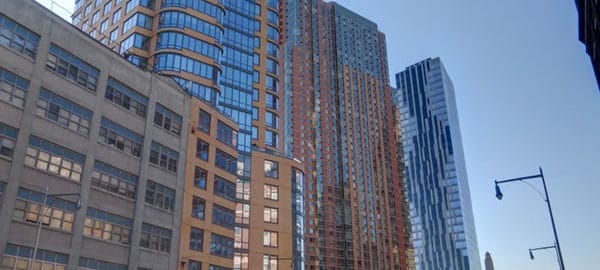
![C_IMG_7735_6_7Adjust [4/5/2012 7:31:27 AM] C_IMG_7735_6_7Adjust [4/5/2012 7:31:27 AM]](https://www.newyorkitecture.com/wp-content/gallery/three-sisters-downtown-brooklyn/c_img_7735_6_7adjust.jpg)
![IMG_8137_8_9Adjust [4/5/2012 10:27:32 AM] IMG_8137_8_9Adjust [4/5/2012 10:27:32 AM]](https://www.newyorkitecture.com/wp-content/gallery/three-sisters-downtown-brooklyn/img_8137_8_9adjust.jpg)
![IMG_7888_89_90Adjust [4/5/2012 8:47:47 AM] IMG_7888_89_90Adjust [4/5/2012 8:47:47 AM]](https://www.newyorkitecture.com/wp-content/gallery/three-sisters-downtown-brooklyn/img_7888_89_90adjust.jpg)
![IMG_7693_4_5Adjust [4/5/2012 7:25:17 AM] IMG_7693_4_5Adjust [4/5/2012 7:25:17 AM]](https://www.newyorkitecture.com/wp-content/gallery/three-sisters-downtown-brooklyn/img_7693_4_5adjust.jpg)
![IMG_7642_3_4Adjust [4/5/2012 7:11:07 AM] IMG_7642_3_4Adjust [4/5/2012 7:11:07 AM]](https://www.newyorkitecture.com/wp-content/gallery/three-sisters-downtown-brooklyn/img_7642_3_4adjust.jpg)
![D_IMG_7654_5_6Adjust [4/5/2012 7:13:21 AM] D_IMG_7654_5_6Adjust [4/5/2012 7:13:21 AM]](https://www.newyorkitecture.com/wp-content/gallery/three-sisters-downtown-brooklyn/d_img_7654_5_6adjust.jpg)
![D_IMG_6937_8_9Adjust [4/4/2012 9:12:45 AM] D_IMG_6937_8_9Adjust [4/4/2012 9:12:45 AM]](https://www.newyorkitecture.com/wp-content/gallery/three-sisters-downtown-brooklyn/d_img_6937_8_9adjust.jpg)
![C_IMG_7777_8_9Adjust [4/5/2012 7:46:51 AM] C_IMG_7777_8_9Adjust [4/5/2012 7:46:51 AM]](https://www.newyorkitecture.com/wp-content/gallery/three-sisters-downtown-brooklyn/c_img_7777_8_9adjust.jpg)
![C_IMG_7744_5_6Adjust [4/5/2012 7:35:41 AM] C_IMG_7744_5_6Adjust [4/5/2012 7:35:41 AM]](https://www.newyorkitecture.com/wp-content/gallery/three-sisters-downtown-brooklyn/c_img_7744_5_6adjust.jpg)
![C_IMG_7741_2_3Adjust [4/5/2012 7:34:28 AM] C_IMG_7741_2_3Adjust [4/5/2012 7:34:28 AM]](https://www.newyorkitecture.com/wp-content/gallery/three-sisters-downtown-brooklyn/c_img_7741_2_3adjust.jpg)
![A_IMG_7750_1_2Adjust [4/5/2012 7:40:41 AM] A_IMG_7750_1_2Adjust [4/5/2012 7:40:41 AM]](https://www.newyorkitecture.com/wp-content/gallery/three-sisters-downtown-brooklyn/a_img_7750_1_2adjust.jpg)
![C_IMG_6880_1_2Adjust [4/4/2012 9:04:57 AM] C_IMG_6880_1_2Adjust [4/4/2012 9:04:57 AM]](https://www.newyorkitecture.com/wp-content/gallery/three-sisters-downtown-brooklyn/c_img_6880_1_2adjust.jpg)
![B_IMG_8362_3_4Adjust [4/6/2012 9:27:57 AM] B_IMG_8362_3_4Adjust [4/6/2012 9:27:57 AM]](https://www.newyorkitecture.com/wp-content/gallery/three-sisters-downtown-brooklyn/b_img_8362_3_4adjust.jpg)
![B_IMG_8359_60_61Adjust [4/6/2012 9:27:24 AM] B_IMG_8359_60_61Adjust [4/6/2012 9:27:24 AM]](https://www.newyorkitecture.com/wp-content/gallery/three-sisters-downtown-brooklyn/b_img_8359_60_61adjust.jpg)
![B_IMG_7669_70_71Adjust [4/5/2012 7:17:29 AM] B_IMG_7669_70_71Adjust [4/5/2012 7:17:29 AM]](https://www.newyorkitecture.com/wp-content/gallery/three-sisters-downtown-brooklyn/b_img_7669_70_71adjust.jpg)
![B_IMG_7411_2_3Adjust [4/4/2012 12:04:00 PM] B_IMG_7411_2_3Adjust [4/4/2012 12:04:00 PM]](https://www.newyorkitecture.com/wp-content/gallery/three-sisters-downtown-brooklyn/b_img_7411_2_3adjust.jpg)
![B_IMG_6961_2_3Adjust [4/4/2012 9:19:19 AM] B_IMG_6961_2_3Adjust [4/4/2012 9:19:19 AM]](https://www.newyorkitecture.com/wp-content/gallery/three-sisters-downtown-brooklyn/b_img_6961_2_3adjust.jpg)
![B_IMG_6868_69_70Adjust [4/4/2012 9:02:21 AM] B_IMG_6868_69_70Adjust [4/4/2012 9:02:21 AM]](https://www.newyorkitecture.com/wp-content/gallery/three-sisters-downtown-brooklyn/b_img_6868_69_70adjust.jpg)
![AA_IMG_6820_1_2Adjust [4/4/2012 8:49:05 AM] AA_IMG_6820_1_2Adjust [4/4/2012 8:49:05 AM]](https://www.newyorkitecture.com/wp-content/gallery/three-sisters-downtown-brooklyn/aa_img_6820_1_2adjust.jpg)
![A_IMG_7765_6_7Adjust [4/5/2012 7:44:42 AM] A_IMG_7765_6_7Adjust [4/5/2012 7:44:42 AM]](https://www.newyorkitecture.com/wp-content/gallery/three-sisters-downtown-brooklyn/a_img_7765_6_7adjust.jpg)
![C_IMG_6880_1_2Adjust [4/4/2012 9:04:57 AM]](https://www.newyorkitecture.com/wp-content/flagallery/three-sisters/thumbs/thumbs_c_img_6880_1_2adjust.jpg)
![D_IMG_6937_8_9Adjust [4/4/2012 9:12:45 AM]](https://www.newyorkitecture.com/wp-content/flagallery/three-sisters/thumbs/thumbs_d_img_6937_8_9adjust.jpg)
![B_IMG_6868_69_70Adjust [4/4/2012 9:02:21 AM]](https://www.newyorkitecture.com/wp-content/flagallery/three-sisters/thumbs/thumbs_b_img_6868_69_70adjust.jpg)
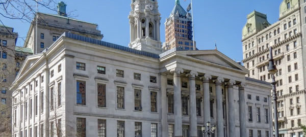
![[Downtown Brooklyn] IMG_6283_4_5Adjust [4/3/2012 9:29:11 AM] [Downtown Brooklyn] IMG_6283_4_5Adjust [4/3/2012 9:29:11 AM]](https://www.newyorkitecture.com/wp-content/gallery/downtown-brooklyn-civic-center/a01_6283_4_5adjust.jpg)
![[Downtown Brooklyn] IMG_6310_1_2Adjust [4/3/2012 9:37:52 AM] [Downtown Brooklyn] IMG_6310_1_2Adjust [4/3/2012 9:37:52 AM]](https://www.newyorkitecture.com/wp-content/gallery/downtown-brooklyn-civic-center/a02_6310_1_2adjust.jpg)
![[Downtown Brooklyn] IMG_6316_7_8Adjust [4/3/2012 9:39:26 AM] [Downtown Brooklyn] IMG_6316_7_8Adjust [4/3/2012 9:39:26 AM]](https://www.newyorkitecture.com/wp-content/gallery/downtown-brooklyn-civic-center/a03_6316_7_8adjust.jpg)
![[Downtown Brooklyn] IMG_6328_29_30Adjust [4/3/2012 9:46:04 AM] [Downtown Brooklyn] IMG_6328_29_30Adjust [4/3/2012 9:46:04 AM]](https://www.newyorkitecture.com/wp-content/gallery/downtown-brooklyn-civic-center/a04_6328_29_30adjust.jpg)
![[Downtown Brooklyn] IMG_6334_5_6Adjust [4/3/2012 9:48:01 AM] [Downtown Brooklyn] IMG_6334_5_6Adjust [4/3/2012 9:48:01 AM]](https://www.newyorkitecture.com/wp-content/gallery/downtown-brooklyn-civic-center/a05_6334_5_6adjust.jpg)
![[Downtown Brooklyn] IMG_6343_4_5Adjust [4/3/2012 9:51:30 AM] [Downtown Brooklyn] IMG_6343_4_5Adjust [4/3/2012 9:51:30 AM]](https://www.newyorkitecture.com/wp-content/gallery/downtown-brooklyn-civic-center/a06_6343_4_5adjust.jpg)
![[Downtown Brooklyn] IMG_6358_59_60Adjust [4/3/2012 9:56:29 AM] [Downtown Brooklyn] IMG_6358_59_60Adjust [4/3/2012 9:56:29 AM]](https://www.newyorkitecture.com/wp-content/gallery/downtown-brooklyn-civic-center/a07_6358_59_60adjust.jpg)
![[Downtown Brooklyn] IMG_6364_5_6Adjust [4/3/2012 9:58:11 AM] [Downtown Brooklyn] IMG_6364_5_6Adjust [4/3/2012 9:58:11 AM]](https://www.newyorkitecture.com/wp-content/gallery/downtown-brooklyn-civic-center/a08_6364_5_6adjust.jpg)
![[Downtown Brooklyn] IMG_6367_8_9Adjust [4/3/2012 10:00:09 AM] [Downtown Brooklyn] IMG_6367_8_9Adjust [4/3/2012 10:00:09 AM]](https://www.newyorkitecture.com/wp-content/gallery/downtown-brooklyn-civic-center/a09_6367_8_9adjust.jpg)
![[Downtown Brooklyn] IMG_6352_3_4Adjust [4/3/2012 9:53:11 AM] [Downtown Brooklyn] IMG_6352_3_4Adjust [4/3/2012 9:53:11 AM]](https://www.newyorkitecture.com/wp-content/gallery/downtown-brooklyn-civic-center/a10_6352_3_4adjust.jpg)
![[Downtown Brooklyn] IMG_8020_1_2Adjust [4/5/2012 9:30:19 AM] [Downtown Brooklyn] IMG_8020_1_2Adjust [4/5/2012 9:30:19 AM]](https://www.newyorkitecture.com/wp-content/gallery/downtown-brooklyn-civic-center/a11_8020_1_2adjust.jpg)
![[Downtown Brooklyn] IMG_8026_7_8Adjust [4/5/2012 9:33:46 AM] [Downtown Brooklyn] IMG_8026_7_8Adjust [4/5/2012 9:33:46 AM]](https://www.newyorkitecture.com/wp-content/gallery/downtown-brooklyn-civic-center/a12_8026_7_8adjust.jpg)
![[Downtown Brooklyn] IMG_8038_39_40Adjust [4/5/2012 9:35:34 AM] [Downtown Brooklyn] IMG_8038_39_40Adjust [4/5/2012 9:35:34 AM]](https://www.newyorkitecture.com/wp-content/gallery/downtown-brooklyn-civic-center/a13_8038_39_40adjust.jpg)
![[Downtown Brooklyn] IMG_6373_4_5Adjust [4/3/2012 10:05:29 AM] [Downtown Brooklyn] IMG_6373_4_5Adjust [4/3/2012 10:05:29 AM]](https://www.newyorkitecture.com/wp-content/gallery/downtown-brooklyn-civic-center/a14_6373_4_5adjust.jpg)
![[Downtown Brooklyn] IMG_6379_80_81Adjust [4/3/2012 10:06:17 AM] [Downtown Brooklyn] IMG_6379_80_81Adjust [4/3/2012 10:06:17 AM]](https://www.newyorkitecture.com/wp-content/gallery/downtown-brooklyn-civic-center/a15_6379_80_81adjust.jpg)
![[Downtown Brooklyn] IMG_8059_60_61Adjust [4/5/2012 9:38:25 AM] [Downtown Brooklyn] IMG_8059_60_61Adjust [4/5/2012 9:38:25 AM]](https://www.newyorkitecture.com/wp-content/gallery/downtown-brooklyn-civic-center/a16_8059_60_61adjust.jpg)
![[Downtown Brooklyn] IMG_8098_099_100Adjust [4/5/2012 9:50:02 AM] [Downtown Brooklyn] IMG_8098_099_100Adjust [4/5/2012 9:50:02 AM]](https://www.newyorkitecture.com/wp-content/gallery/downtown-brooklyn-civic-center/a17_8098_099_100adjust.jpg)
![[Downtown Brooklyn] IMG_6298_299_300Adjust [4/3/2012 9:33:17 AM] [Downtown Brooklyn] IMG_6298_299_300Adjust [4/3/2012 9:33:17 AM]](https://www.newyorkitecture.com/wp-content/gallery/downtown-brooklyn-civic-center/b_6298_299_300adjust.jpg)
![[Downtown Brooklyn] IMG_7984_5_6Adjust [4/5/2012 9:20:04 AM] [Downtown Brooklyn] IMG_7984_5_6Adjust [4/5/2012 9:20:04 AM]](https://www.newyorkitecture.com/wp-content/gallery/downtown-brooklyn-civic-center/b_7984_5_6adjust.jpg)
![[Downtown Brooklyn] IMG_7990_1_2Adjust [4/5/2012 9:21:34 AM] [Downtown Brooklyn] IMG_7990_1_2Adjust [4/5/2012 9:21:34 AM]](https://www.newyorkitecture.com/wp-content/gallery/downtown-brooklyn-civic-center/b_7990_1_2adjust.jpg)
![[Downtown Brooklyn] IMG_6382_3_4Adjust [4/3/2012 10:07:33 AM] [Downtown Brooklyn] IMG_6382_3_4Adjust [4/3/2012 10:07:33 AM]](https://www.newyorkitecture.com/wp-content/gallery/downtown-brooklyn-civic-center/c01_6382_3_4adjust.jpg)
![[Downtown Brooklyn] IMG_8104_5_6Adjust [4/5/2012 9:54:56 AM] [Downtown Brooklyn] IMG_8104_5_6Adjust [4/5/2012 9:54:56 AM]](https://www.newyorkitecture.com/wp-content/gallery/downtown-brooklyn-civic-center/c01a_8104_5_6adjust.jpg)
![[Downtown Brooklyn] IMG_6421_2_3Adjust [4/3/2012 10:19:08 AM] [Downtown Brooklyn] IMG_6421_2_3Adjust [4/3/2012 10:19:08 AM]](https://www.newyorkitecture.com/wp-content/gallery/downtown-brooklyn-civic-center/c02_6421_2_3adjust.jpg)
![[Downtown Brooklyn] IMG_8008_09_10Adjust [4/5/2012 9:27:58 AM] [Downtown Brooklyn] IMG_8008_09_10Adjust [4/5/2012 9:27:58 AM]](https://www.newyorkitecture.com/wp-content/gallery/downtown-brooklyn-civic-center/c02a_8008_09_10adjust.jpg)
![[Downtown Brooklyn] IMG_8080_1_2Adjust [4/5/2012 9:46:39 AM] [Downtown Brooklyn] IMG_8080_1_2Adjust [4/5/2012 9:46:39 AM]](https://www.newyorkitecture.com/wp-content/gallery/downtown-brooklyn-civic-center/c03_8080_1_2adjust.jpg)
![[Downtown Brooklyn] IMG_7549_50_51Adjust [4/4/2012 1:04:49 PM] [Downtown Brooklyn] IMG_7549_50_51Adjust [4/4/2012 1:04:49 PM]](https://www.newyorkitecture.com/wp-content/gallery/downtown-brooklyn-civic-center/c04_7549_50_51adjust.jpg)
![[Downtown Brooklyn] IMG_6553_4_5Adjust [4/3/2012 11:03:52 AM] [Downtown Brooklyn] IMG_6553_4_5Adjust [4/3/2012 11:03:52 AM]](https://www.newyorkitecture.com/wp-content/gallery/downtown-brooklyn-civic-center/c05_6553_4_5adjust.jpg)
![[Downtown Brooklyn] IMG_7558_59_60Adjust [4/4/2012 1:08:51 PM] [Downtown Brooklyn] IMG_7558_59_60Adjust [4/4/2012 1:08:51 PM]](https://www.newyorkitecture.com/wp-content/gallery/downtown-brooklyn-civic-center/c06_7558_59_60adjust.jpg)
![[Downtown Brooklyn] IMG_6595_6_7Adjust [4/3/2012 11:18:35 AM] [Downtown Brooklyn] IMG_6595_6_7Adjust [4/3/2012 11:18:35 AM]](https://www.newyorkitecture.com/wp-content/gallery/downtown-brooklyn-civic-center/c07_6595_6_7adjust.jpg)
![[Downtown Brooklyn] IMG_6622_3_4Adjust [4/3/2012 11:25:33 AM] [Downtown Brooklyn] IMG_6622_3_4Adjust [4/3/2012 11:25:33 AM]](https://www.newyorkitecture.com/wp-content/gallery/downtown-brooklyn-civic-center/c08_6622_3_4adjust.jpg)
![[Downtown Brooklyn] IMG_6436_7_8Adjust [4/3/2012 10:27:12 AM] [Downtown Brooklyn] IMG_6436_7_8Adjust [4/3/2012 10:27:12 AM]](https://www.newyorkitecture.com/wp-content/gallery/downtown-brooklyn-civic-center/d01_6436_7_8adjust.jpg)
![[Downtown Brooklyn] IMG_6448_49_50Adjust [4/3/2012 10:32:31 AM] [Downtown Brooklyn] IMG_6448_49_50Adjust [4/3/2012 10:32:31 AM]](https://www.newyorkitecture.com/wp-content/gallery/downtown-brooklyn-civic-center/d02_6448_49_50adjust.jpg)
![[Downtown Brooklyn] IMG_6460_1_2Adjust [4/3/2012 10:34:50 AM] [Downtown Brooklyn] IMG_6460_1_2Adjust [4/3/2012 10:34:50 AM]](https://www.newyorkitecture.com/wp-content/gallery/downtown-brooklyn-civic-center/d03_6460_1_2adjust.jpg)
![[Downtown Brooklyn] IMG_6475_6_7Adjust [4/3/2012 10:37:48 AM] [Downtown Brooklyn] IMG_6475_6_7Adjust [4/3/2012 10:37:48 AM]](https://www.newyorkitecture.com/wp-content/gallery/downtown-brooklyn-civic-center/d04_6475_6_7adjust.jpg)
![[Downtown Brooklyn] IMG_6487_8_9Adjust [4/3/2012 10:39:15 AM] [Downtown Brooklyn] IMG_6487_8_9Adjust [4/3/2012 10:39:15 AM]](https://www.newyorkitecture.com/wp-content/gallery/downtown-brooklyn-civic-center/d05_6487_8_9adjust.jpg)
![[Downtown Brooklyn] IMG_6493_4_5Adjust [4/3/2012 10:43:32 AM] [Downtown Brooklyn] IMG_6493_4_5Adjust [4/3/2012 10:43:32 AM]](https://www.newyorkitecture.com/wp-content/gallery/downtown-brooklyn-civic-center/d06_6493_4_5adjust.jpg)
![[Downtown Brooklyn] IMG_6502_3_4Adjust [4/3/2012 10:45:38 AM] [Downtown Brooklyn] IMG_6502_3_4Adjust [4/3/2012 10:45:38 AM]](https://www.newyorkitecture.com/wp-content/gallery/downtown-brooklyn-civic-center/d07_6502_3_4adjust.jpg)
![[Downtown Brooklyn] IMG_6514_5_6Adjust [4/3/2012 10:48:49 AM] [Downtown Brooklyn] IMG_6514_5_6Adjust [4/3/2012 10:48:49 AM]](https://www.newyorkitecture.com/wp-content/gallery/downtown-brooklyn-civic-center/d08_6514_5_6adjust.jpg)
![[Downtown Brooklyn] IMG_6559_60_61Adjust [4/3/2012 11:06:14 AM] [Downtown Brooklyn] IMG_6559_60_61Adjust [4/3/2012 11:06:14 AM]](https://www.newyorkitecture.com/wp-content/gallery/downtown-brooklyn-civic-center/d09_6559_60_61adjust.jpg)
![[Downtown Brooklyn] IMG_6517_8_9Adjust [4/3/2012 10:51:06 AM] [Downtown Brooklyn] IMG_6517_8_9Adjust [4/3/2012 10:51:06 AM]](https://www.newyorkitecture.com/wp-content/gallery/downtown-brooklyn-civic-center/d10_6517_8_9adjust.jpg)
![[Downtown Brooklyn] IMG_6538_39_40Adjust [4/3/2012 11:01:31 AM] [Downtown Brooklyn] IMG_6538_39_40Adjust [4/3/2012 11:01:31 AM]](https://www.newyorkitecture.com/wp-content/gallery/downtown-brooklyn-civic-center/d11_6538_39_40adjust.jpg)
![[Downtown Brooklyn] IMG_8182_3_4Adjust [4/6/2012 8:22:48 AM] [Downtown Brooklyn] IMG_8182_3_4Adjust [4/6/2012 8:22:48 AM]](https://www.newyorkitecture.com/wp-content/gallery/downtown-brooklyn-civic-center/d11_8182_3_4adjust.jpg)
![[Downtown Brooklyn] IMG_6577_8_9Adjust [4/3/2012 11:15:11 AM] [Downtown Brooklyn] IMG_6577_8_9Adjust [4/3/2012 11:15:11 AM]](https://www.newyorkitecture.com/wp-content/gallery/downtown-brooklyn-civic-center/d12_6577_8_9adjust.jpg)
![[Downtown Brooklyn] IMG_6586_7_8Adjust [4/3/2012 11:16:19 AM] [Downtown Brooklyn] IMG_6586_7_8Adjust [4/3/2012 11:16:19 AM]](https://www.newyorkitecture.com/wp-content/gallery/downtown-brooklyn-civic-center/d13_6586_7_8adjust.jpg)
![[Downtown Brooklyn] IMG_7612_3_4Adjust [4/4/2012 1:41:50 PM] [Downtown Brooklyn] IMG_7612_3_4Adjust [4/4/2012 1:41:50 PM]](https://www.newyorkitecture.com/wp-content/gallery/downtown-brooklyn-civic-center/d14_7612_3_4adjust.jpg)
![[Downtown Brooklyn] IMG_6607_8_9Adjust [4/3/2012 11:20:28 AM] [Downtown Brooklyn] IMG_6607_8_9Adjust [4/3/2012 11:20:28 AM]](https://www.newyorkitecture.com/wp-content/gallery/downtown-brooklyn-civic-center/d15_6607_8_9adjust.jpg)
![[Downtown Brooklyn] IMG_6628_29_30Adjust [4/3/2012 11:30:17 AM] [Downtown Brooklyn] IMG_6628_29_30Adjust [4/3/2012 11:30:17 AM]](https://www.newyorkitecture.com/wp-content/gallery/downtown-brooklyn-civic-center/d16_6628_29_30adjust.jpg)
![[Downtown Brooklyn] IMG_6634_5_6Adjust [4/3/2012 11:32:15 AM] [Downtown Brooklyn] IMG_6634_5_6Adjust [4/3/2012 11:32:15 AM]](https://www.newyorkitecture.com/wp-content/gallery/downtown-brooklyn-civic-center/d17_6634_5_6adjust.jpg)
![[Downtown Brooklyn] IMG_6649_50_51Adjust [4/3/2012 11:36:02 AM] [Downtown Brooklyn] IMG_6649_50_51Adjust [4/3/2012 11:36:02 AM]](https://www.newyorkitecture.com/wp-content/gallery/downtown-brooklyn-civic-center/d18_6649_50_51adjust.jpg)
![[Downtown Brooklyn] IMG_6655_6_7Adjust [4/3/2012 11:37:39 AM] [Downtown Brooklyn] IMG_6655_6_7Adjust [4/3/2012 11:37:39 AM]](https://www.newyorkitecture.com/wp-content/gallery/downtown-brooklyn-civic-center/d19_6655_6_7adjust.jpg)
![[Downtown Brooklyn] IMG_6781_2_3Adjust [4/3/2012 12:27:12 PM] [Downtown Brooklyn] IMG_6781_2_3Adjust [4/3/2012 12:27:12 PM]](https://www.newyorkitecture.com/wp-content/gallery/downtown-brooklyn-civic-center/d20_6781_2_3adjust.jpg)
![[Downtown Brooklyn] IMG_6787_8_9Adjust [4/3/2012 12:28:54 PM] [Downtown Brooklyn] IMG_6787_8_9Adjust [4/3/2012 12:28:54 PM]](https://www.newyorkitecture.com/wp-content/gallery/downtown-brooklyn-civic-center/d21_6787_8_9adjust.jpg)
![[Downtown Brooklyn] IMG_7633_4_5Adjust [4/4/2012 1:57:50 PM] [Downtown Brooklyn] IMG_7633_4_5Adjust [4/4/2012 1:57:50 PM]](https://www.newyorkitecture.com/wp-content/gallery/downtown-brooklyn-civic-center/d22_7633_4_5adjust.jpg)
![[Downtown Brooklyn] IMG_6790_1_2Adjust [4/3/2012 12:29:50 PM] [Downtown Brooklyn] IMG_6790_1_2Adjust [4/3/2012 12:29:50 PM]](https://www.newyorkitecture.com/wp-content/gallery/downtown-brooklyn-civic-center/d23_6790_1_2adjust.jpg)
![[Downtown Brooklyn] IMG_6916_7_8Adjust [4/4/2012 9:08:42 AM] [Downtown Brooklyn] IMG_6916_7_8Adjust [4/4/2012 9:08:42 AM]](https://www.newyorkitecture.com/wp-content/gallery/downtown-brooklyn-civic-center/e01_6916_7_8adjust.jpg)
![[Downtown Brooklyn] IMG_6952_3_4Adjust [4/4/2012 9:15:02 AM] [Downtown Brooklyn] IMG_6952_3_4Adjust [4/4/2012 9:15:02 AM]](https://www.newyorkitecture.com/wp-content/gallery/downtown-brooklyn-civic-center/e02_6952_3_4adjust.jpg)
![[Downtown Brooklyn] IMG_6853_4_5Adjust [4/4/2012 8:56:59 AM] [Downtown Brooklyn] IMG_6853_4_5Adjust [4/4/2012 8:56:59 AM]](https://www.newyorkitecture.com/wp-content/gallery/downtown-brooklyn-civic-center/e03_6853_4_5adjust.jpg)
![[Downtown Brooklyn] IMG_6928_29_30Adjust [4/4/2012 9:10:36 AM] [Downtown Brooklyn] IMG_6928_29_30Adjust [4/4/2012 9:10:36 AM]](https://www.newyorkitecture.com/wp-content/gallery/downtown-brooklyn-civic-center/e04_6928_29_30adjust.jpg)
![[Downtown Brooklyn] IMG_8341_2_3Adjust [4/6/2012 9:20:57 AM] [Downtown Brooklyn] IMG_8341_2_3Adjust [4/6/2012 9:20:57 AM]](https://www.newyorkitecture.com/wp-content/gallery/downtown-brooklyn-civic-center/e05_8341_2_3adjust.jpg)
![[Downtown Brooklyn] IMG_8353_4_5Adjust [4/6/2012 9:21:56 AM] [Downtown Brooklyn] IMG_8353_4_5Adjust [4/6/2012 9:21:56 AM]](https://www.newyorkitecture.com/wp-content/gallery/downtown-brooklyn-civic-center/e06_8353_4_5adjust.jpg)
![[Downtown Brooklyn] IMG_8374_5_6Adjust [4/6/2012 9:34:00 AM] [Downtown Brooklyn] IMG_8374_5_6Adjust [4/6/2012 9:34:00 AM]](https://www.newyorkitecture.com/wp-content/gallery/downtown-brooklyn-civic-center/e07_8374_5_6adjust.jpg)
![[Downtown Brooklyn] IMG_8383_4_5Adjust [4/6/2012 9:37:28 AM] [Downtown Brooklyn] IMG_8383_4_5Adjust [4/6/2012 9:37:28 AM]](https://www.newyorkitecture.com/wp-content/gallery/downtown-brooklyn-civic-center/e08_8383_4_5adjust.jpg)
![[Downtown Brooklyn] IMG_6976_7_8Adjust [4/4/2012 9:24:30 AM] [Downtown Brooklyn] IMG_6976_7_8Adjust [4/4/2012 9:24:30 AM]](https://www.newyorkitecture.com/wp-content/gallery/downtown-brooklyn-civic-center/e09_6976_7_8adjust.jpg)
![[Downtown Brooklyn] IMG_6988_89_90Adjust [4/4/2012 9:27:36 AM] [Downtown Brooklyn] IMG_6988_89_90Adjust [4/4/2012 9:27:36 AM]](https://www.newyorkitecture.com/wp-content/gallery/downtown-brooklyn-civic-center/e10_6988_89_90adjust.jpg)
![[Downtown Brooklyn] IMG_6970_1_2Adjust [4/4/2012 9:22:17 AM] [Downtown Brooklyn] IMG_6970_1_2Adjust [4/4/2012 9:22:17 AM]](https://www.newyorkitecture.com/wp-content/gallery/downtown-brooklyn-civic-center/e11_6970_1_2adjust.jpg)
![[Downtown Brooklyn] IMG_6973_4_5Adjust [4/4/2012 9:22:58 AM] [Downtown Brooklyn] IMG_6973_4_5Adjust [4/4/2012 9:22:58 AM]](https://www.newyorkitecture.com/wp-content/gallery/downtown-brooklyn-civic-center/e12_6973_4_5adjust.jpg)
![[Downtown Brooklyn] IMG_7513_4_5Adjust [4/4/2012 12:38:47 PM] [Downtown Brooklyn] IMG_7513_4_5Adjust [4/4/2012 12:38:47 PM]](https://www.newyorkitecture.com/wp-content/gallery/downtown-brooklyn-civic-center/e13_7513_4_5adjust.jpg)
![[Downtown Brooklyn] IMG_7879_80_81Adjust [4/5/2012 8:44:14 AM] [Downtown Brooklyn] IMG_7879_80_81Adjust [4/5/2012 8:44:14 AM]](https://www.newyorkitecture.com/wp-content/gallery/downtown-brooklyn-civic-center/e14_7879_80_81adjust.jpg)
![[Downtown Brooklyn] IMG_8284_5_6Adjust [4/6/2012 8:58:38 AM] [Downtown Brooklyn] IMG_8284_5_6Adjust [4/6/2012 8:58:38 AM]](https://www.newyorkitecture.com/wp-content/gallery/downtown-brooklyn-civic-center/e15_8284_5_6adjust.jpg)
![[Downtown Brooklyn] IMG_8242_3_4Adjust [4/6/2012 8:44:45 AM] [Downtown Brooklyn] IMG_8242_3_4Adjust [4/6/2012 8:44:45 AM]](https://www.newyorkitecture.com/wp-content/gallery/downtown-brooklyn-civic-center/e16_8242_3_4adjust.jpg)
![[Downtown Brooklyn] IMG_8251_2_3Adjust [4/6/2012 8:47:35 AM] [Downtown Brooklyn] IMG_8251_2_3Adjust [4/6/2012 8:47:35 AM]](https://www.newyorkitecture.com/wp-content/gallery/downtown-brooklyn-civic-center/e17_8251_2_3adjust.jpg)
![[Downtown Brooklyn] IMG_8269_70_71Adjust [4/6/2012 8:50:01 AM] [Downtown Brooklyn] IMG_8269_70_71Adjust [4/6/2012 8:50:01 AM]](https://www.newyorkitecture.com/wp-content/gallery/downtown-brooklyn-civic-center/e18_8269_70_71adjust.jpg)
![[Downtown Brooklyn] IMG_8272_3_4Adjust [4/6/2012 8:55:49 AM] [Downtown Brooklyn] IMG_8272_3_4Adjust [4/6/2012 8:55:49 AM]](https://www.newyorkitecture.com/wp-content/gallery/downtown-brooklyn-civic-center/e19_8272_3_4adjust.jpg)
![[Downtown Brooklyn] IMG_8299_300_301Adjust [4/6/2012 9:00:24 AM] [Downtown Brooklyn] IMG_8299_300_301Adjust [4/6/2012 9:00:24 AM]](https://www.newyorkitecture.com/wp-content/gallery/downtown-brooklyn-civic-center/e20_8299_300_301adjust.jpg)
![[Downtown Brooklyn] IMG_7405_6_7Adjust [4/4/2012 12:02:25 PM] [Downtown Brooklyn] IMG_7405_6_7Adjust [4/4/2012 12:02:25 PM]](https://www.newyorkitecture.com/wp-content/gallery/downtown-brooklyn-civic-center/f01_7405_6_7adjust.jpg)
![[Downtown Brooklyn] IMG_7015_6_7Adjust [4/4/2012 9:39:16 AM] [Downtown Brooklyn] IMG_7015_6_7Adjust [4/4/2012 9:39:16 AM]](https://www.newyorkitecture.com/wp-content/gallery/downtown-brooklyn-civic-center/f02_7015_6_7adjust.jpg)
![[Downtown Brooklyn] IMG_7018_19_20Adjust [4/4/2012 9:41:31 AM] [Downtown Brooklyn] IMG_7018_19_20Adjust [4/4/2012 9:41:31 AM]](https://www.newyorkitecture.com/wp-content/gallery/downtown-brooklyn-civic-center/f03_7018_19_20adjust.jpg)
![[Downtown Brooklyn] IMG_7027_8_9Adjust [4/4/2012 9:42:22 AM] [Downtown Brooklyn] IMG_7027_8_9Adjust [4/4/2012 9:42:22 AM]](https://www.newyorkitecture.com/wp-content/gallery/downtown-brooklyn-civic-center/f04_7027_8_9adjust.jpg)
![[Downtown Brooklyn] IMG_7036_7_8Adjust [4/4/2012 9:45:21 AM] [Downtown Brooklyn] IMG_7036_7_8Adjust [4/4/2012 9:45:21 AM]](https://www.newyorkitecture.com/wp-content/gallery/downtown-brooklyn-civic-center/f05_7036_7_8adjust.jpg)
![[Downtown Brooklyn] IMG_7381_2_3Adjust [4/4/2012 11:56:33 AM] [Downtown Brooklyn] IMG_7381_2_3Adjust [4/4/2012 11:56:33 AM]](https://www.newyorkitecture.com/wp-content/gallery/downtown-brooklyn-civic-center/f06_7381_2_3adjust.jpg)
![[Downtown Brooklyn] IMG_7420_1_2Adjust [4/4/2012 12:05:22 PM] [Downtown Brooklyn] IMG_7420_1_2Adjust [4/4/2012 12:05:22 PM]](https://www.newyorkitecture.com/wp-content/gallery/downtown-brooklyn-civic-center/f07_7420_1_2adjust.jpg)
![[Downtown Brooklyn] IMG_7285_6_7Adjust [4/4/2012 11:29:34 AM] [Downtown Brooklyn] IMG_7285_6_7Adjust [4/4/2012 11:29:34 AM]](https://www.newyorkitecture.com/wp-content/gallery/downtown-brooklyn-civic-center/f08_7285_6_7adjust.jpg)
![[Downtown Brooklyn] IMG_7357_8_9Adjust [4/4/2012 11:50:57 AM] [Downtown Brooklyn] IMG_7357_8_9Adjust [4/4/2012 11:50:57 AM]](https://www.newyorkitecture.com/wp-content/gallery/downtown-brooklyn-civic-center/f09_7357_8_9adjust.jpg)
![[Downtown Brooklyn] IMG_7366_7_8Adjust [4/4/2012 11:51:59 AM] [Downtown Brooklyn] IMG_7366_7_8Adjust [4/4/2012 11:51:59 AM]](https://www.newyorkitecture.com/wp-content/gallery/downtown-brooklyn-civic-center/f10_7366_7_8adjust.jpg)
![[Downtown Brooklyn] IMG_7429_30_31Adjust [4/4/2012 12:09:30 PM] [Downtown Brooklyn] IMG_7429_30_31Adjust [4/4/2012 12:09:30 PM]](https://www.newyorkitecture.com/wp-content/gallery/downtown-brooklyn-civic-center/f11_7429_30_31adjust.jpg)
![[Downtown Brooklyn] IMG_7456_7_8Adjust [4/4/2012 12:20:03 PM] [Downtown Brooklyn] IMG_7456_7_8Adjust [4/4/2012 12:20:03 PM]](https://www.newyorkitecture.com/wp-content/gallery/downtown-brooklyn-civic-center/f12_7456_7_8adjust.jpg)
![[Downtown Brooklyn] IMG_7462_3_4Adjust [4/4/2012 12:21:12 PM] [Downtown Brooklyn] IMG_7462_3_4Adjust [4/4/2012 12:21:12 PM]](https://www.newyorkitecture.com/wp-content/gallery/downtown-brooklyn-civic-center/f13_7462_3_4adjust.jpg)
![[Downtown Brooklyn] IMG_7435_6_7Adjust [4/4/2012 12:11:18 PM] [Downtown Brooklyn] IMG_7435_6_7Adjust [4/4/2012 12:11:18 PM]](https://www.newyorkitecture.com/wp-content/gallery/downtown-brooklyn-civic-center/f14_7435_6_7adjust.jpg)
![[Downtown Brooklyn] IMG_7441_2_3Adjust [4/4/2012 12:12:30 PM] [Downtown Brooklyn] IMG_7441_2_3Adjust [4/4/2012 12:12:30 PM]](https://www.newyorkitecture.com/wp-content/gallery/downtown-brooklyn-civic-center/f15_7441_2_3adjust.jpg)
![[Downtown Brooklyn] IMG_7447_8_9Adjust [4/4/2012 12:13:58 PM] [Downtown Brooklyn] IMG_7447_8_9Adjust [4/4/2012 12:13:58 PM]](https://www.newyorkitecture.com/wp-content/gallery/downtown-brooklyn-civic-center/f16_7447_8_9adjust.jpg)
![[Downtown Brooklyn] IMG_7006_7_8Adjust [4/4/2012 9:35:01 AM] [Downtown Brooklyn] IMG_7006_7_8Adjust [4/4/2012 9:35:01 AM]](https://www.newyorkitecture.com/wp-content/gallery/downtown-brooklyn-civic-center/g01_7006_7_8adjust.jpg)
![[Downtown Brooklyn] IMG_7324_5_6Adjust [4/4/2012 11:38:55 AM] [Downtown Brooklyn] IMG_7324_5_6Adjust [4/4/2012 11:38:55 AM]](https://www.newyorkitecture.com/wp-content/gallery/downtown-brooklyn-civic-center/g01_7324_5_6adjust.jpg)
![[Downtown Brooklyn] IMG_7330_1_2Adjust [4/4/2012 11:43:04 AM] [Downtown Brooklyn] IMG_7330_1_2Adjust [4/4/2012 11:43:04 AM]](https://www.newyorkitecture.com/wp-content/gallery/downtown-brooklyn-civic-center/g02_7330_1_2adjust.jpg)
![[Downtown Brooklyn] IMG_7339_40_41Adjust [4/4/2012 11:44:35 AM] [Downtown Brooklyn] IMG_7339_40_41Adjust [4/4/2012 11:44:35 AM]](https://www.newyorkitecture.com/wp-content/gallery/downtown-brooklyn-civic-center/g03_7339_40_41adjust.jpg)
![[Downtown Brooklyn] IMG_7471_2_3Adjust [4/4/2012 12:27:18 PM] [Downtown Brooklyn] IMG_7471_2_3Adjust [4/4/2012 12:27:18 PM]](https://www.newyorkitecture.com/wp-content/gallery/downtown-brooklyn-civic-center/g04_7471_2_3adjust.jpg)
![[Downtown Brooklyn] IMG_7489_90_91Adjust [4/4/2012 12:32:37 PM] [Downtown Brooklyn] IMG_7489_90_91Adjust [4/4/2012 12:32:37 PM]](https://www.newyorkitecture.com/wp-content/gallery/downtown-brooklyn-civic-center/g05_7489_90_91adjust.jpg)
![[Downtown Brooklyn] IMG_7525_6_7Adjust [4/4/2012 12:42:13 PM] [Downtown Brooklyn] IMG_7525_6_7Adjust [4/4/2012 12:42:13 PM]](https://www.newyorkitecture.com/wp-content/gallery/downtown-brooklyn-civic-center/g06_7525_6_7adjust.jpg)
![[Downtown Brooklyn] IMG_7483_4_5Adjust [4/4/2012 12:31:39 PM] [Downtown Brooklyn] IMG_7483_4_5Adjust [4/4/2012 12:31:39 PM]](https://www.newyorkitecture.com/wp-content/gallery/downtown-brooklyn-civic-center/g07_7483_4_5adjust.jpg)
![[Downtown Brooklyn] IMG_7498_499_500Adjust [4/4/2012 12:34:26 PM] [Downtown Brooklyn] IMG_7498_499_500Adjust [4/4/2012 12:34:26 PM]](https://www.newyorkitecture.com/wp-content/gallery/downtown-brooklyn-civic-center/g08_7498_499_500adjust.jpg)
![[Downtown Brooklyn] IMG_7504_5_6Adjust [4/4/2012 12:35:51 PM] [Downtown Brooklyn] IMG_7504_5_6Adjust [4/4/2012 12:35:51 PM]](https://www.newyorkitecture.com/wp-content/gallery/downtown-brooklyn-civic-center/g09_7504_5_6adjust.jpg)
![[Downtown Brooklyn] IMG_7534_5_6Adjust [4/4/2012 12:49:39 PM] [Downtown Brooklyn] IMG_7534_5_6Adjust [4/4/2012 12:49:39 PM]](https://www.newyorkitecture.com/wp-content/gallery/downtown-brooklyn-civic-center/g10_7534_5_6adjust.jpg)
![[Downtown Brooklyn] IMG_7561_2_3Adjust [4/4/2012 1:13:35 PM] [Downtown Brooklyn] IMG_7561_2_3Adjust [4/4/2012 1:13:35 PM]](https://www.newyorkitecture.com/wp-content/gallery/downtown-brooklyn-civic-center/g11_7561_2_3adjust.jpg)
![[Downtown Brooklyn] IMG_7579_80_81Adjust [4/4/2012 1:20:34 PM] [Downtown Brooklyn] IMG_7579_80_81Adjust [4/4/2012 1:20:34 PM]](https://www.newyorkitecture.com/wp-content/gallery/downtown-brooklyn-civic-center/g12_7579_80_81adjust.jpg)
![[Downtown Brooklyn] IMG_7585_6_7Adjust [4/4/2012 1:25:45 PM] [Downtown Brooklyn] IMG_7585_6_7Adjust [4/4/2012 1:25:45 PM]](https://www.newyorkitecture.com/wp-content/gallery/downtown-brooklyn-civic-center/g13_7585_6_7adjust.jpg)
![[Downtown Brooklyn] IMG_7603_4_5Adjust [4/4/2012 1:30:46 PM] [Downtown Brooklyn] IMG_7603_4_5Adjust [4/4/2012 1:30:46 PM]](https://www.newyorkitecture.com/wp-content/gallery/downtown-brooklyn-civic-center/g14_7603_4_5adjust.jpg)
![[Downtown Brooklyn] IMG_7621_2_3Adjust [4/4/2012 1:45:50 PM] [Downtown Brooklyn] IMG_7621_2_3Adjust [4/4/2012 1:45:50 PM]](https://www.newyorkitecture.com/wp-content/gallery/downtown-brooklyn-civic-center/g15_7621_2_3adjust.jpg)
![[Downtown Brooklyn] IMG_7819_20_21Adjust [4/5/2012 8:07:31 AM] [Downtown Brooklyn] IMG_7819_20_21Adjust [4/5/2012 8:07:31 AM]](https://www.newyorkitecture.com/wp-content/gallery/downtown-brooklyn-civic-center/g16_7819_20_21adjust.jpg)
![[Downtown Brooklyn] IMG_7843_4_5Adjust [4/5/2012 8:13:27 AM] [Downtown Brooklyn] IMG_7843_4_5Adjust [4/5/2012 8:13:27 AM]](https://www.newyorkitecture.com/wp-content/gallery/downtown-brooklyn-civic-center/g17_7843_4_5adjust.jpg)
![[Downtown Brooklyn] IMG_7816_7_8Adjust [4/5/2012 8:03:39 AM] [Downtown Brooklyn] IMG_7816_7_8Adjust [4/5/2012 8:03:39 AM]](https://www.newyorkitecture.com/wp-content/gallery/downtown-brooklyn-civic-center/g18_7816_7_8adjust.jpg)
![[Downtown Brooklyn] IMG_7789_90_91Adjust [4/5/2012 7:50:10 AM] [Downtown Brooklyn] IMG_7789_90_91Adjust [4/5/2012 7:50:10 AM]](https://www.newyorkitecture.com/wp-content/gallery/downtown-brooklyn-civic-center/g19_7789_90_91adjust.jpg)
![[Downtown Brooklyn] IMG_7804_5_6Adjust [4/5/2012 7:57:57 AM] [Downtown Brooklyn] IMG_7804_5_6Adjust [4/5/2012 7:57:57 AM]](https://www.newyorkitecture.com/wp-content/gallery/downtown-brooklyn-civic-center/g20_7804_5_6adjust.jpg)
![[Downtown Brooklyn] IMG_7801_2_3Adjust [4/5/2012 7:56:13 AM] [Downtown Brooklyn] IMG_7801_2_3Adjust [4/5/2012 7:56:13 AM]](https://www.newyorkitecture.com/wp-content/gallery/downtown-brooklyn-civic-center/g21_7801_2_3adjust.jpg)
![[Downtown Brooklyn] IMG_7888_89_90Adjust [4/5/2012 8:47:47 AM] [Downtown Brooklyn] IMG_7888_89_90Adjust [4/5/2012 8:47:47 AM]](https://www.newyorkitecture.com/wp-content/gallery/downtown-brooklyn-civic-center/g22_7888_89_90adjust.jpg)
![[Downtown Brooklyn] IMG_8332_3_4Adjust [4/6/2012 9:11:01 AM] [Downtown Brooklyn] IMG_8332_3_4Adjust [4/6/2012 9:11:01 AM]](https://www.newyorkitecture.com/wp-content/gallery/downtown-brooklyn-civic-center/g22_8332_3_4adjust.jpg)
![[Downtown Brooklyn] IMG_7912_3_4Adjust [4/5/2012 8:54:19 AM] [Downtown Brooklyn] IMG_7912_3_4Adjust [4/5/2012 8:54:19 AM]](https://www.newyorkitecture.com/wp-content/gallery/downtown-brooklyn-civic-center/g23_7912_3_4adjust.jpg)
![[Downtown Brooklyn] IMG_7852_3_4Adjust [4/5/2012 8:18:38 AM] [Downtown Brooklyn] IMG_7852_3_4Adjust [4/5/2012 8:18:38 AM]](https://www.newyorkitecture.com/wp-content/gallery/downtown-brooklyn-civic-center/g24_7852_3_4adjust.jpg)
![[Downtown Brooklyn] IMG_8314_5_6Adjust [4/6/2012 9:07:14 AM] [Downtown Brooklyn] IMG_8314_5_6Adjust [4/6/2012 9:07:14 AM]](https://www.newyorkitecture.com/wp-content/gallery/downtown-brooklyn-civic-center/g24_8314_5_6adjust.jpg)
![[Downtown Brooklyn] IMG_8308_09_10Adjust [4/6/2012 9:04:20 AM] [Downtown Brooklyn] IMG_8308_09_10Adjust [4/6/2012 9:04:20 AM]](https://www.newyorkitecture.com/wp-content/gallery/downtown-brooklyn-civic-center/g24b_8308_09_10adjust.jpg)
![[Downtown Brooklyn] IMG_7858_59_60Adjust [4/5/2012 8:21:01 AM] [Downtown Brooklyn] IMG_7858_59_60Adjust [4/5/2012 8:21:01 AM]](https://www.newyorkitecture.com/wp-content/gallery/downtown-brooklyn-civic-center/g25_7858_59_60adjust.jpg)
![[Downtown Brooklyn] IMG_7861_2_3Adjust [4/5/2012 8:22:51 AM] [Downtown Brooklyn] IMG_7861_2_3Adjust [4/5/2012 8:22:51 AM]](https://www.newyorkitecture.com/wp-content/gallery/downtown-brooklyn-civic-center/g26_7861_2_3adjust.jpg)
![[Downtown Brooklyn] IMG_8206_7_8Adjust [4/6/2012 8:28:31 AM] [Downtown Brooklyn] IMG_8206_7_8Adjust [4/6/2012 8:28:31 AM]](https://www.newyorkitecture.com/wp-content/gallery/downtown-brooklyn-civic-center/g27_8206_7_8adjust.jpg)
![[Downtown Brooklyn] IMG_8215_6_7Adjust [4/6/2012 8:29:44 AM] [Downtown Brooklyn] IMG_8215_6_7Adjust [4/6/2012 8:29:44 AM]](https://www.newyorkitecture.com/wp-content/gallery/downtown-brooklyn-civic-center/g28_8215_6_7adjust.jpg)
![[Downtown Brooklyn] IMG_7867_8_9Adjust [4/5/2012 8:34:50 AM] [Downtown Brooklyn] IMG_7867_8_9Adjust [4/5/2012 8:34:50 AM]](https://www.newyorkitecture.com/wp-content/gallery/downtown-brooklyn-civic-center/g29_7867_8_9adjust.jpg)
![[Downtown Brooklyn] IMG_7939_40_41Adjust [4/5/2012 9:06:31 AM] [Downtown Brooklyn] IMG_7939_40_41Adjust [4/5/2012 9:06:31 AM]](https://www.newyorkitecture.com/wp-content/gallery/downtown-brooklyn-civic-center/g30_7939_40_41adjust.jpg)
![[Downtown Brooklyn] IMG_7966_7_8Adjust [4/5/2012 9:15:37 AM] [Downtown Brooklyn] IMG_7966_7_8Adjust [4/5/2012 9:15:37 AM]](https://www.newyorkitecture.com/wp-content/gallery/downtown-brooklyn-civic-center/g31_7966_7_8adjust.jpg)
![[Downtown Brooklyn] IMG_7930_1_2Adjust [4/5/2012 9:03:20 AM] [Downtown Brooklyn] IMG_7930_1_2Adjust [4/5/2012 9:03:20 AM]](https://www.newyorkitecture.com/wp-content/gallery/downtown-brooklyn-civic-center/g32_7930_1_2adjust.jpg)
![[Downtown Brooklyn] IMG_8236_7_8Adjust [4/6/2012 8:36:19 AM] [Downtown Brooklyn] IMG_8236_7_8Adjust [4/6/2012 8:36:19 AM]](https://www.newyorkitecture.com/wp-content/gallery/downtown-brooklyn-civic-center/g33_8236_7_8adjust.jpg)
![[Downtown Brooklyn] IMG_8389_90_91Adjust [4/6/2012 9:45:37 AM] [Downtown Brooklyn] IMG_8389_90_91Adjust [4/6/2012 9:45:37 AM]](https://www.newyorkitecture.com/wp-content/gallery/downtown-brooklyn-civic-center/g34_8389_90_91adjust.jpg)
![[Downtown Brooklyn] IMG_7183_4_5Adjust [4/4/2012 10:53:28 AM] [Downtown Brooklyn] IMG_7183_4_5Adjust [4/4/2012 10:53:28 AM]](https://www.newyorkitecture.com/wp-content/gallery/downtown-brooklyn-civic-center/g35_7183_4_5adjust.jpg)
![[Downtown Brooklyn] IMG_7045_6_7Adjust [4/4/2012 9:48:41 AM] [Downtown Brooklyn] IMG_7045_6_7Adjust [4/4/2012 9:48:41 AM]](https://www.newyorkitecture.com/wp-content/gallery/downtown-brooklyn-civic-center/l_7045_6_7adjust.jpg)
![[Downtown Brooklyn] IMG_7069_70_71Adjust [4/4/2012 10:11:21 AM] [Downtown Brooklyn] IMG_7069_70_71Adjust [4/4/2012 10:11:21 AM]](https://www.newyorkitecture.com/wp-content/gallery/downtown-brooklyn-civic-center/l_7069_70_71adjust.jpg)
![[Downtown Brooklyn] IMG_8161_2_3Adjust [4/5/2012 10:38:42 AM] [Downtown Brooklyn] IMG_8161_2_3Adjust [4/5/2012 10:38:42 AM]](https://www.newyorkitecture.com/wp-content/gallery/downtown-brooklyn-civic-center/l_8161_2_3adjust.jpg)
![[Downtown Brooklyn] IMG_6958_59_60Adjust [4/4/2012 9:17:28 AM] [Downtown Brooklyn] IMG_6958_59_60Adjust [4/4/2012 9:17:28 AM]](https://www.newyorkitecture.com/wp-content/gallery/downtown-brooklyn-civic-center/x_6958_59_60adjust.jpg)
![[Downtown Brooklyn] IMG_7726_7_8Adjust [4/5/2012 7:30:32 AM] [Downtown Brooklyn] IMG_7726_7_8Adjust [4/5/2012 7:30:32 AM]](https://www.newyorkitecture.com/wp-content/gallery/downtown-brooklyn-civic-center/x_7726_7_8adjust.jpg)
![[Downtown Brooklyn] IMG_7750_1_2Adjust [4/5/2012 7:40:41 AM] [Downtown Brooklyn] IMG_7750_1_2Adjust [4/5/2012 7:40:41 AM]](https://www.newyorkitecture.com/wp-content/gallery/downtown-brooklyn-civic-center/x_7750_1_2adjust.jpg)
![[Downtown Brooklyn] IMG_8368_69_70Adjust [4/6/2012 9:33:05 AM] [Downtown Brooklyn] IMG_8368_69_70Adjust [4/6/2012 9:33:05 AM]](https://www.newyorkitecture.com/wp-content/gallery/downtown-brooklyn-civic-center/x_8368_69_70adjust.jpg)
![[Downtown Brooklyn] IMG_6820_1_2Adjust [4/4/2012 8:49:05 AM] [Downtown Brooklyn] IMG_6820_1_2Adjust [4/4/2012 8:49:05 AM]](https://www.newyorkitecture.com/wp-content/gallery/downtown-brooklyn-civic-center/xx_6820_1_2adjust.jpg)
![[Downtown Brooklyn] IMG_6961_2_3Adjust [4/4/2012 9:19:19 AM] [Downtown Brooklyn] IMG_6961_2_3Adjust [4/4/2012 9:19:19 AM]](https://www.newyorkitecture.com/wp-content/gallery/downtown-brooklyn-civic-center/xx_6961_2_3adjust.jpg)
![[Downtown Brooklyn] IMG_7654_5_6Adjust [4/5/2012 7:13:21 AM] [Downtown Brooklyn] IMG_7654_5_6Adjust [4/5/2012 7:13:21 AM]](https://www.newyorkitecture.com/wp-content/gallery/downtown-brooklyn-civic-center/xy_7654_5_6adjust.jpg)
![[Downtown Brooklyn] IMG_6880_1_2Adjust [4/4/2012 9:04:57 AM] [Downtown Brooklyn] IMG_6880_1_2Adjust [4/4/2012 9:04:57 AM]](https://www.newyorkitecture.com/wp-content/gallery/downtown-brooklyn-civic-center/xz_6880_1_2adjust.jpg)
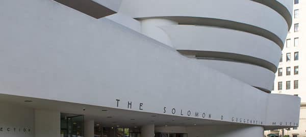
![[Frank Lloyd Wright] IMG_2084_resize [6/5/2012 9:53:12 AM] [Frank Lloyd Wright] IMG_2084_resize [6/5/2012 9:53:12 AM]](https://www.newyorkitecture.com/wp-content/gallery/the-wright-stuff/img_2084_resize.jpg)
![[Frank Lloyd Wright] IMG_2190_resize [6/6/2012 10:04:39 AM] [Frank Lloyd Wright] IMG_2190_resize [6/6/2012 10:04:39 AM]](https://www.newyorkitecture.com/wp-content/gallery/the-wright-stuff/img_2190_resize.jpg)
![[Frank Lloyd Wright] IMG_2189_resize [6/6/2012 10:04:22 AM] [Frank Lloyd Wright] IMG_2189_resize [6/6/2012 10:04:22 AM]](https://www.newyorkitecture.com/wp-content/gallery/the-wright-stuff/img_2189_resize.jpg)
![[Frank Lloyd Wright] IMG_2182_resize [6/6/2012 10:00:52 AM] [Frank Lloyd Wright] IMG_2182_resize [6/6/2012 10:00:52 AM]](https://www.newyorkitecture.com/wp-content/gallery/the-wright-stuff/img_2182_resize.jpg)
![[Frank Lloyd Wright] IMG_2180_resize [6/6/2012 9:59:42 AM] [Frank Lloyd Wright] IMG_2180_resize [6/6/2012 9:59:42 AM]](https://www.newyorkitecture.com/wp-content/gallery/the-wright-stuff/img_2180_resize.jpg)
![[Frank Lloyd Wright] IMG_2179_resize [6/6/2012 9:58:47 AM] [Frank Lloyd Wright] IMG_2179_resize [6/6/2012 9:58:47 AM]](https://www.newyorkitecture.com/wp-content/gallery/the-wright-stuff/img_2179_resize.jpg)
![[Frank Lloyd Wright] IMG_2178_resize [6/6/2012 9:58:36 AM] [Frank Lloyd Wright] IMG_2178_resize [6/6/2012 9:58:36 AM]](https://www.newyorkitecture.com/wp-content/gallery/the-wright-stuff/img_2178_resize.jpg)
![[Frank Lloyd Wright] IMG_2177_resize [6/6/2012 9:58:18 AM] [Frank Lloyd Wright] IMG_2177_resize [6/6/2012 9:58:18 AM]](https://www.newyorkitecture.com/wp-content/gallery/the-wright-stuff/img_2177_resize.jpg)
![[Frank Lloyd Wright] IMG_2176_resize [6/6/2012 9:57:53 AM] [Frank Lloyd Wright] IMG_2176_resize [6/6/2012 9:57:53 AM]](https://www.newyorkitecture.com/wp-content/gallery/the-wright-stuff/img_2176_resize.jpg)
![[Frank Lloyd Wright] IMG_2078_resize [6/5/2012 9:50:07 AM] [Frank Lloyd Wright] IMG_2078_resize [6/5/2012 9:50:07 AM]](https://www.newyorkitecture.com/wp-content/gallery/the-wright-stuff/img_2078_resize.jpg)
![[Frank Lloyd Wright] IMG_2076_resize [6/5/2012 9:49:14 AM] [Frank Lloyd Wright] IMG_2076_resize [6/5/2012 9:49:14 AM]](https://www.newyorkitecture.com/wp-content/gallery/the-wright-stuff/img_2076_resize.jpg)
![[Frank Lloyd Wright] IMG_2073_resize [6/5/2012 9:48:02 AM] [Frank Lloyd Wright] IMG_2073_resize [6/5/2012 9:48:02 AM]](https://www.newyorkitecture.com/wp-content/gallery/the-wright-stuff/img_2073_resize.jpg)
![[Frank Lloyd Wright] IMG_2072_resize [6/5/2012 9:46:27 AM] [Frank Lloyd Wright] IMG_2072_resize [6/5/2012 9:46:27 AM]](https://www.newyorkitecture.com/wp-content/gallery/the-wright-stuff/img_2072_resize.jpg)
![[Frank Lloyd Wright] IMG_2069_resize [6/5/2012 9:45:56 AM] [Frank Lloyd Wright] IMG_2069_resize [6/5/2012 9:45:56 AM]](https://www.newyorkitecture.com/wp-content/gallery/the-wright-stuff/img_2069_resize.jpg)
![[Frank Lloyd Wright] IMG_1974_resize [6/5/2012 8:30:42 AM] [Frank Lloyd Wright] IMG_1974_resize [6/5/2012 8:30:42 AM]](https://www.newyorkitecture.com/wp-content/gallery/the-wright-stuff/img_1974_resize.jpg)
![[Frank Lloyd Wright] IMG_1959_resize [6/5/2012 8:23:02 AM] [Frank Lloyd Wright] IMG_1959_resize [6/5/2012 8:23:02 AM]](https://www.newyorkitecture.com/wp-content/gallery/the-wright-stuff/img_1959_resize.jpg)
![[Frank Lloyd Wright] IMG_1953_resize [6/5/2012 8:16:28 AM] [Frank Lloyd Wright] IMG_1953_resize [6/5/2012 8:16:28 AM]](https://www.newyorkitecture.com/wp-content/gallery/the-wright-stuff/img_1953_resize.jpg)