Chelsea began in 1750 as a single estate, extending from what is now 28th Street south to 19th Street, and from the Hudson River east to Eighth Avenue. Now in its third century of subdivision, the neighborhood’s definition has expanded south to 14th Street and east to Seventh Avenue.
Chelsea’s commercial and residential makeup has shifted like the tides: Breweries, warehouses, factories, film studios, theaters, town houses and tenements have come and gone; multiple rail lines, both street level and elevated, brought goods in and out (the last remnant is now The High Line park).
Contemporary Chelsea has luxury housing, shops and art galleries – overflow from SoHo. And although the neighborhood boasts three historic districts – Chelsea Historic District, Chelsea Historic District Extension, and West Chelsea Historic District – the neighborhood has a tremendous variety of architectural styles. You’ll find modern landmarks such as the IAC Building (2007) and 100 Eleventh Avenue (2009) just two blocks from the Gothic Revival style General Theological Seminary (1883).
For NewYorkitecture.com’s purposes, we are dividing this area into two parts: West Chelsea, the area between W 28th Street and W 15th Street west of The High Line; Chelsea, from W 28th Street south to W 15th Street and The High Line east to Seventh Avenue.
Among the Chelsea landmarks that are outside the Landmarks Preservation Commission-designated historic district are four notable whole-block structures.
Chelsea Market, the interconnected buildings between W 15th and W 16th Streets and Ninth to Tenth Avenues, is the former Nabisco plant where Oreos were invented and produced (now that’s historic!). An extension from Tenth to Eleventh Avenues is connected by a bridge. Today the buildings house stores, restaurants, offices and television production studios – including, appropriately, The Food Network. See more on Wikipedia: http://en.wikipedia.org/wiki/Chelsea_Market.
Just across Ninth Avenue from Chelsea Market is Port of New York Authority Commerce Building/ Union Inland Terminal No. 1. This is the one-time headquarters of the Port Authority (before they moved into the World Trade Center). Conceived as a warehouse/distribution center at a time when Hudson River piers were active and rail lines served Tenth Avenue, the building is now offices, and was purchased by Google in 2010. Some interesting background at: http://wirednewyork.com/forum/showthread.php?t=4949&page=73.
London Terrace Gardens apartments is 14 interconnected buildings between W 23rd and W 24th Streets, from Ninth to Tenth Avenue. When built in 1930, the complex was the world’s largest apartment building. The set has been broken up – the 10 inner buildings and the four avenue-facing towers have separate owners. See more at: http://www.londonterrace.com/building/history-photography.htm.
The Fashion Institute of Technology campus occupies eight buildings on two blocks: from Seventh (Fashion) Avenue to Eighth Avenue, W 26th Street to W 28th Street. The campus was built over the period of 1958 to 2001. See the Wikipedia article at: http://en.wikipedia.org/wiki/Fashion_Institute_of_Technology.
Chelsea Recommended Reading
Also see High Line Park gallery.
Google Map
![IMG_6961_2_3Adjust [2/4/2012 12:53:08 PM] IMG_6961_2_3Adjust [2/4/2012 12:53:08 PM]](https://www.newyorkitecture.com/wp-content/gallery/ladies-mile/img_6961_2_3adjust.jpg)
![IMG_6874_5_6Adjust [2/4/2012 12:30:36 PM] IMG_6874_5_6Adjust [2/4/2012 12:30:36 PM]](https://www.newyorkitecture.com/wp-content/gallery/ladies-mile/img_6874_5_6adjust.jpg)
![IMG_6877_8_9Adjust [2/4/2012 12:31:25 PM] IMG_6877_8_9Adjust [2/4/2012 12:31:25 PM]](https://www.newyorkitecture.com/wp-content/gallery/ladies-mile/img_6877_8_9adjust.jpg)
![IMG_6883_4_5Adjust [2/4/2012 12:32:27 PM] IMG_6883_4_5Adjust [2/4/2012 12:32:27 PM]](https://www.newyorkitecture.com/wp-content/gallery/ladies-mile/img_6883_4_5adjust.jpg)
![IMG_6892_3_4Adjust [2/4/2012 12:34:50 PM] IMG_6892_3_4Adjust [2/4/2012 12:34:50 PM]](https://www.newyorkitecture.com/wp-content/gallery/ladies-mile/img_6892_3_4adjust.jpg)
![IMG_6898_899_900Adjust [2/4/2012 12:36:20 PM] IMG_6898_899_900Adjust [2/4/2012 12:36:20 PM]](https://www.newyorkitecture.com/wp-content/gallery/ladies-mile/img_6898_899_900adjust.jpg)
![IMG_6907_8_9Adjust [2/4/2012 12:37:52 PM] IMG_6907_8_9Adjust [2/4/2012 12:37:52 PM]](https://www.newyorkitecture.com/wp-content/gallery/ladies-mile/img_6907_8_9adjust.jpg)
![IMG_6913_4_5Adjust [2/4/2012 12:39:29 PM] IMG_6913_4_5Adjust [2/4/2012 12:39:29 PM]](https://www.newyorkitecture.com/wp-content/gallery/ladies-mile/img_6913_4_5adjust.jpg)
![IMG_6916_7_8Adjust [2/4/2012 12:41:06 PM] IMG_6916_7_8Adjust [2/4/2012 12:41:06 PM]](https://www.newyorkitecture.com/wp-content/gallery/ladies-mile/img_6916_7_8adjust.jpg)
![IMG_6925_6_7Adjust [2/4/2012 12:43:53 PM] IMG_6925_6_7Adjust [2/4/2012 12:43:53 PM]](https://www.newyorkitecture.com/wp-content/gallery/ladies-mile/img_6925_6_7adjust.jpg)
![IMG_6931_2_3Adjust [2/4/2012 12:45:23 PM] IMG_6931_2_3Adjust [2/4/2012 12:45:23 PM]](https://www.newyorkitecture.com/wp-content/gallery/ladies-mile/img_6931_2_3adjust.jpg)
![IMG_6937_8_9Adjust [2/4/2012 12:48:08 PM] IMG_6937_8_9Adjust [2/4/2012 12:48:08 PM]](https://www.newyorkitecture.com/wp-content/gallery/ladies-mile/img_6937_8_9adjust.jpg)
![IMG_6952_3_4Adjust [2/4/2012 12:50:27 PM] IMG_6952_3_4Adjust [2/4/2012 12:50:27 PM]](https://www.newyorkitecture.com/wp-content/gallery/ladies-mile/img_6952_3_4adjust.jpg)
![IMG_6958_59_60Adjust [2/4/2012 12:52:28 PM] IMG_6958_59_60Adjust [2/4/2012 12:52:28 PM]](https://www.newyorkitecture.com/wp-content/gallery/ladies-mile/img_6958_59_60adjust.jpg)
![IMG_6859_60_61Adjust [2/4/2012 12:28:01 PM] IMG_6859_60_61Adjust [2/4/2012 12:28:01 PM]](https://www.newyorkitecture.com/wp-content/gallery/ladies-mile/img_6859_60_61adjust.jpg)
![IMG_6976_7_8Adjust [2/4/2012 12:57:04 PM] IMG_6976_7_8Adjust [2/4/2012 12:57:04 PM]](https://www.newyorkitecture.com/wp-content/gallery/ladies-mile/img_6976_7_8adjust.jpg)
![IMG_6988_89_90Adjust [2/4/2012 12:59:22 PM] IMG_6988_89_90Adjust [2/4/2012 12:59:22 PM]](https://www.newyorkitecture.com/wp-content/gallery/ladies-mile/img_6988_89_90adjust.jpg)
![IMG_7003_4_5Adjust [2/4/2012 1:07:39 PM] IMG_7003_4_5Adjust [2/4/2012 1:07:39 PM]](https://www.newyorkitecture.com/wp-content/gallery/ladies-mile/img_7003_4_5adjust.jpg)
![IMG_7012_3_4Adjust [2/4/2012 1:14:51 PM] IMG_7012_3_4Adjust [2/4/2012 1:14:51 PM]](https://www.newyorkitecture.com/wp-content/gallery/ladies-mile/img_7012_3_4adjust.jpg)
![IMG_7018_19_20Adjust [2/4/2012 1:18:02 PM] IMG_7018_19_20Adjust [2/4/2012 1:18:02 PM]](https://www.newyorkitecture.com/wp-content/gallery/ladies-mile/img_7018_19_20adjust.jpg)
![IMG_7024_5_6Adjust [2/4/2012 1:19:58 PM] IMG_7024_5_6Adjust [2/4/2012 1:19:58 PM]](https://www.newyorkitecture.com/wp-content/gallery/ladies-mile/img_7024_5_6adjust.jpg)
![IMG_7027_8_9Adjust [2/4/2012 1:21:59 PM] IMG_7027_8_9Adjust [2/4/2012 1:21:59 PM]](https://www.newyorkitecture.com/wp-content/gallery/ladies-mile/img_7027_8_9adjust.jpg)
![IMG_7063_4_5Adjust [2/4/2012 1:29:19 PM] IMG_7063_4_5Adjust [2/4/2012 1:29:19 PM]](https://www.newyorkitecture.com/wp-content/gallery/ladies-mile/img_7063_4_5adjust.jpg)
![IMG_7069_70_71Adjust [2/4/2012 1:30:55 PM] IMG_7069_70_71Adjust [2/4/2012 1:30:55 PM]](https://www.newyorkitecture.com/wp-content/gallery/ladies-mile/img_7069_70_71adjust.jpg)
![IMG_7084_5_6Adjust [2/4/2012 1:37:34 PM] IMG_7084_5_6Adjust [2/4/2012 1:37:34 PM]](https://www.newyorkitecture.com/wp-content/gallery/ladies-mile/img_7084_5_6adjust.jpg)
![IMG_7111_2_3Adjust [2/4/2012 1:47:20 PM] IMG_7111_2_3Adjust [2/4/2012 1:47:20 PM]](https://www.newyorkitecture.com/wp-content/gallery/ladies-mile/img_7111_2_3adjust.jpg)
![IMG_7129_30_31Adjust [2/4/2012 1:55:14 PM] IMG_7129_30_31Adjust [2/4/2012 1:55:14 PM]](https://www.newyorkitecture.com/wp-content/gallery/ladies-mile/img_7129_30_31adjust.jpg)
![IMG_6754_5_6Adjust [2/4/2012 11:58:40 AM] IMG_6754_5_6Adjust [2/4/2012 11:58:40 AM]](https://www.newyorkitecture.com/wp-content/gallery/ladies-mile/img_6754_5_6adjust.jpg)
![IMG_5209_10_11 [1/1/2012 12:30:53 PM] IMG_5209_10_11 [1/1/2012 12:30:53 PM]](https://www.newyorkitecture.com/wp-content/gallery/ladies-mile/img_5209_10_11.jpg)
![IMG_6670_1_2Adjust [2/4/2012 11:37:24 AM] IMG_6670_1_2Adjust [2/4/2012 11:37:24 AM]](https://www.newyorkitecture.com/wp-content/gallery/ladies-mile/img_6670_1_2adjust.jpg)
![IMG_6682_3_4Adjust [2/4/2012 11:40:18 AM] IMG_6682_3_4Adjust [2/4/2012 11:40:18 AM]](https://www.newyorkitecture.com/wp-content/gallery/ladies-mile/img_6682_3_4adjust.jpg)
![IMG_6694_5_6Adjust [2/4/2012 11:43:06 AM] IMG_6694_5_6Adjust [2/4/2012 11:43:06 AM]](https://www.newyorkitecture.com/wp-content/gallery/ladies-mile/img_6694_5_6adjust.jpg)
![IMG_6697_8_9Adjust [2/4/2012 11:44:04 AM] IMG_6697_8_9Adjust [2/4/2012 11:44:04 AM]](https://www.newyorkitecture.com/wp-content/gallery/ladies-mile/img_6697_8_9adjust.jpg)
![IMG_6706_7_8Adjust [2/4/2012 11:45:48 AM] IMG_6706_7_8Adjust [2/4/2012 11:45:48 AM]](https://www.newyorkitecture.com/wp-content/gallery/ladies-mile/img_6706_7_8adjust.jpg)
![IMG_6709_10_11Adjust [2/4/2012 11:46:24 AM] IMG_6709_10_11Adjust [2/4/2012 11:46:24 AM]](https://www.newyorkitecture.com/wp-content/gallery/ladies-mile/img_6709_10_11adjust.jpg)
![IMG_6718_19_20Adjust [2/4/2012 11:47:56 AM] IMG_6718_19_20Adjust [2/4/2012 11:47:56 AM]](https://www.newyorkitecture.com/wp-content/gallery/ladies-mile/img_6718_19_20adjust.jpg)
![IMG_6724_5_6Adjust [2/4/2012 11:49:35 AM] IMG_6724_5_6Adjust [2/4/2012 11:49:35 AM]](https://www.newyorkitecture.com/wp-content/gallery/ladies-mile/img_6724_5_6adjust.jpg)
![IMG_6736_7_8Adjust [2/4/2012 11:52:53 AM] IMG_6736_7_8Adjust [2/4/2012 11:52:53 AM]](https://www.newyorkitecture.com/wp-content/gallery/ladies-mile/img_6736_7_8adjust.jpg)
![IMG_6745_6_7Adjust [2/4/2012 11:55:22 AM] IMG_6745_6_7Adjust [2/4/2012 11:55:22 AM]](https://www.newyorkitecture.com/wp-content/gallery/ladies-mile/img_6745_6_7adjust.jpg)
![IMG_6751_2_3Adjust [2/4/2012 11:57:19 AM] IMG_6751_2_3Adjust [2/4/2012 11:57:19 AM]](https://www.newyorkitecture.com/wp-content/gallery/ladies-mile/img_6751_2_3adjust.jpg)
![IMG_5197_8_9 [1/1/2012 12:27:00 PM] IMG_5197_8_9 [1/1/2012 12:27:00 PM]](https://www.newyorkitecture.com/wp-content/gallery/ladies-mile/img_5197_8_9.jpg)
![IMG_6760_1_2Adjust [2/4/2012 11:59:52 AM] IMG_6760_1_2Adjust [2/4/2012 11:59:52 AM]](https://www.newyorkitecture.com/wp-content/gallery/ladies-mile/img_6760_1_2adjust.jpg)
![IMG_6769_70_71Adjust [2/4/2012 12:01:20 PM] IMG_6769_70_71Adjust [2/4/2012 12:01:20 PM]](https://www.newyorkitecture.com/wp-content/gallery/ladies-mile/img_6769_70_71adjust.jpg)
![IMG_6772_3_4Adjust [2/4/2012 12:02:17 PM] IMG_6772_3_4Adjust [2/4/2012 12:02:17 PM]](https://www.newyorkitecture.com/wp-content/gallery/ladies-mile/img_6772_3_4adjust.jpg)
![IMG_6778_79_80Adjust [2/4/2012 12:04:28 PM] IMG_6778_79_80Adjust [2/4/2012 12:04:28 PM]](https://www.newyorkitecture.com/wp-content/gallery/ladies-mile/img_6778_79_80adjust.jpg)
![IMG_6787_8_9Adjust [2/4/2012 12:06:35 PM] IMG_6787_8_9Adjust [2/4/2012 12:06:35 PM]](https://www.newyorkitecture.com/wp-content/gallery/ladies-mile/img_6787_8_9adjust.jpg)
![IMG_6796_7_8Adjust [2/4/2012 12:09:52 PM] IMG_6796_7_8Adjust [2/4/2012 12:09:52 PM]](https://www.newyorkitecture.com/wp-content/gallery/ladies-mile/img_6796_7_8adjust.jpg)
![IMG_6802_3_4Adjust [2/4/2012 12:12:12 PM] IMG_6802_3_4Adjust [2/4/2012 12:12:12 PM]](https://www.newyorkitecture.com/wp-content/gallery/ladies-mile/img_6802_3_4adjust.jpg)
![IMG_6805_6_7Adjust [2/4/2012 12:13:24 PM] IMG_6805_6_7Adjust [2/4/2012 12:13:24 PM]](https://www.newyorkitecture.com/wp-content/gallery/ladies-mile/img_6805_6_7adjust.jpg)
![IMG_6817_8_9Adjust [2/4/2012 12:18:08 PM] IMG_6817_8_9Adjust [2/4/2012 12:18:08 PM]](https://www.newyorkitecture.com/wp-content/gallery/ladies-mile/img_6817_8_9adjust.jpg)
![IMG_6829_30_31Adjust [2/4/2012 12:21:27 PM] IMG_6829_30_31Adjust [2/4/2012 12:21:27 PM]](https://www.newyorkitecture.com/wp-content/gallery/ladies-mile/img_6829_30_31adjust.jpg)
![IMG_6841_2_3Adjust [2/4/2012 12:23:21 PM] IMG_6841_2_3Adjust [2/4/2012 12:23:21 PM]](https://www.newyorkitecture.com/wp-content/gallery/ladies-mile/img_6841_2_3adjust.jpg)
![IMG_6847_8_9Adjust [2/4/2012 12:26:00 PM] IMG_6847_8_9Adjust [2/4/2012 12:26:00 PM]](https://www.newyorkitecture.com/wp-content/gallery/ladies-mile/img_6847_8_9adjust.jpg)
![A_IMG_7186_7_8Adjust [2/5/2012 11:39:27 AM] A_IMG_7186_7_8Adjust [2/5/2012 11:39:27 AM]](https://www.newyorkitecture.com/wp-content/gallery/tribeca-tour/a_img_7186_7_8adjust.jpg)
![A_IMG_9337_8_9Adjust [2/9/2012 12:11:45 PM] A_IMG_9337_8_9Adjust [2/9/2012 12:11:45 PM]](https://www.newyorkitecture.com/wp-content/gallery/tribeca-tour/a_img_9337_8_9adjust.jpg)
![A_IMG_9340_1_2Adjust [2/9/2012 12:12:35 PM] A_IMG_9340_1_2Adjust [2/9/2012 12:12:35 PM]](https://www.newyorkitecture.com/wp-content/gallery/tribeca-tour/a_img_9340_1_2adjust.jpg)
![A_IMG_9391_2_3Adjust [2/9/2012 12:28:29 PM] A_IMG_9391_2_3Adjust [2/9/2012 12:28:29 PM]](https://www.newyorkitecture.com/wp-content/gallery/tribeca-tour/a_img_9391_2_3adjust.jpg)
![B_IMG_7213_4_5Adjust [2/5/2012 11:49:06 AM] B_IMG_7213_4_5Adjust [2/5/2012 11:49:06 AM]](https://www.newyorkitecture.com/wp-content/gallery/tribeca-tour/b_img_7213_4_5adjust.jpg)
![B_IMG_7255_6_7Adjust [2/5/2012 12:00:51 PM] B_IMG_7255_6_7Adjust [2/5/2012 12:00:51 PM]](https://www.newyorkitecture.com/wp-content/gallery/tribeca-tour/b_img_7255_6_7adjust.jpg)
![B_IMG_7261_2_3Adjust [2/5/2012 12:02:22 PM] B_IMG_7261_2_3Adjust [2/5/2012 12:02:22 PM]](https://www.newyorkitecture.com/wp-content/gallery/tribeca-tour/b_img_7261_2_3adjust.jpg)
![B_IMG_7279_80_81Adjust [2/5/2012 12:09:27 PM] B_IMG_7279_80_81Adjust [2/5/2012 12:09:27 PM]](https://www.newyorkitecture.com/wp-content/gallery/tribeca-tour/b_img_7279_80_81adjust.jpg)
![C_IMG_7387_8_9Adjust [2/5/2012 12:42:57 PM] C_IMG_7387_8_9Adjust [2/5/2012 12:42:57 PM]](https://www.newyorkitecture.com/wp-content/gallery/tribeca-tour/c_img_7387_8_9adjust.jpg)
![C_IMG_7486_7_8Adjust [2/5/2012 1:10:14 PM] C_IMG_7486_7_8Adjust [2/5/2012 1:10:14 PM]](https://www.newyorkitecture.com/wp-content/gallery/tribeca-tour/c_img_7486_7_8adjust.jpg)
![C_IMG_7492_3_4Adjust [2/5/2012 1:11:56 PM] C_IMG_7492_3_4Adjust [2/5/2012 1:11:56 PM]](https://www.newyorkitecture.com/wp-content/gallery/tribeca-tour/c_img_7492_3_4adjust.jpg)
![C_IMG_7513_4_5Adjust [2/5/2012 1:15:40 PM] C_IMG_7513_4_5Adjust [2/5/2012 1:15:40 PM]](https://www.newyorkitecture.com/wp-content/gallery/tribeca-tour/c_img_7513_4_5adjust.jpg)
![C_IMG_8314_5_6Adjust [2/6/2012 2:11:45 PM] C_IMG_8314_5_6Adjust [2/6/2012 2:11:45 PM]](https://www.newyorkitecture.com/wp-content/gallery/tribeca-tour/c_img_8314_5_6adjust.jpg)
![C_IMG_8689_90_91Adjust [2/7/2012 11:54:02 AM] C_IMG_8689_90_91Adjust [2/7/2012 11:54:02 AM]](https://www.newyorkitecture.com/wp-content/gallery/tribeca-tour/c_img_8689_90_91adjust.jpg)
![C_IMG_8752_3_4Adjust [2/7/2012 12:14:50 PM] C_IMG_8752_3_4Adjust [2/7/2012 12:14:50 PM]](https://www.newyorkitecture.com/wp-content/gallery/tribeca-tour/c_img_8752_3_4adjust.jpg)
![C_IMG_8758_59_60Adjust [2/7/2012 12:17:32 PM] C_IMG_8758_59_60Adjust [2/7/2012 12:17:32 PM]](https://www.newyorkitecture.com/wp-content/gallery/tribeca-tour/c_img_8758_59_60adjust.jpg)
![C_IMG_8887_8_9Adjust [2/7/2012 12:59:37 PM] C_IMG_8887_8_9Adjust [2/7/2012 12:59:37 PM]](https://www.newyorkitecture.com/wp-content/gallery/tribeca-tour/c_img_8887_8_9adjust.jpg)
![C_IMG_8896_7_8Adjust [2/7/2012 1:00:54 PM] C_IMG_8896_7_8Adjust [2/7/2012 1:00:54 PM]](https://www.newyorkitecture.com/wp-content/gallery/tribeca-tour/c_img_8896_7_8adjust.jpg)
![C_IMG_8899_900_901Adjust [2/7/2012 1:02:04 PM] C_IMG_8899_900_901Adjust [2/7/2012 1:02:04 PM]](https://www.newyorkitecture.com/wp-content/gallery/tribeca-tour/c_img_8899_900_901adjust.jpg)
![D_IMG_8131_2_3Adjust [2/6/2012 1:05:50 PM] D_IMG_8131_2_3Adjust [2/6/2012 1:05:50 PM]](https://www.newyorkitecture.com/wp-content/gallery/tribeca-tour/d_img_8131_2_3adjust.jpg)
![D_IMG_8362_3_4Adjust [2/6/2012 2:33:58 PM] D_IMG_8362_3_4Adjust [2/6/2012 2:33:58 PM]](https://www.newyorkitecture.com/wp-content/gallery/tribeca-tour/d_img_8362_3_4adjust.jpg)
![D_IMG_8374_5_6Adjust [2/6/2012 2:38:39 PM] D_IMG_8374_5_6Adjust [2/6/2012 2:38:39 PM]](https://www.newyorkitecture.com/wp-content/gallery/tribeca-tour/d_img_8374_5_6adjust.jpg)
![D_IMG_8401_2_3Adjust [2/7/2012 10:01:28 AM] D_IMG_8401_2_3Adjust [2/7/2012 10:01:28 AM]](https://www.newyorkitecture.com/wp-content/gallery/tribeca-tour/d_img_8401_2_3adjust.jpg)
![D_IMG_8413_4_5Adjust [2/7/2012 10:07:54 AM] D_IMG_8413_4_5Adjust [2/7/2012 10:07:54 AM]](https://www.newyorkitecture.com/wp-content/gallery/tribeca-tour/d_img_8413_4_5adjust.jpg)
![D_IMG_8428_29_30Adjust [2/7/2012 10:10:05 AM] D_IMG_8428_29_30Adjust [2/7/2012 10:10:05 AM]](https://www.newyorkitecture.com/wp-content/gallery/tribeca-tour/d_img_8428_29_30adjust.jpg)
![D_IMG_8431_2_3Adjust [2/7/2012 10:10:51 AM] D_IMG_8431_2_3Adjust [2/7/2012 10:10:51 AM]](https://www.newyorkitecture.com/wp-content/gallery/tribeca-tour/d_img_8431_2_3adjust.jpg)
![D_IMG_9037_8_9Adjust [2/9/2012 10:16:22 AM] D_IMG_9037_8_9Adjust [2/9/2012 10:16:22 AM]](https://www.newyorkitecture.com/wp-content/gallery/tribeca-tour/d_img_9037_8_9adjust.jpg)
![D_IMG_9043_4_5Adjust [2/9/2012 10:17:02 AM] D_IMG_9043_4_5Adjust [2/9/2012 10:17:02 AM]](https://www.newyorkitecture.com/wp-content/gallery/tribeca-tour/d_img_9043_4_5adjust.jpg)
![D_IMG_9097_8_9Adjust [2/9/2012 10:31:35 AM] D_IMG_9097_8_9Adjust [2/9/2012 10:31:35 AM]](https://www.newyorkitecture.com/wp-content/gallery/tribeca-tour/d_img_9097_8_9adjust.jpg)
![D_IMG_9151_2_3Adjust [2/9/2012 10:59:35 AM] D_IMG_9151_2_3Adjust [2/9/2012 10:59:35 AM]](https://www.newyorkitecture.com/wp-content/gallery/tribeca-tour/d_img_9151_2_3adjust.jpg)
![D_IMG_9220_1_2Adjust [2/9/2012 11:28:58 AM] D_IMG_9220_1_2Adjust [2/9/2012 11:28:58 AM]](https://www.newyorkitecture.com/wp-content/gallery/tribeca-tour/d_img_9220_1_2adjust.jpg)
![E_IMG_7408_09_10Adjust [2/5/2012 12:48:10 PM] E_IMG_7408_09_10Adjust [2/5/2012 12:48:10 PM]](https://www.newyorkitecture.com/wp-content/gallery/tribeca-tour/e_img_7408_09_10adjust.jpg)
![E_IMG_7483_4_5Adjust [2/5/2012 1:08:44 PM] E_IMG_7483_4_5Adjust [2/5/2012 1:08:44 PM]](https://www.newyorkitecture.com/wp-content/gallery/tribeca-tour/e_img_7483_4_5adjust.jpg)
![E_IMG_7561_2_3Adjust [2/5/2012 1:32:24 PM] E_IMG_7561_2_3Adjust [2/5/2012 1:32:24 PM]](https://www.newyorkitecture.com/wp-content/gallery/tribeca-tour/e_img_7561_2_3adjust.jpg)
![E_IMG_8920_1_2Adjust [2/7/2012 1:06:35 PM] E_IMG_8920_1_2Adjust [2/7/2012 1:06:35 PM]](https://www.newyorkitecture.com/wp-content/gallery/tribeca-tour/e_img_8920_1_2adjust.jpg)
![E_IMG_8929_30_31Adjust [2/7/2012 1:08:23 PM] E_IMG_8929_30_31Adjust [2/7/2012 1:08:23 PM]](https://www.newyorkitecture.com/wp-content/gallery/tribeca-tour/e_img_8929_30_31adjust.jpg)
![E_IMG_8941_2_3Adjust [2/7/2012 1:12:54 PM] E_IMG_8941_2_3Adjust [2/7/2012 1:12:54 PM]](https://www.newyorkitecture.com/wp-content/gallery/tribeca-tour/e_img_8941_2_3adjust.jpg)
![F_IMG_7807_8_9Adjust [2/6/2012 10:26:56 AM] F_IMG_7807_8_9Adjust [2/6/2012 10:26:56 AM]](https://www.newyorkitecture.com/wp-content/gallery/tribeca-tour/f_img_7807_8_9adjust.jpg)
![F_IMG_7816_7_8Adjust [2/6/2012 10:30:05 AM] F_IMG_7816_7_8Adjust [2/6/2012 10:30:05 AM]](https://www.newyorkitecture.com/wp-content/gallery/tribeca-tour/f_img_7816_7_8adjust.jpg)
![F_IMG_7822_3_4Adjust [2/6/2012 10:31:58 AM] F_IMG_7822_3_4Adjust [2/6/2012 10:31:58 AM]](https://www.newyorkitecture.com/wp-content/gallery/tribeca-tour/f_img_7822_3_4adjust.jpg)
![F_IMG_7927_8_9Adjust [2/6/2012 11:45:19 AM] F_IMG_7927_8_9Adjust [2/6/2012 11:45:19 AM]](https://www.newyorkitecture.com/wp-content/gallery/tribeca-tour/f_img_7927_8_9adjust.jpg)
![G_IMG_7987_8_9Adjust [2/6/2012 12:16:30 PM] G_IMG_7987_8_9Adjust [2/6/2012 12:16:30 PM]](https://www.newyorkitecture.com/wp-content/gallery/tribeca-tour/g_img_7987_8_9adjust.jpg)
![G_IMG_7993_4_5Adjust [2/6/2012 12:20:04 PM] G_IMG_7993_4_5Adjust [2/6/2012 12:20:04 PM]](https://www.newyorkitecture.com/wp-content/gallery/tribeca-tour/g_img_7993_4_5adjust.jpg)
![G_IMG_7996_7_8Adjust [2/6/2012 12:20:32 PM] G_IMG_7996_7_8Adjust [2/6/2012 12:20:32 PM]](https://www.newyorkitecture.com/wp-content/gallery/tribeca-tour/g_img_7996_7_8adjust.jpg)
![G_IMG_8008_09_10Adjust [2/6/2012 12:23:16 PM] G_IMG_8008_09_10Adjust [2/6/2012 12:23:16 PM]](https://www.newyorkitecture.com/wp-content/gallery/tribeca-tour/g_img_8008_09_10adjust.jpg)
![G_IMG_8011_2_3Adjust [2/6/2012 12:23:49 PM] G_IMG_8011_2_3Adjust [2/6/2012 12:23:49 PM]](https://www.newyorkitecture.com/wp-content/gallery/tribeca-tour/g_img_8011_2_3adjust.jpg)
![H_IMG_8149_50_51Adjust [2/6/2012 1:11:42 PM] H_IMG_8149_50_51Adjust [2/6/2012 1:11:42 PM]](https://www.newyorkitecture.com/wp-content/gallery/tribeca-tour/h_img_8149_50_51adjust.jpg)
![H_IMG_8335_6_7Adjust [2/6/2012 2:22:51 PM] H_IMG_8335_6_7Adjust [2/6/2012 2:22:51 PM]](https://www.newyorkitecture.com/wp-content/gallery/tribeca-tour/h_img_8335_6_7adjust.jpg)
![H_IMG_8587_8_9Adjust [2/7/2012 11:06:25 AM] H_IMG_8587_8_9Adjust [2/7/2012 11:06:25 AM]](https://www.newyorkitecture.com/wp-content/gallery/tribeca-tour/h_img_8587_8_9adjust.jpg)
![I_IMG_8170_1_2Adjust [2/6/2012 1:23:35 PM] I_IMG_8170_1_2Adjust [2/6/2012 1:23:35 PM]](https://www.newyorkitecture.com/wp-content/gallery/tribeca-tour/i_img_8170_1_2adjust.jpg)
![I_IMG_8317_8_9Adjust [2/6/2012 2:15:40 PM] I_IMG_8317_8_9Adjust [2/6/2012 2:15:40 PM]](https://www.newyorkitecture.com/wp-content/gallery/tribeca-tour/i_img_8317_8_9adjust.jpg)
![I_IMG_8836_7_8Adjust [2/7/2012 12:44:09 PM] I_IMG_8836_7_8Adjust [2/7/2012 12:44:09 PM]](https://www.newyorkitecture.com/wp-content/gallery/tribeca-tour/i_img_8836_7_8adjust.jpg)
![J_IMG_8284_5_6Adjust [2/6/2012 2:00:17 PM] J_IMG_8284_5_6Adjust [2/6/2012 2:00:17 PM]](https://www.newyorkitecture.com/wp-content/gallery/tribeca-tour/j_img_8284_5_6adjust.jpg)
![J_IMG_8287_8_9Adjust [2/6/2012 2:01:27 PM] J_IMG_8287_8_9Adjust [2/6/2012 2:01:27 PM]](https://www.newyorkitecture.com/wp-content/gallery/tribeca-tour/j_img_8287_8_9adjust.jpg)
![J_IMG_8845_6_7Adjust [2/7/2012 12:48:51 PM] J_IMG_8845_6_7Adjust [2/7/2012 12:48:51 PM]](https://www.newyorkitecture.com/wp-content/gallery/tribeca-tour/j_img_8845_6_7adjust.jpg)
![J_IMG_8860_1_2Adjust [2/7/2012 12:53:15 PM] J_IMG_8860_1_2Adjust [2/7/2012 12:53:15 PM]](https://www.newyorkitecture.com/wp-content/gallery/tribeca-tour/j_img_8860_1_2adjust.jpg)
![J_IMG_8869_70_71Adjust [2/7/2012 12:54:44 PM] J_IMG_8869_70_71Adjust [2/7/2012 12:54:44 PM]](https://www.newyorkitecture.com/wp-content/gallery/tribeca-tour/j_img_8869_70_71adjust.jpg)
![K_IMG_8776_7_8Adjust [2/7/2012 12:27:15 PM] K_IMG_8776_7_8Adjust [2/7/2012 12:27:15 PM]](https://www.newyorkitecture.com/wp-content/gallery/tribeca-tour/k_img_8776_7_8adjust.jpg)
![K_IMG_8779_80_81Adjust [2/7/2012 12:28:03 PM] K_IMG_8779_80_81Adjust [2/7/2012 12:28:03 PM]](https://www.newyorkitecture.com/wp-content/gallery/tribeca-tour/k_img_8779_80_81adjust.jpg)
![K_IMG_8809_10_11Adjust [2/7/2012 12:37:17 PM] K_IMG_8809_10_11Adjust [2/7/2012 12:37:17 PM]](https://www.newyorkitecture.com/wp-content/gallery/tribeca-tour/k_img_8809_10_11adjust.jpg)
![L_IMG_8380_1_2Adjust [2/6/2012 2:43:08 PM] L_IMG_8380_1_2Adjust [2/6/2012 2:43:08 PM]](https://www.newyorkitecture.com/wp-content/gallery/tribeca-tour/l_img_8380_1_2adjust.jpg)
![L_IMG_8452_3_4Adjust [2/7/2012 10:22:13 AM] L_IMG_8452_3_4Adjust [2/7/2012 10:22:13 AM]](https://www.newyorkitecture.com/wp-content/gallery/tribeca-tour/l_img_8452_3_4adjust.jpg)
![L_IMG_8473_4_5Adjust [2/7/2012 10:26:14 AM] L_IMG_8473_4_5Adjust [2/7/2012 10:26:14 AM]](https://www.newyorkitecture.com/wp-content/gallery/tribeca-tour/l_img_8473_4_5adjust.jpg)
![M_IMG_8365_6_7Adjust [2/6/2012 2:35:52 PM] M_IMG_8365_6_7Adjust [2/6/2012 2:35:52 PM]](https://www.newyorkitecture.com/wp-content/gallery/tribeca-tour/m_img_8365_6_7adjust.jpg)
![M_IMG_8371_2_3Adjust [2/6/2012 2:37:37 PM] M_IMG_8371_2_3Adjust [2/6/2012 2:37:37 PM]](https://www.newyorkitecture.com/wp-content/gallery/tribeca-tour/m_img_8371_2_3adjust.jpg)
![M_IMG_8389_90_91Adjust [2/7/2012 9:55:26 AM] M_IMG_8389_90_91Adjust [2/7/2012 9:55:26 AM]](https://www.newyorkitecture.com/wp-content/gallery/tribeca-tour/m_img_8389_90_91adjust.jpg)
![M_IMG_8398_399_400Adjust [2/7/2012 9:59:46 AM] M_IMG_8398_399_400Adjust [2/7/2012 9:59:46 AM]](https://www.newyorkitecture.com/wp-content/gallery/tribeca-tour/m_img_8398_399_400adjust.jpg)
![N_IMG_8434_5_6Adjust [2/7/2012 10:13:49 AM] N_IMG_8434_5_6Adjust [2/7/2012 10:13:49 AM]](https://www.newyorkitecture.com/wp-content/gallery/tribeca-tour/n_img_8434_5_6adjust.jpg)
![N_IMG_9016_7_8Adjust [2/9/2012 10:13:27 AM] N_IMG_9016_7_8Adjust [2/9/2012 10:13:27 AM]](https://www.newyorkitecture.com/wp-content/gallery/tribeca-tour/n_img_9016_7_8adjust.jpg)
![N_IMG_9052_3_4Adjust [2/9/2012 10:19:54 AM] N_IMG_9052_3_4Adjust [2/9/2012 10:19:54 AM]](https://www.newyorkitecture.com/wp-content/gallery/tribeca-tour/n_img_9052_3_4adjust.jpg)
![Z_IMG_7180_1_2Adjust [2/5/2012 11:36:56 AM] Z_IMG_7180_1_2Adjust [2/5/2012 11:36:56 AM]](https://www.newyorkitecture.com/wp-content/gallery/tribeca-tour/z_img_7180_1_2adjust.jpg)
![Z_IMG_7183_4_5Adjust [2/5/2012 11:38:16 AM] Z_IMG_7183_4_5Adjust [2/5/2012 11:38:16 AM]](https://www.newyorkitecture.com/wp-content/gallery/tribeca-tour/z_img_7183_4_5adjust.jpg)
![Z_IMG_7198_199_200Adjust [2/5/2012 11:41:56 AM] Z_IMG_7198_199_200Adjust [2/5/2012 11:41:56 AM]](https://www.newyorkitecture.com/wp-content/gallery/tribeca-tour/z_img_7198_199_200adjust.jpg)
![Z_IMG_7228_29_30Adjust [2/5/2012 11:52:41 AM] Z_IMG_7228_29_30Adjust [2/5/2012 11:52:41 AM]](https://www.newyorkitecture.com/wp-content/gallery/tribeca-tour/z_img_7228_29_30adjust.jpg)
![Z_IMG_7237_8_9Adjust [2/5/2012 11:55:19 AM] Z_IMG_7237_8_9Adjust [2/5/2012 11:55:19 AM]](https://www.newyorkitecture.com/wp-content/gallery/tribeca-tour/z_img_7237_8_9adjust.jpg)
![Z_IMG_7240_1_2Adjust [2/5/2012 11:56:58 AM] Z_IMG_7240_1_2Adjust [2/5/2012 11:56:58 AM]](https://www.newyorkitecture.com/wp-content/gallery/tribeca-tour/z_img_7240_1_2adjust.jpg)
![Z_IMG_7252_3_4Adjust [2/5/2012 12:00:27 PM] Z_IMG_7252_3_4Adjust [2/5/2012 12:00:27 PM]](https://www.newyorkitecture.com/wp-content/gallery/tribeca-tour/z_img_7252_3_4adjust.jpg)
![Z_IMG_7264_5_6Adjust [2/5/2012 12:04:34 PM] Z_IMG_7264_5_6Adjust [2/5/2012 12:04:34 PM]](https://www.newyorkitecture.com/wp-content/gallery/tribeca-tour/z_img_7264_5_6adjust.jpg)
![Z_IMG_7270_1_2Adjust [2/5/2012 12:07:45 PM] Z_IMG_7270_1_2Adjust [2/5/2012 12:07:45 PM]](https://www.newyorkitecture.com/wp-content/gallery/tribeca-tour/z_img_7270_1_2adjust.jpg)
![Z_IMG_7282_3_4Adjust [2/5/2012 12:12:27 PM] Z_IMG_7282_3_4Adjust [2/5/2012 12:12:27 PM]](https://www.newyorkitecture.com/wp-content/gallery/tribeca-tour/z_img_7282_3_4adjust.jpg)
![Z_IMG_7303_4_5Adjust [2/5/2012 12:18:13 PM] Z_IMG_7303_4_5Adjust [2/5/2012 12:18:13 PM]](https://www.newyorkitecture.com/wp-content/gallery/tribeca-tour/z_img_7303_4_5adjust.jpg)
![Z_IMG_7309_10_11Adjust [2/5/2012 12:19:24 PM] Z_IMG_7309_10_11Adjust [2/5/2012 12:19:24 PM]](https://www.newyorkitecture.com/wp-content/gallery/tribeca-tour/z_img_7309_10_11adjust.jpg)
![Z_IMG_7318_19_20Adjust [2/5/2012 12:20:58 PM] Z_IMG_7318_19_20Adjust [2/5/2012 12:20:58 PM]](https://www.newyorkitecture.com/wp-content/gallery/tribeca-tour/z_img_7318_19_20adjust.jpg)
![Z_IMG_7321_2_3Adjust [2/5/2012 12:23:08 PM] Z_IMG_7321_2_3Adjust [2/5/2012 12:23:08 PM]](https://www.newyorkitecture.com/wp-content/gallery/tribeca-tour/z_img_7321_2_3adjust.jpg)
![Z_IMG_7327_8_9Adjust [2/5/2012 12:25:58 PM] Z_IMG_7327_8_9Adjust [2/5/2012 12:25:58 PM]](https://www.newyorkitecture.com/wp-content/gallery/tribeca-tour/z_img_7327_8_9adjust.jpg)
![Z_IMG_7333_4_5Adjust [2/5/2012 12:27:45 PM] Z_IMG_7333_4_5Adjust [2/5/2012 12:27:45 PM]](https://www.newyorkitecture.com/wp-content/gallery/tribeca-tour/z_img_7333_4_5adjust.jpg)
![Z_IMG_7336_7_8Adjust [2/5/2012 12:28:21 PM] Z_IMG_7336_7_8Adjust [2/5/2012 12:28:21 PM]](https://www.newyorkitecture.com/wp-content/gallery/tribeca-tour/z_img_7336_7_8adjust.jpg)
![Z_IMG_7345_6_7Adjust [2/5/2012 12:31:07 PM] Z_IMG_7345_6_7Adjust [2/5/2012 12:31:07 PM]](https://www.newyorkitecture.com/wp-content/gallery/tribeca-tour/z_img_7345_6_7adjust.jpg)
![Z_IMG_7357_8_9Adjust [2/5/2012 12:32:59 PM] Z_IMG_7357_8_9Adjust [2/5/2012 12:32:59 PM]](https://www.newyorkitecture.com/wp-content/gallery/tribeca-tour/z_img_7357_8_9adjust.jpg)
![Z_IMG_7360_1_2Adjust [2/5/2012 12:34:47 PM] Z_IMG_7360_1_2Adjust [2/5/2012 12:34:47 PM]](https://www.newyorkitecture.com/wp-content/gallery/tribeca-tour/z_img_7360_1_2adjust.jpg)
![Z_IMG_7399_400_401Adjust [2/5/2012 12:46:23 PM] Z_IMG_7399_400_401Adjust [2/5/2012 12:46:23 PM]](https://www.newyorkitecture.com/wp-content/gallery/tribeca-tour/z_img_7399_400_401adjust.jpg)
![Z_IMG_7405_6_7Adjust [2/5/2012 12:47:17 PM] Z_IMG_7405_6_7Adjust [2/5/2012 12:47:17 PM]](https://www.newyorkitecture.com/wp-content/gallery/tribeca-tour/z_img_7405_6_7adjust.jpg)
![Z_IMG_7420_1_2Adjust [2/5/2012 12:50:34 PM] Z_IMG_7420_1_2Adjust [2/5/2012 12:50:34 PM]](https://www.newyorkitecture.com/wp-content/gallery/tribeca-tour/z_img_7420_1_2adjust.jpg)
![Z_IMG_7426_7_8Adjust [2/5/2012 12:51:29 PM] Z_IMG_7426_7_8Adjust [2/5/2012 12:51:29 PM]](https://www.newyorkitecture.com/wp-content/gallery/tribeca-tour/z_img_7426_7_8adjust.jpg)
![Z_IMG_7441_2_3Adjust [2/5/2012 12:54:18 PM] Z_IMG_7441_2_3Adjust [2/5/2012 12:54:18 PM]](https://www.newyorkitecture.com/wp-content/gallery/tribeca-tour/z_img_7441_2_3adjust.jpg)
![Z_IMG_7447_8_9Adjust [2/5/2012 12:56:15 PM] Z_IMG_7447_8_9Adjust [2/5/2012 12:56:15 PM]](https://www.newyorkitecture.com/wp-content/gallery/tribeca-tour/z_img_7447_8_9adjust.jpg)
![Z_IMG_7453_4_5Adjust [2/5/2012 12:58:05 PM] Z_IMG_7453_4_5Adjust [2/5/2012 12:58:05 PM]](https://www.newyorkitecture.com/wp-content/gallery/tribeca-tour/z_img_7453_4_5adjust.jpg)
![Z_IMG_7468_69_70Adjust [2/5/2012 1:04:14 PM] Z_IMG_7468_69_70Adjust [2/5/2012 1:04:14 PM]](https://www.newyorkitecture.com/wp-content/gallery/tribeca-tour/z_img_7468_69_70adjust.jpg)
![Z_IMG_7474_5_6Adjust [2/5/2012 1:05:39 PM] Z_IMG_7474_5_6Adjust [2/5/2012 1:05:39 PM]](https://www.newyorkitecture.com/wp-content/gallery/tribeca-tour/z_img_7474_5_6adjust.jpg)
![Z_IMG_7480_1_2Adjust [2/5/2012 1:06:59 PM] Z_IMG_7480_1_2Adjust [2/5/2012 1:06:59 PM]](https://www.newyorkitecture.com/wp-content/gallery/tribeca-tour/z_img_7480_1_2adjust.jpg)
![Z_IMG_7519_20_21Adjust [2/5/2012 1:16:54 PM] Z_IMG_7519_20_21Adjust [2/5/2012 1:16:54 PM]](https://www.newyorkitecture.com/wp-content/gallery/tribeca-tour/z_img_7519_20_21adjust.jpg)
![Z_IMG_7525_6_7Adjust [2/5/2012 1:18:35 PM] Z_IMG_7525_6_7Adjust [2/5/2012 1:18:35 PM]](https://www.newyorkitecture.com/wp-content/gallery/tribeca-tour/z_img_7525_6_7adjust.jpg)
![Z_IMG_7537_8_9Adjust [2/5/2012 1:24:35 PM] Z_IMG_7537_8_9Adjust [2/5/2012 1:24:35 PM]](https://www.newyorkitecture.com/wp-content/gallery/tribeca-tour/z_img_7537_8_9adjust.jpg)
![Z_IMG_7543_4_5Adjust [2/5/2012 1:28:58 PM] Z_IMG_7543_4_5Adjust [2/5/2012 1:28:58 PM]](https://www.newyorkitecture.com/wp-content/gallery/tribeca-tour/z_img_7543_4_5adjust.jpg)
![Z_IMG_7570_1_2Adjust [2/5/2012 1:38:19 PM] Z_IMG_7570_1_2Adjust [2/5/2012 1:38:19 PM]](https://www.newyorkitecture.com/wp-content/gallery/tribeca-tour/z_img_7570_1_2adjust.jpg)
![Z_IMG_7576_7_8Adjust [2/5/2012 1:41:16 PM] Z_IMG_7576_7_8Adjust [2/5/2012 1:41:16 PM]](https://www.newyorkitecture.com/wp-content/gallery/tribeca-tour/z_img_7576_7_8adjust.jpg)
![Z_IMG_7612_3_4Adjust [2/5/2012 1:49:53 PM] Z_IMG_7612_3_4Adjust [2/5/2012 1:49:53 PM]](https://www.newyorkitecture.com/wp-content/gallery/tribeca-tour/z_img_7612_3_4adjust.jpg)
![Z_IMG_7786_7_8Adjust [2/6/2012 10:16:25 AM] Z_IMG_7786_7_8Adjust [2/6/2012 10:16:25 AM]](https://www.newyorkitecture.com/wp-content/gallery/tribeca-tour/z_img_7786_7_8adjust.jpg)
![Z_IMG_7789_90_91Adjust [2/6/2012 10:20:11 AM] Z_IMG_7789_90_91Adjust [2/6/2012 10:20:11 AM]](https://www.newyorkitecture.com/wp-content/gallery/tribeca-tour/z_img_7789_90_91adjust.jpg)
![Z_IMG_7804_5_6Adjust [2/6/2012 10:25:17 AM] Z_IMG_7804_5_6Adjust [2/6/2012 10:25:17 AM]](https://www.newyorkitecture.com/wp-content/gallery/tribeca-tour/z_img_7804_5_6adjust.jpg)
![Z_IMG_7834_5_6Adjust [2/6/2012 10:39:11 AM] Z_IMG_7834_5_6Adjust [2/6/2012 10:39:11 AM]](https://www.newyorkitecture.com/wp-content/gallery/tribeca-tour/z_img_7834_5_6adjust.jpg)
![Z_IMG_7837_8_9Adjust [2/6/2012 10:46:21 AM] Z_IMG_7837_8_9Adjust [2/6/2012 10:46:21 AM]](https://www.newyorkitecture.com/wp-content/gallery/tribeca-tour/z_img_7837_8_9adjust.jpg)
![Z_IMG_7861_2_3Adjust [2/6/2012 11:01:57 AM] Z_IMG_7861_2_3Adjust [2/6/2012 11:01:57 AM]](https://www.newyorkitecture.com/wp-content/gallery/tribeca-tour/z_img_7861_2_3adjust.jpg)
![Z_IMG_7939_40_41Adjust [2/6/2012 11:53:23 AM] Z_IMG_7939_40_41Adjust [2/6/2012 11:53:23 AM]](https://www.newyorkitecture.com/wp-content/gallery/tribeca-tour/z_img_7939_40_41adjust.jpg)
![Z_IMG_7957_8_9Adjust [2/6/2012 11:59:58 AM] Z_IMG_7957_8_9Adjust [2/6/2012 11:59:58 AM]](https://www.newyorkitecture.com/wp-content/gallery/tribeca-tour/z_img_7957_8_9adjust.jpg)
![Z_IMG_7966_7_8Adjust [2/6/2012 12:03:59 PM] Z_IMG_7966_7_8Adjust [2/6/2012 12:03:59 PM]](https://www.newyorkitecture.com/wp-content/gallery/tribeca-tour/z_img_7966_7_8adjust.jpg)
![Z_IMG_7978_79_80Adjust [2/6/2012 12:08:32 PM] Z_IMG_7978_79_80Adjust [2/6/2012 12:08:32 PM]](https://www.newyorkitecture.com/wp-content/gallery/tribeca-tour/z_img_7978_79_80adjust.jpg)
![Z_IMG_7984_5_6Adjust [2/6/2012 12:13:25 PM] Z_IMG_7984_5_6Adjust [2/6/2012 12:13:25 PM]](https://www.newyorkitecture.com/wp-content/gallery/tribeca-tour/z_img_7984_5_6adjust.jpg)
![Z_IMG_8005_6_7Adjust [2/6/2012 12:22:09 PM] Z_IMG_8005_6_7Adjust [2/6/2012 12:22:09 PM]](https://www.newyorkitecture.com/wp-content/gallery/tribeca-tour/z_img_8005_6_7adjust.jpg)
![Z_IMG_8017_8_9Adjust [2/6/2012 12:25:38 PM] Z_IMG_8017_8_9Adjust [2/6/2012 12:25:38 PM]](https://www.newyorkitecture.com/wp-content/gallery/tribeca-tour/z_img_8017_8_9adjust.jpg)
![Z_IMG_8020_1_2Adjust [2/6/2012 12:27:00 PM] Z_IMG_8020_1_2Adjust [2/6/2012 12:27:00 PM]](https://www.newyorkitecture.com/wp-content/gallery/tribeca-tour/z_img_8020_1_2adjust.jpg)
![Z_IMG_8023_4_5Adjust [2/6/2012 12:27:37 PM] Z_IMG_8023_4_5Adjust [2/6/2012 12:27:37 PM]](https://www.newyorkitecture.com/wp-content/gallery/tribeca-tour/z_img_8023_4_5adjust.jpg)
![Z_IMG_8035_6_7Adjust [2/6/2012 12:38:12 PM] Z_IMG_8035_6_7Adjust [2/6/2012 12:38:12 PM]](https://www.newyorkitecture.com/wp-content/gallery/tribeca-tour/z_img_8035_6_7adjust.jpg)
![Z_IMG_8044_5_6Adjust [2/6/2012 12:39:45 PM] Z_IMG_8044_5_6Adjust [2/6/2012 12:39:45 PM]](https://www.newyorkitecture.com/wp-content/gallery/tribeca-tour/z_img_8044_5_6adjust.jpg)
![Z_IMG_8053_4_5Adjust [2/6/2012 12:41:43 PM] Z_IMG_8053_4_5Adjust [2/6/2012 12:41:43 PM]](https://www.newyorkitecture.com/wp-content/gallery/tribeca-tour/z_img_8053_4_5adjust.jpg)
![Z_IMG_8080_1_2Adjust [2/6/2012 12:48:08 PM] Z_IMG_8080_1_2Adjust [2/6/2012 12:48:08 PM]](https://www.newyorkitecture.com/wp-content/gallery/tribeca-tour/z_img_8080_1_2adjust.jpg)
![Z_IMG_8083_4_5Adjust [2/6/2012 12:49:19 PM] Z_IMG_8083_4_5Adjust [2/6/2012 12:49:19 PM]](https://www.newyorkitecture.com/wp-content/gallery/tribeca-tour/z_img_8083_4_5adjust.jpg)
![Z_IMG_8089_90_91Adjust [2/6/2012 12:50:54 PM] Z_IMG_8089_90_91Adjust [2/6/2012 12:50:54 PM]](https://www.newyorkitecture.com/wp-content/gallery/tribeca-tour/z_img_8089_90_91adjust.jpg)
![Z_IMG_8104_5_6Adjust [2/6/2012 12:54:28 PM] Z_IMG_8104_5_6Adjust [2/6/2012 12:54:28 PM]](https://www.newyorkitecture.com/wp-content/gallery/tribeca-tour/z_img_8104_5_6adjust.jpg)
![Z_IMG_8113_4_5Adjust [2/6/2012 1:00:11 PM] Z_IMG_8113_4_5Adjust [2/6/2012 1:00:11 PM]](https://www.newyorkitecture.com/wp-content/gallery/tribeca-tour/z_img_8113_4_5adjust.jpg)
![Z_IMG_8119_20_21Adjust [2/6/2012 1:01:54 PM] Z_IMG_8119_20_21Adjust [2/6/2012 1:01:54 PM]](https://www.newyorkitecture.com/wp-content/gallery/tribeca-tour/z_img_8119_20_21adjust.jpg)
![Z_IMG_8125_6_7Adjust [2/6/2012 1:03:57 PM] Z_IMG_8125_6_7Adjust [2/6/2012 1:03:57 PM]](https://www.newyorkitecture.com/wp-content/gallery/tribeca-tour/z_img_8125_6_7adjust.jpg)
![Z_IMG_8143_4_5Adjust [2/6/2012 1:09:03 PM] Z_IMG_8143_4_5Adjust [2/6/2012 1:09:03 PM]](https://www.newyorkitecture.com/wp-content/gallery/tribeca-tour/z_img_8143_4_5adjust.jpg)
![Z_IMG_8152_3_4Adjust [2/6/2012 1:19:07 PM] Z_IMG_8152_3_4Adjust [2/6/2012 1:19:07 PM]](https://www.newyorkitecture.com/wp-content/gallery/tribeca-tour/z_img_8152_3_4adjust.jpg)
![Z_IMG_8158_59_60Adjust [2/6/2012 1:20:32 PM] Z_IMG_8158_59_60Adjust [2/6/2012 1:20:32 PM]](https://www.newyorkitecture.com/wp-content/gallery/tribeca-tour/z_img_8158_59_60adjust.jpg)
![Z_IMG_8161_2_3Adjust [2/6/2012 1:22:09 PM] Z_IMG_8161_2_3Adjust [2/6/2012 1:22:09 PM]](https://www.newyorkitecture.com/wp-content/gallery/tribeca-tour/z_img_8161_2_3adjust.jpg)
![Z_IMG_8176_7_8Adjust [2/6/2012 1:25:10 PM] Z_IMG_8176_7_8Adjust [2/6/2012 1:25:10 PM]](https://www.newyorkitecture.com/wp-content/gallery/tribeca-tour/z_img_8176_7_8adjust.jpg)
![Z_IMG_8182_3_4Adjust [2/6/2012 1:27:52 PM] Z_IMG_8182_3_4Adjust [2/6/2012 1:27:52 PM]](https://www.newyorkitecture.com/wp-content/gallery/tribeca-tour/z_img_8182_3_4adjust.jpg)
![Z_IMG_8197_8_9Adjust [2/6/2012 1:32:39 PM] Z_IMG_8197_8_9Adjust [2/6/2012 1:32:39 PM]](https://www.newyorkitecture.com/wp-content/gallery/tribeca-tour/z_img_8197_8_9adjust.jpg)
![Z_IMG_8209_10_11Adjust [2/6/2012 1:38:33 PM] Z_IMG_8209_10_11Adjust [2/6/2012 1:38:33 PM]](https://www.newyorkitecture.com/wp-content/gallery/tribeca-tour/z_img_8209_10_11adjust.jpg)
![Z_IMG_8221_2_3Adjust [2/6/2012 1:40:50 PM] Z_IMG_8221_2_3Adjust [2/6/2012 1:40:50 PM]](https://www.newyorkitecture.com/wp-content/gallery/tribeca-tour/z_img_8221_2_3adjust.jpg)
![Z_IMG_8239_40_41Adjust [2/6/2012 1:45:00 PM] Z_IMG_8239_40_41Adjust [2/6/2012 1:45:00 PM]](https://www.newyorkitecture.com/wp-content/gallery/tribeca-tour/z_img_8239_40_41adjust.jpg)
![Z_IMG_8248_49_50Adjust [2/6/2012 1:48:25 PM] Z_IMG_8248_49_50Adjust [2/6/2012 1:48:25 PM]](https://www.newyorkitecture.com/wp-content/gallery/tribeca-tour/z_img_8248_49_50adjust.jpg)
![Z_IMG_8254_5_6Adjust [2/6/2012 1:51:22 PM] Z_IMG_8254_5_6Adjust [2/6/2012 1:51:22 PM]](https://www.newyorkitecture.com/wp-content/gallery/tribeca-tour/z_img_8254_5_6adjust.jpg)
![Z_IMG_8296_7_8Adjust [2/6/2012 2:06:02 PM] Z_IMG_8296_7_8Adjust [2/6/2012 2:06:02 PM]](https://www.newyorkitecture.com/wp-content/gallery/tribeca-tour/z_img_8296_7_8adjust.jpg)
![Z_IMG_8329_30_31Adjust [2/6/2012 2:20:07 PM] Z_IMG_8329_30_31Adjust [2/6/2012 2:20:07 PM]](https://www.newyorkitecture.com/wp-content/gallery/tribeca-tour/z_img_8329_30_31adjust.jpg)
![Z_IMG_8338_39_40Adjust [2/6/2012 2:24:47 PM] Z_IMG_8338_39_40Adjust [2/6/2012 2:24:47 PM]](https://www.newyorkitecture.com/wp-content/gallery/tribeca-tour/z_img_8338_39_40adjust.jpg)
![Z_IMG_8497_8_9Adjust [2/7/2012 10:34:52 AM] Z_IMG_8497_8_9Adjust [2/7/2012 10:34:52 AM]](https://www.newyorkitecture.com/wp-content/gallery/tribeca-tour/z_img_8497_8_9adjust.jpg)
![Z_IMG_8521_2_3Adjust [2/7/2012 10:39:37 AM] Z_IMG_8521_2_3Adjust [2/7/2012 10:39:37 AM]](https://www.newyorkitecture.com/wp-content/gallery/tribeca-tour/z_img_8521_2_3adjust.jpg)
![Z_IMG_8536_7_8Adjust [2/7/2012 10:43:16 AM] Z_IMG_8536_7_8Adjust [2/7/2012 10:43:16 AM]](https://www.newyorkitecture.com/wp-content/gallery/tribeca-tour/z_img_8536_7_8adjust.jpg)
![Z_IMG_8548_49_50Adjust [2/7/2012 10:46:43 AM] Z_IMG_8548_49_50Adjust [2/7/2012 10:46:43 AM]](https://www.newyorkitecture.com/wp-content/gallery/tribeca-tour/z_img_8548_49_50adjust.jpg)
![Z_IMG_8563_4_5Adjust [2/7/2012 10:57:19 AM] Z_IMG_8563_4_5Adjust [2/7/2012 10:57:19 AM]](https://www.newyorkitecture.com/wp-content/gallery/tribeca-tour/z_img_8563_4_5adjust.jpg)
![Z_IMG_8566_7_8Adjust [2/7/2012 10:58:28 AM] Z_IMG_8566_7_8Adjust [2/7/2012 10:58:28 AM]](https://www.newyorkitecture.com/wp-content/gallery/tribeca-tour/z_img_8566_7_8adjust.jpg)
![Z_IMG_8578_79_80Adjust [2/7/2012 11:02:06 AM] Z_IMG_8578_79_80Adjust [2/7/2012 11:02:06 AM]](https://www.newyorkitecture.com/wp-content/gallery/tribeca-tour/z_img_8578_79_80adjust.jpg)
![Z_IMG_8596_7_8Adjust [2/7/2012 11:09:13 AM] Z_IMG_8596_7_8Adjust [2/7/2012 11:09:13 AM]](https://www.newyorkitecture.com/wp-content/gallery/tribeca-tour/z_img_8596_7_8adjust.jpg)
![Z_IMG_8599_600_601Adjust [2/7/2012 11:13:58 AM] Z_IMG_8599_600_601Adjust [2/7/2012 11:13:58 AM]](https://www.newyorkitecture.com/wp-content/gallery/tribeca-tour/z_img_8599_600_601adjust.jpg)
![Z_IMG_8635_6_7Adjust [2/7/2012 11:24:42 AM] Z_IMG_8635_6_7Adjust [2/7/2012 11:24:42 AM]](https://www.newyorkitecture.com/wp-content/gallery/tribeca-tour/z_img_8635_6_7adjust.jpg)
![Z_IMG_8641_2_3Adjust [2/7/2012 11:27:01 AM] Z_IMG_8641_2_3Adjust [2/7/2012 11:27:01 AM]](https://www.newyorkitecture.com/wp-content/gallery/tribeca-tour/z_img_8641_2_3adjust.jpg)
![Z_IMG_8650_1_2Adjust [2/7/2012 11:37:35 AM] Z_IMG_8650_1_2Adjust [2/7/2012 11:37:35 AM]](https://www.newyorkitecture.com/wp-content/gallery/tribeca-tour/z_img_8650_1_2adjust.jpg)
![Z_IMG_8659_60_61Adjust [2/7/2012 11:39:28 AM] Z_IMG_8659_60_61Adjust [2/7/2012 11:39:28 AM]](https://www.newyorkitecture.com/wp-content/gallery/tribeca-tour/z_img_8659_60_61adjust.jpg)
![Z_IMG_8713_4_5Adjust [2/7/2012 11:58:33 AM] Z_IMG_8713_4_5Adjust [2/7/2012 11:58:33 AM]](https://www.newyorkitecture.com/wp-content/gallery/tribeca-tour/z_img_8713_4_5adjust.jpg)
![Z_IMG_8728_29_30Adjust [2/7/2012 12:03:16 PM] Z_IMG_8728_29_30Adjust [2/7/2012 12:03:16 PM]](https://www.newyorkitecture.com/wp-content/gallery/tribeca-tour/z_img_8728_29_30adjust.jpg)
![Z_IMG_8734_5_6Adjust [2/7/2012 12:06:09 PM] Z_IMG_8734_5_6Adjust [2/7/2012 12:06:09 PM]](https://www.newyorkitecture.com/wp-content/gallery/tribeca-tour/z_img_8734_5_6adjust.jpg)
![Z_IMG_8743_4_5Adjust [2/7/2012 12:11:25 PM] Z_IMG_8743_4_5Adjust [2/7/2012 12:11:25 PM]](https://www.newyorkitecture.com/wp-content/gallery/tribeca-tour/z_img_8743_4_5adjust.jpg)
![Z_IMG_8764_5_6Adjust [2/7/2012 12:19:59 PM] Z_IMG_8764_5_6Adjust [2/7/2012 12:19:59 PM]](https://www.newyorkitecture.com/wp-content/gallery/tribeca-tour/z_img_8764_5_6adjust.jpg)
![Z_IMG_8782_3_4Adjust [2/7/2012 12:29:47 PM] Z_IMG_8782_3_4Adjust [2/7/2012 12:29:47 PM]](https://www.newyorkitecture.com/wp-content/gallery/tribeca-tour/z_img_8782_3_4adjust.jpg)
![Z_IMG_8797_8_9Adjust [2/7/2012 12:33:46 PM] Z_IMG_8797_8_9Adjust [2/7/2012 12:33:46 PM]](https://www.newyorkitecture.com/wp-content/gallery/tribeca-tour/z_img_8797_8_9adjust.jpg)
![Z_IMG_8812_3_4Adjust [2/7/2012 12:38:14 PM] Z_IMG_8812_3_4Adjust [2/7/2012 12:38:14 PM]](https://www.newyorkitecture.com/wp-content/gallery/tribeca-tour/z_img_8812_3_4adjust.jpg)
![Z_IMG_8848_49_50Adjust [2/7/2012 12:50:33 PM] Z_IMG_8848_49_50Adjust [2/7/2012 12:50:33 PM]](https://www.newyorkitecture.com/wp-content/gallery/tribeca-tour/z_img_8848_49_50adjust.jpg)
![Z_IMG_8851_2_3Adjust [2/7/2012 12:50:59 PM] Z_IMG_8851_2_3Adjust [2/7/2012 12:50:59 PM]](https://www.newyorkitecture.com/wp-content/gallery/tribeca-tour/z_img_8851_2_3adjust.jpg)
![Z_IMG_8875_6_7Adjust [2/7/2012 12:56:39 PM] Z_IMG_8875_6_7Adjust [2/7/2012 12:56:39 PM]](https://www.newyorkitecture.com/wp-content/gallery/tribeca-tour/z_img_8875_6_7adjust.jpg)
![Z_IMG_8881_2_3Adjust [2/7/2012 12:57:18 PM] Z_IMG_8881_2_3Adjust [2/7/2012 12:57:18 PM]](https://www.newyorkitecture.com/wp-content/gallery/tribeca-tour/z_img_8881_2_3adjust.jpg)
![Z_IMG_8944_5_6Adjust [2/7/2012 1:17:26 PM] Z_IMG_8944_5_6Adjust [2/7/2012 1:17:26 PM]](https://www.newyorkitecture.com/wp-content/gallery/tribeca-tour/z_img_8944_5_6adjust.jpg)
![Z_IMG_8947_8_9Adjust [2/7/2012 1:18:27 PM] Z_IMG_8947_8_9Adjust [2/7/2012 1:18:27 PM]](https://www.newyorkitecture.com/wp-content/gallery/tribeca-tour/z_img_8947_8_9adjust.jpg)
![Z_IMG_8959_60_61Adjust [2/7/2012 1:22:19 PM] Z_IMG_8959_60_61Adjust [2/7/2012 1:22:19 PM]](https://www.newyorkitecture.com/wp-content/gallery/tribeca-tour/z_img_8959_60_61adjust.jpg)
![Z_IMG_8971_2_3Adjust [2/7/2012 1:29:39 PM] Z_IMG_8971_2_3Adjust [2/7/2012 1:29:39 PM]](https://www.newyorkitecture.com/wp-content/gallery/tribeca-tour/z_img_8971_2_3adjust.jpg)
![Z_IMG_9196_7_8Adjust [2/9/2012 11:14:33 AM] Z_IMG_9196_7_8Adjust [2/9/2012 11:14:33 AM]](https://www.newyorkitecture.com/wp-content/gallery/tribeca-tour/z_img_9196_7_8adjust.jpg)
![Z_IMG_9214_5_6Adjust [2/9/2012 11:22:06 AM] Z_IMG_9214_5_6Adjust [2/9/2012 11:22:06 AM]](https://www.newyorkitecture.com/wp-content/gallery/tribeca-tour/z_img_9214_5_6adjust.jpg)
![Z_IMG_9226_7_8Adjust [2/9/2012 11:31:47 AM] Z_IMG_9226_7_8Adjust [2/9/2012 11:31:47 AM]](https://www.newyorkitecture.com/wp-content/gallery/tribeca-tour/z_img_9226_7_8adjust.jpg)
![Z_IMG_9235_6_7Adjust [2/9/2012 11:36:17 AM] Z_IMG_9235_6_7Adjust [2/9/2012 11:36:17 AM]](https://www.newyorkitecture.com/wp-content/gallery/tribeca-tour/z_img_9235_6_7adjust.jpg)
![Z_IMG_9241_2_3Adjust [2/9/2012 11:40:43 AM] Z_IMG_9241_2_3Adjust [2/9/2012 11:40:43 AM]](https://www.newyorkitecture.com/wp-content/gallery/tribeca-tour/z_img_9241_2_3adjust.jpg)
![Z_IMG_9244_5_6Adjust [2/9/2012 11:41:31 AM] Z_IMG_9244_5_6Adjust [2/9/2012 11:41:31 AM]](https://www.newyorkitecture.com/wp-content/gallery/tribeca-tour/z_img_9244_5_6adjust.jpg)
![Z_IMG_9250_1_2Adjust [2/9/2012 11:43:23 AM] Z_IMG_9250_1_2Adjust [2/9/2012 11:43:23 AM]](https://www.newyorkitecture.com/wp-content/gallery/tribeca-tour/z_img_9250_1_2adjust.jpg)
![Z_IMG_9262_3_4Adjust [2/9/2012 11:47:46 AM] Z_IMG_9262_3_4Adjust [2/9/2012 11:47:46 AM]](https://www.newyorkitecture.com/wp-content/gallery/tribeca-tour/z_img_9262_3_4adjust.jpg)
![Z_IMG_9280_1_2Adjust [2/9/2012 11:52:51 AM] Z_IMG_9280_1_2Adjust [2/9/2012 11:52:51 AM]](https://www.newyorkitecture.com/wp-content/gallery/tribeca-tour/z_img_9280_1_2adjust.jpg)
![Z_IMG_9292_3_4Adjust [2/9/2012 11:58:02 AM] Z_IMG_9292_3_4Adjust [2/9/2012 11:58:02 AM]](https://www.newyorkitecture.com/wp-content/gallery/tribeca-tour/z_img_9292_3_4adjust.jpg)
![Z_IMG_9310_1_2Adjust [2/9/2012 12:05:28 PM] Z_IMG_9310_1_2Adjust [2/9/2012 12:05:28 PM]](https://www.newyorkitecture.com/wp-content/gallery/tribeca-tour/z_img_9310_1_2adjust.jpg)
![Z_IMG_9358_59_60Adjust [2/9/2012 12:17:36 PM] Z_IMG_9358_59_60Adjust [2/9/2012 12:17:36 PM]](https://www.newyorkitecture.com/wp-content/gallery/tribeca-tour/z_img_9358_59_60adjust.jpg)
![Z_IMG_9379_80_81Adjust [2/9/2012 12:25:11 PM] Z_IMG_9379_80_81Adjust [2/9/2012 12:25:11 PM]](https://www.newyorkitecture.com/wp-content/gallery/tribeca-tour/z_img_9379_80_81adjust.jpg)
![Z_IMG_9412_3_4Adjust [2/9/2012 12:33:43 PM] Z_IMG_9412_3_4Adjust [2/9/2012 12:33:43 PM]](https://www.newyorkitecture.com/wp-content/gallery/tribeca-tour/z_img_9412_3_4adjust.jpg)
![Z_IMG_9424_5_6Adjust [2/9/2012 12:36:09 PM] Z_IMG_9424_5_6Adjust [2/9/2012 12:36:09 PM]](https://www.newyorkitecture.com/wp-content/gallery/tribeca-tour/z_img_9424_5_6adjust.jpg)
![Z_IMG_9430_1_2Adjust [2/9/2012 12:39:46 PM] Z_IMG_9430_1_2Adjust [2/9/2012 12:39:46 PM]](https://www.newyorkitecture.com/wp-content/gallery/tribeca-tour/z_img_9430_1_2adjust.jpg)
![Z_IMG_9457_8_9Adjust [2/9/2012 12:45:05 PM] Z_IMG_9457_8_9Adjust [2/9/2012 12:45:05 PM]](https://www.newyorkitecture.com/wp-content/gallery/tribeca-tour/z_img_9457_8_9adjust.jpg)
![Z_IMG_9460_1_2Adjust [2/9/2012 12:46:23 PM] Z_IMG_9460_1_2Adjust [2/9/2012 12:46:23 PM]](https://www.newyorkitecture.com/wp-content/gallery/tribeca-tour/z_img_9460_1_2adjust.jpg)
![Z_IMG_9481_2_3Adjust [2/9/2012 12:50:29 PM] Z_IMG_9481_2_3Adjust [2/9/2012 12:50:29 PM]](https://www.newyorkitecture.com/wp-content/gallery/tribeca-tour/z_img_9481_2_3adjust.jpg)
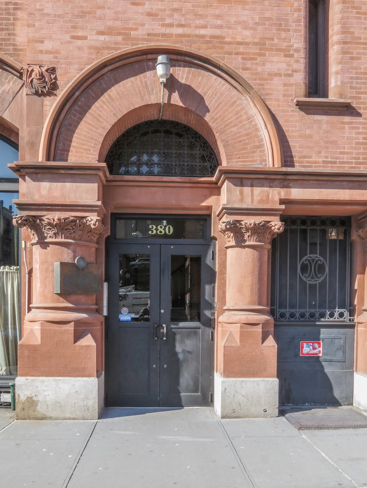
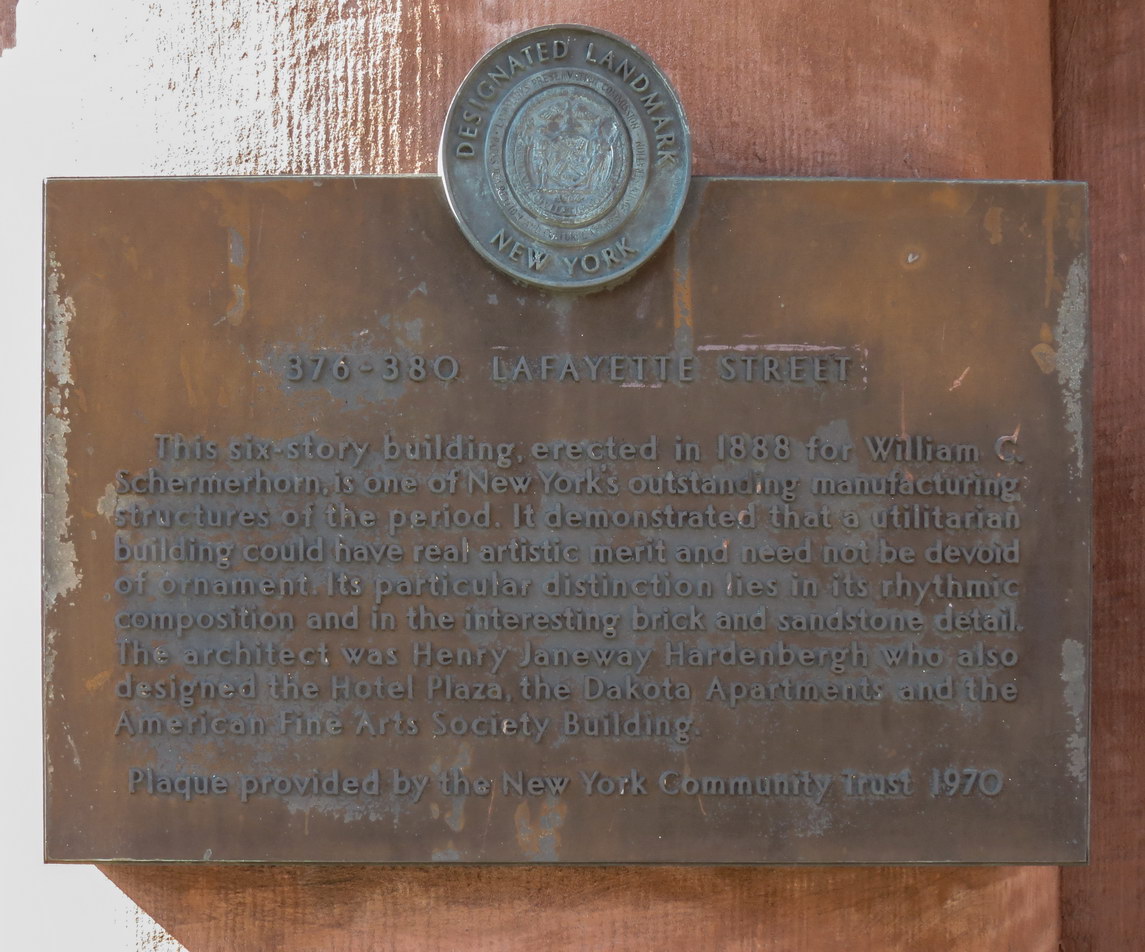
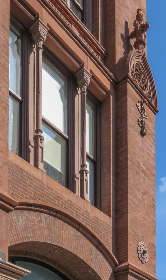
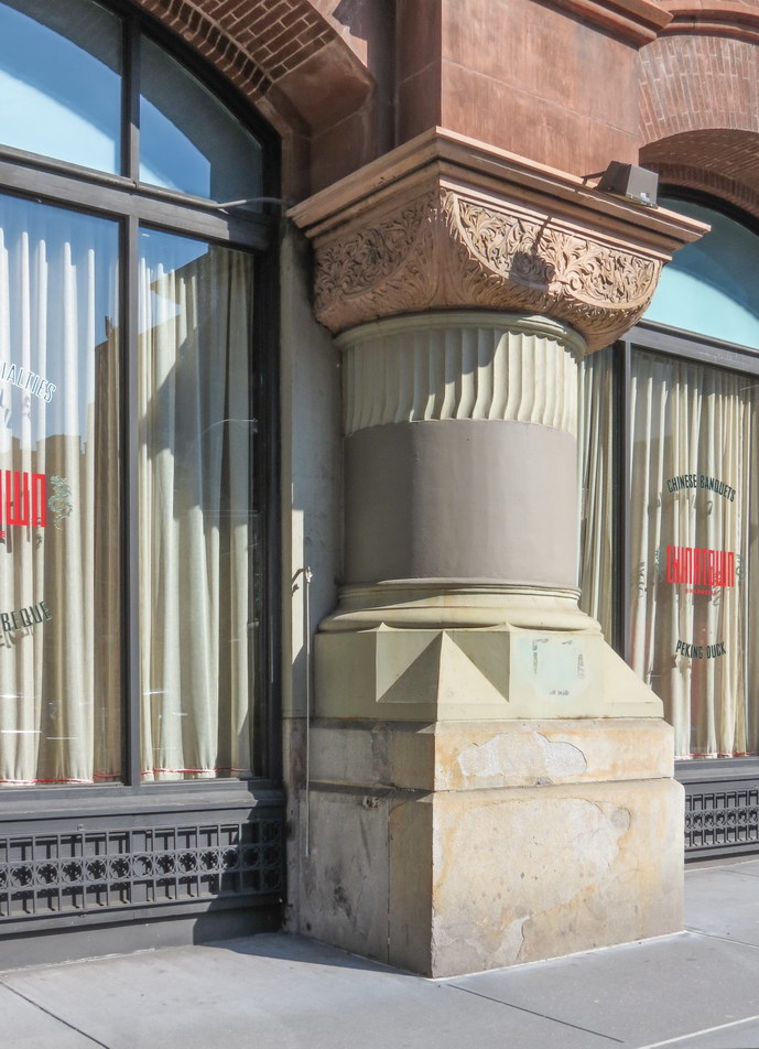
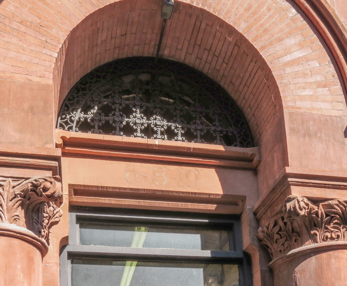
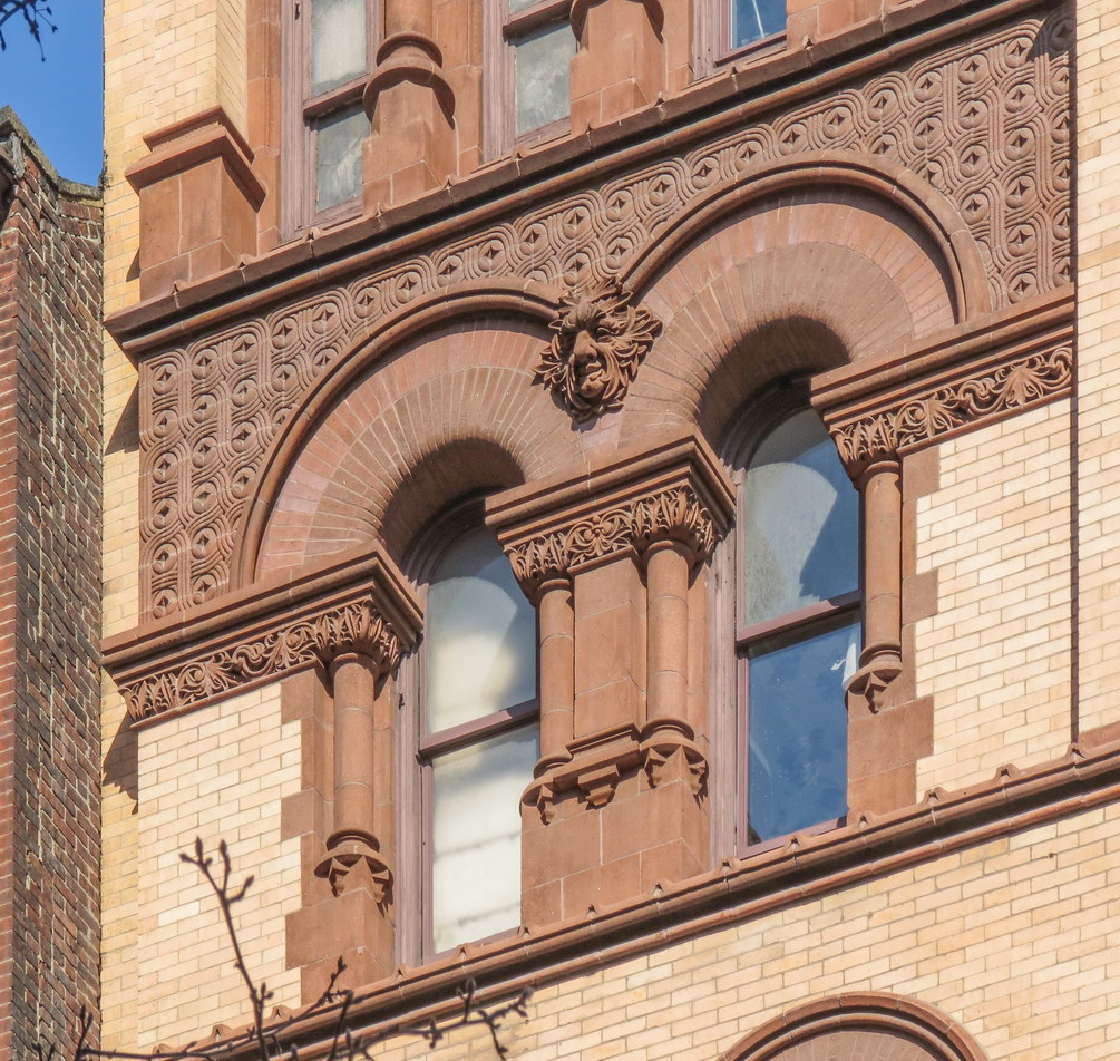
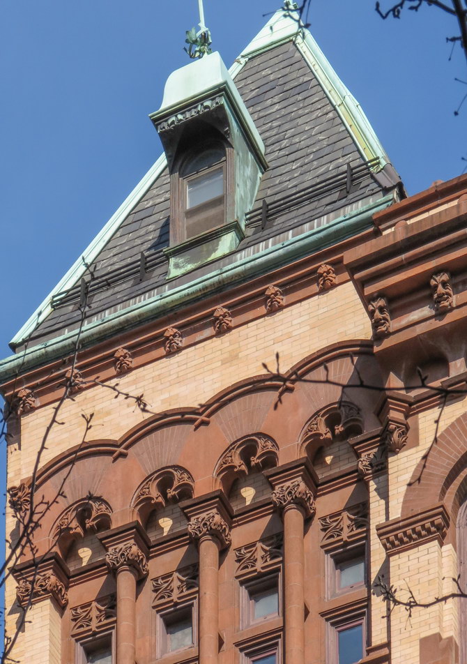
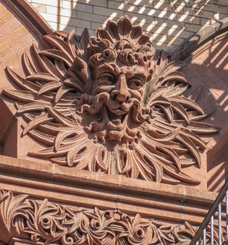
![IMG_0448_49_50Adjust [2/19/2012 2:01:17 PM] IMG_0448_49_50Adjust [2/19/2012 2:01:17 PM]](https://www.newyorkitecture.com/wp-content/gallery/bond-street-noho/img_0448_49_50adjust.jpg)
![IMG_0553_4_5Adjust [2/19/2012 2:37:42 PM] IMG_0553_4_5Adjust [2/19/2012 2:37:42 PM]](https://www.newyorkitecture.com/wp-content/gallery/bond-street-noho/img_0553_4_5adjust.jpg)
![IMG_0547_8_9Adjust [2/19/2012 2:36:35 PM] IMG_0547_8_9Adjust [2/19/2012 2:36:35 PM]](https://www.newyorkitecture.com/wp-content/gallery/bond-street-noho/img_0547_8_9adjust.jpg)
![IMG_0544_5_6Adjust [2/19/2012 2:34:53 PM] IMG_0544_5_6Adjust [2/19/2012 2:34:53 PM]](https://www.newyorkitecture.com/wp-content/gallery/bond-street-noho/img_0544_5_6adjust.jpg)
![IMG_0538_39_40Adjust [2/19/2012 2:33:39 PM] IMG_0538_39_40Adjust [2/19/2012 2:33:39 PM]](https://www.newyorkitecture.com/wp-content/gallery/bond-street-noho/img_0538_39_40adjust.jpg)
![IMG_0523_4_5Adjust [2/19/2012 2:30:08 PM] IMG_0523_4_5Adjust [2/19/2012 2:30:08 PM]](https://www.newyorkitecture.com/wp-content/gallery/bond-street-noho/img_0523_4_5adjust.jpg)
![IMG_0514_5_6Adjust [2/19/2012 2:26:28 PM] IMG_0514_5_6Adjust [2/19/2012 2:26:28 PM]](https://www.newyorkitecture.com/wp-content/gallery/bond-street-noho/img_0514_5_6adjust.jpg)
![IMG_0508_09_10Adjust [2/19/2012 2:24:01 PM] IMG_0508_09_10Adjust [2/19/2012 2:24:01 PM]](https://www.newyorkitecture.com/wp-content/gallery/bond-street-noho/img_0508_09_10adjust.jpg)
![IMG_0487_8_9Adjust [2/19/2012 2:18:59 PM] IMG_0487_8_9Adjust [2/19/2012 2:18:59 PM]](https://www.newyorkitecture.com/wp-content/gallery/bond-street-noho/img_0487_8_9adjust.jpg)
![IMG_0484_5_6Adjust [2/19/2012 2:17:40 PM] IMG_0484_5_6Adjust [2/19/2012 2:17:40 PM]](https://www.newyorkitecture.com/wp-content/gallery/bond-street-noho/img_0484_5_6adjust.jpg)
![IMG_0481_2_3Adjust [2/19/2012 2:15:47 PM] IMG_0481_2_3Adjust [2/19/2012 2:15:47 PM]](https://www.newyorkitecture.com/wp-content/gallery/bond-street-noho/img_0481_2_3adjust.jpg)
![IMG_0478_79_80Adjust [2/19/2012 2:14:06 PM] IMG_0478_79_80Adjust [2/19/2012 2:14:06 PM]](https://www.newyorkitecture.com/wp-content/gallery/bond-street-noho/img_0478_79_80adjust.jpg)
![IMG_0466_7_8Adjust [2/19/2012 2:08:06 PM] IMG_0466_7_8Adjust [2/19/2012 2:08:06 PM]](https://www.newyorkitecture.com/wp-content/gallery/bond-street-noho/img_0466_7_8adjust.jpg)
![IMG_0463_4_5Adjust [2/19/2012 2:07:07 PM] IMG_0463_4_5Adjust [2/19/2012 2:07:07 PM]](https://www.newyorkitecture.com/wp-content/gallery/bond-street-noho/img_0463_4_5adjust.jpg)
![IMG_0457_8_9Adjust [2/19/2012 2:04:10 PM] IMG_0457_8_9Adjust [2/19/2012 2:04:10 PM]](https://www.newyorkitecture.com/wp-content/gallery/bond-street-noho/img_0457_8_9adjust.jpg)
![IMG_0451_2_3Adjust [2/19/2012 2:02:17 PM] IMG_0451_2_3Adjust [2/19/2012 2:02:17 PM]](https://www.newyorkitecture.com/wp-content/gallery/bond-street-noho/img_0451_2_3adjust.jpg)
![IMG_0382_3_4Adjust [2/19/2012 1:36:02 PM] IMG_0382_3_4Adjust [2/19/2012 1:36:02 PM]](https://www.newyorkitecture.com/wp-content/gallery/bond-street-noho/img_0382_3_4adjust.jpg)
![IMG_0445_6_7Adjust [2/19/2012 2:00:20 PM] IMG_0445_6_7Adjust [2/19/2012 2:00:20 PM]](https://www.newyorkitecture.com/wp-content/gallery/bond-street-noho/img_0445_6_7adjust.jpg)
![IMG_0436_7_8Adjust [2/19/2012 1:58:14 PM] IMG_0436_7_8Adjust [2/19/2012 1:58:14 PM]](https://www.newyorkitecture.com/wp-content/gallery/bond-street-noho/img_0436_7_8adjust.jpg)
![IMG_0433_4_5Adjust [2/19/2012 1:57:01 PM] IMG_0433_4_5Adjust [2/19/2012 1:57:01 PM]](https://www.newyorkitecture.com/wp-content/gallery/bond-street-noho/img_0433_4_5adjust.jpg)
![IMG_0430_1_2Adjust [2/19/2012 1:56:02 PM] IMG_0430_1_2Adjust [2/19/2012 1:56:02 PM]](https://www.newyorkitecture.com/wp-content/gallery/bond-street-noho/img_0430_1_2adjust.jpg)
![IMG_0427_8_9Adjust [2/19/2012 1:55:05 PM] IMG_0427_8_9Adjust [2/19/2012 1:55:05 PM]](https://www.newyorkitecture.com/wp-content/gallery/bond-street-noho/img_0427_8_9adjust.jpg)
![IMG_0424_5_6Adjust [2/19/2012 1:54:22 PM] IMG_0424_5_6Adjust [2/19/2012 1:54:22 PM]](https://www.newyorkitecture.com/wp-content/gallery/bond-street-noho/img_0424_5_6adjust.jpg)
![IMG_0421_2_3Adjust [2/19/2012 1:53:48 PM] IMG_0421_2_3Adjust [2/19/2012 1:53:48 PM]](https://www.newyorkitecture.com/wp-content/gallery/bond-street-noho/img_0421_2_3adjust.jpg)
![IMG_0415_6_7Adjust [2/19/2012 1:52:23 PM] IMG_0415_6_7Adjust [2/19/2012 1:52:23 PM]](https://www.newyorkitecture.com/wp-content/gallery/bond-street-noho/img_0415_6_7adjust.jpg)
![IMG_0409_10_11Adjust [2/19/2012 1:49:32 PM] IMG_0409_10_11Adjust [2/19/2012 1:49:32 PM]](https://www.newyorkitecture.com/wp-content/gallery/bond-street-noho/img_0409_10_11adjust.jpg)
![IMG_0406_7_8Adjust [2/19/2012 1:48:42 PM] IMG_0406_7_8Adjust [2/19/2012 1:48:42 PM]](https://www.newyorkitecture.com/wp-content/gallery/bond-street-noho/img_0406_7_8adjust.jpg)
![IMG_0403_4_5Adjust [2/19/2012 1:47:39 PM] IMG_0403_4_5Adjust [2/19/2012 1:47:39 PM]](https://www.newyorkitecture.com/wp-content/gallery/bond-street-noho/img_0403_4_5adjust.jpg)
![IMG_0397_8_9Adjust [2/19/2012 1:45:14 PM] IMG_0397_8_9Adjust [2/19/2012 1:45:14 PM]](https://www.newyorkitecture.com/wp-content/gallery/bond-street-noho/img_0397_8_9adjust.jpg)
![IMG_0391_2_3Adjust [2/19/2012 1:40:49 PM] IMG_0391_2_3Adjust [2/19/2012 1:40:49 PM]](https://www.newyorkitecture.com/wp-content/gallery/bond-street-noho/img_0391_2_3adjust.jpg)
![IMG_0388_89_90Adjust [2/19/2012 1:37:48 PM] IMG_0388_89_90Adjust [2/19/2012 1:37:48 PM]](https://www.newyorkitecture.com/wp-content/gallery/bond-street-noho/img_0388_89_90adjust.jpg)
![IMG_0385_6_7Adjust [2/19/2012 1:37:07 PM] IMG_0385_6_7Adjust [2/19/2012 1:37:07 PM]](https://www.newyorkitecture.com/wp-content/gallery/bond-street-noho/img_0385_6_7adjust.jpg)
![IMG_0586_7_8Adjust [2/19/2012 2:46:50 PM] IMG_0586_7_8Adjust [2/19/2012 2:46:50 PM]](https://www.newyorkitecture.com/wp-content/gallery/soho/img_a_0586_7_8adjust.jpg)
![IMG_0592_3_4Adjust [2/19/2012 2:50:12 PM] IMG_0592_3_4Adjust [2/19/2012 2:50:12 PM]](https://www.newyorkitecture.com/wp-content/gallery/soho/img_a_0592_3_4adjust.jpg)
![IMG_0997_8_9Adjust [2/22/2012 12:43:28 PM] IMG_0997_8_9Adjust [2/22/2012 12:43:28 PM]](https://www.newyorkitecture.com/wp-content/gallery/soho/img_a_0997_8_9adjust.jpg)
![IMG_1027_8_9Adjust [2/22/2012 12:53:48 PM] IMG_1027_8_9Adjust [2/22/2012 12:53:48 PM]](https://www.newyorkitecture.com/wp-content/gallery/soho/img_a_1027_8_9adjust.jpg)
![IMG_1030_1_2Adjust [2/22/2012 12:59:53 PM] IMG_1030_1_2Adjust [2/22/2012 12:59:53 PM]](https://www.newyorkitecture.com/wp-content/gallery/soho/img_a_1030_1_2adjust.jpg)
![IMG_1051_2_3Adjust [2/22/2012 1:03:25 PM] IMG_1051_2_3Adjust [2/22/2012 1:03:25 PM]](https://www.newyorkitecture.com/wp-content/gallery/soho/img_a_1051_2_3adjust.jpg)
![IMG_1060_1_2Adjust [2/22/2012 1:05:30 PM] IMG_1060_1_2Adjust [2/22/2012 1:05:30 PM]](https://www.newyorkitecture.com/wp-content/gallery/soho/img_a_1060_1_2adjust.jpg)
![IMG_1063_4_5Adjust [2/22/2012 1:06:36 PM] IMG_1063_4_5Adjust [2/22/2012 1:06:36 PM]](https://www.newyorkitecture.com/wp-content/gallery/soho/img_a_1063_4_5adjust.jpg)
![IMG_1072_3_4Adjust [2/22/2012 1:09:09 PM] IMG_1072_3_4Adjust [2/22/2012 1:09:09 PM]](https://www.newyorkitecture.com/wp-content/gallery/soho/img_a_1072_3_4adjust.jpg)
![IMG_1078_79_80Adjust [2/22/2012 1:14:15 PM] IMG_1078_79_80Adjust [2/22/2012 1:14:15 PM]](https://www.newyorkitecture.com/wp-content/gallery/soho/img_a_1078_79_80adjust.jpg)
![IMG_1081_2_3Adjust [2/22/2012 1:16:09 PM] IMG_1081_2_3Adjust [2/22/2012 1:16:09 PM]](https://www.newyorkitecture.com/wp-content/gallery/soho/img_a_1081_2_3adjust.jpg)
![IMG_1084_5_6Adjust [2/22/2012 1:17:19 PM] IMG_1084_5_6Adjust [2/22/2012 1:17:19 PM]](https://www.newyorkitecture.com/wp-content/gallery/soho/img_a_1084_5_6adjust.jpg)
![IMG_1102_3_4Adjust [2/22/2012 1:22:40 PM] IMG_1102_3_4Adjust [2/22/2012 1:22:40 PM]](https://www.newyorkitecture.com/wp-content/gallery/soho/img_a_1102_3_4adjust.jpg)
![IMG_1114_5_6Adjust [2/22/2012 1:25:45 PM] IMG_1114_5_6Adjust [2/22/2012 1:25:45 PM]](https://www.newyorkitecture.com/wp-content/gallery/soho/img_a_1114_5_6adjust.jpg)
![IMG_1120_1_2Adjust [2/22/2012 1:27:14 PM] IMG_1120_1_2Adjust [2/22/2012 1:27:14 PM]](https://www.newyorkitecture.com/wp-content/gallery/soho/img_a_1120_1_2adjust.jpg)
![IMG_1126_7_8Adjust [2/22/2012 1:28:59 PM] IMG_1126_7_8Adjust [2/22/2012 1:28:59 PM]](https://www.newyorkitecture.com/wp-content/gallery/soho/img_a_1126_7_8adjust.jpg)
![IMG_1147_8_9Adjust [2/22/2012 1:33:28 PM] IMG_1147_8_9Adjust [2/22/2012 1:33:28 PM]](https://www.newyorkitecture.com/wp-content/gallery/soho/img_a_1147_8_9adjust.jpg)
![IMG_1162_3_4Adjust [2/22/2012 1:40:58 PM] IMG_1162_3_4Adjust [2/22/2012 1:40:58 PM]](https://www.newyorkitecture.com/wp-content/gallery/soho/img_a_1162_3_4adjust.jpg)
![IMG_1168_69_70Adjust [2/22/2012 1:43:23 PM] IMG_1168_69_70Adjust [2/22/2012 1:43:23 PM]](https://www.newyorkitecture.com/wp-content/gallery/soho/img_a_1168_69_70adjust.jpg)
![IMG_1177_8_9Adjust [2/22/2012 1:45:42 PM] IMG_1177_8_9Adjust [2/22/2012 1:45:42 PM]](https://www.newyorkitecture.com/wp-content/gallery/soho/img_a_1177_8_9adjust.jpg)
![IMG_1186_7_8Adjust [2/22/2012 1:48:09 PM] IMG_1186_7_8Adjust [2/22/2012 1:48:09 PM]](https://www.newyorkitecture.com/wp-content/gallery/soho/img_a_1186_7_8adjust.jpg)
![IMG_1192_3_4Adjust [2/22/2012 1:50:42 PM] IMG_1192_3_4Adjust [2/22/2012 1:50:42 PM]](https://www.newyorkitecture.com/wp-content/gallery/soho/img_a_1192_3_4adjust.jpg)
![IMG_1198_199_200Adjust [2/22/2012 1:52:16 PM] IMG_1198_199_200Adjust [2/22/2012 1:52:16 PM]](https://www.newyorkitecture.com/wp-content/gallery/soho/img_a_1198_199_200adjust.jpg)
![IMG_1207_8_9Adjust [2/22/2012 1:54:57 PM] IMG_1207_8_9Adjust [2/22/2012 1:54:57 PM]](https://www.newyorkitecture.com/wp-content/gallery/soho/img_a_1207_8_9adjust.jpg)
![IMG_1225_6_7Adjust [2/22/2012 1:57:53 PM] IMG_1225_6_7Adjust [2/22/2012 1:57:53 PM]](https://www.newyorkitecture.com/wp-content/gallery/soho/img_a_1225_6_7adjust.jpg)
![IMG_1228_29_30Adjust [2/22/2012 2:01:29 PM] IMG_1228_29_30Adjust [2/22/2012 2:01:29 PM]](https://www.newyorkitecture.com/wp-content/gallery/soho/img_a_1228_29_30adjust.jpg)
![IMG_1255_6_7Adjust [2/22/2012 2:08:08 PM] IMG_1255_6_7Adjust [2/22/2012 2:08:08 PM]](https://www.newyorkitecture.com/wp-content/gallery/soho/img_a_1255_6_7adjust.jpg)
![IMG_1267_8_9Adjust [2/22/2012 2:13:49 PM] IMG_1267_8_9Adjust [2/22/2012 2:13:49 PM]](https://www.newyorkitecture.com/wp-content/gallery/soho/img_a_1267_8_9adjust.jpg)
![IMG_1273_4_5Adjust [2/22/2012 2:15:00 PM] IMG_1273_4_5Adjust [2/22/2012 2:15:00 PM]](https://www.newyorkitecture.com/wp-content/gallery/soho/img_a_1273_4_5adjust.jpg)
![IMG_1282_3_4Adjust [2/22/2012 2:19:07 PM] IMG_1282_3_4Adjust [2/22/2012 2:19:07 PM]](https://www.newyorkitecture.com/wp-content/gallery/soho/img_a_1282_3_4adjust.jpg)
![IMG_1288_89_90Adjust [2/22/2012 2:21:45 PM] IMG_1288_89_90Adjust [2/22/2012 2:21:45 PM]](https://www.newyorkitecture.com/wp-content/gallery/soho/img_a_1288_89_90adjust.jpg)
![IMG_1291_2_3Adjust [2/22/2012 2:23:54 PM] IMG_1291_2_3Adjust [2/22/2012 2:23:54 PM]](https://www.newyorkitecture.com/wp-content/gallery/soho/img_a_1291_2_3adjust.jpg)
![IMG_1303_4_5Adjust [2/22/2012 2:30:35 PM] IMG_1303_4_5Adjust [2/22/2012 2:30:35 PM]](https://www.newyorkitecture.com/wp-content/gallery/soho/img_a_1303_4_5adjust.jpg)
![IMG_1306_7_8Adjust [2/22/2012 2:31:31 PM] IMG_1306_7_8Adjust [2/22/2012 2:31:31 PM]](https://www.newyorkitecture.com/wp-content/gallery/soho/img_a_1306_7_8adjust.jpg)
![IMG_1321_2_3Adjust [2/22/2012 2:40:00 PM] IMG_1321_2_3Adjust [2/22/2012 2:40:00 PM]](https://www.newyorkitecture.com/wp-content/gallery/soho/img_a_1321_2_3adjust.jpg)
![IMG_1324_5_6Adjust [2/22/2012 2:43:43 PM] IMG_1324_5_6Adjust [2/22/2012 2:43:43 PM]](https://www.newyorkitecture.com/wp-content/gallery/soho/img_a_1324_5_6adjust.jpg)
![IMG_1333_4_5Adjust [2/22/2012 2:46:33 PM] IMG_1333_4_5Adjust [2/22/2012 2:46:33 PM]](https://www.newyorkitecture.com/wp-content/gallery/soho/img_a_1333_4_5adjust.jpg)
![IMG_1339_40_41Adjust [2/22/2012 2:47:53 PM] IMG_1339_40_41Adjust [2/22/2012 2:47:53 PM]](https://www.newyorkitecture.com/wp-content/gallery/soho/img_a_1339_40_41adjust.jpg)
![IMG_1354_5_6Adjust [2/22/2012 2:50:54 PM] IMG_1354_5_6Adjust [2/22/2012 2:50:54 PM]](https://www.newyorkitecture.com/wp-content/gallery/soho/img_a_1354_5_6adjust.jpg)
![IMG_1390_1_2Adjust [2/22/2012 3:04:50 PM] IMG_1390_1_2Adjust [2/22/2012 3:04:50 PM]](https://www.newyorkitecture.com/wp-content/gallery/soho/img_a_1390_1_2adjust.jpg)
![IMG_1396_7_8Adjust [2/22/2012 3:07:52 PM] IMG_1396_7_8Adjust [2/22/2012 3:07:52 PM]](https://www.newyorkitecture.com/wp-content/gallery/soho/img_a_1396_7_8adjust.jpg)
![IMG_1402_3_4Adjust [2/22/2012 3:09:28 PM] IMG_1402_3_4Adjust [2/22/2012 3:09:28 PM]](https://www.newyorkitecture.com/wp-content/gallery/soho/img_a_1402_3_4adjust.jpg)
![IMG_1405_6_7Adjust [2/22/2012 3:10:04 PM] IMG_1405_6_7Adjust [2/22/2012 3:10:04 PM]](https://www.newyorkitecture.com/wp-content/gallery/soho/img_a_1405_6_7adjust.jpg)
![IMG_1414_5_6Adjust [2/22/2012 3:13:41 PM] IMG_1414_5_6Adjust [2/22/2012 3:13:41 PM]](https://www.newyorkitecture.com/wp-content/gallery/soho/img_a_1414_5_6adjust.jpg)
![IMG_1429_30_31Adjust [2/22/2012 3:19:30 PM] IMG_1429_30_31Adjust [2/22/2012 3:19:30 PM]](https://www.newyorkitecture.com/wp-content/gallery/soho/img_a_1429_30_31adjust.jpg)
![IMG_1438_39_40Adjust [2/22/2012 3:22:18 PM] IMG_1438_39_40Adjust [2/22/2012 3:22:18 PM]](https://www.newyorkitecture.com/wp-content/gallery/soho/img_a_1438_39_40adjust.jpg)
![IMG_1447_8_9Adjust [2/22/2012 3:26:49 PM] IMG_1447_8_9Adjust [2/22/2012 3:26:49 PM]](https://www.newyorkitecture.com/wp-content/gallery/soho/img_a_1447_8_9adjust.jpg)
![IMG_1459_60_61Adjust [2/22/2012 3:31:06 PM] IMG_1459_60_61Adjust [2/22/2012 3:31:06 PM]](https://www.newyorkitecture.com/wp-content/gallery/soho/img_a_1459_60_61adjust.jpg)
![IMG_1471_2_3Adjust [2/22/2012 3:36:28 PM] IMG_1471_2_3Adjust [2/22/2012 3:36:28 PM]](https://www.newyorkitecture.com/wp-content/gallery/soho/img_a_1471_2_3adjust.jpg)
![IMG_1477_8_9Adjust [2/22/2012 3:37:36 PM] IMG_1477_8_9Adjust [2/22/2012 3:37:36 PM]](https://www.newyorkitecture.com/wp-content/gallery/soho/img_a_1477_8_9adjust.jpg)
![IMG_1480_1_2Adjust [2/22/2012 3:41:01 PM] IMG_1480_1_2Adjust [2/22/2012 3:41:01 PM]](https://www.newyorkitecture.com/wp-content/gallery/soho/img_a_1480_1_2adjust.jpg)
![IMG_1492_3_4Adjust [2/22/2012 3:46:13 PM] IMG_1492_3_4Adjust [2/22/2012 3:46:13 PM]](https://www.newyorkitecture.com/wp-content/gallery/soho/img_a_1492_3_4adjust.jpg)
![IMG_1501_2_3Adjust [2/22/2012 3:49:13 PM] IMG_1501_2_3Adjust [2/22/2012 3:49:13 PM]](https://www.newyorkitecture.com/wp-content/gallery/soho/img_a_1501_2_3adjust.jpg)
![IMG_1507_8_9Adjust [2/22/2012 3:51:02 PM] IMG_1507_8_9Adjust [2/22/2012 3:51:02 PM]](https://www.newyorkitecture.com/wp-content/gallery/soho/img_a_1507_8_9adjust.jpg)
![IMG_1513_4_5Adjust [2/22/2012 3:52:56 PM] IMG_1513_4_5Adjust [2/22/2012 3:52:56 PM]](https://www.newyorkitecture.com/wp-content/gallery/soho/img_a_1513_4_5adjust.jpg)
![IMG_1528_29_30Adjust [2/22/2012 3:57:26 PM] IMG_1528_29_30Adjust [2/22/2012 3:57:26 PM]](https://www.newyorkitecture.com/wp-content/gallery/soho/img_a_1528_29_30adjust.jpg)
![IMG_1537_8_9Adjust [2/22/2012 3:58:39 PM] IMG_1537_8_9Adjust [2/22/2012 3:58:39 PM]](https://www.newyorkitecture.com/wp-content/gallery/soho/img_a_1537_8_9adjust.jpg)
![IMG_1546_7_8Adjust [2/22/2012 4:03:12 PM] IMG_1546_7_8Adjust [2/22/2012 4:03:12 PM]](https://www.newyorkitecture.com/wp-content/gallery/soho/img_a_1546_7_8adjust.jpg)
![IMG_1549_50_51Adjust [2/22/2012 4:04:48 PM] IMG_1549_50_51Adjust [2/22/2012 4:04:48 PM]](https://www.newyorkitecture.com/wp-content/gallery/soho/img_a_1549_50_51adjust.jpg)
![IMG_1555_6_7Adjust [2/22/2012 4:07:32 PM] IMG_1555_6_7Adjust [2/22/2012 4:07:32 PM]](https://www.newyorkitecture.com/wp-content/gallery/soho/img_a_1555_6_7adjust.jpg)
![IMG_1564_5_6Adjust [2/22/2012 4:09:59 PM] IMG_1564_5_6Adjust [2/22/2012 4:09:59 PM]](https://www.newyorkitecture.com/wp-content/gallery/soho/img_a_1564_5_6adjust.jpg)
![IMG_1567_8_9Adjust [2/27/2012 11:55:31 AM] IMG_1567_8_9Adjust [2/27/2012 11:55:31 AM]](https://www.newyorkitecture.com/wp-content/gallery/soho/img_a_1567_8_9adjust.jpg)
![IMG_1582_3_4Adjust [2/27/2012 11:57:24 AM] IMG_1582_3_4Adjust [2/27/2012 11:57:24 AM]](https://www.newyorkitecture.com/wp-content/gallery/soho/img_a_1582_3_4adjust.jpg)
![IMG_1372_3_4Adjust [2/22/2012 2:57:21 PM] IMG_1372_3_4Adjust [2/22/2012 2:57:21 PM]](https://www.newyorkitecture.com/wp-content/gallery/soho/img_b_1372_3_4adjust.jpg)
![IMG_1375_6_7Adjust [2/22/2012 2:58:02 PM] IMG_1375_6_7Adjust [2/22/2012 2:58:02 PM]](https://www.newyorkitecture.com/wp-content/gallery/soho/img_b_1375_6_7adjust.jpg)
![IMG_1378_79_80Adjust [2/22/2012 3:00:13 PM] IMG_1378_79_80Adjust [2/22/2012 3:00:13 PM]](https://www.newyorkitecture.com/wp-content/gallery/soho/img_b_1378_79_80adjust.jpg)
![IMG_1381_2_3Adjust [2/22/2012 3:02:01 PM] IMG_1381_2_3Adjust [2/22/2012 3:02:01 PM]](https://www.newyorkitecture.com/wp-content/gallery/soho/img_b_1381_2_3adjust.jpg)
![IMG_1585_6_7Adjust [2/27/2012 12:02:14 PM] IMG_1585_6_7Adjust [2/27/2012 12:02:14 PM]](https://www.newyorkitecture.com/wp-content/gallery/soho/img_b_1585_6_7adjust.jpg)
![IMG_1612_3_4Adjust [2/27/2012 12:07:47 PM] IMG_1612_3_4Adjust [2/27/2012 12:07:47 PM]](https://www.newyorkitecture.com/wp-content/gallery/soho/img_b_1612_3_4adjust.jpg)
![IMG_1615_6_7Adjust [2/27/2012 12:08:54 PM] IMG_1615_6_7Adjust [2/27/2012 12:08:54 PM]](https://www.newyorkitecture.com/wp-content/gallery/soho/img_b_1615_6_7adjust.jpg)
![IMG_1618_19_20Adjust [2/27/2012 12:09:29 PM] IMG_1618_19_20Adjust [2/27/2012 12:09:29 PM]](https://www.newyorkitecture.com/wp-content/gallery/soho/img_b_1618_19_20adjust.jpg)
![IMG_1624_5_6Adjust [2/27/2012 12:10:36 PM] IMG_1624_5_6Adjust [2/27/2012 12:10:36 PM]](https://www.newyorkitecture.com/wp-content/gallery/soho/img_b_1624_5_6adjust.jpg)
![IMG_1627_8_9Adjust [2/27/2012 12:11:16 PM] IMG_1627_8_9Adjust [2/27/2012 12:11:16 PM]](https://www.newyorkitecture.com/wp-content/gallery/soho/img_b_1627_8_9adjust.jpg)
![IMG_1630_1_2Adjust [2/27/2012 12:13:08 PM] IMG_1630_1_2Adjust [2/27/2012 12:13:08 PM]](https://www.newyorkitecture.com/wp-content/gallery/soho/img_b_1630_1_2adjust.jpg)
![IMG_1636_7_8Adjust [2/27/2012 12:14:14 PM] IMG_1636_7_8Adjust [2/27/2012 12:14:14 PM]](https://www.newyorkitecture.com/wp-content/gallery/soho/img_c_1636_7_8adjust.jpg)
![IMG_1642_3_4Adjust [2/27/2012 12:15:56 PM] IMG_1642_3_4Adjust [2/27/2012 12:15:56 PM]](https://www.newyorkitecture.com/wp-content/gallery/soho/img_c_1642_3_4adjust.jpg)
![IMG_1651_2_3Adjust [2/27/2012 12:18:16 PM] IMG_1651_2_3Adjust [2/27/2012 12:18:16 PM]](https://www.newyorkitecture.com/wp-content/gallery/soho/img_c_1651_2_3adjust.jpg)
![IMG_1669_70_71Adjust [2/27/2012 12:26:53 PM] IMG_1669_70_71Adjust [2/27/2012 12:26:53 PM]](https://www.newyorkitecture.com/wp-content/gallery/soho/img_c_1669_70_71adjust.jpg)
![IMG_1684_5_6Adjust [2/27/2012 12:31:42 PM] IMG_1684_5_6Adjust [2/27/2012 12:31:42 PM]](https://www.newyorkitecture.com/wp-content/gallery/soho/img_c_1684_5_6adjust.jpg)
![IMG_1693_4_5Adjust [2/27/2012 12:33:42 PM] IMG_1693_4_5Adjust [2/27/2012 12:33:42 PM]](https://www.newyorkitecture.com/wp-content/gallery/soho/img_c_1693_4_5adjust.jpg)
![IMG_1699_700_701Adjust [2/27/2012 12:35:32 PM] IMG_1699_700_701Adjust [2/27/2012 12:35:32 PM]](https://www.newyorkitecture.com/wp-content/gallery/soho/img_c_1699_700_701adjust.jpg)
![IMG_1720_1_2Adjust [2/27/2012 12:41:43 PM] IMG_1720_1_2Adjust [2/27/2012 12:41:43 PM]](https://www.newyorkitecture.com/wp-content/gallery/soho/img_c_1720_1_2adjust.jpg)
![IMG_1738_39_40Adjust [2/27/2012 12:46:12 PM] IMG_1738_39_40Adjust [2/27/2012 12:46:12 PM]](https://www.newyorkitecture.com/wp-content/gallery/soho/img_c_1738_39_40adjust.jpg)
![IMG_1762_3_4Adjust [2/27/2012 12:53:20 PM] IMG_1762_3_4Adjust [2/27/2012 12:53:20 PM]](https://www.newyorkitecture.com/wp-content/gallery/soho/img_c_1762_3_4adjust.jpg)
![IMG_1783_4_5Adjust [2/27/2012 12:57:42 PM] IMG_1783_4_5Adjust [2/27/2012 12:57:42 PM]](https://www.newyorkitecture.com/wp-content/gallery/soho/img_c_1783_4_5adjust.jpg)
![IMG_1801_2_3Adjust [2/27/2012 1:01:52 PM] IMG_1801_2_3Adjust [2/27/2012 1:01:52 PM]](https://www.newyorkitecture.com/wp-content/gallery/soho/img_c_1801_2_3adjust.jpg)
![IMG_1810_1_2Adjust [2/27/2012 1:05:42 PM] IMG_1810_1_2Adjust [2/27/2012 1:05:42 PM]](https://www.newyorkitecture.com/wp-content/gallery/soho/img_c_1810_1_2adjust.jpg)
![IMG_1819_20_21Adjust [2/27/2012 1:08:21 PM] IMG_1819_20_21Adjust [2/27/2012 1:08:21 PM]](https://www.newyorkitecture.com/wp-content/gallery/soho/img_c_1819_20_21adjust.jpg)
![IMG_1822_3_4Adjust [2/27/2012 1:09:52 PM] IMG_1822_3_4Adjust [2/27/2012 1:09:52 PM]](https://www.newyorkitecture.com/wp-content/gallery/soho/img_c_1822_3_4adjust.jpg)
![IMG_1834_5_6Adjust [2/27/2012 1:17:13 PM] IMG_1834_5_6Adjust [2/27/2012 1:17:13 PM]](https://www.newyorkitecture.com/wp-content/gallery/soho/img_c_1834_5_6adjust.jpg)
![IMG_1840_1_2Adjust [2/27/2012 1:18:55 PM] IMG_1840_1_2Adjust [2/27/2012 1:18:55 PM]](https://www.newyorkitecture.com/wp-content/gallery/soho/img_c_1840_1_2adjust.jpg)
![IMG_1852_3_4Adjust [2/27/2012 1:20:31 PM] IMG_1852_3_4Adjust [2/27/2012 1:20:31 PM]](https://www.newyorkitecture.com/wp-content/gallery/soho/img_c_1852_3_4adjust.jpg)
![IMG_1855_6_7Adjust [2/27/2012 1:21:34 PM] IMG_1855_6_7Adjust [2/27/2012 1:21:34 PM]](https://www.newyorkitecture.com/wp-content/gallery/soho/img_c_1855_6_7adjust.jpg)
![IMG_1864_5_6Adjust [2/27/2012 1:23:36 PM] IMG_1864_5_6Adjust [2/27/2012 1:23:36 PM]](https://www.newyorkitecture.com/wp-content/gallery/soho/img_c_1864_5_6adjust.jpg)
![IMG_1876_7_8Adjust [2/27/2012 1:26:46 PM] IMG_1876_7_8Adjust [2/27/2012 1:26:46 PM]](https://www.newyorkitecture.com/wp-content/gallery/soho/img_c_1876_7_8adjust.jpg)
![IMG_1918_19_20Adjust [2/27/2012 1:32:55 PM] IMG_1918_19_20Adjust [2/27/2012 1:32:55 PM]](https://www.newyorkitecture.com/wp-content/gallery/soho/img_c_1918_19_20adjust.jpg)
![IMG_1924_5_6Adjust [2/27/2012 1:34:03 PM] IMG_1924_5_6Adjust [2/27/2012 1:34:03 PM]](https://www.newyorkitecture.com/wp-content/gallery/soho/img_c_1924_5_6adjust.jpg)
![IMG_1954_5_6Adjust [2/27/2012 1:37:33 PM] IMG_1954_5_6Adjust [2/27/2012 1:37:33 PM]](https://www.newyorkitecture.com/wp-content/gallery/soho/img_c_1954_5_6adjust.jpg)
![IMG_d_1966_7_8Adjust [2/28/2012 11:46:02 AM] IMG_d_1966_7_8Adjust [2/28/2012 11:46:02 AM]](https://www.newyorkitecture.com/wp-content/gallery/soho/img_d_1966_7_8adjust.jpg)
![IMG_d_1978_79_80Adjust [2/28/2012 11:50:17 AM] IMG_d_1978_79_80Adjust [2/28/2012 11:50:17 AM]](https://www.newyorkitecture.com/wp-content/gallery/soho/img_d_1978_79_80adjust.jpg)
![IMG_d_2008_09_10Adjust [2/28/2012 11:54:02 AM] IMG_d_2008_09_10Adjust [2/28/2012 11:54:02 AM]](https://www.newyorkitecture.com/wp-content/gallery/soho/img_d_2008_09_10adjust.jpg)
![IMG_d_2026_7_8Adjust [2/28/2012 11:57:07 AM] IMG_d_2026_7_8Adjust [2/28/2012 11:57:07 AM]](https://www.newyorkitecture.com/wp-content/gallery/soho/img_d_2026_7_8adjust.jpg)
![IMG_d_2050_1_2Adjust [2/28/2012 12:02:09 PM] IMG_d_2050_1_2Adjust [2/28/2012 12:02:09 PM]](https://www.newyorkitecture.com/wp-content/gallery/soho/img_d_2050_1_2adjust.jpg)
![IMG_d_2074_5_6Adjust [2/28/2012 12:09:12 PM] IMG_d_2074_5_6Adjust [2/28/2012 12:09:12 PM]](https://www.newyorkitecture.com/wp-content/gallery/soho/img_d_2074_5_6adjust.jpg)
![IMG_d_2086_7_8Adjust [2/28/2012 12:11:23 PM] IMG_d_2086_7_8Adjust [2/28/2012 12:11:23 PM]](https://www.newyorkitecture.com/wp-content/gallery/soho/img_d_2086_7_8adjust.jpg)
![IMG_d_2095_6_7Adjust [2/28/2012 12:12:25 PM] IMG_d_2095_6_7Adjust [2/28/2012 12:12:25 PM]](https://www.newyorkitecture.com/wp-content/gallery/soho/img_d_2095_6_7adjust.jpg)
![IMG_d_2101_2_3Adjust [2/28/2012 12:15:17 PM] IMG_d_2101_2_3Adjust [2/28/2012 12:15:17 PM]](https://www.newyorkitecture.com/wp-content/gallery/soho/img_d_2101_2_3adjust.jpg)
![IMG_d_2104_5_6Adjust [2/28/2012 12:20:24 PM] IMG_d_2104_5_6Adjust [2/28/2012 12:20:24 PM]](https://www.newyorkitecture.com/wp-content/gallery/soho/img_d_2104_5_6adjust.jpg)
![IMG_d_2122_3_4Adjust [2/28/2012 12:31:59 PM] IMG_d_2122_3_4Adjust [2/28/2012 12:31:59 PM]](https://www.newyorkitecture.com/wp-content/gallery/soho/img_d_2122_3_4adjust.jpg)
![IMG_d_2140_1_2Adjust [2/28/2012 12:37:25 PM] IMG_d_2140_1_2Adjust [2/28/2012 12:37:25 PM]](https://www.newyorkitecture.com/wp-content/gallery/soho/img_d_2140_1_2adjust.jpg)
![IMG_d_2152_3_4Adjust [2/28/2012 12:41:45 PM] IMG_d_2152_3_4Adjust [2/28/2012 12:41:45 PM]](https://www.newyorkitecture.com/wp-content/gallery/soho/img_d_2152_3_4adjust.jpg)
![IMG_d_2173_4_5Adjust [2/28/2012 12:50:09 PM] IMG_d_2173_4_5Adjust [2/28/2012 12:50:09 PM]](https://www.newyorkitecture.com/wp-content/gallery/soho/img_d_2173_4_5adjust.jpg)
![IMG_d_2188_89_90Adjust [2/28/2012 12:53:30 PM] IMG_d_2188_89_90Adjust [2/28/2012 12:53:30 PM]](https://www.newyorkitecture.com/wp-content/gallery/soho/img_d_2188_89_90adjust.jpg)
![IMG_d_2203_4_5Adjust [2/28/2012 1:00:23 PM] IMG_d_2203_4_5Adjust [2/28/2012 1:00:23 PM]](https://www.newyorkitecture.com/wp-content/gallery/soho/img_d_2203_4_5adjust.jpg)
![IMG_d_2212_3_4Adjust [2/28/2012 1:01:47 PM] IMG_d_2212_3_4Adjust [2/28/2012 1:01:47 PM]](https://www.newyorkitecture.com/wp-content/gallery/soho/img_d_2212_3_4adjust.jpg)
![IMG_d_2215_6_7Adjust [2/28/2012 1:04:43 PM] IMG_d_2215_6_7Adjust [2/28/2012 1:04:43 PM]](https://www.newyorkitecture.com/wp-content/gallery/soho/img_d_2215_6_7adjust.jpg)
![IMG_d_2230_1_2Adjust [2/28/2012 1:10:40 PM] IMG_d_2230_1_2Adjust [2/28/2012 1:10:40 PM]](https://www.newyorkitecture.com/wp-content/gallery/soho/img_d_2230_1_2adjust.jpg)
![IMG_d_2245_6_7Adjust [2/28/2012 1:16:27 PM] IMG_d_2245_6_7Adjust [2/28/2012 1:16:27 PM]](https://www.newyorkitecture.com/wp-content/gallery/soho/img_d_2245_6_7adjust.jpg)
![IMG_d_2251_2_3Adjust [2/28/2012 1:18:15 PM] IMG_d_2251_2_3Adjust [2/28/2012 1:18:15 PM]](https://www.newyorkitecture.com/wp-content/gallery/soho/img_d_2251_2_3adjust.jpg)
![IMG_d_2260_1_2Adjust [2/28/2012 1:22:30 PM] IMG_d_2260_1_2Adjust [2/28/2012 1:22:30 PM]](https://www.newyorkitecture.com/wp-content/gallery/soho/img_d_2260_1_2adjust.jpg)
![IMG_d_2266_7_8Adjust [2/28/2012 1:25:44 PM] IMG_d_2266_7_8Adjust [2/28/2012 1:25:44 PM]](https://www.newyorkitecture.com/wp-content/gallery/soho/img_d_2266_7_8adjust.jpg)
![IMG_d_2275_6_7Adjust [2/28/2012 1:29:52 PM] IMG_d_2275_6_7Adjust [2/28/2012 1:29:52 PM]](https://www.newyorkitecture.com/wp-content/gallery/soho/img_d_2275_6_7adjust.jpg)
![IMG_d_2296_7_8Adjust [2/28/2012 1:36:53 PM] IMG_d_2296_7_8Adjust [2/28/2012 1:36:53 PM]](https://www.newyorkitecture.com/wp-content/gallery/soho/img_d_2296_7_8adjust.jpg)
![IMG_d_2305_6_7Adjust [2/28/2012 1:43:07 PM] IMG_d_2305_6_7Adjust [2/28/2012 1:43:07 PM]](https://www.newyorkitecture.com/wp-content/gallery/soho/img_d_2305_6_7adjust.jpg)
![IMG_d_2311_2_3Adjust [2/28/2012 1:43:52 PM] IMG_d_2311_2_3Adjust [2/28/2012 1:43:52 PM]](https://www.newyorkitecture.com/wp-content/gallery/soho/img_d_2311_2_3adjust.jpg)
![IMG_d_2317_8_9Adjust [2/28/2012 1:47:07 PM] IMG_d_2317_8_9Adjust [2/28/2012 1:47:07 PM]](https://www.newyorkitecture.com/wp-content/gallery/soho/img_d_2317_8_9adjust.jpg)
![IMG_d_2326_7_8Adjust [2/28/2012 1:51:25 PM] IMG_d_2326_7_8Adjust [2/28/2012 1:51:25 PM]](https://www.newyorkitecture.com/wp-content/gallery/soho/img_d_2326_7_8adjust.jpg)
![IMG_d_2332_3_4Adjust [2/28/2012 1:52:15 PM] IMG_d_2332_3_4Adjust [2/28/2012 1:52:15 PM]](https://www.newyorkitecture.com/wp-content/gallery/soho/img_d_2332_3_4adjust.jpg)
![IMG_d_2338_39_40Adjust [2/28/2012 1:54:25 PM] IMG_d_2338_39_40Adjust [2/28/2012 1:54:25 PM]](https://www.newyorkitecture.com/wp-content/gallery/soho/img_d_2338_39_40adjust.jpg)
![IMG_d_2341_2_3Adjust [2/28/2012 1:55:50 PM] IMG_d_2341_2_3Adjust [2/28/2012 1:55:50 PM]](https://www.newyorkitecture.com/wp-content/gallery/soho/img_d_2341_2_3adjust.jpg)
![IMG_d_2377_8_9Adjust [2/28/2012 2:04:50 PM] IMG_d_2377_8_9Adjust [2/28/2012 2:04:50 PM]](https://www.newyorkitecture.com/wp-content/gallery/soho/img_d_2377_8_9adjust.jpg)
![IMG_7063_4_5Adjust [2/4/2012 1:29:19 PM] IMG_7063_4_5Adjust [2/4/2012 1:29:19 PM]](https://www.newyorkitecture.com/wp-content/gallery/nyc-firehouses/img_7063_4_5adjust.jpg)
![WAT_10_10121 [11/30/2011 11:46:52 AM] WAT_10_10121 [11/30/2011 11:46:52 AM]](https://www.newyorkitecture.com/wp-content/gallery/nyc-firehouses/wat_10_10121.jpg)
![P9150247 [9/15/2011 11:47:26 AM] P9150247 [9/15/2011 11:47:26 AM]](https://www.newyorkitecture.com/wp-content/gallery/nyc-firehouses/p9150247.jpg)
![P9150246 [9/15/2011 11:46:26 AM] P9150246 [9/15/2011 11:46:26 AM]](https://www.newyorkitecture.com/wp-content/gallery/nyc-firehouses/p9150246.jpg)
![P9150004 [9/15/2011 7:37:56 AM] P9150004 [9/15/2011 7:37:56 AM]](https://www.newyorkitecture.com/wp-content/gallery/nyc-firehouses/p9150004.jpg)
![IMG_9725_6_7_tonemapped [11/27/2011 3:25:04 PM] IMG_9725_6_7_tonemapped [11/27/2011 3:25:04 PM]](https://www.newyorkitecture.com/wp-content/gallery/nyc-firehouses/img_9725_6_7_tonemapped.jpg)
![IMG_09724_5_6Adjust [2/18/2012 1:01:56 PM] IMG_09724_5_6Adjust [2/18/2012 1:01:56 PM]](https://www.newyorkitecture.com/wp-content/gallery/nyc-firehouses/img_09724_5_6adjust.jpg)
![IMG_09718_19_20Adjust [2/18/2012 1:00:51 PM] IMG_09718_19_20Adjust [2/18/2012 1:00:51 PM]](https://www.newyorkitecture.com/wp-content/gallery/nyc-firehouses/img_09718_19_20adjust.jpg)
![IMG_09712_3_4Adjust [2/18/2012 12:58:43 PM] IMG_09712_3_4Adjust [2/18/2012 12:58:43 PM]](https://www.newyorkitecture.com/wp-content/gallery/nyc-firehouses/img_09712_3_4adjust.jpg)
![CC_13375_6_7_fused [12/17/2011 11:13:39 AM] CC_13375_6_7_fused [12/17/2011 11:13:39 AM]](https://www.newyorkitecture.com/wp-content/gallery/nyc-firehouses/cc_13375_6_7_fused.jpg)
![IMG_7027_8_9Adjust [2/4/2012 1:21:59 PM] IMG_7027_8_9Adjust [2/4/2012 1:21:59 PM]](https://www.newyorkitecture.com/wp-content/gallery/nyc-firehouses/img_7027_8_9adjust.jpg)
![IMG_5926_7_8Adjust [3/14/2012 2:04:41 PM] IMG_5926_7_8Adjust [3/14/2012 2:04:41 PM]](https://www.newyorkitecture.com/wp-content/gallery/nyc-firehouses/img_5926_7_8adjust.jpg)
![IMG_5494_5_6 [10/31/2011 1:30:09 PM] IMG_5494_5_6 [10/31/2011 1:30:09 PM]](https://www.newyorkitecture.com/wp-content/gallery/nyc-firehouses/img_5494_5_6.jpg)
![IMG_5233_4_5Adjust [3/12/2012 11:58:13 AM] IMG_5233_4_5Adjust [3/12/2012 11:58:13 AM]](https://www.newyorkitecture.com/wp-content/gallery/nyc-firehouses/img_5233_4_5adjust.jpg)
![IMG_5227_8_9Adjust [3/12/2012 11:56:25 AM] IMG_5227_8_9Adjust [3/12/2012 11:56:25 AM]](https://www.newyorkitecture.com/wp-content/gallery/nyc-firehouses/img_5227_8_9adjust.jpg)
![IMG_5215_6_7Adjust [3/12/2012 11:54:10 AM] IMG_5215_6_7Adjust [3/12/2012 11:54:10 AM]](https://www.newyorkitecture.com/wp-content/gallery/nyc-firehouses/img_5215_6_7adjust.jpg)
![IMG_5191_2_3Adjust [3/12/2012 11:50:34 AM] IMG_5191_2_3Adjust [3/12/2012 11:50:34 AM]](https://www.newyorkitecture.com/wp-content/gallery/nyc-firehouses/img_5191_2_3adjust.jpg)
![IMG_0788_89_90_tonemapped [9/30/2011 12:20:52 PM] IMG_0788_89_90_tonemapped [9/30/2011 12:20:52 PM]](https://www.newyorkitecture.com/wp-content/gallery/nyc-firehouses/img_0788_89_90_tonemapped.jpg)
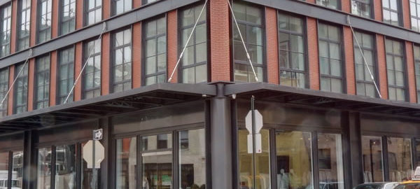
![IMG_3358_59_60Adjust [3/9/2012 11:08:54 AM] IMG_3358_59_60Adjust [3/9/2012 11:08:54 AM]](https://www.newyorkitecture.com/wp-content/gallery/gansevoort-meatpacking-district/img_3358_59_60adjust.jpg)
![IMG_6463_4_5Adjust [2/1/2012 3:35:19 PM] IMG_6463_4_5Adjust [2/1/2012 3:35:19 PM]](https://www.newyorkitecture.com/wp-content/gallery/gansevoort-meatpacking-district/img_6463_4_5adjust.jpg)
![IMG_6451_2_3Adjust [2/1/2012 3:29:15 PM] IMG_6451_2_3Adjust [2/1/2012 3:29:15 PM]](https://www.newyorkitecture.com/wp-content/gallery/gansevoort-meatpacking-district/img_6451_2_3adjust.jpg)
![IMG_6430_1_2Adjust [2/1/2012 3:21:49 PM] IMG_6430_1_2Adjust [2/1/2012 3:21:49 PM]](https://www.newyorkitecture.com/wp-content/gallery/gansevoort-meatpacking-district/img_6430_1_2adjust.jpg)
![IMG_6424_5_6Adjust [2/1/2012 3:17:49 PM] IMG_6424_5_6Adjust [2/1/2012 3:17:49 PM]](https://www.newyorkitecture.com/wp-content/gallery/gansevoort-meatpacking-district/img_6424_5_6adjust.jpg)
![IMG_3436_7_8Adjust [3/9/2012 11:36:57 AM] IMG_3436_7_8Adjust [3/9/2012 11:36:57 AM]](https://www.newyorkitecture.com/wp-content/gallery/gansevoort-meatpacking-district/img_3436_7_8adjust.jpg)
![IMG_3424_5_6Adjust [3/9/2012 11:29:55 AM] IMG_3424_5_6Adjust [3/9/2012 11:29:55 AM]](https://www.newyorkitecture.com/wp-content/gallery/gansevoort-meatpacking-district/img_3424_5_6adjust.jpg)
![IMG_3418_19_20Adjust [3/9/2012 11:26:33 AM] IMG_3418_19_20Adjust [3/9/2012 11:26:33 AM]](https://www.newyorkitecture.com/wp-content/gallery/gansevoort-meatpacking-district/img_3418_19_20adjust.jpg)
![IMG_3412_3_4Adjust [3/9/2012 11:25:22 AM] IMG_3412_3_4Adjust [3/9/2012 11:25:22 AM]](https://www.newyorkitecture.com/wp-content/gallery/gansevoort-meatpacking-district/img_3412_3_4adjust.jpg)
![IMG_3403_4_5Adjust [3/9/2012 11:24:07 AM] IMG_3403_4_5Adjust [3/9/2012 11:24:07 AM]](https://www.newyorkitecture.com/wp-content/gallery/gansevoort-meatpacking-district/img_3403_4_5adjust.jpg)
![IMG_3394_5_6Adjust [3/9/2012 11:22:42 AM] IMG_3394_5_6Adjust [3/9/2012 11:22:42 AM]](https://www.newyorkitecture.com/wp-content/gallery/gansevoort-meatpacking-district/img_3394_5_6adjust.jpg)
![IMG_3376_7_8Adjust [3/9/2012 11:19:21 AM] IMG_3376_7_8Adjust [3/9/2012 11:19:21 AM]](https://www.newyorkitecture.com/wp-content/gallery/gansevoort-meatpacking-district/img_3376_7_8adjust.jpg)
![IMG_3370_1_2Adjust [3/9/2012 11:18:04 AM] IMG_3370_1_2Adjust [3/9/2012 11:18:04 AM]](https://www.newyorkitecture.com/wp-content/gallery/gansevoort-meatpacking-district/img_3370_1_2adjust.jpg)
![IMG_3361_2_3Adjust [3/9/2012 11:14:52 AM] IMG_3361_2_3Adjust [3/9/2012 11:14:52 AM]](https://www.newyorkitecture.com/wp-content/gallery/gansevoort-meatpacking-district/img_3361_2_3adjust.jpg)
![IMG_3235_6_7Adjust [3/9/2012 10:26:17 AM] IMG_3235_6_7Adjust [3/9/2012 10:26:17 AM]](https://www.newyorkitecture.com/wp-content/gallery/gansevoort-meatpacking-district/img_3235_6_7adjust.jpg)
![IMG_3349_50_51Adjust [3/9/2012 11:05:57 AM] IMG_3349_50_51Adjust [3/9/2012 11:05:57 AM]](https://www.newyorkitecture.com/wp-content/gallery/gansevoort-meatpacking-district/img_3349_50_51adjust.jpg)
![IMG_3346_7_8Adjust [3/9/2012 11:03:44 AM] IMG_3346_7_8Adjust [3/9/2012 11:03:44 AM]](https://www.newyorkitecture.com/wp-content/gallery/gansevoort-meatpacking-district/img_3346_7_8adjust.jpg)
![IMG_3322_3_4Adjust [3/9/2012 10:58:41 AM] IMG_3322_3_4Adjust [3/9/2012 10:58:41 AM]](https://www.newyorkitecture.com/wp-content/gallery/gansevoort-meatpacking-district/img_3322_3_4adjust.jpg)
![IMG_3310_1_2Adjust [3/9/2012 10:53:13 AM] IMG_3310_1_2Adjust [3/9/2012 10:53:13 AM]](https://www.newyorkitecture.com/wp-content/gallery/gansevoort-meatpacking-district/img_3310_1_2adjust.jpg)
![IMG_3298_299_300Adjust [3/9/2012 10:48:05 AM] IMG_3298_299_300Adjust [3/9/2012 10:48:05 AM]](https://www.newyorkitecture.com/wp-content/gallery/gansevoort-meatpacking-district/img_3298_299_300adjust.jpg)
![IMG_3286_7_8Adjust [3/9/2012 10:44:45 AM] IMG_3286_7_8Adjust [3/9/2012 10:44:45 AM]](https://www.newyorkitecture.com/wp-content/gallery/gansevoort-meatpacking-district/img_3286_7_8adjust.jpg)
![IMG_3280_1_2Adjust [3/9/2012 10:43:14 AM] IMG_3280_1_2Adjust [3/9/2012 10:43:14 AM]](https://www.newyorkitecture.com/wp-content/gallery/gansevoort-meatpacking-district/img_3280_1_2adjust.jpg)
![IMG_3268_69_70Adjust [3/9/2012 10:41:16 AM] IMG_3268_69_70Adjust [3/9/2012 10:41:16 AM]](https://www.newyorkitecture.com/wp-content/gallery/gansevoort-meatpacking-district/img_3268_69_70adjust.jpg)
![IMG_3262_3_4Adjust [3/9/2012 10:38:08 AM] IMG_3262_3_4Adjust [3/9/2012 10:38:08 AM]](https://www.newyorkitecture.com/wp-content/gallery/gansevoort-meatpacking-district/img_3262_3_4adjust.jpg)
![IMG_3250_1_2Adjust [3/9/2012 10:33:31 AM] IMG_3250_1_2Adjust [3/9/2012 10:33:31 AM]](https://www.newyorkitecture.com/wp-content/gallery/gansevoort-meatpacking-district/img_3250_1_2adjust.jpg)
![IMG_3244_5_6Adjust [3/9/2012 10:31:11 AM] IMG_3244_5_6Adjust [3/9/2012 10:31:11 AM]](https://www.newyorkitecture.com/wp-content/gallery/gansevoort-meatpacking-district/img_3244_5_6adjust.jpg)
![IMG_3241_2_3Adjust [3/9/2012 10:28:18 AM] IMG_3241_2_3Adjust [3/9/2012 10:28:18 AM]](https://www.newyorkitecture.com/wp-content/gallery/gansevoort-meatpacking-district/img_3241_2_3adjust.jpg)
![IMG_3238_39_40Adjust [3/9/2012 10:26:53 AM] IMG_3238_39_40Adjust [3/9/2012 10:26:53 AM]](https://www.newyorkitecture.com/wp-content/gallery/gansevoort-meatpacking-district/img_3238_39_40adjust.jpg)
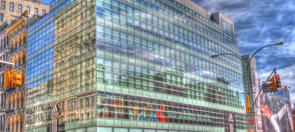
![IMG_5599_600_601 [1/1/2012 2:47:59 PM] IMG_5599_600_601 [1/1/2012 2:47:59 PM]](https://www.newyorkitecture.com/wp-content/gallery/posterized-photos/img_5599_600_601.jpg)
![IMG_4765_6_7 [3/12/2012 9:09:07 AM] IMG_4765_6_7 [3/12/2012 9:09:07 AM]](https://www.newyorkitecture.com/wp-content/gallery/posterized-photos/img_4765_6_7.jpg)
![IMG_4792_3_4 [3/12/2012 9:18:50 AM] IMG_4792_3_4 [3/12/2012 9:18:50 AM]](https://www.newyorkitecture.com/wp-content/gallery/posterized-photos/img_4792_3_4.jpg)
![IMG_4795_6_7 [3/12/2012 9:20:07 AM] IMG_4795_6_7 [3/12/2012 9:20:07 AM]](https://www.newyorkitecture.com/wp-content/gallery/posterized-photos/img_4795_6_7.jpg)
![IMG_4948_49_50 [3/12/2012 10:18:21 AM] IMG_4948_49_50 [3/12/2012 10:18:21 AM]](https://www.newyorkitecture.com/wp-content/gallery/posterized-photos/img_4948_49_50.jpg)
![IMG_4993_4_5 [3/12/2012 10:47:48 AM] IMG_4993_4_5 [3/12/2012 10:47:48 AM]](https://www.newyorkitecture.com/wp-content/gallery/posterized-photos/img_4993_4_5.jpg)
![IMG_5050_1_2 [3/12/2012 11:01:18 AM] IMG_5050_1_2 [3/12/2012 11:01:18 AM]](https://www.newyorkitecture.com/wp-content/gallery/posterized-photos/img_5050_1_2.jpg)
![IMG_5080_1_2 [3/12/2012 11:09:44 AM] IMG_5080_1_2 [3/12/2012 11:09:44 AM]](https://www.newyorkitecture.com/wp-content/gallery/posterized-photos/img_5080_1_2.jpg)
![IMG_5086_7_8 [3/12/2012 11:11:37 AM] IMG_5086_7_8 [3/12/2012 11:11:37 AM]](https://www.newyorkitecture.com/wp-content/gallery/posterized-photos/img_5086_7_8.jpg)
![IMG_5128_29_30 [3/12/2012 11:24:31 AM] IMG_5128_29_30 [3/12/2012 11:24:31 AM]](https://www.newyorkitecture.com/wp-content/gallery/posterized-photos/img_5128_29_30.jpg)
![IMG_5161_2_3 [1/1/2012 12:17:33 PM] IMG_5161_2_3 [1/1/2012 12:17:33 PM]](https://www.newyorkitecture.com/wp-content/gallery/posterized-photos/img_5161_2_3.jpg)
![IMG_5191_2_3 [1/1/2012 12:24:26 PM] IMG_5191_2_3 [1/1/2012 12:24:26 PM]](https://www.newyorkitecture.com/wp-content/gallery/posterized-photos/img_5191_2_3.jpg)
![IMG_5359_60_61 [1/1/2012 1:26:06 PM] IMG_5359_60_61 [1/1/2012 1:26:06 PM]](https://www.newyorkitecture.com/wp-content/gallery/posterized-photos/img_5359_60_61.jpg)
![IMG_5479_80_81 [1/1/2012 2:05:27 PM] IMG_5479_80_81 [1/1/2012 2:05:27 PM]](https://www.newyorkitecture.com/wp-content/gallery/posterized-photos/img_5479_80_81.jpg)
![IMG_4636_7_8 [3/12/2012 8:15:05 AM] IMG_4636_7_8 [3/12/2012 8:15:05 AM]](https://www.newyorkitecture.com/wp-content/gallery/posterized-photos/img_4636_7_8.jpg)
![IMG_5874_5_6_tonemapped [1/6/2012 12:56:32 PM] IMG_5874_5_6_tonemapped [1/6/2012 12:56:32 PM]](https://www.newyorkitecture.com/wp-content/gallery/posterized-photos/img_5874_5_6_tonemapped.jpg)
![IMG_6430_1_2 [2/1/2012 3:21:49 PM] IMG_6430_1_2 [2/1/2012 3:21:49 PM]](https://www.newyorkitecture.com/wp-content/gallery/posterized-photos/img_6430_1_2.jpg)
![IMG_6451_2_3 [2/1/2012 3:29:15 PM] IMG_6451_2_3 [2/1/2012 3:29:15 PM]](https://www.newyorkitecture.com/wp-content/gallery/posterized-photos/img_6451_2_3.jpg)
![IMG_6463_4_5 [2/1/2012 3:35:19 PM] IMG_6463_4_5 [2/1/2012 3:35:19 PM]](https://www.newyorkitecture.com/wp-content/gallery/posterized-photos/img_6463_4_5.jpg)
![IMG_6505_6_7 [2/1/2012 4:08:20 PM] IMG_6505_6_7 [2/1/2012 4:08:20 PM]](https://www.newyorkitecture.com/wp-content/gallery/posterized-photos/img_6505_6_7.jpg)
![IMG_6580_1_2 [2/1/2012 4:49:04 PM] IMG_6580_1_2 [2/1/2012 4:49:04 PM]](https://www.newyorkitecture.com/wp-content/gallery/posterized-photos/img_6580_1_2.jpg)
![IMG_09613_4_5Enhancer [2/18/2012 12:26:08 PM] IMG_09613_4_5Enhancer [2/18/2012 12:26:08 PM]](https://www.newyorkitecture.com/wp-content/gallery/posterized-photos/img_09613_4_5enhancer.jpg)
![IMG_09622_3_4Enhanced [2/18/2012 12:30:35 PM] IMG_09622_3_4Enhanced [2/18/2012 12:30:35 PM]](https://www.newyorkitecture.com/wp-content/gallery/posterized-photos/img_09622_3_4enhanced.jpg)
![IMG_09685_6_7 [2/18/2012 12:49:07 PM] IMG_09685_6_7 [2/18/2012 12:49:07 PM]](https://www.newyorkitecture.com/wp-content/gallery/posterized-photos/img_09685_6_7.jpg)
![IMG_09826_7_8 [2/18/2012 1:34:17 PM] IMG_09826_7_8 [2/18/2012 1:34:17 PM]](https://www.newyorkitecture.com/wp-content/gallery/posterized-photos/img_09826_7_8.jpg)
![IMG_09841_2_3Enhancer [2/18/2012 1:38:26 PM] IMG_09841_2_3Enhancer [2/18/2012 1:38:26 PM]](https://www.newyorkitecture.com/wp-content/gallery/posterized-photos/img_09841_2_3enhancer.jpg)
![IMG_09880_1_2Enhancer [2/18/2012 1:47:19 PM] IMG_09880_1_2Enhancer [2/18/2012 1:47:19 PM]](https://www.newyorkitecture.com/wp-content/gallery/posterized-photos/img_09880_1_2enhancer.jpg)
![IMG_10067_8_9Enhancer [2/18/2012 2:37:34 PM] IMG_10067_8_9Enhancer [2/18/2012 2:37:34 PM]](https://www.newyorkitecture.com/wp-content/gallery/posterized-photos/img_10067_8_9enhancer.jpg)
![IMG_3298_299_300 [3/9/2012 10:48:05 AM] IMG_3298_299_300 [3/9/2012 10:48:05 AM]](https://www.newyorkitecture.com/wp-content/gallery/posterized-photos/img_3298_299_300.jpg)
![9a_IMG_0136_7_8_tonemapped [2/19/2012 11:46:22 AM] 9a_IMG_0136_7_8_tonemapped [2/19/2012 11:46:22 AM]](https://www.newyorkitecture.com/wp-content/gallery/posterized-photos/9a_img_0136_7_8_tonemapped.jpg)
![IMG_2431_2_3 [3/6/2012 12:34:47 PM] IMG_2431_2_3 [3/6/2012 12:34:47 PM]](https://www.newyorkitecture.com/wp-content/gallery/posterized-photos/img_2431_2_3.jpg)
![IMG_2449_50_51 [3/6/2012 12:38:17 PM] IMG_2449_50_51 [3/6/2012 12:38:17 PM]](https://www.newyorkitecture.com/wp-content/gallery/posterized-photos/img_2449_50_51.jpg)
![IMG_2470_1_2 [3/6/2012 12:47:42 PM] IMG_2470_1_2 [3/6/2012 12:47:42 PM]](https://www.newyorkitecture.com/wp-content/gallery/posterized-photos/img_2470_1_2.jpg)
![IMG_2497_8_9 [3/6/2012 1:00:15 PM] IMG_2497_8_9 [3/6/2012 1:00:15 PM]](https://www.newyorkitecture.com/wp-content/gallery/posterized-photos/img_2497_8_9.jpg)
![IMG_2665_6_7 [3/6/2012 2:03:41 PM] IMG_2665_6_7 [3/6/2012 2:03:41 PM]](https://www.newyorkitecture.com/wp-content/gallery/posterized-photos/img_2665_6_7.jpg)
![IMG_2752_3_4 [3/6/2012 2:45:38 PM] IMG_2752_3_4 [3/6/2012 2:45:38 PM]](https://www.newyorkitecture.com/wp-content/gallery/posterized-photos/img_2752_3_4.jpg)
![IMG_2779_80_81 [3/7/2012 9:28:51 AM] IMG_2779_80_81 [3/7/2012 9:28:51 AM]](https://www.newyorkitecture.com/wp-content/gallery/posterized-photos/img_2779_80_81.jpg)
![IMG_2794_5_6 [3/7/2012 9:31:51 AM] IMG_2794_5_6 [3/7/2012 9:31:51 AM]](https://www.newyorkitecture.com/wp-content/gallery/posterized-photos/img_2794_5_6.jpg)
![IMG_2917_8_9 [3/7/2012 10:08:40 AM] IMG_2917_8_9 [3/7/2012 10:08:40 AM]](https://www.newyorkitecture.com/wp-content/gallery/posterized-photos/img_2917_8_9.jpg)
![IMG_2935_6_7 [3/7/2012 10:13:02 AM] IMG_2935_6_7 [3/7/2012 10:13:02 AM]](https://www.newyorkitecture.com/wp-content/gallery/posterized-photos/img_2935_6_7.jpg)
![IMG_3019_20_21 [3/7/2012 10:45:26 AM] IMG_3019_20_21 [3/7/2012 10:45:26 AM]](https://www.newyorkitecture.com/wp-content/gallery/posterized-photos/img_3019_20_21.jpg)
![IMG_3286_7_8 [3/9/2012 10:44:45 AM] IMG_3286_7_8 [3/9/2012 10:44:45 AM]](https://www.newyorkitecture.com/wp-content/gallery/posterized-photos/img_3286_7_8.jpg)
![5_IMG_0121_2_3_tonemapped [2/19/2012 11:43:09 AM] 5_IMG_0121_2_3_tonemapped [2/19/2012 11:43:09 AM]](https://www.newyorkitecture.com/wp-content/gallery/posterized-photos/5_img_0121_2_3_tonemapped.jpg)
![IMG_3403_4_5 [3/9/2012 11:24:07 AM] IMG_3403_4_5 [3/9/2012 11:24:07 AM]](https://www.newyorkitecture.com/wp-content/gallery/posterized-photos/img_3403_4_5.jpg)
![IMG_3946_7_8 [3/11/2012 12:04:26 PM] IMG_3946_7_8 [3/11/2012 12:04:26 PM]](https://www.newyorkitecture.com/wp-content/gallery/posterized-photos/img_3946_7_8.jpg)
![IMG_4036_7_8 [3/11/2012 12:38:37 PM] IMG_4036_7_8 [3/11/2012 12:38:37 PM]](https://www.newyorkitecture.com/wp-content/gallery/posterized-photos/img_4036_7_8.jpg)
![IMG_4054_5_6 [3/11/2012 12:42:24 PM] IMG_4054_5_6 [3/11/2012 12:42:24 PM]](https://www.newyorkitecture.com/wp-content/gallery/posterized-photos/img_4054_5_6.jpg)
![IMG_4069_70_71 [3/11/2012 12:47:39 PM] IMG_4069_70_71 [3/11/2012 12:47:39 PM]](https://www.newyorkitecture.com/wp-content/gallery/posterized-photos/img_4069_70_71.jpg)
![IMG_4108_09_10 [3/11/2012 1:01:29 PM] IMG_4108_09_10 [3/11/2012 1:01:29 PM]](https://www.newyorkitecture.com/wp-content/gallery/posterized-photos/img_4108_09_10.jpg)
![IMG_4183_4_5 [3/11/2012 1:21:32 PM] IMG_4183_4_5 [3/11/2012 1:21:32 PM]](https://www.newyorkitecture.com/wp-content/gallery/posterized-photos/img_4183_4_5.jpg)
![IMG_4285_6_7 [3/11/2012 1:57:12 PM] IMG_4285_6_7 [3/11/2012 1:57:12 PM]](https://www.newyorkitecture.com/wp-content/gallery/posterized-photos/img_4285_6_7.jpg)
![IMG_4300_1_2 [3/11/2012 2:01:23 PM] IMG_4300_1_2 [3/11/2012 2:01:23 PM]](https://www.newyorkitecture.com/wp-content/gallery/posterized-photos/img_4300_1_2.jpg)
![IMG_4303_4_5 [3/11/2012 2:02:40 PM] IMG_4303_4_5 [3/11/2012 2:02:40 PM]](https://www.newyorkitecture.com/wp-content/gallery/posterized-photos/img_4303_4_5.jpg)
![IMG_4438_39_40 [3/11/2012 2:46:01 PM] IMG_4438_39_40 [3/11/2012 2:46:01 PM]](https://www.newyorkitecture.com/wp-content/gallery/posterized-photos/img_4438_39_40.jpg)
![IMG_4513_4_5 [3/11/2012 3:08:17 PM] IMG_4513_4_5 [3/11/2012 3:08:17 PM]](https://www.newyorkitecture.com/wp-content/gallery/posterized-photos/img_4513_4_5.jpg)
![IMG_4627_8_9 [3/12/2012 8:13:52 AM] IMG_4627_8_9 [3/12/2012 8:13:52 AM]](https://www.newyorkitecture.com/wp-content/gallery/posterized-photos/img_4627_8_9.jpg)
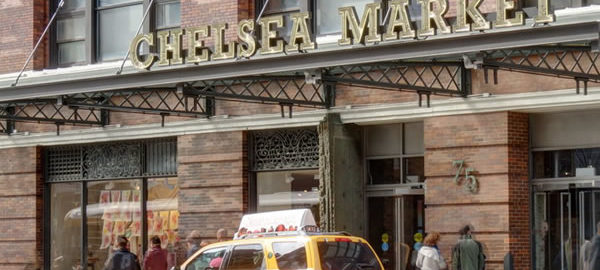
![IMG_2497_8_9Adjust [3/6/2012 1:00:15 PM] IMG_2497_8_9Adjust [3/6/2012 1:00:15 PM]](https://www.newyorkitecture.com/wp-content/gallery/chelsea/img_2497_8_9adjust.jpg)
![IMG_2509_10_11Adjust [3/6/2012 1:04:27 PM] IMG_2509_10_11Adjust [3/6/2012 1:04:27 PM]](https://www.newyorkitecture.com/wp-content/gallery/chelsea/img_2509_10_11adjust.jpg)
![IMG_2521_2_3Adjust [3/6/2012 1:06:49 PM] IMG_2521_2_3Adjust [3/6/2012 1:06:49 PM]](https://www.newyorkitecture.com/wp-content/gallery/chelsea/img_2521_2_3adjust.jpg)
![IMG_2524_5_6Adjust [3/6/2012 1:10:16 PM] IMG_2524_5_6Adjust [3/6/2012 1:10:16 PM]](https://www.newyorkitecture.com/wp-content/gallery/chelsea/img_2524_5_6adjust.jpg)
![IMG_2530_1_2Adjust [3/6/2012 1:11:53 PM] IMG_2530_1_2Adjust [3/6/2012 1:11:53 PM]](https://www.newyorkitecture.com/wp-content/gallery/chelsea/img_2530_1_2adjust.jpg)
![IMG_2536_7_8Adjust [3/6/2012 1:12:45 PM] IMG_2536_7_8Adjust [3/6/2012 1:12:45 PM]](https://www.newyorkitecture.com/wp-content/gallery/chelsea/img_2536_7_8adjust.jpg)
![IMG_2545_6_7Adjust [3/6/2012 1:14:04 PM] IMG_2545_6_7Adjust [3/6/2012 1:14:04 PM]](https://www.newyorkitecture.com/wp-content/gallery/chelsea/img_2545_6_7adjust.jpg)
![IMG_2557_8_9Adjust [3/6/2012 1:18:54 PM] IMG_2557_8_9Adjust [3/6/2012 1:18:54 PM]](https://www.newyorkitecture.com/wp-content/gallery/chelsea/img_2557_8_9adjust.jpg)
![IMG_2569_70_71Adjust [3/6/2012 1:21:25 PM] IMG_2569_70_71Adjust [3/6/2012 1:21:25 PM]](https://www.newyorkitecture.com/wp-content/gallery/chelsea/img_2569_70_71adjust.jpg)
![IMG_2584_5_6Adjust [3/6/2012 1:29:47 PM] IMG_2584_5_6Adjust [3/6/2012 1:29:47 PM]](https://www.newyorkitecture.com/wp-content/gallery/chelsea/img_2584_5_6adjust.jpg)
![IMG_2587_8_9Adjust [3/6/2012 1:30:47 PM] IMG_2587_8_9Adjust [3/6/2012 1:30:47 PM]](https://www.newyorkitecture.com/wp-content/gallery/chelsea/img_2587_8_9adjust.jpg)
![IMG_2593_4_5Adjust [3/6/2012 1:32:33 PM] IMG_2593_4_5Adjust [3/6/2012 1:32:33 PM]](https://www.newyorkitecture.com/wp-content/gallery/chelsea/img_2593_4_5adjust.jpg)
![IMG_2596_7_8Adjust [3/6/2012 1:35:30 PM] IMG_2596_7_8Adjust [3/6/2012 1:35:30 PM]](https://www.newyorkitecture.com/wp-content/gallery/chelsea/img_2596_7_8adjust.jpg)
![IMG_2605_6_7Adjust [3/6/2012 1:37:01 PM] IMG_2605_6_7Adjust [3/6/2012 1:37:01 PM]](https://www.newyorkitecture.com/wp-content/gallery/chelsea/img_2605_6_7adjust.jpg)
![IMG_2608_09_10Adjust [3/6/2012 1:37:57 PM] IMG_2608_09_10Adjust [3/6/2012 1:37:57 PM]](https://www.newyorkitecture.com/wp-content/gallery/chelsea/img_2608_09_10adjust.jpg)
![IMG_2623_4_5Adjust [3/6/2012 1:44:27 PM] IMG_2623_4_5Adjust [3/6/2012 1:44:27 PM]](https://www.newyorkitecture.com/wp-content/gallery/chelsea/img_2623_4_5adjust.jpg)
![IMG_2665_6_7Adjust [3/6/2012 2:03:41 PM] IMG_2665_6_7Adjust [3/6/2012 2:03:41 PM]](https://www.newyorkitecture.com/wp-content/gallery/chelsea/img_2665_6_7adjust.jpg)
![IMG_2680_1_2Adjust [3/6/2012 2:06:45 PM] IMG_2680_1_2Adjust [3/6/2012 2:06:45 PM]](https://www.newyorkitecture.com/wp-content/gallery/chelsea/img_2680_1_2adjust.jpg)
![IMG_2710_1_2Adjust [3/6/2012 2:21:15 PM] IMG_2710_1_2Adjust [3/6/2012 2:21:15 PM]](https://www.newyorkitecture.com/wp-content/gallery/chelsea/img_2710_1_2adjust.jpg)
![IMG_2731_2_3Adjust [3/6/2012 2:27:07 PM] IMG_2731_2_3Adjust [3/6/2012 2:27:07 PM]](https://www.newyorkitecture.com/wp-content/gallery/chelsea/img_2731_2_3adjust.jpg)
![IMG_2737_8_9Adjust [3/6/2012 2:33:46 PM] IMG_2737_8_9Adjust [3/6/2012 2:33:46 PM]](https://www.newyorkitecture.com/wp-content/gallery/chelsea/img_2737_8_9adjust.jpg)
![IMG_2911_2_3Adjust [3/7/2012 10:06:51 AM] IMG_2911_2_3Adjust [3/7/2012 10:06:51 AM]](https://www.newyorkitecture.com/wp-content/gallery/chelsea/img_2911_2_3adjust.jpg)
![IMG_2917_8_9Adjust [3/7/2012 10:08:40 AM] IMG_2917_8_9Adjust [3/7/2012 10:08:40 AM]](https://www.newyorkitecture.com/wp-content/gallery/chelsea/img_2917_8_9adjust.jpg)
![IMG_2923_4_5Adjust [3/7/2012 10:10:25 AM] IMG_2923_4_5Adjust [3/7/2012 10:10:25 AM]](https://www.newyorkitecture.com/wp-content/gallery/chelsea/img_2923_4_5adjust.jpg)
![IMG_2926_7_8Adjust [3/7/2012 10:11:09 AM] IMG_2926_7_8Adjust [3/7/2012 10:11:09 AM]](https://www.newyorkitecture.com/wp-content/gallery/chelsea/img_2926_7_8adjust.jpg)
![IMG_2929_30_31Adjust [3/7/2012 10:11:56 AM] IMG_2929_30_31Adjust [3/7/2012 10:11:56 AM]](https://www.newyorkitecture.com/wp-content/gallery/chelsea/img_2929_30_31adjust.jpg)
![IMG_2935_6_7Adjust [3/7/2012 10:13:02 AM] IMG_2935_6_7Adjust [3/7/2012 10:13:02 AM]](https://www.newyorkitecture.com/wp-content/gallery/chelsea/img_2935_6_7adjust.jpg)
![IMG_2941_2_3Adjust [3/7/2012 10:14:45 AM] IMG_2941_2_3Adjust [3/7/2012 10:14:45 AM]](https://www.newyorkitecture.com/wp-content/gallery/chelsea/img_2941_2_3adjust.jpg)
![IMG_2947_8_9Adjust [3/7/2012 10:18:26 AM] IMG_2947_8_9Adjust [3/7/2012 10:18:26 AM]](https://www.newyorkitecture.com/wp-content/gallery/chelsea/img_2947_8_9adjust.jpg)
![IMG_2956_7_8Adjust [3/7/2012 10:21:46 AM] IMG_2956_7_8Adjust [3/7/2012 10:21:46 AM]](https://www.newyorkitecture.com/wp-content/gallery/chelsea/img_2956_7_8adjust.jpg)
![IMG_2968_69_70Adjust [3/7/2012 10:25:14 AM] IMG_2968_69_70Adjust [3/7/2012 10:25:14 AM]](https://www.newyorkitecture.com/wp-content/gallery/chelsea/img_2968_69_70adjust.jpg)
![IMG_2974_5_6Adjust [3/7/2012 10:28:33 AM] IMG_2974_5_6Adjust [3/7/2012 10:28:33 AM]](https://www.newyorkitecture.com/wp-content/gallery/chelsea/img_2974_5_6adjust.jpg)
![IMG_2983_4_5Adjust [3/7/2012 10:33:36 AM] IMG_2983_4_5Adjust [3/7/2012 10:33:36 AM]](https://www.newyorkitecture.com/wp-content/gallery/chelsea/img_2983_4_5adjust.jpg)
![IMG_2989_90_91Adjust [3/7/2012 10:36:34 AM] IMG_2989_90_91Adjust [3/7/2012 10:36:34 AM]](https://www.newyorkitecture.com/wp-content/gallery/chelsea/img_2989_90_91adjust.jpg)
![IMG_3004_5_6Adjust [3/7/2012 10:43:03 AM] IMG_3004_5_6Adjust [3/7/2012 10:43:03 AM]](https://www.newyorkitecture.com/wp-content/gallery/chelsea/img_3004_5_6adjust.jpg)
![IMG_3019_20_21Adjust [3/7/2012 10:45:26 AM] IMG_3019_20_21Adjust [3/7/2012 10:45:26 AM]](https://www.newyorkitecture.com/wp-content/gallery/chelsea/img_3019_20_21adjust.jpg)
![IMG_3037_8_9Adjust [3/7/2012 10:48:21 AM] IMG_3037_8_9Adjust [3/7/2012 10:48:21 AM]](https://www.newyorkitecture.com/wp-content/gallery/chelsea/img_3037_8_9adjust.jpg)
![IMG_3043_4_5Adjust [3/7/2012 10:49:20 AM] IMG_3043_4_5Adjust [3/7/2012 10:49:20 AM]](https://www.newyorkitecture.com/wp-content/gallery/chelsea/img_3043_4_5adjust.jpg)
![IMG_3049_50_51Adjust [3/7/2012 10:50:58 AM] IMG_3049_50_51Adjust [3/7/2012 10:50:58 AM]](https://www.newyorkitecture.com/wp-content/gallery/chelsea/img_3049_50_51adjust.jpg)
![IMG_3055_6_7Adjust [3/7/2012 10:52:23 AM] IMG_3055_6_7Adjust [3/7/2012 10:52:23 AM]](https://www.newyorkitecture.com/wp-content/gallery/chelsea/img_3055_6_7adjust.jpg)
![IMG_3082_3_4Adjust [3/7/2012 10:58:40 AM] IMG_3082_3_4Adjust [3/7/2012 10:58:40 AM]](https://www.newyorkitecture.com/wp-content/gallery/chelsea/img_3082_3_4adjust.jpg)
![IMG_3106_7_8Adjust [3/7/2012 11:03:56 AM] IMG_3106_7_8Adjust [3/7/2012 11:03:56 AM]](https://www.newyorkitecture.com/wp-content/gallery/chelsea/img_3106_7_8adjust.jpg)
![IMG_3115_6_7Adjust [3/7/2012 11:06:26 AM] IMG_3115_6_7Adjust [3/7/2012 11:06:26 AM]](https://www.newyorkitecture.com/wp-content/gallery/chelsea/img_3115_6_7adjust.jpg)
![IMG_3484_5_6Adjust [3/9/2012 11:49:48 AM] IMG_3484_5_6Adjust [3/9/2012 11:49:48 AM]](https://www.newyorkitecture.com/wp-content/gallery/chelsea/img_3484_5_6adjust.jpg)
![IMG_3499_500_501Adjust [3/9/2012 11:52:38 AM] IMG_3499_500_501Adjust [3/9/2012 11:52:38 AM]](https://www.newyorkitecture.com/wp-content/gallery/chelsea/img_3499_500_501adjust.jpg)
![IMG_3511_2_3Adjust [3/9/2012 11:55:47 AM] IMG_3511_2_3Adjust [3/9/2012 11:55:47 AM]](https://www.newyorkitecture.com/wp-content/gallery/chelsea/img_3511_2_3adjust.jpg)
![IMG_3535_6_7Adjust [3/9/2012 12:04:43 PM] IMG_3535_6_7Adjust [3/9/2012 12:04:43 PM]](https://www.newyorkitecture.com/wp-content/gallery/chelsea/img_3535_6_7adjust.jpg)
![IMG_3544_5_6Adjust [3/9/2012 12:06:14 PM] IMG_3544_5_6Adjust [3/9/2012 12:06:14 PM]](https://www.newyorkitecture.com/wp-content/gallery/chelsea/img_3544_5_6adjust.jpg)
![IMG_3553_4_5Adjust [3/9/2012 12:11:46 PM] IMG_3553_4_5Adjust [3/9/2012 12:11:46 PM]](https://www.newyorkitecture.com/wp-content/gallery/chelsea/img_3553_4_5adjust.jpg)
![IMG_3556_7_8Adjust [3/9/2012 12:12:37 PM] IMG_3556_7_8Adjust [3/9/2012 12:12:37 PM]](https://www.newyorkitecture.com/wp-content/gallery/chelsea/img_3556_7_8adjust.jpg)
![IMG_3562_3_4Adjust [3/9/2012 12:14:22 PM] IMG_3562_3_4Adjust [3/9/2012 12:14:22 PM]](https://www.newyorkitecture.com/wp-content/gallery/chelsea/img_3562_3_4adjust.jpg)
![IMG_3568_69_70Adjust [3/9/2012 12:17:38 PM] IMG_3568_69_70Adjust [3/9/2012 12:17:38 PM]](https://www.newyorkitecture.com/wp-content/gallery/chelsea/img_3568_69_70adjust.jpg)
![IMG_3574_5_6Adjust [3/9/2012 12:21:43 PM] IMG_3574_5_6Adjust [3/9/2012 12:21:43 PM]](https://www.newyorkitecture.com/wp-content/gallery/chelsea/img_3574_5_6adjust.jpg)
![IMG_3601_2_3Adjust [3/9/2012 12:28:47 PM] IMG_3601_2_3Adjust [3/9/2012 12:28:47 PM]](https://www.newyorkitecture.com/wp-content/gallery/chelsea/img_3601_2_3adjust.jpg)
![IMG_3610_1_2Adjust [3/9/2012 12:33:47 PM] IMG_3610_1_2Adjust [3/9/2012 12:33:47 PM]](https://www.newyorkitecture.com/wp-content/gallery/chelsea/img_3610_1_2adjust.jpg)
![IMG_3622_3_4Adjust [3/9/2012 12:35:52 PM] IMG_3622_3_4Adjust [3/9/2012 12:35:52 PM]](https://www.newyorkitecture.com/wp-content/gallery/chelsea/img_3622_3_4adjust.jpg)
![IMG_3631_2_3Adjust [3/9/2012 12:42:39 PM] IMG_3631_2_3Adjust [3/9/2012 12:42:39 PM]](https://www.newyorkitecture.com/wp-content/gallery/chelsea/img_3631_2_3adjust.jpg)
![IMG_3634_5_6Adjust [3/9/2012 12:44:00 PM] IMG_3634_5_6Adjust [3/9/2012 12:44:00 PM]](https://www.newyorkitecture.com/wp-content/gallery/chelsea/img_3634_5_6adjust.jpg)
![IMG_3640_1_2Adjust [3/9/2012 12:44:57 PM] IMG_3640_1_2Adjust [3/9/2012 12:44:57 PM]](https://www.newyorkitecture.com/wp-content/gallery/chelsea/img_3640_1_2adjust.jpg)
![IMG_3655_6_7Adjust [3/9/2012 12:48:22 PM] IMG_3655_6_7Adjust [3/9/2012 12:48:22 PM]](https://www.newyorkitecture.com/wp-content/gallery/chelsea/img_3655_6_7adjust.jpg)
![IMG_3667_8_9Adjust [3/9/2012 12:55:14 PM] IMG_3667_8_9Adjust [3/9/2012 12:55:14 PM]](https://www.newyorkitecture.com/wp-content/gallery/chelsea/img_3667_8_9adjust.jpg)
![IMG_3673_4_5Adjust [3/9/2012 12:57:13 PM] IMG_3673_4_5Adjust [3/9/2012 12:57:13 PM]](https://www.newyorkitecture.com/wp-content/gallery/chelsea/img_3673_4_5adjust.jpg)
![IMG_3679_80_81Adjust [3/9/2012 12:58:51 PM] IMG_3679_80_81Adjust [3/9/2012 12:58:51 PM]](https://www.newyorkitecture.com/wp-content/gallery/chelsea/img_3679_80_81adjust.jpg)
![IMG_3691_2_3Adjust [3/9/2012 1:00:28 PM] IMG_3691_2_3Adjust [3/9/2012 1:00:28 PM]](https://www.newyorkitecture.com/wp-content/gallery/chelsea/img_3691_2_3adjust.jpg)
![IMG_3703_4_5Adjust [3/9/2012 1:02:59 PM] IMG_3703_4_5Adjust [3/9/2012 1:02:59 PM]](https://www.newyorkitecture.com/wp-content/gallery/chelsea/img_3703_4_5adjust.jpg)
![IMG_3727_8_9Adjust [3/9/2012 1:09:08 PM] IMG_3727_8_9Adjust [3/9/2012 1:09:08 PM]](https://www.newyorkitecture.com/wp-content/gallery/chelsea/img_3727_8_9adjust.jpg)
![IMG_3730_1_2Adjust [3/9/2012 1:11:45 PM] IMG_3730_1_2Adjust [3/9/2012 1:11:45 PM]](https://www.newyorkitecture.com/wp-content/gallery/chelsea/img_3730_1_2adjust.jpg)
![IMG_3745_6_7Adjust [3/9/2012 1:13:31 PM] IMG_3745_6_7Adjust [3/9/2012 1:13:31 PM]](https://www.newyorkitecture.com/wp-content/gallery/chelsea/img_3745_6_7adjust.jpg)
![IMG_3751_2_3Adjust [3/9/2012 1:14:43 PM] IMG_3751_2_3Adjust [3/9/2012 1:14:43 PM]](https://www.newyorkitecture.com/wp-content/gallery/chelsea/img_3751_2_3adjust.jpg)
![IMG_3766_7_8Adjust [3/9/2012 1:23:22 PM] IMG_3766_7_8Adjust [3/9/2012 1:23:22 PM]](https://www.newyorkitecture.com/wp-content/gallery/chelsea/img_3766_7_8adjust.jpg)
![IMG_3778_79_80Adjust [3/9/2012 1:30:29 PM] IMG_3778_79_80Adjust [3/9/2012 1:30:29 PM]](https://www.newyorkitecture.com/wp-content/gallery/chelsea/img_3778_79_80adjust.jpg)
![IMG_3787_8_9Adjust [3/9/2012 1:33:30 PM] IMG_3787_8_9Adjust [3/9/2012 1:33:30 PM]](https://www.newyorkitecture.com/wp-content/gallery/chelsea/img_3787_8_9adjust.jpg)
![IMG_3799_800_801Adjust [3/9/2012 1:35:57 PM] IMG_3799_800_801Adjust [3/9/2012 1:35:57 PM]](https://www.newyorkitecture.com/wp-content/gallery/chelsea/img_3799_800_801adjust.jpg)
![IMG_3892_3_4Adjust [3/11/2012 11:24:47 AM] IMG_3892_3_4Adjust [3/11/2012 11:24:47 AM]](https://www.newyorkitecture.com/wp-content/gallery/chelsea/img_3892_3_4adjust.jpg)
![IMG_3895_6_7Adjust [3/11/2012 11:27:07 AM] IMG_3895_6_7Adjust [3/11/2012 11:27:07 AM]](https://www.newyorkitecture.com/wp-content/gallery/chelsea/img_3895_6_7adjust.jpg)
![IMG_3901_2_3Adjust [3/11/2012 11:28:32 AM] IMG_3901_2_3Adjust [3/11/2012 11:28:32 AM]](https://www.newyorkitecture.com/wp-content/gallery/chelsea/img_3901_2_3adjust.jpg)
![IMG_4270_1_2Adjust [3/11/2012 1:51:35 PM] IMG_4270_1_2Adjust [3/11/2012 1:51:35 PM]](https://www.newyorkitecture.com/wp-content/gallery/chelsea/img_4270_1_2adjust.jpg)
![IMG_4276_7_8Adjust [3/11/2012 1:53:23 PM] IMG_4276_7_8Adjust [3/11/2012 1:53:23 PM]](https://www.newyorkitecture.com/wp-content/gallery/chelsea/img_4276_7_8adjust.jpg)
![IMG_4330_1_2Adjust [3/11/2012 2:13:13 PM] IMG_4330_1_2Adjust [3/11/2012 2:13:13 PM]](https://www.newyorkitecture.com/wp-content/gallery/chelsea/img_4330_1_2adjust.jpg)
![IMG_4336_7_8Adjust [3/11/2012 2:16:14 PM] IMG_4336_7_8Adjust [3/11/2012 2:16:14 PM]](https://www.newyorkitecture.com/wp-content/gallery/chelsea/img_4336_7_8adjust.jpg)
![IMG_4348_49_50Adjust [3/11/2012 2:20:41 PM] IMG_4348_49_50Adjust [3/11/2012 2:20:41 PM]](https://www.newyorkitecture.com/wp-content/gallery/chelsea/img_4348_49_50adjust.jpg)
![IMG_4384_5_6Adjust [3/11/2012 2:28:02 PM] IMG_4384_5_6Adjust [3/11/2012 2:28:02 PM]](https://www.newyorkitecture.com/wp-content/gallery/chelsea/img_4384_5_6adjust.jpg)
![IMG_4423_4_5Adjust [3/11/2012 2:37:13 PM] IMG_4423_4_5Adjust [3/11/2012 2:37:13 PM]](https://www.newyorkitecture.com/wp-content/gallery/chelsea/img_4423_4_5adjust.jpg)
![IMG_4432_3_4Adjust [3/11/2012 2:40:01 PM] IMG_4432_3_4Adjust [3/11/2012 2:40:01 PM]](https://www.newyorkitecture.com/wp-content/gallery/chelsea/img_4432_3_4adjust.jpg)
![IMG_4453_4_5Adjust [3/11/2012 2:49:49 PM] IMG_4453_4_5Adjust [3/11/2012 2:49:49 PM]](https://www.newyorkitecture.com/wp-content/gallery/chelsea/img_4453_4_5adjust.jpg)
![IMG_4462_3_4Adjust [3/11/2012 2:56:06 PM] IMG_4462_3_4Adjust [3/11/2012 2:56:06 PM]](https://www.newyorkitecture.com/wp-content/gallery/chelsea/img_4462_3_4adjust.jpg)
![IMG_4480_1_2Adjust [3/11/2012 2:59:16 PM] IMG_4480_1_2Adjust [3/11/2012 2:59:16 PM]](https://www.newyorkitecture.com/wp-content/gallery/chelsea/img_4480_1_2adjust.jpg)
![IMG_4483_4_5Adjust [3/11/2012 3:00:32 PM] IMG_4483_4_5Adjust [3/11/2012 3:00:32 PM]](https://www.newyorkitecture.com/wp-content/gallery/chelsea/img_4483_4_5adjust.jpg)
![IMG_4507_8_9Adjust [3/11/2012 3:05:08 PM] IMG_4507_8_9Adjust [3/11/2012 3:05:08 PM]](https://www.newyorkitecture.com/wp-content/gallery/chelsea/img_4507_8_9adjust.jpg)
![IMG_4516_7_8Adjust [3/11/2012 3:08:24 PM] IMG_4516_7_8Adjust [3/11/2012 3:08:24 PM]](https://www.newyorkitecture.com/wp-content/gallery/chelsea/img_4516_7_8adjust.jpg)
![IMG_4534_5_6Adjust [3/11/2012 3:11:03 PM] IMG_4534_5_6Adjust [3/11/2012 3:11:03 PM]](https://www.newyorkitecture.com/wp-content/gallery/chelsea/img_4534_5_6adjust.jpg)
![IMG_4540_1_2Adjust [3/11/2012 3:15:58 PM] IMG_4540_1_2Adjust [3/11/2012 3:15:58 PM]](https://www.newyorkitecture.com/wp-content/gallery/chelsea/img_4540_1_2adjust.jpg)
![IMG_5296_7_8Adjust [1/1/2012 1:02:46 PM] IMG_5296_7_8Adjust [1/1/2012 1:02:46 PM]](https://www.newyorkitecture.com/wp-content/gallery/chelsea/img_5296_7_8adjust.jpg)
![IMG_5302_3_4Adjust [1/1/2012 1:04:05 PM] IMG_5302_3_4Adjust [1/1/2012 1:04:05 PM]](https://www.newyorkitecture.com/wp-content/gallery/chelsea/img_5302_3_4adjust.jpg)
![IMG_5305_6_7Adjust [1/1/2012 1:04:43 PM] IMG_5305_6_7Adjust [1/1/2012 1:04:43 PM]](https://www.newyorkitecture.com/wp-content/gallery/chelsea/img_5305_6_7adjust.jpg)
![IMG_5311_2_3Adjust [1/1/2012 1:08:19 PM] IMG_5311_2_3Adjust [1/1/2012 1:08:19 PM]](https://www.newyorkitecture.com/wp-content/gallery/chelsea/img_5311_2_3adjust.jpg)
![IMG_5329_30_31Adjust [1/1/2012 1:13:46 PM] IMG_5329_30_31Adjust [1/1/2012 1:13:46 PM]](https://www.newyorkitecture.com/wp-content/gallery/chelsea/img_5329_30_31adjust.jpg)
![IMG_5332_3_4Adjust [1/1/2012 1:15:08 PM] IMG_5332_3_4Adjust [1/1/2012 1:15:08 PM]](https://www.newyorkitecture.com/wp-content/gallery/chelsea/img_5332_3_4adjust.jpg)
![IMG_5356_7_8Adjust [1/1/2012 1:25:39 PM] IMG_5356_7_8Adjust [1/1/2012 1:25:39 PM]](https://www.newyorkitecture.com/wp-content/gallery/chelsea/img_5356_7_8adjust.jpg)
![IMG_5359_60_61Adjust [1/1/2012 1:26:06 PM] IMG_5359_60_61Adjust [1/1/2012 1:26:06 PM]](https://www.newyorkitecture.com/wp-content/gallery/chelsea/img_5359_60_61adjust.jpg)
![IMG_5362_3_4Adjust [1/1/2012 1:28:08 PM] IMG_5362_3_4Adjust [1/1/2012 1:28:08 PM]](https://www.newyorkitecture.com/wp-content/gallery/chelsea/img_5362_3_4adjust.jpg)
![IMG_5374_5_6Adjust [1/1/2012 1:29:58 PM] IMG_5374_5_6Adjust [1/1/2012 1:29:58 PM]](https://www.newyorkitecture.com/wp-content/gallery/chelsea/img_5374_5_6adjust.jpg)
![IMG_5386_7_8Adjust [1/1/2012 1:34:44 PM] IMG_5386_7_8Adjust [1/1/2012 1:34:44 PM]](https://www.newyorkitecture.com/wp-content/gallery/chelsea/img_5386_7_8adjust.jpg)
![IMG_5392_3_4Adjust [1/1/2012 1:36:10 PM] IMG_5392_3_4Adjust [1/1/2012 1:36:10 PM]](https://www.newyorkitecture.com/wp-content/gallery/chelsea/img_5392_3_4adjust.jpg)
![IMG_5395_6_7Adjust [1/1/2012 1:41:10 PM] IMG_5395_6_7Adjust [1/1/2012 1:41:10 PM]](https://www.newyorkitecture.com/wp-content/gallery/chelsea/img_5395_6_7adjust.jpg)
![IMG_5398_399_400Adjust [1/1/2012 1:41:43 PM] IMG_5398_399_400Adjust [1/1/2012 1:41:43 PM]](https://www.newyorkitecture.com/wp-content/gallery/chelsea/img_5398_399_400adjust.jpg)
![IMG_5401_2_3Adjust [1/1/2012 1:42:24 PM] IMG_5401_2_3Adjust [1/1/2012 1:42:24 PM]](https://www.newyorkitecture.com/wp-content/gallery/chelsea/img_5401_2_3adjust.jpg)
![IMG_5404_5_6Adjust [1/1/2012 1:45:08 PM] IMG_5404_5_6Adjust [1/1/2012 1:45:08 PM]](https://www.newyorkitecture.com/wp-content/gallery/chelsea/img_5404_5_6adjust.jpg)
![IMG_5413_4_5Adjust [1/1/2012 1:46:39 PM] IMG_5413_4_5Adjust [1/1/2012 1:46:39 PM]](https://www.newyorkitecture.com/wp-content/gallery/chelsea/img_5413_4_5adjust.jpg)
![IMG_5428_29_30Adjust [1/1/2012 1:51:14 PM] IMG_5428_29_30Adjust [1/1/2012 1:51:14 PM]](https://www.newyorkitecture.com/wp-content/gallery/chelsea/img_5428_29_30adjust.jpg)
![IMG_5440_1_2Adjust [1/1/2012 1:54:00 PM] IMG_5440_1_2Adjust [1/1/2012 1:54:00 PM]](https://www.newyorkitecture.com/wp-content/gallery/chelsea/img_5440_1_2adjust.jpg)
![IMG_5455_6_7Adjust [1/1/2012 1:58:24 PM] IMG_5455_6_7Adjust [1/1/2012 1:58:24 PM]](https://www.newyorkitecture.com/wp-content/gallery/chelsea/img_5455_6_7adjust.jpg)
![IMG_5476_7_8Adjust [1/1/2012 2:04:07 PM] IMG_5476_7_8Adjust [1/1/2012 2:04:07 PM]](https://www.newyorkitecture.com/wp-content/gallery/chelsea/img_5476_7_8adjust.jpg)
![IMG_5479_80_81Adjust [1/1/2012 2:05:27 PM] IMG_5479_80_81Adjust [1/1/2012 2:05:27 PM]](https://www.newyorkitecture.com/wp-content/gallery/chelsea/img_5479_80_81adjust.jpg)
![IMG_5482_3_4Adjust [1/1/2012 2:06:04 PM] IMG_5482_3_4Adjust [1/1/2012 2:06:04 PM]](https://www.newyorkitecture.com/wp-content/gallery/chelsea/img_5482_3_4adjust.jpg)
![IMG_5503_4_5Adjust [1/1/2012 2:11:14 PM] IMG_5503_4_5Adjust [1/1/2012 2:11:14 PM]](https://www.newyorkitecture.com/wp-content/gallery/chelsea/img_5503_4_5adjust.jpg)
![IMG_5506_7_8Adjust [1/1/2012 2:12:59 PM] IMG_5506_7_8Adjust [1/1/2012 2:12:59 PM]](https://www.newyorkitecture.com/wp-content/gallery/chelsea/img_5506_7_8adjust.jpg)
![IMG_5512_3_4Adjust [1/1/2012 2:17:45 PM] IMG_5512_3_4Adjust [1/1/2012 2:17:45 PM]](https://www.newyorkitecture.com/wp-content/gallery/chelsea/img_5512_3_4adjust.jpg)
![IMG_5536_7_8Adjust [1/1/2012 2:22:34 PM] IMG_5536_7_8Adjust [1/1/2012 2:22:34 PM]](https://www.newyorkitecture.com/wp-content/gallery/chelsea/img_5536_7_8adjust.jpg)
![IMG_5548_49_50Adjust [1/1/2012 2:28:21 PM] IMG_5548_49_50Adjust [1/1/2012 2:28:21 PM]](https://www.newyorkitecture.com/wp-content/gallery/chelsea/img_5548_49_50adjust.jpg)
![IMG_5563_4_5Adjust [1/1/2012 2:32:33 PM] IMG_5563_4_5Adjust [1/1/2012 2:32:33 PM]](https://www.newyorkitecture.com/wp-content/gallery/chelsea/img_5563_4_5adjust.jpg)
![IMG_5566_7_8Adjust [1/1/2012 2:36:29 PM] IMG_5566_7_8Adjust [1/1/2012 2:36:29 PM]](https://www.newyorkitecture.com/wp-content/gallery/chelsea/img_5566_7_8adjust.jpg)
![IMG_5581_2_3Adjust [1/1/2012 2:41:47 PM] IMG_5581_2_3Adjust [1/1/2012 2:41:47 PM]](https://www.newyorkitecture.com/wp-content/gallery/chelsea/img_5581_2_3adjust.jpg)
![IMG_5584_5_6Adjust [1/1/2012 2:42:30 PM] IMG_5584_5_6Adjust [1/1/2012 2:42:30 PM]](https://www.newyorkitecture.com/wp-content/gallery/chelsea/img_5584_5_6adjust.jpg)
![IMG_5599_600_601Adjust [1/1/2012 2:47:59 PM] IMG_5599_600_601Adjust [1/1/2012 2:47:59 PM]](https://www.newyorkitecture.com/wp-content/gallery/chelsea/img_5599_600_601adjust.jpg)