Category Archives: Guides

Guides

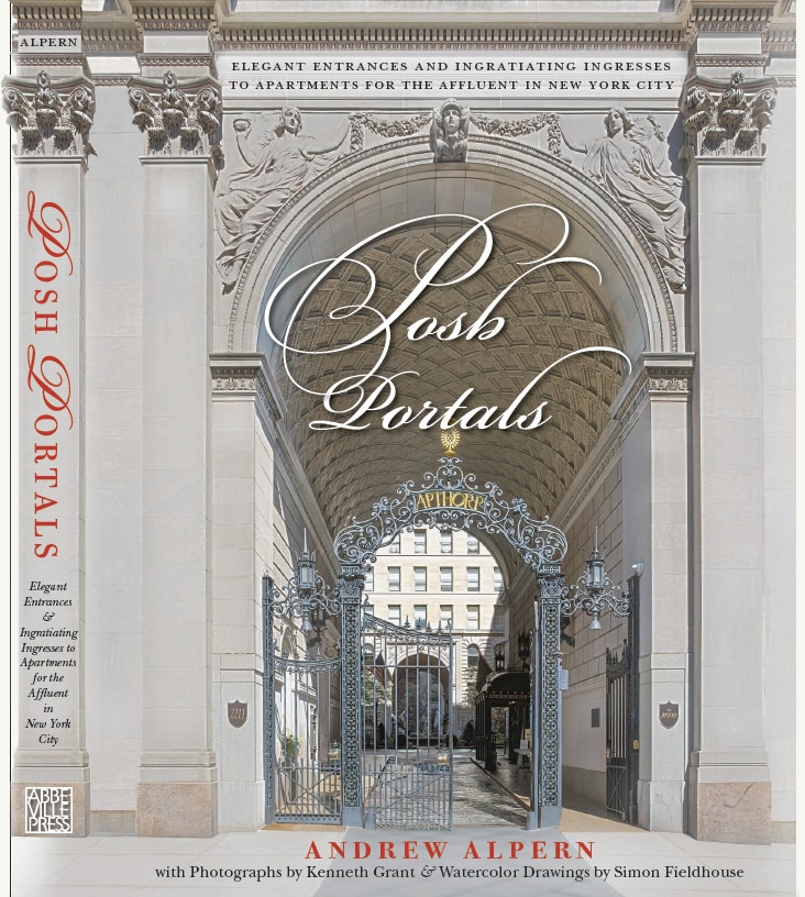
Posh Portals cover

Posh Portals

Posh Portals cover
“Posh Portals,” published by Abbeville Press. Pictured is the 2211 Broadway entrance to Apthorp Apartments. The book is now available from Abbeville Press or Amazon.com (as an Amazon Associate, I earn from qualifying purchases).

I’ve been calling Posh Portals “my book” for years, though actually the author is noted architectural historian Andrew Alpern – who already had 10 other volumes published. But the cover and more than 350 inside photos are mine, and the watercolor illustrations are also based on my photos, so I really can’t be too objective, can I?

One of the reasons that I find architecture so fascinating is that buildings, like people, are so similar and at the same time infinitely diverse.

Take doors, for example. Every apartment building has to have a way in, obviously. It has to be substantial enough to keep out the elements, and large enough to permit occupants and their belongings to enter. So much for the similarities. The size, shape, material, style and embellishment, the scale, framing and placement of the front door are variables that together articulate the building’s character. A building’s portrait is never complete without an image of the front door.

In years of roaming cities with my camera, I’ve often shot doors and ignored the rest of the building. Some ancient, dilapidated dwellings – even crumbling tenements – were endowed with inviting portals. To the extent permitted by a developer’s budget, architects pride themselves on combining beauty with utility. One of the saddest parts of public housing is the cold steel front door, a mean, forbidding portal obviously designed more to keep people out than to invite people in.

In Andrew’s words, “The entrance to an apartment house is that important first impression, the opening sentence of the architectural story that sets the mood of the apartment building. A successful apartment house entrance must perform several functions, all of which must be kept in a delicate balance, consistent with the program that the developer has laid out for the architect to fulfill. The entrance is the dividing line between public and private space. It must make clear to the passer-by that he may approach and enter only if he has legitimate business within. Yet that entrance cannot be as forbidding as a fort, nor as evidently guarded as a prison, as it provides entrée to the homes of its residents, who may be the hosts of the approaching visitors.”

Here, then, is a collection of New York City’s most luxurious and distinctive apartment buildings, each endowed by their architect with entrances that speak volumes.

While these Posh Portals are no accident, my role this collection is definitely a case of serendipity. Your humble photographer was walking south along New York City’s Central Park West, an avenue lined with magnificent architecture. Out of the corner of my eye I noticed a distinguished-looking gentleman sitting on a bench across from the famed Dakota; there was something familiar about him . . . A few steps later it clicked: “Andrew?” I asked, approaching the bench. “Ken?” he replied. Until this morning, we had only seen photos of each other, though we had conversed almost five months about photos for his book, “The Dakota – A History of the World’s Best-Known Apartment Building.” He was waiting for a friend, and Andrew described a project he and Australian artist Simon Fieldhouse were discussing, an illustrated guide to the elaborate and ornate entrances to New York’s luxury apartment buildings. They’d need a good source of photos . . .

And so, from this chance meeting on a sunny January 13, 2014, my camera and I became part of Posh Portals. It’s been fun, educational, and sometimes challenging: Photographing buildings from street level in New York puts you at the mercy of the sun, traffic, parked trucks, and scaffolding that sometimes stays in place for years. The project took less than six minutes to describe, more than six years to complete, and was worth every second.

While obviously I’d LOVE for you to buy the book (shameless plug) from Amazon.com (as an Amazon Associate, I earn from qualifying purchases), photographs from Posh Portals are also available as framed or unframed prints on heavy paper, acrylic, or metal in a variety of sizes and styles. Just visit my Posh Portals photo gallery.

My gallery could not include the watercolor drawings by Simon Fieldhouse, but you can contact the artist at www.simonfieldhouse.com/new-york-apartment-entrances/.

Is your building here?

These are the notable apartment buildings we’ve selected as the Posh Portals of New York City. They’re listed by street address in dictionary order, so you’ll find 2 Sutton Place South after 1925 Seventh Avenue.

1 East End Avenue • 1 Fifth Avenue • 1 Sutton Place South • 1 West 30 Street – Wilbraham • 1 West 67 Street – Hotel des Artistes • 1 West 72 Street – Dakota • 10 Gracie Square • 1000 Park Avenue • 101 Central Park West • 1016 Fifth Avenue • 1067 Fifth Avenue • 1107 Fifth Avenue • 116 East 68 Street – Milan House • 1185 Park Avenue • 1198 Pacific Street – Imperial • 12 West 72 Street – Oliver Cromwell • 1215 Fifth Avenue • 1225 Park Avenue • 126 East 12 Street • 1261 Madison Avenue • 135 Central Park West – Langham • 135 East 79 Street • 135 West 70 Street – Pythian • 136 Waverly Place – Waverly • 140 Riverside Drive – Normandy • 141 East 3 Street – Ageloff Towers • 145 Central Park West – San Remo • 145 West 79 Street – Manchester House • 147 West 79 Street • 15 Central Park West • 15 West 67 Street – Central Park Studios • 151 Central Park West – Kenilworth • 171 West 71 Street – Dorilton • 180 West 58 Street – Alwyn Court • 19 East 72 Street • 1925 Seventh Avenue – Graham Court • 194 Riverside Drive

2 Sutton Place South • 20 East End Avenue • 200 Hicks Street -Casino Mansions Apartments • 201 West 79 Street – Lucerne • 210 East 68 Street • 2109 Broadway – Ansonia • 211 Central Park West – Beresford • 214 Riverside Drive – Chatillion • 215 West 98 Street – Gramont • 22 East 89 Street – Graham • 2207 Broadway – Apthorp • 222 Central Park South – Gainsborough • 225 Central Park West – Alden • 225 West 86 Street – Belnord • 235 East 22 Street – Gramercy House • 235 West End Avenue • 239 Central Park West • 240 East 79 Street • 241 Central Park West • 243 Riverside Drive – Cliff Dwelling • 243 West End Avenue • 246 East 4 Street • 25 Central Park West – Century • 25 East End Avenue • 251 West 71 Street • 25-35 Tennis Court – Chateau Frontenac • 258 Riverside Drive – Peter Stuyvesant • 27 West 67 Street – Sixty Seventh Street Studio • 285 Central Park West – St. Urban

3 East 84 Street • 30 East 76 Street • 300 Central Park West – Eldorado • 301 West 108 Street – Manhasset • 305 West 98 Street – Schuyler Arms • 310 Riverside Drive – Master Apartments • 32 St. Marks Place • 325 East 79 Street • 325 West End Avenue • 33 West 67 Street • 333 West End Avenue • 336 Central Park West • 34 Gramercy Park East – Gramercy • 344 West 72 Street – Chatsworth • 350 West 85 Street – Red House • 37 Washington Square West • 370 Central Park West • 380 Riverside Drive – Hendrik Hudson • 39 Fifth Avenue • 393 West End Avenue

40 East 62 Street • 400 Chambers Street – Tribeca Park • 401 Eighth Avenue Brooklyn – Roosevelt Arms • 410 Riverside Drive – Riverside Mansions • 418 Central Park West – Braender • 420 West End Avenue • 425 West 23 Street – London Terrace • 43 Fifth Avenue • 435 East 52 Street – River House • 439 East 551 Street – Beekman Mansion • 44 West 77 Street • 440 Riverside Drive – Paterno • 440 West End Avenue • 444 Central Park West • 446 Ocean Avenue Brooklyn • 45 East 66 Street • 450 East 52 Street – Campanile • 455 Ocean Avenue Brooklyn • 465 Ocean Avenue Brooklyn • 47 Plaza Street • 480 Park Avenue • 488 Nostrand Avenue – Renaissance • 49 East 96 Street • 490 West End Avenue • 495 West End Avenue • 498 West End Avenue

50 Central Park West – Prasada • 509 East 77 Street – Cherokee Apartments • 509 West 121 Street – Bancroft • 515 Park Avenue • 52 Riverside Drive • 520 Park Avenue • 521 Park Avenue • 522 West End Avenue • 527 Cathedral Parkway – Britannia • 540 Ocean Avenue Brooklyn – Cathedral Arms • 55 Central Park West • 57 West 75 Street – La Rochelle

625 Ocean Avenue Brooklyn – Arista • 666 Ocean Avenue Brooklyn – Cameo Court

7 Gracie Square • 70 Remsen Street • 70 Vestry Street • 711 Brightwater Court • 716 Ocean Avenue Brooklyn – Valence • 720 Park Avenue • 726 Ocean Avenue Brooklyn • 730 Park Avenue • 74 East 79 Street • 740 Park Avenue • 770 Park Avenue • 780 West End Avenue

800 Park Avenue • 820 Park Avenue • 834 Fifth Avenue • 838 West End Avenue • 850 Park Avenue • 898 Park Avenue

924 West End Avenue – Clebourne • 993 Fifth Avenue • 998 Fifth Avenue

Book Review: NY Skyscrapers

NY Skyscrapers

Dirk Stichweh, photos by Jörg Machirus and Scott Murphy | 192 pages | Prestel | 2016

This is a magnificent celebration of the buildings that make New York’s skyline so exciting. The large 9½ʺ x 12½ʺ format and brilliant color photography make “NY Skyscrapers” a joy to browse again and again. You’ll find the city’s classic icons, of course, but also less-photographed and under-appreciated structures such as the West Street Building, Crown Building, and Paramount Building. Half of the photos are high-angle shots – seemingly from a helicopter or nearby buildings – so even familiar landmarks seem fresh. Each of the book’s 82 buildings is described with concise architectural commentary.

“NY Skyscrapers” provides context three ways: The volume begins with a history of skyscrapers in New York City; downtown and midtown skyscrapers are grouped, with maps; and numerous aerial group photos show the buildings’ relationship to their neighborhoods.

While any book on this subject is soon out of date, “NY Skyscrapers” includes renderings and descriptions of eight under-construction buildings scheduled to be completed by 2020.

More reviews at NYC Architecture: Books

Mapping New York City

Mapping New York City is a full-time endeavor of hundreds, if not thousands, of amateur and professional digital cartographers. Thanks to the paid and unpaid users, it’s getting easier and easier to find anything or any place in the Big Apple.

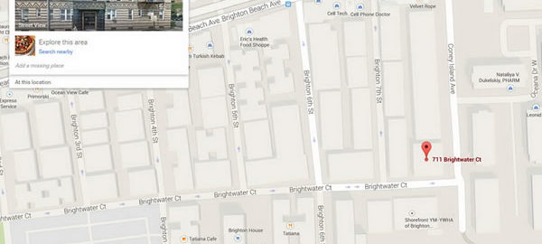
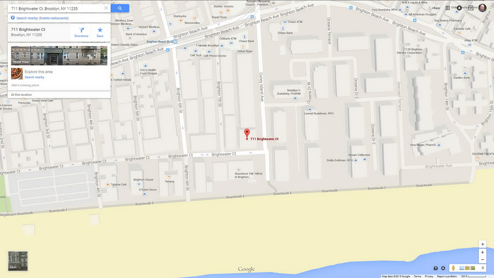
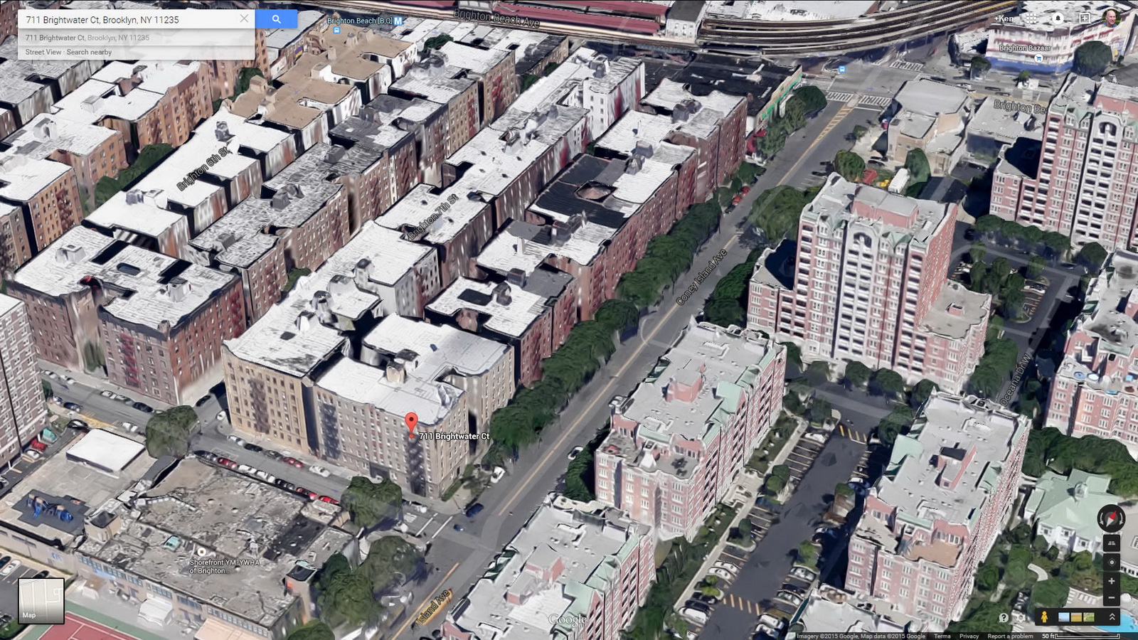
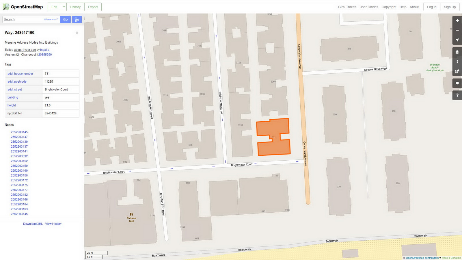
Here are some of the online maps that I’ve found particularly helpful for planning my explorations and researching buildings and neighborhoods. In the following samples, click the titles to open a new window with that map. Most links will load the location of 711 Brightwater Court in Brighton Beach, Brooklyn – a building that I was researching for a gallery.

Google Map

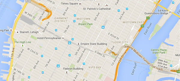
This is my default map – it loads quickly, and searches intelligently in the areas I browse most frequently. Street View lets me see the lay of the land quickly, and helps me verify the location of buildings that I’ve photographed. When I’m scouting new areas or a particular landmark, Street View helps me find the best vantage points. Google’s Transportation layer shows subways and bus routes – even bus arrival times – a boon when planning a trip to an unfamiliar neighborhood. Just remember to double-check the MTA maps, because Google’s info is sometimes out of date.

Google Earth

Google Earth is like having a personal helicopter – without the noise. Unlike other online maps, you can change the orientation any way that you want: North doesn’t have to be at the top of the screen. And unlike other aerial maps, you can change your angle of view – you aren’t locked in to a two-dimensional straight-down view.

Open Street Map

Open Street Map is a user-supported, open-source map. It contains details that you might not be able to find elsewhere. For example, I recently used this to find the boundaries of Forest Hills Gardens. (The development declined to provide a map, and my usual sources came up blank.)

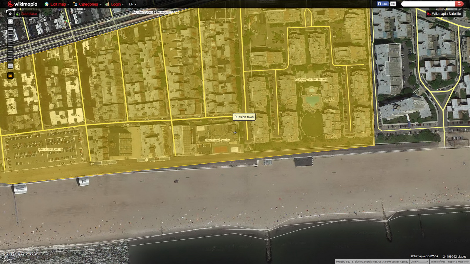
WikiMapia

Like Open Street Map, WikiMapia is an open-source, user-supported map with lots of historical and architectural details, frequently including links to other sites. You can switch among 11 different interfaces (Google, Bing, OSM, etc.), making this easy to learn and use.

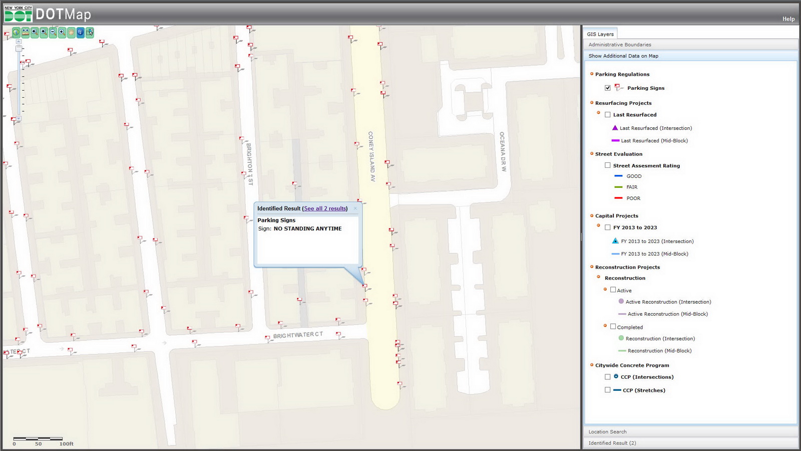
DOT Map

I refer to this whenever I want to find the best times for photographing a building without parked cars. This maps every traffic and parking sign in the city, so you can check to see when street-cleaning rules mandate “No Parking.”

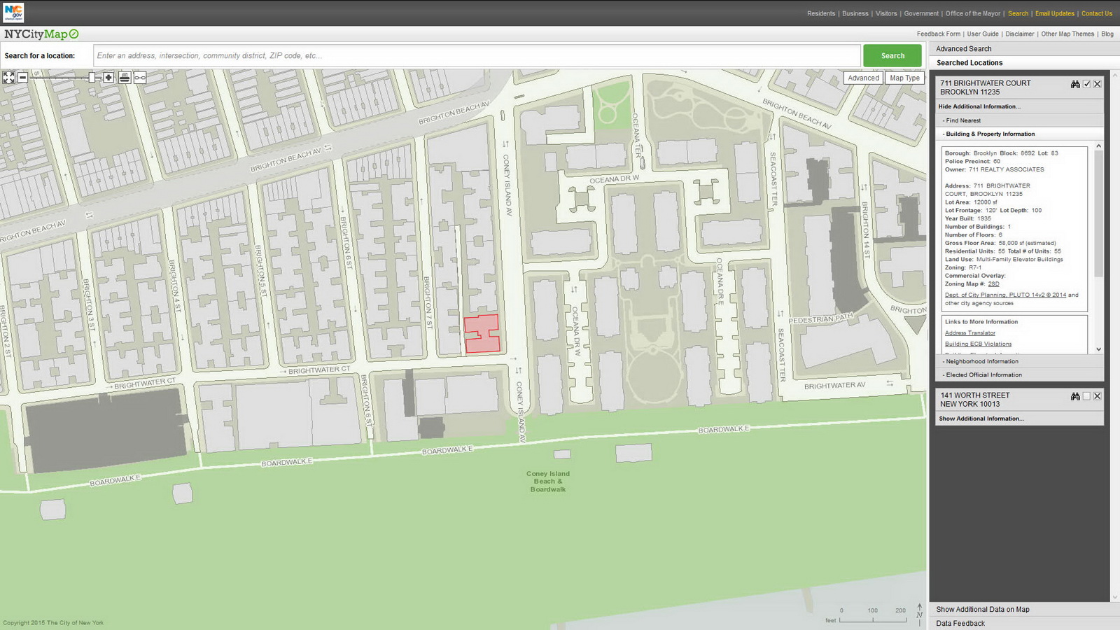
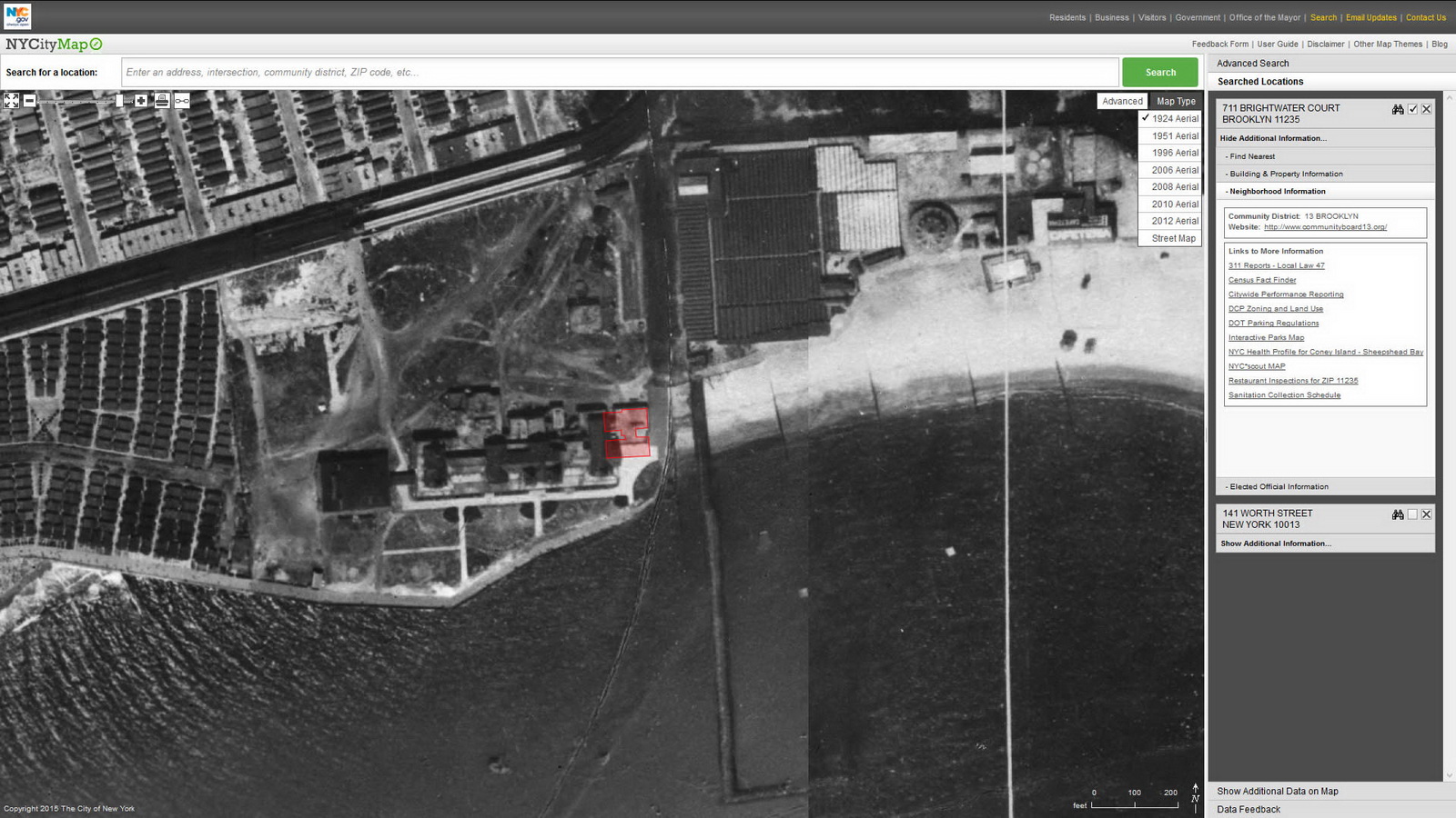
NYC Map

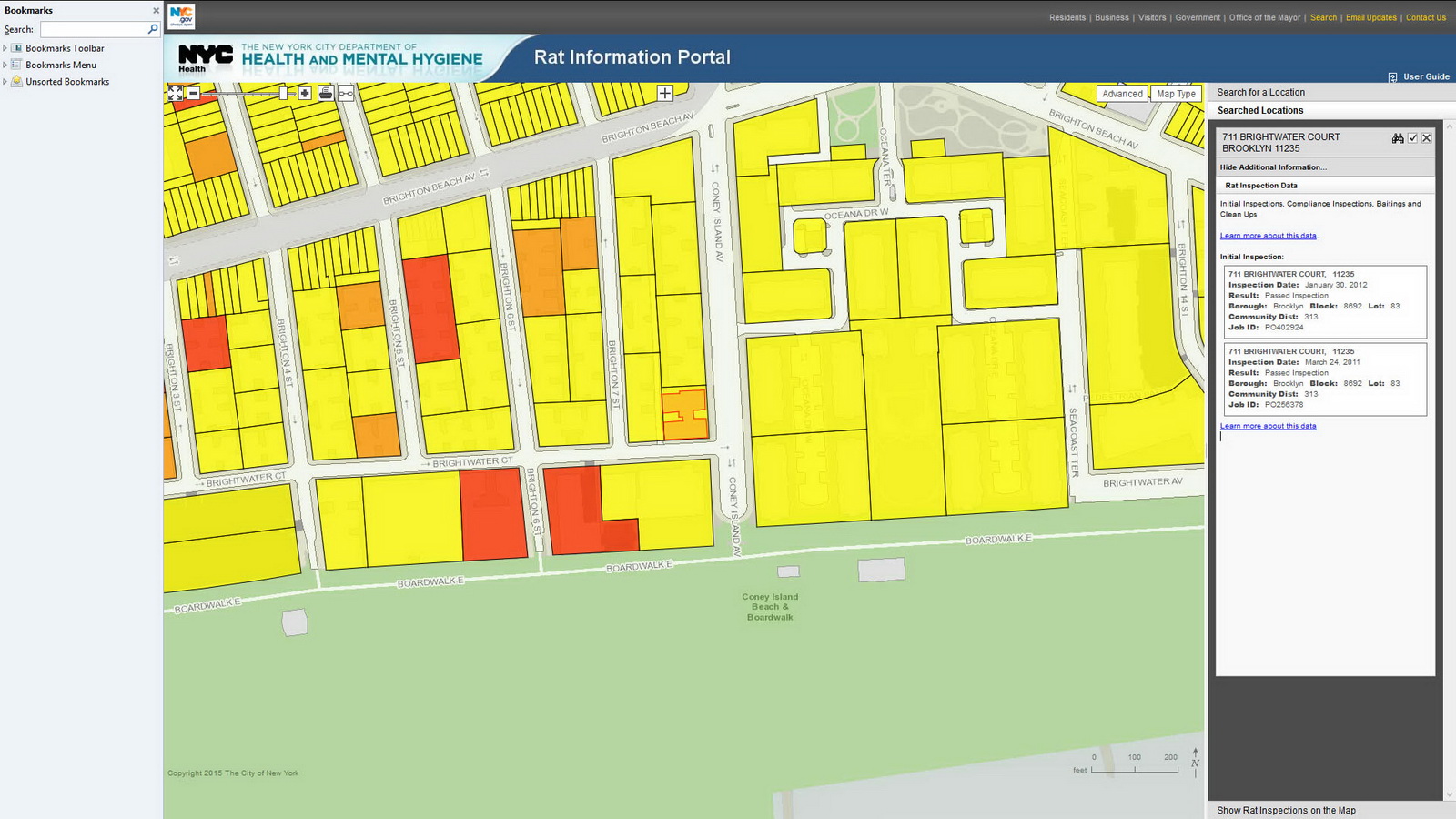
New York City Map is 12 maps in one! And it’s a time machine – just select one of the seven historic aerial views going back to 1924. The default view is linked to the Department of Buildings database, but 11 other map themes lead to 311 service requests, tax maps, census information, Green Infrastructure, NYC Parks, street closures, zoning and more. Before you buy a condo or sign a lease, you’ll want to check the Department of Buildings site for violations, and the Rat Information Portal to make sure that you don’t have any unexpected roommates!

NYC SCOUT

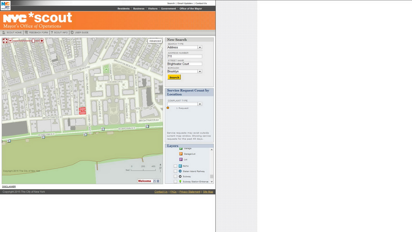
There’s a crater in the middle of the street and you want to find out if it has been reported to 311? Here you go!

The Street Conditions Observation Unit (SCOUT) is a team of inspectors based in the Mayor’s Office of Operations. Their mission is to drive every City street once per month and report conditions that negatively impact quality of life to 311. SCOUT inspectors send reports of conditions they observe to the 311 system, and 311 assigns the conditions to the relevant agency for appropriate corrective action – the very same way that 311 handles complaints from the public.

Ride The City

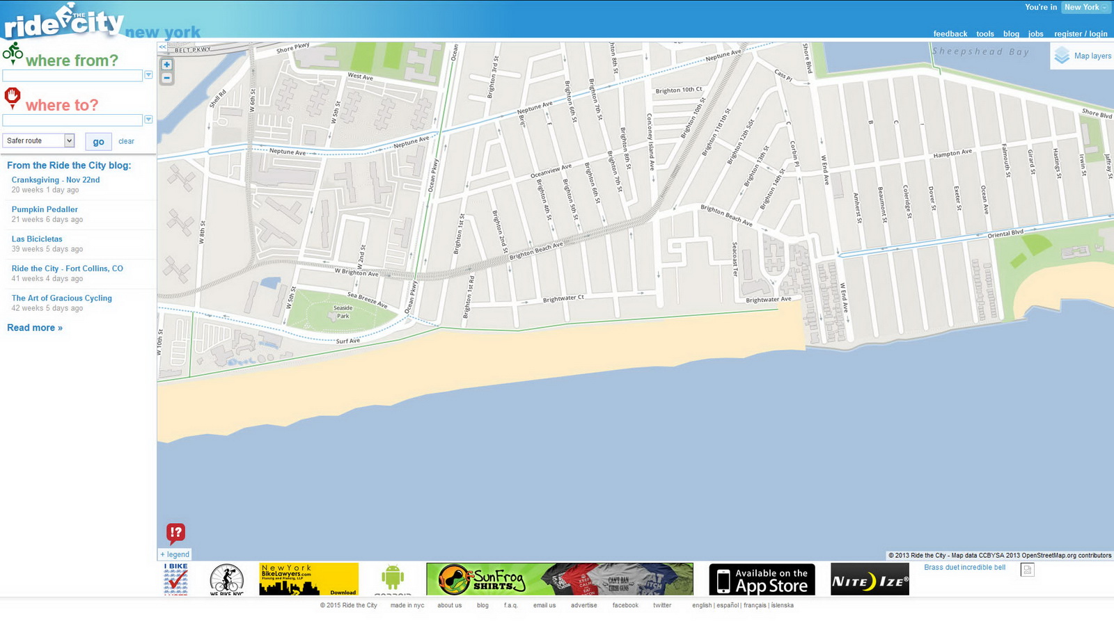
This map for bike riders will show you how to pedal from point A to point B – so its search function requires a starting and ending address. You can request the direct route, safe route, or safer route – select according to your skill and traffic comfort level.

SunCalc

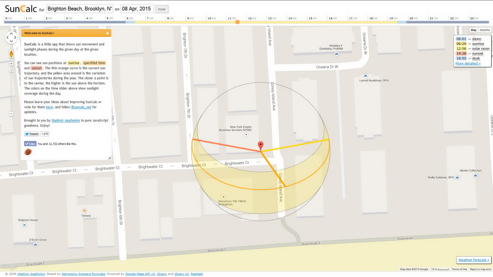
It doesn’t matter how much you spent on your camera. Your photos will only be as good as your light. Being in the right spot at the right time doesn’t have to be a matter of luck – you can predict the sun’s position with great accuracy using SunCalc. This is built on the Google Map interface, so it’s easy to navigate. Click on the landmark that you want to photograph, input the date (or click the NOW button) and drag the time slider to see how the sun angle changes during the day.

MapQuest

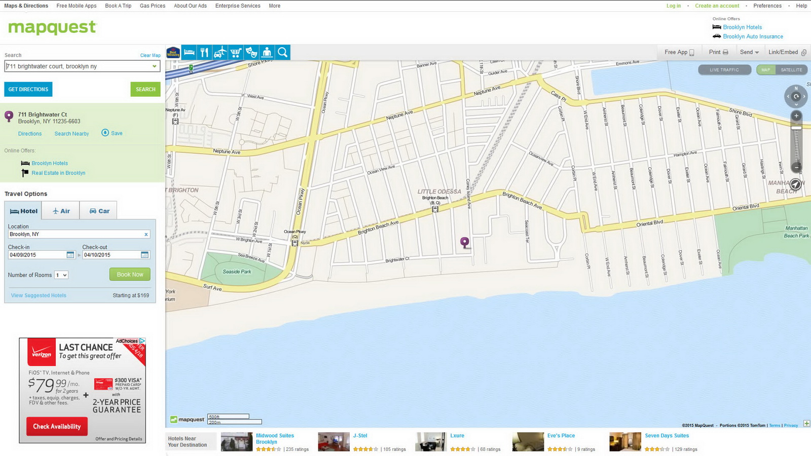
MapQuest is one of the earliest digital maps. It’s current claim to fame is travel – getting from point A to point B and finding a hotel and car rental when you get there.

MTA Subway Map

MTA’s website, mta.info, is complicated but essential for anyone who wants to use public transit in New York, especially on weekends when maintenance is in full swing. The map is interactive, and you can also download a pdf version.

MTA Bus Maps: Bronx, Brooklyn, Manhattan, Queens, Staten Island

Each borough has its own bus map; the links above lead to pdf downloads.

Mapping New York City Recommended Reading

Contents – Index

Find It Faster

There are many ways to explore NewYorkitecture. By borough and neighborhood; by year, by style, by building type, by architect, by specific building. You can easily follow your own path in the index below.

  • Posts lists all galleries by category. Like a Table of Contents.
  • Tags leads to archives of galleries related by theme, such as an architectural style, year of completion, architect, street address, alternate name, neighborhood or building type. Like an Index.
  • Works In Progress is intended for photo researchers who are looking for images of specific buildings. I have photos of these buildings that are available for publication, but I haven’t yet completed the research needed to put them in NewYorkitecture.com. Like a “Coming Attractions.”
  • Menu Items (above) give you visual indexes by category – handy if you know what a building looks like, but don’t know the name or address.
  • If all else fails, try the search widgets located at the top AND bottom of the page!

Posts

Tags

Sitemap created with WP Realtime Sitemap.

Works In Progress

I have photography for the following buildings that are not yet in gallery form. If you are interested in licensing these photos, please use my contact form to request a contact sheet.

Brooklyn

  • 18th Precinct
  • St. Michaels

Bronx

  • Poe Cottage

Manhattan

  • 100 11th Avenue
  • 100 Broadway
  • 1009 Fifth Avenue
  • 119 W 23rd Street
  • 122 Cedar Street
  • 122 E 66th Street
  • 125 Cedar Street
  • 126 E 66th Street
  • 130 W 30th Street
  • 14 Penn Plaza
  • 141 Fifth Avenue
  • 165 W 57th Street
  • 166 Fifth Avenue
  • 17 E 84th Street
  • 19 E 22nd Street
  • 19 Rector Street
  • 195 Broadway
  • 2 E 70th Street
  • 2 Park Avenue
  • 215 E 68th Street
  • 230 Riverside Drive
  • 242 W 23rd Street
  • 281 Park Avenue South
  • 285 Madison Avenue
  • 295 Central Park West
  • 3 E 84th Street
  • 3 UN Plaza
  • 304 E 20th Street
  • 304 E 23rd Street
  • 33 Maiden Lane
  • 330 Riverside Drive
  • 351 Riverside Drive
  • 380 Second Avenue
  • 393 West End Avenue
  • 40 E 62nd Street
  • 40 Wall Street
  • 420 West End Avenue
  • 444 Central Park West
  • 450 Park Avenue
  • 51 Astor Place
  • 515 Park Avenue
  • 521 Park Avenue
  • 65 Central Park West
  • 70 Pine Street
  • 720 Park Avenue
  • 730 Park Avenue
  • 740 Park Avenue
  • 76 Third Avenue
  • 770 Park Avenue
  • 788 West End Avenue
  • 800 Park Avenue
  • 805 Atrium
  • 808 West End Avenue
  • 820 Park Avenue
  • 888 Park Avenue
  • 890 Park Avenue
  • 998 Fifth Avenue
  • Ace Hotel
  • Alden
  • American Express Building
  • Ariel Towers
  • Art Students League
  • Bennington Corners
  • Bowery Savings Bank
  • Britannia
  • Broadway Franklin Building
  • Buddhist Church
  • Cable Building
  • Calvary Baptist Church
  • Carteret
  • Chelsea Hotel
  • Chelsea Mews
  • Christ Church
  • City Hall
  • Cooper Gramercy
  • Cooper Square Hotel
  • Cooper Union
  • Crown Building
  • DC37
  • Emmet
  • Engine Company 30 (Fire Museum)
  • Engine Company 74
  • Equitable Building
  • Excelsior Power Company Building
  • Field Building – Baruch College
  • George Washington Hotel
  • Goelet Building
  • Gramercy Arms
  • Grand Central Terminal
  • Grand Hotel
  • Graybar Building
  • Guggenheim Museum
  • Hearst Building
  • Helmsley Building
  • Hendrik Hudson
  • Holy Trinity Lutheran Church
  • Home Life
  • Home Life Insurance Company
  • Hotel Pierre
  • Hotel Wales
  • ITT Building
  • LaQuinta (former Aberdene Hotel)
  • Learningspring School
  • Lyceum
  • Madison Belvedere
  • Madison Medical Building
  • Majestic
  • Manhattan Trade School for Girls (School of the Future)
  • McBurney YMCA
  • Met Life HQ
  • Met Life/Pan Am
  • Methodist Book Concern
  • Morse Building
  • Museum of Natural History
  • Neue Gallery
  • New York County Lawyers Association
  • New York Evening Post
  • Oliver Cromwell
  • One Madison Park
  • One Penn Plaza
  • Osborne Apartments
  • Pace University
  • Parc Vendome Apartments
  • Park Avenue Synagogue
  • Police Department Headquarters
  • Post Towers
  • PS 40
  • Remsen Building
  • Renaissance Hotel 57
  • River Tower
  • Rodin Studios
  • Royal Building
  • Sage House
  • San Remo
  • Schuyler Arms
  • Serbian Cathedral Church of St. Sava
  • Sohmer Piano Building
  • Sony Tower (former AT&T Headquarters)
  • St. John the Baptist
  • Staten Island Ferry Terminal
  • Surrogates Court
  • Textile Building
  • The Colosseum
  • The Mark
  • United Charities Building
  • Verizon Building
  • Verona
  • Waldo House
  • West Side YMCA
  • Western Union Building

Photo Tips

General Electric Building.

General Electric Building (1931), 570 Lexington Avenue at E 51st Street. Architect: Cross & Cross.

After taking a few thousand photos, I can share a few observations about photography in The Big Apple.

  • Traffic is ugly. Cars, trucks, and buses are constantly getting in the way of your picture. Traffic signs and traffic lights are even worse – they never move out of the way. The only cure for parked cars is to make note of the alternate-side-of-the-street-parking signs: They’ll tell you when one side of the street is supposed to be clear for the street sweepers, so you should be able to get a clear shot. But if you’re patient, you’ll usually find breaks in traffic that give you a clear shot of a building. At street corners, moving a few feet closer to a building can clear traffic lights and signs from your picture.
    This site: www.nycdot.info/ maps all of the parking signs! Just zoom in on the location you’re photographing, check the “Parking Signs” checkbox, and then click a sign in front of the building. The resulting popup will show you the parking regulation in effect.
  • Scaffolding is ugly. New York’s Local Law 11 is intended to ensure that buildings are inspected and repaired often enough to prevent bricks and gargoyles from falling on tourists. This actually happened once, and the city naturally overreacted. Now, building facades must be inspected every five years; Local Law 11 could also be named the Scaffold Workers Full Employment Act. Ironically, more people are now injured each year by scaffold accidents than were previously hurt by falling bricks. Go figure. Meanwhile, that gorgeous building you want to photograph may be wrapped in pipes and boards. Come back in six months.
  • Beware the tripod police. Over-zealous building security folks can go crazy when they see you aim a camera at their building. Especially if you’re using a tripod. Serious photographers use tripods, but the uninformed and uniformed assume that all tripod users are either professionals who need a permit, or terrorists who need to be locked up. For the record, tripods and still photography are completely legal without permit for professionals and non-professionals, as long as you’re on public property and aren’t claiming exclusive use of the street or sidewalk. If you’re shooting and moving, you’re OK. [ See and print out NYC photo permits – paragraph 3. I carry this with me and show it to police or whoever else questions me. ]
  • New York buildings are big. And close together. Which means that if you’re trying to capture whole buildings in a single shot, a wide-angle lens (or wide-angle zoom) will really come in handy. Of course a telephoto lens also comes in handy, for cross-river shots or even capturing building details from across the street. This is where a super-zoom point-and-shoot like the Canon SX40 can leave a DSLR in the dust. You might also try for a vertical panorama – capture horizontal slices of a building, then stack and stitch the photos together using your favorite panorama software.
  • The most important ingredient is LIGHT. To capture the detail and texture of brick and stone, strong direct lighting is best. You need to have the sun in the right place – which only happens at certain times of the day. There’s a web site that will show you the best time to shoot (weather permitting): SunCalc.net. If you follow the link, you’ll see the setup for shooting the Studio Building on March 13, 2015. It uses Google Map as a base; you can set any date and time to see the direction of the sun.

Transit Tips

SubwayMap

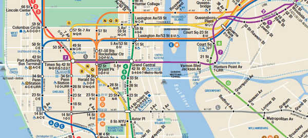
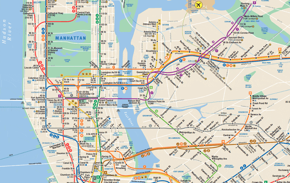
Map of NYC subway system. Download pdf version.

When exploring and photographing the Big Apple’s architecture, subways are generally the best way to get around town. The ride to any point in the city is only $2.75 – a bargain compared to taxis, vans or car services, and often faster, too. You may have to stand, it may be crowded at times, but if you can follow a map this is the way to go.

For current fares and discounts, visit the MTA (Metropolitan Transit Authority) website. Current maps are also online to view or download at www.mta.info/nyct/maps/submap.htm; there are also subway and bus map apps that you can download to your smart phone. Old-fashioned paper maps are available at station booths for free – and they’re probably more up to date than maps sold in stores. You’ll also find permanent (stationary) maps at subway entrances, on many platforms, and on every subway car (one near each end).

But beware: MTA does most of its maintenance on weekends, so there are many service interruptions and re-routing from late Friday night through early Monday morning. You can get up-to-date information at http://travel.mtanyct.info/serviceadvisory/. Also be aware that some lines don’t operate on weekends – the B train, for example, runs 6 a.m.-11 p.m. weekdays only.

New York City buses are not for anyone in a hurry, but they do let you see more of the city if you can get a window seat. For example, the M5 bus runs from South Ferry all the way up to 179th Street and Broadway, including a 63-block stretch along scenic Riverside Drive. Weekdays, M5 runs Limited-Stop (faster) service. The M4 bus operates between 32nd Street and The Cloisters Museum/Fort Tryon Park. You can get bus maps at the MTA website, but getting a paper map is a little trickier, because buses don’t usually carry any maps. There’s no system-wide map; each borough has its own guide.

If your visit takes you to the Battery/Financial District, make a quick stop at the MTA Customer Service Center, 3 Stone Street, in lower Manhattan between Broadway and Broad Street. You can get ALL bus and subway maps there. The center is open weekdays, 9 a.m.-5 p.m. [map] The R train Whitehall Street station has an exit right on the corner (contrary to Google map, the N train no longer stops there); the Bowling Green station of the 4 and 5 trains are also close by.

New York City Neighborhoods

New York City has five boroughs; each borough has several subdivisions and within subdivisions are the neighborhoods. Neighborhood boundaries are not always clearly defined, so a particular block might be considered part of two neighborhoods. Many New York City Neighborhoods originally reflected ethnic concentrations – Chinatown and Little Italy being the best-known examples. Other neighborhoods were named by their original (or early) owners, such as Chelsea. But some “neighborhoods” are marketing inventions, designed to enhance the image and desirability of real estate.

“AIA Guide to New York City” divides the city into 31 sections comprising 204 neighborhoods or precincts. Rather than re-invent the wheel, we’ll try to stick to that organization in NewYorkitecture.com. Just be aware that the neighborhoods named in this site won’t always agree with your favorite map or guidebook. (Of course if you make “AIA Guide to New York City” your favorite guidebook, problem solved!)

MANHATTAN

Lower Manhattan

  • Financial District
  • Water Street Corridor
  • South Street Seaport
  • Broadway-Nassau
  • Battery Park City
  • World Trade Center Area
  • Tribeca/Lower West Side
  • Civic Center
  • Chinatown/Little Italy
  • Lower East Side
  • SoHo

The Villages

  • Greenwich Village
  • Washington Square and Environs
  • Astor Place, NoHo and Environs
  • West Village
  • South Village/West SoHo/The Glass Box District
  • East Village

Midtown Manhattan

  • Chelsea
  • Gansevoort Market
  • The High Line and West Chelsea
  • Hudson River Park
  • Ladies Mile
  • Union Square to Gramercy Park
  • Stuyvesant Square and North
  • Rose Hill
  • Kips Bay
  • Madison Square to Bryant Park
  • Madison Square to the Javits Center
  • Murray Hill
  • Clinton
  • Times Square to Columbus Circle
  • Grand Central/Park Avenue
  • The Fifth Avenue Swath
  • United Nations/Turtle Bay

Upper West Side

  • Lincoln Center
  • Riverside Drive/West End Avenue
  • Broadway and Environs
  • Central Park West/The Parks Blocks
  • West Side Urban Renewal Area
  • Manhattan Valley

Central Park

Upper East Side

  • The Gold Coast
  • Metropolitan Museum Vicinity
  • Carnegie Hill and Beyond
  • East of Eden
  • Hospitalia
  • Yorkville
  • Gracie Square and Environs

The Heights and the Harlems

  • Morningside Heights
  • Manhattanville
  • Hamilton Heights
  • Harlem
  • East Harlem

Upper Manhattan

  • Washington Heights

BROOKLYN

West Central Brooklyn

  • Civic Center/Downtown Brooklyn
  • Brooklyn Heights
  • Fulton Ferry
  • DUMBO
  • Vinegar Hill
  • The Navy Yard
  • Cobble Hill
  • Carroll Gardens
  • Gowanus
  • Red Hook
  • Boerum Hill
  • Fort Greene
  • Clinton Hill
  • Park Slope
  • Prospect Heights
  • Grand Army Plaza
  • Prospect Park
  • Institute Park
  • Bedford-Stuyvesant
  • Crown Heights

Northern Brooklyn

  • Bushwick-Ridgewood
  • Williamsburg
  • East Williamsburg
  • Greenpoint

Central Brooklyn

  • Central Flatbush
  • Prospect Park South
  • Ditmas Park
  • East Flatbush/Rugby
  • Windsor Terrace/Parkville

Southwestern Brooklyn

  • Sunset Park and Environs
  • Bay Ridge/Forth Hamilton/Dyker Heights
  • Bensonhurst/Bath Beach

Southern Brooklyn

  • Gravesend
  • Sheepshead Bay
  • Gerritsen Beach
  • Marine Park/Manhattan and Brighton Beaches
  • Coney Island

Southeastern Brooklyn

  • Midwood
  • Flatlands
  • Canarsie

Eastern Brooklyn

  • Highland Park/Cypress Hills
  • Brownsville
  • East New York
  • New Lots
  • Spring Creek

QUEENS

Western Queens

  • Hallets Point
  • Ravenswood
  • Astoria
  • Ditmars/Steinway
  • South Astoria
  • Sunnyside
  • Woodside
  • Hunters Point
  • Queens West
  • Long Island City/Blissville

Central Queens

  • North Beach
  • Jackson Heights
  • Corona
  • Flushing Meadows-Corona Park
  • Elmhurst
  • Rego Park/Maspeth
  • Ridgewood
  • Middle Village/Glendale
  • Forest Hills
  • Kew Gardens

Northeastern Queens

  • College Point
  • Malba
  • Whitestone
  • Beechhurst
  • Flushing
  • Murray Hill/Broadway-Flushing/Auburndale
  • Fresh Meadows
  • Bayside

Southern Queens

  • Woodhaven
  • Richmond Hill
  • Jamaica
  • Hollis/St. Albans/South Ozone Park

Far Queens

  • Douglaston Manor
  • Douglaston/Glen Oaks/Creedmoor
  • Queens Village/Canbria Heights/Laurelton/JFK Airport
  • Howard Beach
  • Far Rockaway
  • Bayswater/Arverne
  • Broad Channel
  • Riis Park

THE BRONX

Southern Bronx

  • Mott Haven
  • Port Morris/Melrose
  • The Hub
  • Morrisania
  • Crotona Park
  • Longwood
  • Hunts Point

Central Bronx

  • Twin Parks West/Tremont
  • Fordham University
  • Belmont
  • West Farms
  • Bronx Zoo
  • New York Botanical Garden

Western Bronx

  • The Grand Concourse
  • Highbridge Heights
  • University Heights
  • Kingsbridge Heights
  • Kingsbridge/Marble Hill (Manhattan)/Bedford Park
  • Norwood

Riverdale

  • Sputen Duyvil
  • Riverdale
  • North Riverdale
  • Fieldston
  • Van Cortlandt Park

Eastern Bronx

  • Soundview/Classon Point
  • Unionport/Van Nest
  • Parkchester/Westchester Square
  • Morris Park
  • Pelham Parkway Neighborhood
  • Bronxdale/Throgs Neck
  • Pelham Bay
  • City Island

Northern Bronx

  • Williamsbridge
  • Baychester/Eastchester
  • Wakefield

STATEN ISLAND

Northern Staten Island

  • St. George
  • New Brighton
  • Livingston
  • West Brighton
  • Port Richmond
  • Mariners Harbor

Eastern Staten Island

  • Tompkinsville/Stapleton
  • Stapleton Heights
  • Clifton
  • Rosebank
  • Arrochar

Central Staten Island

  • Westerleigh
  • Sunnyside
  • Willowbrook
  • Grymes Hill
  • Emerson Hill/Dongan Hills/Concord/Todt Hill
  • Egbertville
  • New Dorp
  • Richmond Town

Southern Staten Island

  • Eltingville
  • Great Kills/Rossville
  • Woodrow
  • Charleston
  • Richmond Valley/Tottenville
  • Mount Loretto/Princes Bay
  • Annadale/Huguenot

THE OTHER ISLANDS

  • Liberty Island/Ellis Island
  • Governors Island
  • Roosevelt Island
  • Wards Island/Randalls Island/North and South Brother Islands

New York City Architecture – Web Resources

NewYorkitecture.com is intended as a recreational site – exploring the city’s buildings, parks and infrastructure just for the fun of it. But lots of people have been documenting the same subject for years, with more serious intent. So, if you want to dig deeper (metaphorically, or course) into New York City Architecture, here are some excellent Internet resources:

NYC Landmarks Preservation Commission: www.nyc.gov/html/lpc/html/home/home.shtml
If you’re interested in classic architecture, “they don’t build ‘em like this anymore” structures, here’s your shortcut to finding them. The NYC Landmarks Preservation Commission “is responsible for identifying and designating the City’s landmarks and the buildings in the City’s historic districts. The Commission also regulates changes to designated buildings.”
The commission has a handy Glossary of Architectural Terms – www.nyc.gov/html/lpc/html/glossary/glossary.shtml – just in case I throw out some obscure term without explaining it (shame on me!).

City Realty: Cityrealty.com
I discovered this site by fortunate accident, while researching some addresses along Riverside Drive. Typing the address or building name in Google almost always returned references to CityRealty.com – which had detailed reports on the building in question. Architectural style, architect, year built, number of floors, famous residents, etc. Even architectural ratings and reviews!
Their secret is Carter B. Horsley, who spent 36 years as a reporter/editor covering architecture and real estate for The New York Times and The New York Post.

SkyscraperPage.com: Skyscraperpage.com
If you love skyscrapers, you’ll love this site! They have a huge database of skyscrapers around the world, including interactive maps, illustrations and fact sheets. And check out their store, for one-of-a-kind puzzles and posters. Check out their interactive NYC map: skyscraperpage.com/cities/maps/?cityID=8

NewYorkArchitecture.info: www.newyorkarchitecture.info/
NewYorkArchitecture.info is aimed more at people who are in the trade – architects, contractors, realtors, etc. Includes news and progress reports for new construction in the city.

GlassSteelAndStone.com: www.glasssteelandstone.com/
Glass Steel and Stone is another site for building trade professionals, but with a global perspective – you can check on buildings around the world.

Museum of the City of New York: www.mcny.org/
The Museum of the City of New York covers all things New York – with significant exhibitions on architecture and city planning. The museum also has lectures and tours to complement the exhibits – check and book early, they sell out quickly.

NYC-Architecture.com: nyc-architecture.com/
nyc-architecture.com contains news and reviews of historic and contemporary buildings of note, with archives by architectural style and building types (among other categories).

Buildipedia.com: Buildipedia.com
This is another building trades website, where you can become immersed in architecture’s state of the art – trends, best practices, etc., plus news of who’s building what, and where.

Emporis.com: emporis.com/city/newyorkcity-ny-usa
Emporis (formerly skyscrapers.com) is a global buildings database company – listing 403,420 buildings in 190 countries. If you have the name and/or address of a specific structure, you’ll find not only the architects, but also the engineers, suppliers, and contractors involved; when construction started and finished; the construction type, architectural style, height, number of floors, intended use – and photos. The link above brings you to the New York City page.

Wikimapia.org: wikimapia.org/#lat=40.7048512&lon=-74.0117115&z=18&l=0&m=b
This site is a Google map mashup that gives you building-by-building details for many of the city’s historic (and some not-historic) districts. Zoom in to see individual building outlines, traced around Google satellite images; click for building details, which often includes history, statistics, photos and links to the emporis.com database and/or Wikipedia. Amazing site, highly recommended. The link above puts you right into the heart of the Financial District.

Columbia University – Avery Architectural and Fine Arts Library: library.columbia.edu/indiv/avery/guides/nycbuild.html
This is a site devoted to researching New York City Buildings. For the serious architectural scholar or historian.

NYC Architecture: Books

Amazon.com has more than a thousand book titles dealing with New York City architecture, so there’s no shortage of reading material on this subject! I’ve spent a fair amount of time (and money) browsing physical and online book stores – here’s a short list of architecture books that I’ve found particularly helpful and enjoyable.

I’ve categorized the books by scope: Some are about Architecture in New York City; others are about Architecture in general; yet others are about New York City. I think you’ll find all to be interesting and useful.

Just click on the titles to see these books in Amazon.com (As an Amazon Associate, I earn from qualifying purchases)

NEW YORK CITY ARCHITECTURE

AIA Guide To New York City

Norval White and Elliot Willensky with Fran Leadon | 1055 pages | Oxford University Press | 2010

If you find that the architecture bug has bitten you – beware, there is no antidote – you will need a guide. The best guide, IMHO, is “AIA Guide to New York City.” The fifth edition includes 955 pages of maps, photos and detailed block-by-block, building-by-building commentary on virtually every architecturally significant structure within the five boroughs – even noting significant demolitions! The AIA Guide has nearly 100 pages of subject and address indexes, a glossary of architectural terms, even touring and photography tips. You can use the book as a walking tour guide, as a reference book, or as a history book of sorts (read about real estate development battles, zoning law trades, etc.). The authors’ scholarship is matched by their wit, so you’ll be entertained as well as educated. The “AIA” in the title, by the way, stands for American Institute of Architects.

NY Skyscrapers

Dirk Stichweh, photos by Jörg Machirus and Scott Murphy | 192 pages | Prestel | 2016

This is a magnificent celebration of the buildings that make New York’s skyline so exciting. The large 9½ʺ x 12½ʺ format and brilliant color photography make “NY Skyscrapers” a joy to browse again and again. You’ll find the city’s classic icons, of course, but also less-photographed and under-appreciated structures such as the West Street Building, Crown Building, and Paramount Building. Half of the photos are high-angle shots – seemingly from a helicopter or nearby buildings – so even familiar landmarks seem fresh. Each of the book’s 82 buildings is described with concise architectural commentary.

“NY Skyscrapers” provides context three ways: The volume begins with a history of skyscrapers in New York City; downtown and midtown skyscrapers are grouped, with maps; and numerous aerial group photos show the buildings’ relationship to their neighborhoods.

While any book on this subject is soon out of date, “NY Skyscrapers” includes renderings and descriptions of eight under-construction buildings scheduled to be completed by 2020.

Guide to Contemporary New York City Architecture

John Hill | 303 pages | W. W. Norton & Company | 2011

A colorful and informative compendium of 200 buildings built in New York City since 2000. Overall, an exciting collection of structures, very well photographed and explained so that you understand how a building’s design evolved.

It’s intriguing to see the contrasts between this book’s author, John Hill, and AIA Guide’s Norval White and Elliot Willensky. White and Willensky are classical purists; Hill appears to be more pragmatic and concerned with technical aspects of architecture. Hearst Tower for example, “…suddenly erupt[s] Alien-like in triangular facets of glass and steel… …about as strange and abrupt as one could imagine in a single building…” according to White and Willensky. But as Hill sees it, “…the design recalls the structural inventiveness of R. Buckminster Fuller, whom [architect Norman] Foster worked with in the 1970s…” Now you’ll just have to go see the building and decide for yourself!

The book thoughtfully includes subway directions to each structure.

Five Hundred Buildings of New York

Jorg Brockmann, Bill Harris | 640 pages | Black Dog & Leventhal | 2002

Photographer Jorg Brockmann terms his photos “portraits,” and it’s an apt term: Like classical black and white portraits these photos reveal their subjects’ character and personality, not merely their shape and size. Frankly, I wish I had consulted this book before taking my own pictures of many of these buildings – Jorg has found just the right angle, just the right viewpoint, just the right light and just the right moment to capture his subjects.

Jorg took pains to photograph each building free of distractions such as traffic and pedestrians; the book’s designer honored that artistic commitment by placing the text in a separate section. Minimalist captions give the building’s name, location, year of construction and architect’s name.

The author, Bill Harris, has given each building one paragraph of commentary combining history and architectural critique. It’s not easy to write just a single paragraph – even if that paragraph is sometimes a quarter of a page long – when there’s usually so much to say. My hat’s off to Bill for all the research – and focus.

The Dakota: A History of the World’s Best-Known Apartment Building

Andrew Alpern, Christopher S. Gray, Kenneth G. Grant | 192 pages | Princeton Architectural Press | 2015

The Dakota – and indeed NYC apartment life – is beautifully illuminated by Andrew Alpern’s new “History of the World’s Best-Known Apartment Building.” The noted architectural historian presents the most comprehensive history of The Dakota imaginable! Mr. Alpern documents the building, its builder (and family!), the architect, the neighborhood, the architectural and historical context, and even the Dakota’s residents. Fascinating reading that illuminates not only The Dakota, but also the world of apartment living in New York City.

I’m deeply honored by Mr. Alpern’s use of my photography (from the Dakota Apartments gallery) in this volume.

ARCHITECTURE

Why Buildings Stand Up

Mario Salvadori | 328 pages | W. W. Norton & Company; Reissue edition | 2002

Truth in advertising time: This is an old book, originally released in 1980, which explains references to Sears Tower in Chicago as the world’s tallest building, and 9 W 57th Street being called the Avon Building. But those slips of time aside, Mario Salvadori’s book is a wonderful illustrated layman’s guide to the art and science of architecture. You’ll discover secrets of the pyramids, the Eiffel Tower, the Brooklyn Bridge and many more landmarks. Mario Salvadori uses the landmarks as settings for lessons in the materials, forms and techniques of construction.

So you’ll learn not only how a Gothic arch differs from a Romanesque arch, but also why it is different, and why Gothic arches found their way into cathedrals.

Why Buildings Fall Down

Matthys Levy and Mario Salvadori | 336 pages | W. W. Norton & Company; Reissue edition | 2002

Like its prequel, “Why Buildings Stand Up,” this was written years ago. But this book has been updated to include the most (in)famous building failures – the World Trade Towers on Sept. 11, 2001.

Like “Why Buildings Stand Up,” the book uses famous landmarks to explain, in layman’s terms, the science of architecture. But in this case, the science of architectural failures, whether caused by earthquakes, storms, metal fatigue, overloading, etc.

What Style Is It?

John C. Poppeliers, S. Allen Chambers Jr. | 152 pages | John Wiley & Sons | 2003

Architects and architectural writers toss around style classifications like confetti. The “AIA Guide to New York City Architecture” lists 10 main style groups, most of which have two to four sub-types. It’s easy to get lost.

Fortunately, this slim volume describes and amply illustrates 25 architectural styles, so you can quickly tell the difference between Romanesque Revival and Gothic Revival. The one thing that I found odd is that the authors seemed to go out of their way to avoid showing any New York City-based examples of any style, even when New York has the most and best examples of that style. Oh well.

A Visual Dictionary of Architecture

Francis D. K. Ching | 328 pages | John Wiley & Sons | 2012

What a find! “A Visual Dictionary of Architecture” is a large-format (9- by 12-inch) book profusely illustrated with black-and-white line drawings – illustrations that reveal with astonishing clarity the object, material, technique or concept being defined. The accompanying text has equal clarity and brevity. As a result, this is a “dictionary” that you’ll read cover-to-cover.

When you’ve finished, you’ll have a much better understanding of a building’s components – and probably a much richer appreciation for the work of architects.

As it happens, Francis (Frank) D. K. Ching is as prolific as he is skilled: If you like “A Visual Dictionary of Architecture,” you can go on to “Architecture: Form, Space and Order” or any of the dozen or so other volumes about architecture, interior design, construction, and technical illustration and drawing.

The Annotated Arch – A Crash Course in the History of Architecture

Carol Strickland, Ph.D. | 178 pages | Andrews McMeel Publishing | 2001

Architecture has come a long way since 10,000 B.C.E.: “The Annotated Arch” chronicles the path through time and geography, and in fewer than 200 pages! For the reader, the journey is easy: Hundreds of photos and drawings show rather than tell significant forms and styles; side-by-side comparisons make it easy to distinguish differences among styles and forms (e.g., Baroque, Romanesque, Gothic). Doctor Strickland’s text is as lively as the book’s visual presentation, enlivened by anecdotes, historical quotes and wordplay (e.g., headings such as “Escorial: The Reign in Spain,” “Going for Baroque”).

The Heights – Anatomy of a Skyscraper

Kate Ascher | 208 pages | Penguin Books | 2011

Skyscrapers are almost synonymous with New York City: Here is a clear, layman’s explanation of what goes into a skyscraper, and why. You’ll learn all about foundations, frameworks, windows, facades, elevators, plumbing and wiring. You’ll see how an office building is different from a residential or hotel tower, and the tricks designers use to combine the three in “mixed use” buildings.

“The Heights,” like Kate Ascher’s earlier “The Works” (see below), has a simple, logical organization: Five sections – Introduction (history), Building It (design, foundations, structure, the skin, construction), Living In It (elevators, power, air, and water), Supporting It (life safety, maintenance, sustainability), and Dreaming It (the future).

Excellent diagrams, charts and photos illustrate terms and concepts; specific cases bring the theories and abstract ideas to life. And, although skyscrapers are an American invention, the book takes a world view. You’ll see how the American invention has been embraced and even improved and enlarged throughout Europe, Asia and the Middle East.

NEW YORK CITY

The Works – Anatomy of a City

Kate Ascher | 228 pages | Penguin Books | 2005

New York City is a complex organism – composed of concrete and steel, but a living, breathing creature just the same. Under its asphalt skin, the city has arteries and capillaries to deliver electricity, water, gas and steam; a nervous system of phone and data lines; digestive tracts to remove liquid and solid waste. “The Works” explains and illustrates all of this, and more, in five chapters: Moving People, Moving Freight, Power, Communications, and Keeping It Clean. A sixth chapter, The Future, discusses challenges and possible solutions for the preceding five sections.

While the book’s subtitle “Anatomy of a City” seems generic, make no mistake: “a City” is New York City.

I found the book to be both entertaining and informative. Each topic is revealed layer-by-layer and discusses the history, planning, construction, operation, and maintenance involved. So “Streets,” for example, is a 24-page section of the Moving People chapter that includes overall stats (20,000 miles of streets and highways within the five boroughs) and history (the Commissioners’ Plan of 1811 established Manhattan’s Grid Plan), then moves on to regional traffic planning, monitoring, and signaling, street construction and maintenance, parking, signage – even trees.

Manhattan Block By Block – A Street Atlas

John Tauranac | 176 pages | Tauranac Maps | 2008

The concept of “Manhattan Block By Block” is simple and logical: Slice the island into 15 strips, south to north; then dice each strip into two to four maps, west to east – for a total of 47 two-page maps. The map scale is large enough to show the names of individual buildings and landmarks, but the total package is small enough to be portable: it will fit (snugly) into a number 10 business envelope.

Neighborhoods are color-coded, typefaces are very legible, icons are (mostly) easy to follow. Street-level detail includes subway and bus routes, and traffic flow. (Subway and bus routes change, so those details are helpful but not totally reliable.)

Street and subject indexes both use combination page and map coordinates, so it’s a snap to locate landmarks this way. Visitors should read (and even New Yorkers will enjoy and learn from) the introductory section, which explains Manhattan’s layout, house numbering, neighborhoods, transit and more.

Note: This was out of stock at Amazon at this writing, but is worth tracking down at bookstores.

All Around The Town: Amazing Manhattan Facts and Curiosities (Second Edition)

Patrick Bunyan | 417 pages | Empire State Editions | 2011

New York City is, of course, much more than buildings and geography: It is also the people and events within its facades and borders. While there are scores, if not hundreds of New York City history books, “All Around The Town” stands out by being an historical atlas, organized by Manhattan neighborhood and street rather than by chronology. The people and events are revealed in fast-moving snippets, rather than in essays. A sample:

172 Bleecker Street * Author, playwright and critic James Agee lived on the top floor of this building from 1941 to 1951. It was here that he wrote the screenplay for The African Queen.